ParkaDownload
Glacier National Park

Trails in Glacier National Park

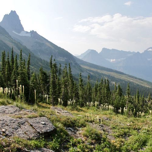
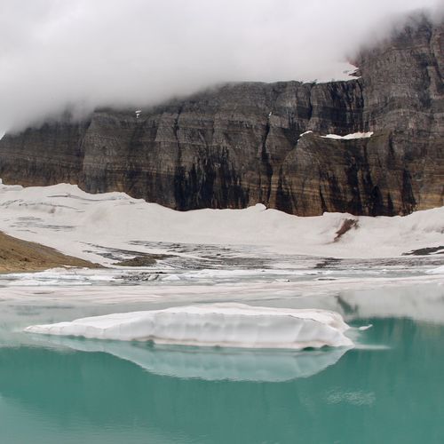
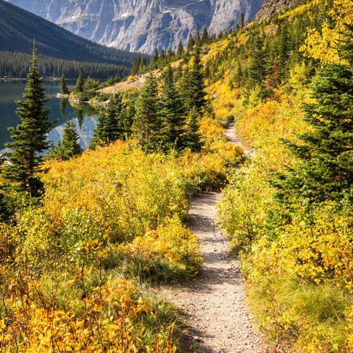
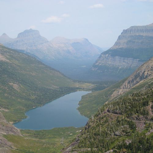
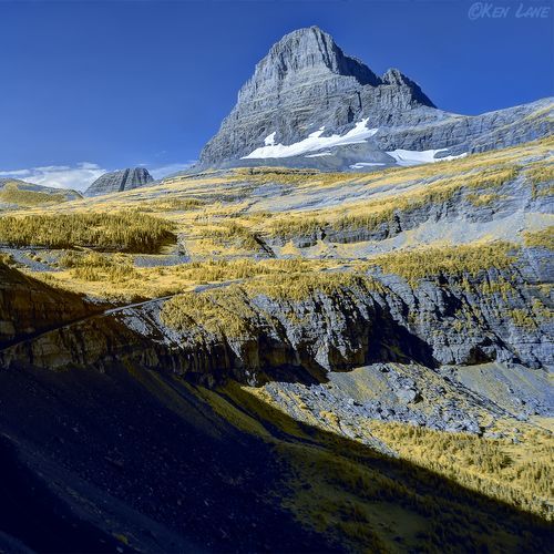
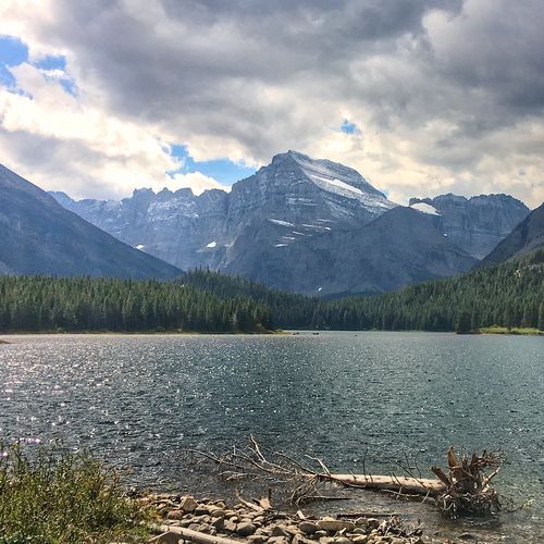
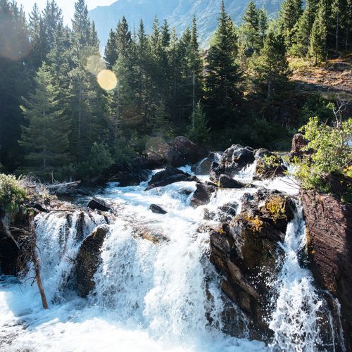
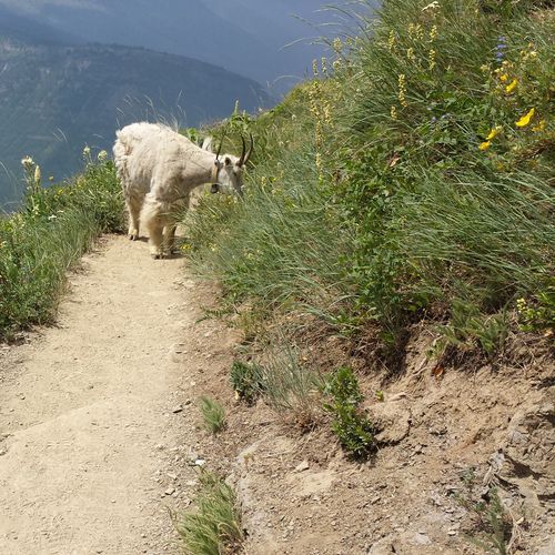
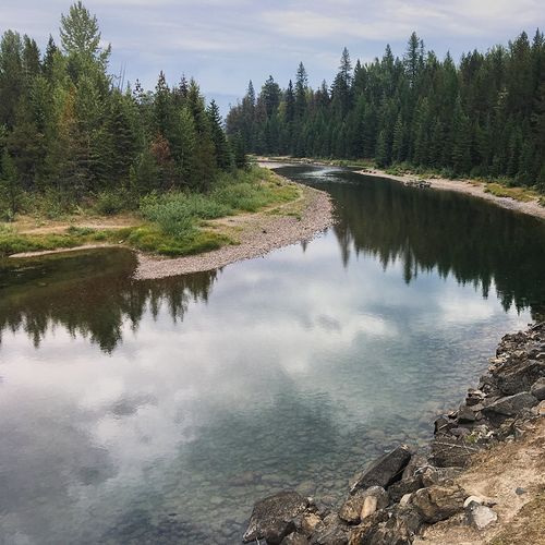
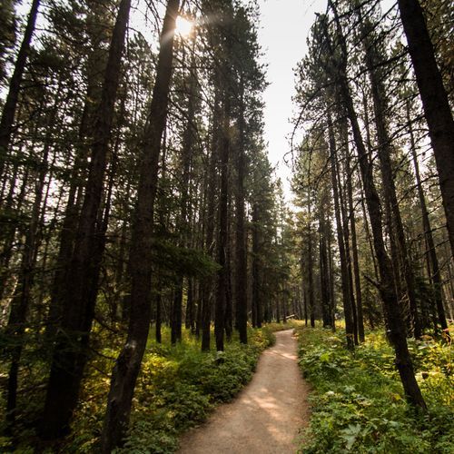
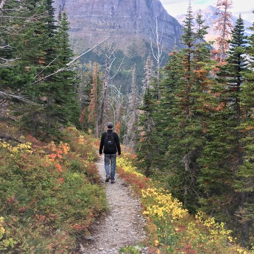
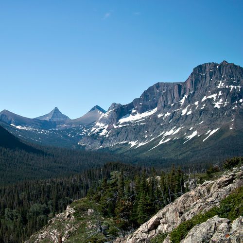
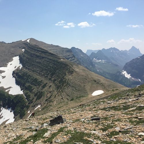
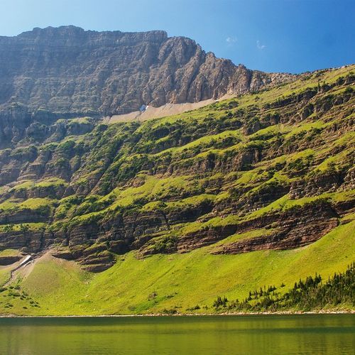
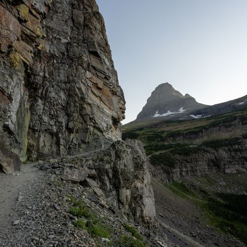
Glacier National Park is one of America’s great hiking parks, with 138 trails spanning an impressive range of difficulty: easy lakeside walks, moderate alpine rambles, demanding mountain routes, and a serious set of extreme backcountry challenges. That breadth is part of the appeal. Families and first-time visitors can ease into the landscape on gentler paths with immediate payoff—clear lakes, waterfalls, forest shade, and big valley views—while stronger hikers can aim for high passes, exposed traverses, and long day hikes that deliver the park at its most dramatic. With more than 700 miles of trail in all, Glacier rewards both casual wanderers and ambitious hikers who want to spend full days deep in the mountains. The standout hikes are the ones that place you directly in Glacier’s signature scenery. The Highline Trail is the park’s classic high-country experience, tracing the Garden Wall above Going-to-the-Sun Road with sweeping views, wildflowers, and a real sense of walking through the heart of the Rockies. Grinnell Glacier is another essential route, combining brilliant turquoise lakes, waterfalls, wildlife sightings, and one of the park’s most memorable glacier views. What makes hiking here special is the sheer concentration of alpine grandeur: hanging valleys, jagged peaks, meadows alive with summer color, and the constant possibility of spotting mountain goats, moose, or bears. Few parks offer such a vivid mix of accessibility and raw mountain drama, and that is why Glacier remains a bucket-list destination for hikers of every level.

Apgar Lookout

Apgar Lookout

Difficult7.1 mi

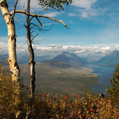
Apgar Lookout offers expansive views of Lake McDonald and the surrounding high peaks. From the plowed parking area in front of the barn, follow the left fork of the unplowed road across the Quarter Circle Bridge, take the right fork and follow the road about ½ mile to the Apgar Lookout trailhead. The trail has an easy start but soon steepens and becomes strenuous; in winter conditions it may require climbing skins if icy and can be difficult for beginning skiers. The lookout provides excellent views at the top.
Apikuni Falls

Apikuni Falls

Moderate1.8 mi

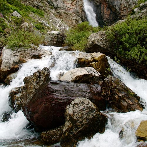
This scenic trail ascends through a meadow and forest, offering views of surrounding peaks and culminating at a dramatic waterfall. The area is known for wildflowers and wildlife, including grizzly bears. The trail's steep climb rewards hikers with breathtaking views of the falls and surrounding landscape.

Aster Park

Aster Park

Easy3.7 mi

This trail offers a gentle stroll through rolling hills, providing scenic vistas and a peaceful atmosphere. The easy terrain makes it accessible for a variety of visitors, while the surrounding landscape offers a serene escape from urban life.

Avalanche Lake

Avalanche Lake

Moderate5.7 mi

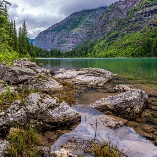
This trail winds through a forested gorge and offers stunning views of a glacier-fed lake. The path begins with a walk through a cedar forest, followed by a climb to the lake, which is rimmed by steep cliffs and features numerous cascading waterfalls.

Bowman Lake

Bowman Lake

Moderate13.5 mi

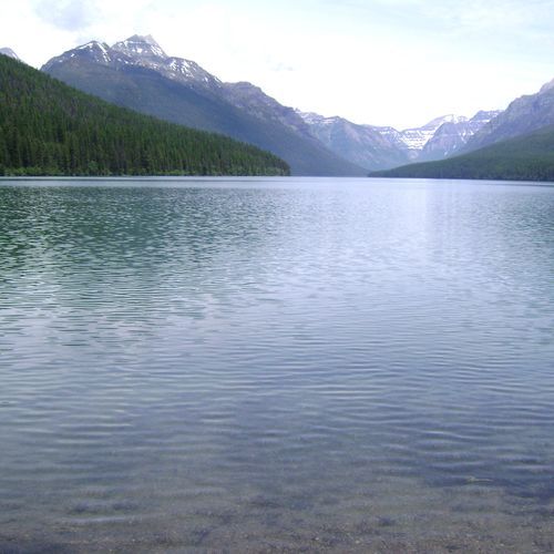
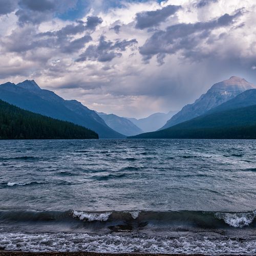
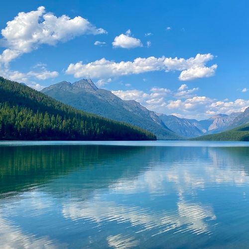
This cross-country route to Bowman Lake is a 12-mile (19.3 km) round trip from the ranger station. After leaving the ranger station, go left at the first junction, then right at the second; several hills on this route can be difficult when icy. The reduced forest canopy from the 1988 burn provides excellent mountain views, and the route leads through forest to a spectacular view at the foot of Bowman Lake. Bowman Lake is popular for canoeing and kayaking; motorized vessels up to 10 horsepower are permitted, and all boats must be inspected for aquatic invasive species prior to launch.

Cracker Lake Trail

Cracker Lake Trail

Difficult12.6 mi

This trail winds through dense forests and along mountain ridges, offering stunning views of the surrounding peaks. The hike culminates at Cracker Lake, a glacially fed lake known for its vibrant turquoise color. Wildlife sightings are common, including grizzly bears and bighorn sheep. The trail's scenic beauty and remote location make it a hidden gem for hikers.

Dawson Pass

Dawson Pass

Difficult13.7 mi

This trail leads to a high pass offering stunning views of the Lewis Range and Big Horn Basin. It traverses scenic meadows and offers chances to see wildlife like bighorn sheep. The hike involves a steep climb through Bighorn Basin, culminating in panoramic views of surrounding peaks.

Granite Park Trail

Granite Park Trail

Difficult11.1 mi

This one-way, point-to-point hike follows the famed Highline Trail from Logan Pass to the Loop Trailhead and finishes at the historic Granite Park Chalet. Reached only by foot, the chalet stands as a backcountry landmark high above sweeping alpine terrain. To complete the route as mapped, plan to use the park shuttle for transportation. Carry plenty of water since there is no potable source at the chalet, and filter before arriving if needed. Overnight stays require advance reservations, so plan ahead for this iconic adventure.

Grinnell Glacier Trail

Grinnell Glacier Trail

Difficult11.2 mi

This trail offers breathtaking views of Grinnell Lake's emerald waters, created by glacial flour, and the majestic Angel Wing cliffs. Hikers can observe big game and enjoy the scenic beauty of the Continental Divide. The trail includes a boat ride option across Swiftcurrent and Lake Josephine to shorten the journey.

Grinnell Lake Trail

Grinnell Lake Trail

Easy7.7 mi

This trail leads to a picturesque lake with stunning turquoise waters, a result of glacial silt. The hike passes through a dense forest and offers scenic views of nearby mountains and waterfalls. Wildlife such as moose and grizzly bears inhabit the area, making it a unique and memorable experience.

Gunsight Pass

Gunsight Pass

Extreme20.3 mi

This trail offers breathtaking views of turquoise lakes, glaciers, and towering mountain peaks. It features Gunsight Lake and Lake Ellen Wilson, with stunning waterfalls and abundant wildlife. The hike includes traversing the Continental Divide and offers a mix of forested areas and alpine landscapes.

Hidden Lake Trail

Hidden Lake Trail

Moderate5.4 mi

Hike through alpine meadows known as the Hanging Gardens, filled with wildflowers and abundant wildlife. The trail offers stunning views of Bearhat Mountain and other peaks, with frequent sightings of mountain goats and bighorn sheep. The descent to the lake provides breathtaking vistas of the surrounding mountains.

Highline Trail

Highline Trail

Difficult15.1 mi

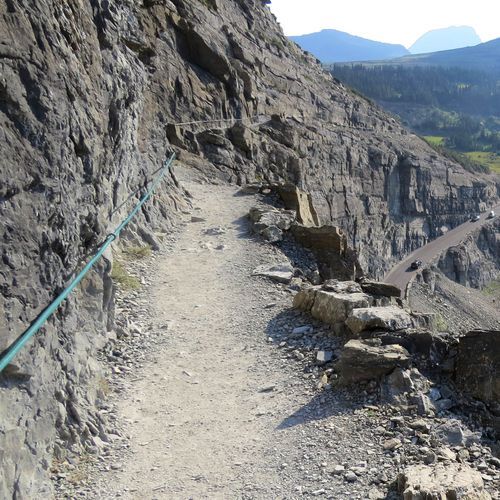
This trail offers breathtaking views of the surrounding mountains and valleys, traversing a narrow shelf carved into the cliffside. It features wildflowers, alpine meadows, and access to the historic Granite Park Chalet. The trail is known for its stunning vistas and diverse wildlife, making it a must-do for many hikers.

Iceberg Lake

Iceberg Lake

Moderate9.6 mi

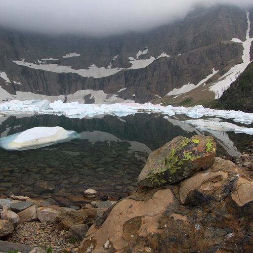
This trail traverses through old-growth forests and wildflower meadows, past waterfalls and abundant wildlife, culminating at a stunning turquoise lake filled with icebergs and surrounded by towering cliffs. The hike offers spectacular views of the Many Glacier Valley and opportunities to spot diverse wildlife.

Lincoln Lake

Lincoln Lake

Difficult16.6 mi

This trail ascends steeply over Snyder Ridge, offering filtered views of the surrounding mountains. It then descends to Lincoln Creek and follows the valley to Lincoln Lake, a picturesque cirque lake surrounded by cliffs. The trail's terminus features the impressive Beaver Chief Falls. Wildlife viewing and birdwatching are popular activities along the route.

Piegan Pass Trail

Piegan Pass Trail

Extreme15.9 mi

Piegan Pass is a popular day hike accessed from the Piegan Pass Trailhead (Siyeh Bend area) along the Continental Divide. The route climbs from forested and subalpine areas into open alpine and talus terrain with sweeping mountain views along the Divide. Wildlife commonly seen in the area includes mountain goats and ptarmigan.

Pitamakan Pass

Pitamakan Pass

Difficult15.1 mi

This challenging loop traverses over a ridge of Rising Wolf Mountain, offering breathtaking views of alpine lakes and surrounding peaks. The trail passes through forests and avalanche chutes, culminating in a scenic traverse across a goat trail with vistas into the Coal/Nyack area. Highlights include Oldman Lake, Pitamakan Pass, and Dawson Pass, with opportunities to spot wildlife like bighorn sheep.

Ptarmigan Tunnel

Ptarmigan Tunnel

Difficult10.4 mi

na

Running Eagle Falls

Running Eagle Falls

Easy0.5 mi

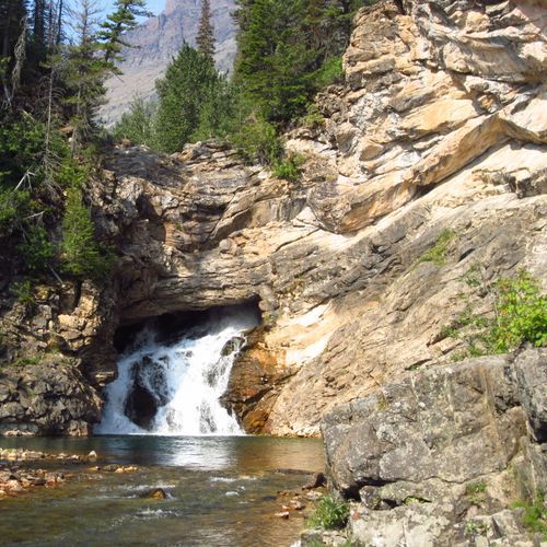
Running Eagle Falls, also called Trick Falls, appears to spill straight from a cavern in the cliff as mountain water rushes downward. This short interpretive walk includes educational signs along the way and leads to a viewing platform and a large rock near the base of the falls, perfect for resting and taking in the scene. Snow can linger in spring and fall, and the road to the trailhead closes seasonally, sometimes requiring a longer walk along the park road. Traction devices may be helpful when conditions are icy, and cell service is limited, so download offline maps in advance. Accessibility: This National Park Service maintained trail is generally accessible for visitors using wheelchairs, mobility equipment, or strollers, though all terrain or motorized assistance may be helpful depending on conditions. The surface is typically hard packed gravel or paved asphalt and at least four feet wide, with grades estimated at five percent or less. Two designated van accessible parking spaces with striped access aisles are available in the paved lot off Two Medicine Road near the southeast end of the trail. About 0.2 miles in, a short narrow bridge without edge barriers requires a step up and may require assistance. Public restrooms are located near the trailhead, but potable water is not available.

Siyeh Pass

Siyeh Pass

Difficult10 mi

This hike traverses through dense forests and opens up to stunning alpine meadows like Preston Park. It features breathtaking views of glaciers and peaks, including Mount Siyeh, one of the park's highest summits. The trail concludes at Sunrift Gorge, offering a dramatic descent with views of Sexton Glacier.

Sperry Chalet

Sperry Chalet

Difficult12.5 mi

The Sperry area trail begins at the Sperry trailhead near Lake McDonald (along Going-to-the-Sun Road, across from Lake McDonald Lodge) and climbs into alpine terrain toward the Sperry Chalet and Sperry Glacier. Hikers on this route encounter mountain and glacier views, notable elevation change, and connections to other Lake McDonald valley routes (for example, trails in the Avalanche Lake/Granite Park corridor).

St Mary and Virginia Falls Trail

St Mary and Virginia Falls Trail

Moderate3 mi

This trail offers stunning views of nearby mountains like Dusty Star Mountain and leads to the picturesque St. Mary Falls. The area was affected by the Reynolds Creek Fire of 2015, but the natural beauty remains intact. Visitors can enjoy the unique aqua-green pools below the falls and spot American dippers along the river.

Sun Point Nature Trail

Sun Point Nature Trail

Easy1.8 mi

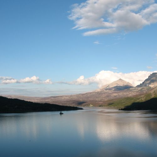
Enjoy stunning views of St. Mary Lake and its rugged mountain backdrop. This short, easy nature trail and picnic area sit on the promontory that once hosted the Going-to-the-Sun Chalet. The site serves as a trailhead to three waterfalls (Baring, St. Mary, and Virginia Falls) and has restrooms and drinking water in the Sun Point parking area, making it a good choice for families and visitors seeking scenic vistas.
Twin Falls

Twin Falls

Moderate6.9 mi

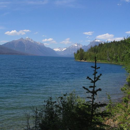
This scenic hike follows the north shore of Two Medicine Lake along the Dawson Pass Trail, leading to a charming forested waterfall where two streams spill down a rocky cliff face. A short spur trail brings you close to the cascades, offering a cool and peaceful retreat beneath the trees. For a quicker approach, you can cross the lake by boat and begin from the West End Dock, turning the journey into a memorable water-and-trail adventure.

Boulder Pass

Boulder Pass

Extreme29.9 mi

This trail follows the shores of Kintla Lake and Upper Kintla Lake, offering stunning views of the surrounding peaks. It ascends steeply to Boulder Pass, providing access to the Hole in the Wall area. The trail is known for its rugged beauty and remote wilderness experience.

Rocky Point

Rocky Point

Easy0.5 mi

This family-friendly trail descends a short hill and remains fairly level for much of the journey. As you near Rocky Point, the forest opens up, revealing stunning views of Lake McDonald and the surrounding mountains. Picnic tables are available near the trailhead, making it an ideal spot for a leisurely outing.

Swiftcurrent Lookout Trail

Swiftcurrent Lookout Trail

Moderate1.4 mi

Ascend through a mix of burned forest and scenic mountain meadows to reach the highest maintained trail in the park. Enjoy breathtaking views of glaciers, lakes, and surrounding peaks, including Swiftcurrent Glacier and Heavens Peak. The trail offers a challenging yet rewarding experience with stunning vistas.

Swiftcurrent Nature Trail

Swiftcurrent Nature Trail

Easy2.5 mi

This trail offers a gentle loop around the lake, providing stunning views and opportunities to spot wildlife. It passes through a forest that occasionally opens up to reveal the lake and surrounding mountains, including Allen Mountain. The trail is suitable for families and those seeking a leisurely hike.

Swiftcurrent Pass

Swiftcurrent Pass

Difficult14.3 mi

This trail offers stunning views of alpine meadows and lakes, including Fishercap, Redrock, and Bullhead Lakes. The hike features picturesque waterfalls like Redrock Falls and provides excellent moose spotting opportunities. The steep ascent to Swiftcurrent Pass rewards hikers with breathtaking views of the surrounding mountains and valleys.

Trail of the Cedars

Trail of the Cedars

Easy0.9 mi

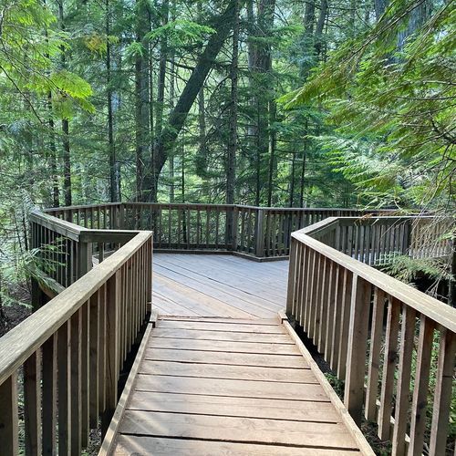
Walk through a lush forest of towering western red cedars and hemlocks, often found in the Pacific Northwest. The trail features a boardwalk section and offers stunning views of Avalanche Gorge via a footbridge over Avalanche Creek. This accessible loop is ideal for families and nature enthusiasts alike.

Virginia Falls Viewpoint

Virginia Falls Viewpoint

Easy0.1 mi

This viewpoint provides views of several waterfalls in the St. Mary Valley, including St. Mary Falls and Virginia Falls (also reachable in combination with Baring Falls). Access is from the St. Mary Falls pullout along the south side of Going-to-the-Sun Road. The route passes through forested areas as well as sections opened up by the Reynolds Creek Fire (2015), offering mountain vistas and opportunities to see wildlife. Visitors should note parking can be limited and the shuttle is recommended to reach this location.

Ahern Pass Overlook

Easy0.4 mi

This short trail offers stunning alpine views, culminating at an overlook of Helen Lake. The scenic route is ideal for those seeking a brief yet breathtaking experience amidst the park's majestic landscapes.

Akokala Creek

Moderate6.7 mi

This trail offers a challenging hike with scenic views, crossing ridges and valleys to reach a peaceful lake. The climb over Numa Ridge provides a gradual ascent through wooded areas, culminating in a picturesque destination.

Akokala Lake

Difficult11.3 mi

Follow the trail up and over Numa Ridge, then descend to Akokala Creek, which leads to the picturesque Akokala Lake. The hike offers views of towering peaks like Reuter and Mount Peabody, set against a backdrop of burned and unburned forest areas.

Apgar Bike Trail

Apgar Bike Trail

Easy4.1 mi

Apgar Bike Trail is a paved multi-use path connecting Park Headquarters to Apgar Village, the Visitor Center, and the campground at the south end of Lake McDonald. The trail winds through developed lakeshore areas, offering beautiful views of Lake McDonald and the surrounding mountains. Its smooth surface makes it suitable for cyclists, strollers, and mobility devices.

Apgar Transit Center Bike Path

Apgar Transit Center Bike Path

Easy0.6 mi

A peaceful, paved route weaves through dense forest, offering serene views of towering pines and glimpses of McDonald Lake's crystal-clear waters. The trail is suitable for all ages and abilities, providing a tranquil experience amidst the natural beauty of the surrounding landscape. A short spur trail offers a scenic overlook of McDonald Creek, adding to the trail's charm.

Belly Ranger Station

Belly Ranger Station

Easy0.3 mi

This trail offers stunning views of the Belly River Valley, featuring large meadows and mountain vistas. It traverses through forests and along rivers, providing opportunities for wildlife viewing and scenic photography. The trail connects with other routes, allowing for extended exploration of the area.

Belly River

Belly River

Easy0.4 mi

This trail descends into a lush valley, offering breathtaking views of surrounding mountains and abundant wildlife. The path winds through forests of spruce, lodgepole, and aspen, with open meadows and creek crossings adding to its charm. It provides access to several lakes and is known for its solitude and scenic beauty.

CDT fccCM - Chief Mountain Route to Canada

Extreme27.6 mi

Pass through a mix of prairies and mountainous landscapes, crossing the international border from the U.S. into Canada. The route offers stunning views of Chief Mountain and the surrounding valleys, with opportunities to spot wildlife such as deer and birds of prey. It connects to Waterton Lakes National Park, providing a unique experience of traversing two countries and multiple ecosystems.

Cleveland South Ridge Route

Difficult3.7 mi

This route offers stunning views of the surrounding mountains and valleys. It involves traversing rugged terrain, including scree slopes and mountain ridges, providing a challenging yet rewarding hiking experience. The area is known for its diverse wildlife and picturesque landscapes.

Covey Meadow Ski Trail

Easy2.2 mi

This tranquil trail winds through meadows and stands of trees, offering a serene backdrop of towering mountain peaks. It is particularly popular in winter for skiing and snowshoeing, while summer brings wildflowers and a peaceful atmosphere.

Cut Bank Pass

Cut Bank Pass

Difficult4.9 mi

This challenging trail traverses through a diverse landscape, offering breathtaking views of surrounding peaks and valleys. It connects different areas of the park, providing an immersive experience with varied flora and fauna.

Dawson Cutoff

Easy0.2 mi

This short trail offers a picturesque route through the Two Medicine area, providing a glimpse into the stunning mountain vistas and lake views characteristic of Glacier National Park. While not as extensive as the Dawson-Pitamakan Loop, it serves as a convenient shortcut for hikers seeking to explore the region's natural beauty.

Elk Mountain

Moderate2.3 mi

This demanding hike begins in a mixed forest and climbs steadily to offer panoramic views from the ridgeline. The terrain shifts from grasses to shale as you approach the peak, which once hosted a lookout structure. The trail rewards hikers with exceptional vistas in all directions.

Ellen Wilson

Ellen Wilson

Easy0.4 mi

This trail leads through diverse landscapes, offering breathtaking views of the surrounding mountains and access to a highly regarded campground. The trail's alpine setting provides a unique hiking experience.

Fish Creek Bike Path

Fish Creek Bike Path

Easy2.3 mi

This trail offers a scenic route between Fish Creek and Apgar, providing views of the surrounding landscape. It is suitable for those looking for a leisurely hike or bike ride. The area is known for its natural beauty and proximity to Lake McDonald.

Florence Falls

Florence Falls

Easy0.7 mi

This trail leads to a picturesque waterfall, offering easy walks through scenic landscapes. The area is known for its refreshing plunge pool and is a popular spot for birding and walking. Visitors can enjoy the natural beauty of the surrounding environment while taking in the sights of the waterfall.

Garden Wall Trail

Garden Wall Trail

Easy0.8 mi

This trail offers breathtaking views of glaciers and alpine lakes. It ascends steeply to the Continental Divide, providing vistas of Grinnell Glacier and surrounding lakes. The trail is part of a larger network that includes the Highline Trail, offering a variety of hiking options.

Goat Haunt Overlook

Goat Haunt Overlook

Easy1.8 mi

This overlook provides scenic views of Waterton Lake and the surrounding peaks near the Goat Haunt Ranger Station. Goat Haunt is a remote location accessible by boat or by an 8.5-mile hike from the Waterton Townsite; there are no services at Goat Haunt other than seasonal ranger presence and scenic boat cruises. If you plan to cross the international boundary, carry a passport or other approved documentation. Allow time to return to the Waterton Townsite by boat or on the trail.

Goat Lick

Goat Lick

Easy0.1 mi

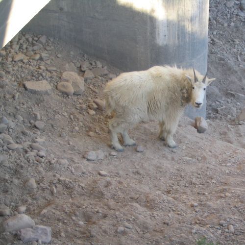
Witness mountain goats as they visit a unique mineral lick, a spot where they gather to replenish essential nutrients. The area offers stunning views of the surrounding landscape and is easily accessible from Highway 2. It's a popular stop for wildlife viewing, especially during spring and summer.

Helen Lake

Moderate4.2 mi

This trail ascends through a forest before opening into breathtaking alpine meadows. The path leads to a picturesque lake surrounded by majestic mountain vistas. Wildflowers and wildlife like marmots are common sights. For the more adventurous, an extension to Cirque Peak offers stunning views of the Wapta Icefield.

Hidden Falls Trail

Hidden Falls Trail

Easy0.1 mi

Offers an intimate encounter with a cascading waterfall nestled in a lush forest. A moderately challenging hike, it rewards with stunning views of the waterfall, especially during the spring runoff. Wildflowers bloom in abundance along the trail during summer, adding a splash of color to the landscape. Wildlife sightings are common, with chances to spot mountain goats, bighorn sheep, and even bears. The trail also provides access to a serene beach area, perfect for a mid-hike rest or picnic. Despite its seclusion, it remains one of the park's most popular trails due to its unique combination of natural beauty and wildlife.

Howe Lake

Howe Lake

Moderate3.6 mi

This trail winds through a forest affected by wildfires, offering a unique ecological landscape with diverse tree ages and species. The journey provides views of surrounding peaks and opportunities for birdwatching, including sightings of rare woodpeckers.

Huckleberry Lookout

Huckleberry Lookout

Difficult5.8 mi

This challenging hike ascends through a lush lodgepole pine forest, offering stunning views of the remote Livingston Range. The trail culminates at the Huckleberry Lookout, providing breathtaking vistas in all directions, including the North Fork Flathead River and surrounding mountains. Hikers may encounter an abundance of wildflowers and wildlife, including bears.

Huckleberry Mtn Interpretive

Easy0.9 mi

This trail offers a gentle hike suitable for families and beginners, providing an opportunity to enjoy the natural surroundings and interpretive information about the local flora and fauna.

Josephine Walk

Josephine Walk

Moderate2.1 mi

This trail offers a peaceful stroll through diverse natural settings, providing an opportunity for relaxation and connection with nature. The gentle terrain makes it accessible for casual hikers.

Kintla Lake Head

Kintla Lake Head

Moderate12.8 mi

This trail offers breathtaking views of remote mountain lakes and glacier-carved peaks, starting near Kintla Lake and traversing through rugged terrain. It features a mix of forested slopes and open mountain vistas, with opportunities to spot diverse wildlife. The trail's challenging nature rewards hikers with solitude and stunning scenery.

Lake McDonald Trail

Lake McDonald Trail

Moderate13.9 mi

This trail offers stunning views of the lake's shoreline as it winds through lush forests and burned areas, providing unique wildlife viewing opportunities. The path is ideal for nature photography and offers a serene hiking experience.

Lee Ridge

Lee Ridge

Difficult5.9 mi

This trail offers a mix of forested and open landscapes, providing stunning views of the surrounding river valley and prairie. The hike includes a gradual elevation gain, leading to spectacular vistas at the Lee Ridge/Gable Pass trail junction. Visitors can enjoy the scenic beauty and possibly encounter wildlife, making it a memorable experience.

Lincoln Creek

Difficult6.7 mi

This trail leads through a forested area, offering views of surrounding mountains and culminates at a picturesque lake with one of the park's tallest waterfalls. The trail features varied landscapes, including old-growth forests and open meadows, making it a unique hiking experience.

Martha's Basin

Moderate1.8 mi

This trail offers a peaceful hike through a picturesque alpine basin, featuring opportunities for bird watching and wildlife viewing. The area is known for its natural beauty and tranquility, making it a great spot for nature enthusiasts.

McGee Meadow Ski Trail

Easy0.5 mi

Offers a unique winter experience, leading skiers through a serene meadow and dense forest landscape. Known for its scenic beauty, the trail provides opportunities to spot wildlife such as elk, deer, and a variety of bird species. The trail is also notable for its quiet, peaceful atmosphere, making it a favorite among visitors seeking solitude and tranquility. The trail's gentle terrain makes it suitable for both beginner and intermediate skiers. The surrounding landscape is particularly beautiful after a fresh snowfall, when the meadow and trees are blanketed in white.

Medicine Grizzly Lake

Medicine Grizzly Lake

Moderate12.8 mi

This scenic trail follows North Fork Cut Bank Creek through forests and meadows, offering views of Bad Marriage Mountain and Mad Wolf Mountain. The hike culminates at Medicine Grizzly Lake, nestled beneath Razoredge Mountain with stunning waterfalls. Prime grizzly bear habitat requires caution and preparedness.

Mt Brown

Mt Brown

Difficult10 mi

This challenging hike ascends through dense forest and recent burn areas, offering spectacular views of Lake McDonald and its surroundings. The trail features steep inclines and switchbacks, culminating in panoramic vistas from the Mt. Brown Lookout. Wildlife sightings, including mountain goats and bears, are common.

No Name Lake

No Name Lake

Moderate9.7 mi

Tucked into rugged high-country terrain, this secluded body of water rests at an elevation approaching 6,000 feet, offering a level of solitude that feels increasingly rare in a landscape that draws visitors from around the world. The surrounding scenery is quintessential Montana wilderness with jagged peaks, wildflower-dotted meadows, and the kind of panoramic silence that makes you feel genuinely far from everything below. The journey begins at the North Shore Trailhead in the Two Medicine area, where you'll gain significant elevation before peeling off onto a short spur that delivers you to the lake and its adjacent wilderness campground. The climb is rewarding rather than punishing, and those who make it are treated to a mirror-still lake that somehow feels entirely undiscovered, a fitting reward for the effort it takes to get there.

Numa Lookout

Numa Lookout

Difficult11.3 mi

Ascend through a forested ridge to a historic fire lookout, offering breathtaking views of Bowman Lake and surrounding peaks like Rainbow Peak. The trail features wildflowers and abundant wildlife, including mountain goats and birds.

Nyack Creek

Extreme35.6 mi

This trail offers a deep backcountry experience, traversing through rugged terrain near Rising Sun. It provides one of the most primitive and demanding hiking experiences in the area, with opportunities to immerse oneself in untouched nature.

Nyack Crossing

Easy0.4 mi

This challenging loop traverses through a pristine wilderness area, featuring numerous stream fords and stunning views of glaciers and mountains. The trail passes by historic sites like the Nyack Ranger Station and offers breathtaking vistas of peaks such as Mount Stimson and Blackfoot Mountain.

Old Flathead River Ranger Station

Moderate3.4 mi

This trail follows an old road, offering easy walking through both forested and open areas. It features a stunning confluence of the Middle and North Forks of the Flathead River, along with the Blankenship Bridge. The trail is known for its vibrant wildflowers and diverse wildlife, including birds, elk, and deer. Beyond the old ranger station site, the trail becomes less maintained but still offers beautiful views and opportunities to spot wildlife.

Oldman Lake

Oldman Lake

Difficult12.8 mi

This trail winds through open meadows and forests, offering stunning views of surrounding mountains like Flinsch Peak and Mt. Morgan. The path leads to a serene alpine lake, surrounded by a ghostly forest of dead whitebark pines. An optional climb to Pitamakan Pass offers panoramic views of multiple lakes.

Paradise Point

Easy0.4 mi

Enjoy a short, family-friendly walk through a scenic landscape, culminating in breathtaking views of surrounding peaks. The trail is ideal for those seeking a quick, accessible hike with rewarding vistas.

Piegan Pass Cutoff

Piegan Pass Cutoff

Easy0.1 mi

Winds through alpine meadows and rocky terrain, offering panoramic views of the surrounding peaks and valleys. The trail is known for its high-altitude journey, providing hikers with a unique perspective of the park's diverse ecosystems. Along the way, expect to encounter a variety of wildlife, including mountain goats and bighorn sheep. The trail is also renowned for its wildflower displays in the summer months. Despite its challenging nature, the trail's breathtaking views and unique alpine environment make it a must-see for adventurous visitors.
Quartz Lake Loop

Quartz Lake Loop

Difficult12.5 mi

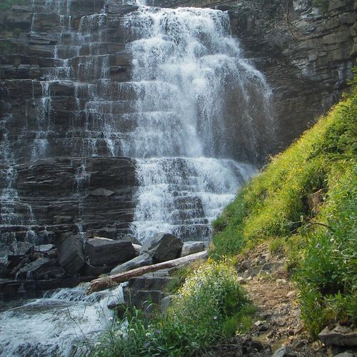
This trail winds through forests and along lake shores, offering stunning views of the Livingston Range. It features three lakes—Quartz Lake, Middle Quartz Lake, and Lower Quartz Lake—each providing unique scenic opportunities. The trail includes a mix of steep climbs and descents, culminating in a picturesque loop around these natural gems.

Quartz Ridge

Easy1.5 mi

Winds through a variety of landscapes, from dense forests to open meadows. Offers panoramic views of the park's diverse terrain, including towering peaks, deep valleys, and sparkling lakes. Known for its wildflower displays in the spring and summer, attracting nature lovers and photographers. Wildlife sightings are common, with opportunities to spot deer, mountain goats, and a variety of bird species. Despite its challenging sections, the trail's breathtaking vistas and diverse ecosystems make it a favorite among hikers.

Red Eagle

Red Eagle

Moderate17.6 mi

This trail follows an old fire road through rolling terrain to Red Eagle Lake. It reaches a scenic bluff overlooking Red Eagle Creek and offers great views of the surrounding mountains, including vistas along St. Mary Lake and the Red Eagle Valley.

Rose Creek

Difficult5.5 mi

Winds through the heart of Glacier National Park's verdant wilderness, following the serene flow of Rose Creek. The trail offers hikers the chance to spot a variety of wildlife, including moose, black bears, and numerous bird species. The lush vegetation along the trail is a mix of coniferous trees and colorful wildflowers, providing a stunning backdrop for the journey. The sound of the creek's flowing water adds to the trail's peaceful ambiance. A unique feature of the trail is the opportunity it provides to witness the park's geological history, with visible signs of glacial activity and erosion.

Scalplock

Difficult3.6 mi

Hike through dense pine and fir forests to reach a stunning lookout offering breathtaking views of Great Northern Mountain, Mount Saint Nicholas, and other peaks. The trail features a steep climb with limited views until the final ascent, where the scenery opens up dramatically.

Snyder Lake

Moderate8.7 mi

This trail ascends through a diverse forest of cedar, hemlock, and larch, eventually giving way to alpine meadows and talus slopes. The scenic Snyder Lake is surrounded by Edwards Mountain, Mount Brown, and the Little Matterhorn, offering breathtaking views and opportunities to spot wildlife like bears and trout.

South Boundary

Extreme20.9 mi

This trail offers a scenic journey along the southern edge of the park, featuring diverse landscapes and wildlife viewing opportunities. It is a point-to-point trail, suitable for those seeking a straightforward hike with minimal elevation changes.

South Shore Josephine Lake Trail

South Shore Josephine Lake Trail

Easy2 mi

This trail offers a peaceful journey along the south shore of a beautiful lake, providing opportunities to observe wildlife such as moose and warblers. The terrain varies from dense forests to riparian areas, making it a diverse and engaging hike.

St Mary Lake

St Mary Lake

Easy0.6 mi

Follow the shoreline of a picturesque lake, offering stunning views of surrounding mountains and diverse wildlife, including elk and bears. The trail passes through varied landscapes, providing opportunities for bird watching and photography.

Two Medecine Boat Dock

Easy0.1 mi

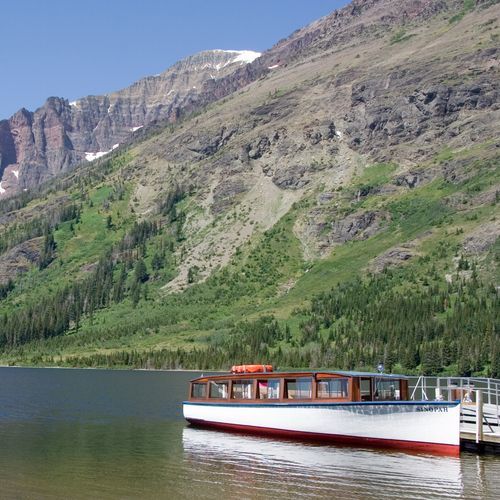
Start your adventure at the historic boat dock on Two Medicine Lake, where you can embark on a scenic boat tour aboard the Sinopah, learning about the rich Blackfeet tribal history. From here, explore hiking trails like the path to Twin Falls or Upper Two Medicine Lake, offering breathtaking views of surrounding mountains and abundant wildlife.

Two Medecine South Shore

Easy0.7 mi

This trail follows the picturesque shoreline, offering views of the surrounding mountains and access to scenic spots like Paradise Point and Rockwell Falls. The area is known for its wildlife, including frequent moose sightings. The trail passes through montane forests and meadows, providing a diverse hiking experience.

Two Medicine Pass

Two Medicine Pass

Easy0.1 mi

This trail offers a demanding journey through the scenic landscapes of Glacier National Park's southeast corner. It features dramatic mountain vistas and traverses diverse ecosystems, but specific details about its route and features are limited in available sources.

Two Medicine South Shore

Moderate5.3 mi

This trail offers stunning views of the surrounding mountains and access to scenic shoreline areas. It provides opportunities for wildlife viewing and connects with other trails in the area, offering a variety of hiking experiences.

Upper McDonald Creek

Upper McDonald Creek

Moderate3.2 mi

Wander through a lush, old-growth forest featuring giant western hemlocks and red cedars, some over 500 years old. Highlights include McDonald Falls and Sacred Dancing Cascades, with opportunities to spot wildlife like harlequin ducks and moose. The trail offers scenic views and a tranquil atmosphere, perfect for nature lovers.

Waterton Lake

Waterton Lake

Easy0.2 mi

Offers a unique hiking experience, straddling the international border between the United States and Canada. The trail provides breathtaking views of the pristine Waterton Lake, surrounded by towering mountain peaks. Along the way, hikers may encounter a diverse array of wildlife, including grizzly bears, moose, and over 260 species of birds. The trail also passes through a variety of ecosystems, from lush forests to alpine meadows, showcasing the park's rich biodiversity. A boat shuttle is available for those wishing to return by water, offering a different perspective of the stunning landscape.

Apgar Flats Horse

Moderate5.1 mi

This trail meanders through a forest of lodgepole pines, offering serene views and opportunities to spot wildlife such as deer and birds. The trail's level terrain makes it suitable for a leisurely ride or hike, providing a peaceful experience amidst nature.

Apgar Mountain Horse Loops

Moderate2.9 mi

This trail offers a scenic loop through an old burn area, providing views of the surrounding landscape. It is suitable for horseback riding and hiking, allowing visitors to enjoy the natural beauty of the region.

Autumn Creek

Moderate4.6 mi

This trail offers a mix of forested paths and open meadows with stunning views of Three Bears Lake and Elk Mountain. The route passes through a variety of wildflowers and offers scenic vistas, especially during summer months. The trail's diverse landscapes make it appealing for both hikers and winter sports enthusiasts.

Camas Creek

Extreme17.4 mi

This trail offers a scenic journey through meadows of tall grasses and Douglas-fir woodlands, eventually reaching picturesque areas like Rogers Meadow. The trail's diverse landscapes make it an interesting choice for hikers looking to explore less crowded areas.

Divide Creek

Moderate2.5 mi

This trail offers a picturesque journey through natural landscapes, following a small creek that once served as an old stagecoach route. The area is popular for skiing during winter months, offering a serene and peaceful experience amidst the natural beauty of the surroundings.

Dry Fork

Moderate2.7 mi

This trail offers a mix of scenic views and varied terrain, though specific details about its features are not available. It appears to be a moderately challenging hike suitable for those seeking a diverse outdoor experience.

Feather Plume Cutoff

Easy1.2 mi

This trail offers a picturesque route that connects hikers to the alpine regions, providing stunning views of the surrounding mountains. It serves as a vital link between different trail systems, allowing hikers to explore diverse landscapes within Glacier National Park.

Fielding

Extreme15.2 mi

This trail traverses multiple creek drainages, including Coal Creek, Muir Creek, Park Creek, and Ole Creek, offering diverse scenery from burned forests to dense fir forests. The route includes river and creek crossings, making it a challenging yet rewarding hike with opportunities for solitude and wildlife viewing.

Harrison Creek

Moderate5.8 mi

This trail offers a challenging journey through varied terrains, providing unique opportunities to experience natural beauty. The route is less traveled, making it ideal for those seeking solitude and adventure.

Howe Ridge

Difficult9.3 mi

This trail traverses a forest heavily impacted by wildfires, offering views of Lake McDonald and surrounding peaks. The landscape is a mix of burned tree trunks and regenerating vegetation, creating a unique ecological environment. Birdwatching is excellent in this area, with sightings of rare species like the black-backed woodpecker.

Jackson Glacier

Jackson Glacier

Difficult6.4 mi

This trail provides stunning views of Jackson Glacier, one of the park's most iconic natural features. Hikers can enjoy the scenic beauty of the area, though the glacier itself has receded significantly. The trail involves steep sections and overgrown areas, requiring careful navigation. Wildlife sightings, including grizzlies and moose, are common, making it essential to carry bear spray.

Kishenehn

Difficult8.8 mi

This trail offers scenic views of the North Fork Flathead River, passing through meadows, treed areas, swamps, and ponds. It includes two creek crossings and leads to a patrol cabin near the border. The trail is suitable for activities like bird watching and wildlife viewing.

Kishenehn Creek

Moderate3.9 mi

This trail winds through meadows, treed areas, and swamps along the North Fork Flathead River, featuring two creek crossings and a historic patrol cabin. It is home to elk, moose, grizzlies, and wolves, offering a truly wild experience. The area is also rich in geological history, with fossils from ancient lakes and forests.

Lake Isabel

Extreme22.6 mi

No description available

Logging Cabin Trail

Easy0.1 mi

This short trail offers a peaceful walk through a forested area, providing a serene experience with minimal elevation change. It is suitable for families or those looking for a quick, easy hike.

Logging Lake

Difficult12.5 mi

This trail offers a challenging hike through a dense forest, culminating at a picturesque lake. The journey provides stunning views and an opportunity to immerse oneself in nature. The trail's remote location makes it less crowded, ideal for those seeking solitude.

Loneman Lookout

Difficult5.4 mi

This challenging hike involves fording rivers and offers breathtaking views of the Nyack Valley, Harrison Lake Valley, and the Great Bear Wilderness. The trail traverses through a mix of old-growth forests and burn areas, culminating at the Loneman Lookout with stunning vistas of surrounding peaks like Mount Jackson and Mount Stimson.

Mad Wolf Boundary

Moderate1.8 mi

This trail offers a scenic passage from creek bottoms to alpine meadows, providing access to climb Mad Wolf Mountain. The route traverses varied landscapes, including forests and meadows, offering stunning views of the surrounding mountains and valleys. The trail's diverse terrain makes it appealing for hikers seeking a mix of scenery and challenge.

McDonald Creek Cutoff

Easy1.7 mi

This trail offers a serene hike through the lush old-growth forest of the McDonald Creek drainage, leading to the shores of the creek. The surroundings are rich in natural beauty, providing a peaceful experience amidst the forest's tranquility.

McDonald Lake

Easy0.1 mi

This trail follows the western shore of Lake McDonald, providing stunning views of the lake and surrounding mountains. The path traverses through both burned and unburned forest areas, offering unique wildlife and nature views. The trail is generally level, making it accessible for a variety of hikers, though parts can be overgrown and lack shade.

McDonald Ranger Station Horse

Easy0.3 mi

This trail offers a serene walk through a forested area, connecting to the Upper McDonald Creek Trail. It provides opportunities to view the creek and surrounding natural beauty, making it a pleasant addition to a visit to the historic Lake McDonald Ranger Station.

Mokowanis Lake

Easy1.4 mi

Enjoy a serene hike to Mokowanis Lake, nestled in the heart of Glacier National Park's stunning alpine landscape. The trail offers picturesque views and a tranquil atmosphere, perfect for those seeking a peaceful connection with nature.

NF Belly River

Difficult6.4 mi

This trail descends into a scenic valley, offering stunning mountain views and access to several lakes, including Elizabeth and Helen Lake. It traverses through forests and meadows, providing a diverse hiking experience with opportunities to spot wildlife.

North Boundary

Moderate5.2 mi

This trail offers a peaceful hike through a pine forest bordering a sequoia grove. It includes scenic views and less crowded areas compared to the main sequoia trails. The loop passes through fire-scarred areas and offers glimpses of giant sequoias.

Nyack Pack Trail

Easy0.8 mi

This trail offers a chance to experience the serene beauty of Glacier National Park's wilderness. However, it does not match any prominent trails like the Nyack Creek - Coal Creek Trail Loop, which is known for its challenging terrain and stunning views of Mount Stimson and Pumpelly Glacier.

Ole Creek

Extreme19.2 mi

This trail offers breathtaking views of the surrounding mountains and leads to serene alpine lakes, providing a challenging yet rewarding hiking experience through diverse landscapes.

Packer's Roost Trail

Moderate1.7 mi

Begin your adventure at Packer's Roost, a trailhead nestled near the Going-to-the-Sun Road. This marks the start of a journey through shaded forests, burn areas, and eventually to mountain peaks like Flattop Mountain. The trail offers scenic views of wildflower meadows and glacier peaks, making it a great starting point for longer backpacking trips.

Porcupine Lookout

Difficult5 mi

Ascend to a mountain lookout offering expansive views of the surrounding landscape. The challenging hike rewards visitors with a unique perspective on the natural beauty of the area.

Quartz Creek

Moderate6.9 mi

This trail begins in a flat drainage speckled with aspen stands and small rivulets, gradually ascending through a dying forest and crossing Quartz Creek. It continues with rocky switchbacks to a wide basin and eventually reaches a saddle at 12,240 feet, offering breathtaking views of the surrounding landscape.

Rainbow Falls

Easy0.4 mi

No description available

Rising Sun

Rising Sun

Easy0.4 mi

This easy trail follows the shoreline of St. Mary Lake, offering stunning views of the surrounding mountains. It passes through aspen groves and crosses Rose Creek, providing frequent access to the lake for activities like skipping rocks. The trail is perfect for families and those seeking a leisurely walk with picturesque views.

Snyder Ridge

Extreme10.7 mi

This trail follows a wooded ridge, offering a mix of cedar rainforest and scenic creek crossings. The solitude is a highlight, though views are limited until nearing the end. Fish Lake provides a welcome change of pace towards the trail's conclusion.

Sue Lake Observation

Easy0.4 mi

This short, steep hike culminates at the crest of Mount Kipp, offering breathtaking views of the Sue Lake basin and the Mokowanis valley. The trail is part of a larger network in Glacier National Park, providing opportunities for bird watching, wildlife viewing, and picnicking amidst stunning mountain scenery.

Avalanche Cutoff

Easy0.3 mi

This trail offers a gentle hike through a scenic area, though specific details are not available due to lack of information.

Bear Mt Lookout

Moderate0.9 mi

This trail offers scenic views from a mountain lookout, providing a panoramic experience for hikers. The trail's features are not detailed in the provided sources.

Crypt Lake Trail

Easy1.1 mi

This hike begins with a boat ride across Upper Waterton Lake, followed by a demanding ascent through forests and mountainous terrain. Highlights include Burnt Rock Falls, Crypt Falls, and a thrilling traverse through a natural tunnel and along a cliffside with cables. The final destination is a pristine alpine lake nestled in a glacial cirque, offering breathtaking views and a chance to cool off in its icy waters.

Dutch Creek

Difficult9.3 mi

No description available

Flattop Mountain Trail

Extreme10.6 mi

Ascend through aspen groves and alpine tundra to reach a plateau offering breathtaking views of surrounding peaks and lakes. This trail, part of a historic route, provides stunning vistas of Longs Peak and Hallett Peak, with options to extend the hike to nearby summits.

Gunsight Horse Trail Cutoff

Easy0.1 mi

This trail serves as a connector, providing access to other scenic trails in the area. It offers views of St. Mary Lake and is part of a larger network of trails that explore the park's diverse landscapes.

Kootenai Cabin

Easy1.4 mi

This trail leads to the site of a historic cabin, offering insights into the region's past. The area is known for its natural beauty and historical significance, making it a unique destination for those interested in exploring both nature and history.

Lime Springs

Difficult7.1 mi

No description available due to lack of specific trail data.

Milk River Ridge Bdy

Easy0.9 mi

This trail offers scenic views of rolling grasslands and unique geological formations, although it is not located within a national park. The area is known for its diverse wildlife and significant cultural heritage.

Mount Richards Alt Route

Moderate1.1 mi

This route involves navigating through dense bear country, offering a mix of hiking and scrambling. The trail leads to a scenic summit with panoramic views, though it requires careful route-finding and physical endurance.

Otatso Creek

Extreme7.3 mi

This trail offers a pleasant hike along Otatso Creek, providing a serene experience as it winds out to the park boundary. The surroundings are characterized by natural beauty, making it a peaceful choice for those seeking a less crowded trail.

Rocky Point Nature Trail

Rocky Point Nature Trail

Easy0.5 mi

This trail offers stunning views of Lake McDonald and the surrounding mountains. It passes through a forest area heavily impacted by the 2003 Robert Fire, showcasing the natural regeneration process. The trail features a mix of dead trees and new growth, highlighting the ecological role of wildfires. The scenic views from Rocky Point are particularly notable, providing a unique perspective on the lake and its surroundings.

Sherburne Boundary

Easy1.5 mi

This trail offers a serene journey through varied landscapes, featuring prairies and oak savannas. The scenery changes with the seasons, offering vibrant colors in spring and summer, and a serene winter landscape. The trail's gentle terrain makes it accessible for a range of visitors.

Sherburne Cutoff

Easy1 mi

This trail offers a challenging descent known for its steepness and rocky terrain. It is often avoided due to its difficulty, despite being a shortcut. The surrounding landscape provides stunning views, but hikers should be prepared for the rugged conditions.

Siyeh Bend Cutoff

Siyeh Bend Cutoff

Easy1.1 mi

This trail offers scenic views of alpine meadows and mountain vistas, similar to those found on the Siyeh Pass Trail. However, the exact trail details do not match known trails in Glacier National Park, suggesting it might be a lesser-known or incorrectly documented path.

Sperry Loading Ramp Trail

Easy0.1 mi

This short trail offers a gentle stroll along a waterfront area, providing scenic views and a peaceful atmosphere. It is suitable for all ages and skill levels, making it an excellent choice for families or those looking for a quick, easy walk.

St Mary Corral Cutoff

Easy0.4 mi

This trail provides a gentle hike through the scenic areas near St. Mary, offering a chance to enjoy the natural beauty of the region. It is suitable for families and beginners, providing a relaxing outdoor experience.

Swiftcurrent Cutoff Trail

Easy0.2 mi

No description available

Get offline trail maps and detailed hiking info in the Parka app

Download Parka — It's Free

Get offline trail maps for Glacier National Park

Free on the App Store

Get Parka

Why Park Lovers Choose Parka

Trip Planner

All the tools for epic adventures

Works Offline

Fully functional without cell service

Updated Weekly

Trail conditions, alerts, and closures

Try Risk-Free

7-day free trial, cancel anytime

Start Your 7-Day Free Trial

Unlock everything you need for your next national park trip. Your first week is on us!

National Park vista

Start your adventure today

Download Parka and plan your perfect national park trip in minutes.