ParkaDownload
Acadia National Park

Trails in Acadia National Park

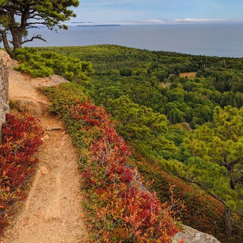
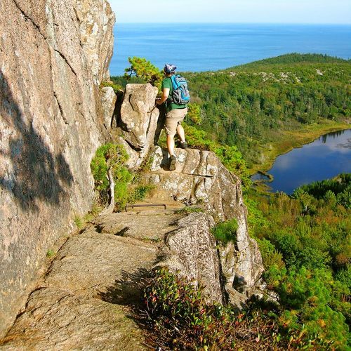
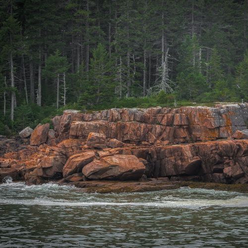
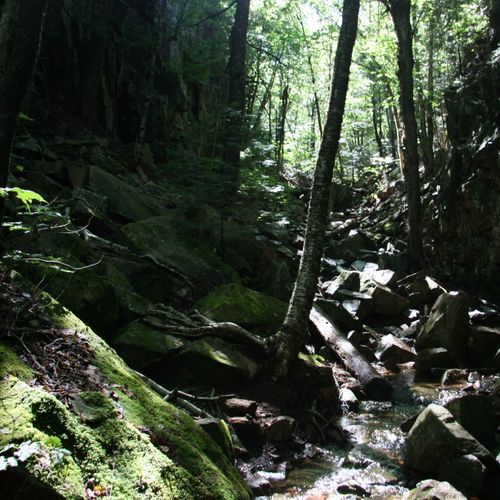
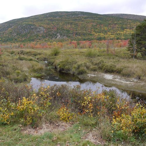
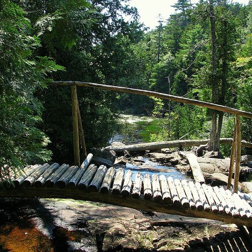
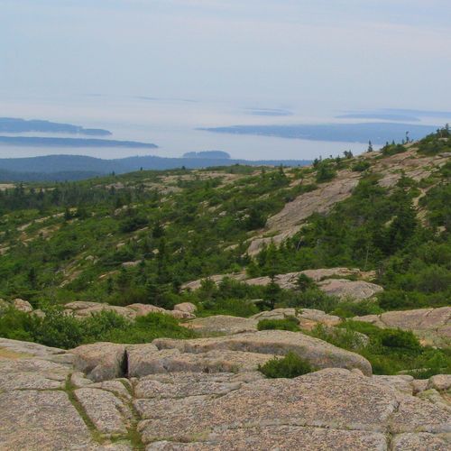
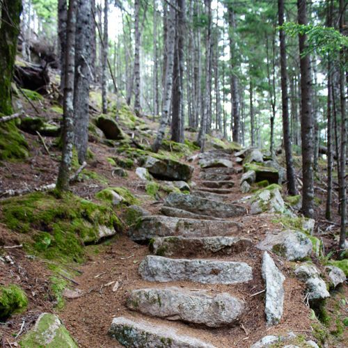
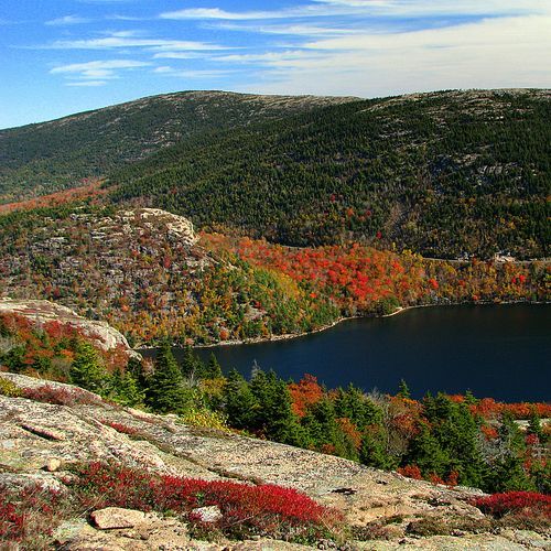
Acadia packs an enormous range of hiking into a relatively compact park, with 140 trails that run from gentle shoreline walks to steep, airy scrambles. Most routes fall on the easy end, which makes the park especially appealing for casual walkers, families, and anyone who wants big scenery without an all-day effort. Trails around Jordan Pond, the Jesup Path and Hemlock Path loop, and the Ocean Path deliver exactly what Acadia does best: polished coast, quiet forest, clear lakes, and mountain views all in a manageable outing. Moderate trails expand the menu with longer loops, rolling climbs, and classic summit approaches, while the park’s difficult routes prove that Acadia’s modest elevations can still feel serious when the terrain rises straight from sea level. The standout hikes are the ones that show off Acadia’s dramatic personality. Beehive, Precipice, and Jordan Cliffs are the park’s signature adrenaline trails, famous for exposed cliff faces, iron rungs, ladders, and narrow ledges that turn a hike into a true adventure. They are thrilling, memorable, and not for anyone uncomfortable with heights. On the other end of the spectrum, Jordan Pond Path and the easy coastal walks offer some of the most iconic scenery in New England with far less effort. What makes hiking here special is the sheer variety packed into a single landscape: in one day you can move through spruce forest, circle a glacial pond, follow a rocky Atlantic shoreline, and stand on a bare granite summit with sweeping ocean views. Few parks deliver such a strong sense of place, or such a wide choice of hikes, in so accessible a setting.


Acadia Mountain Trail

Acadia Mountain Trail

Moderate2.5 mi

This trail winds through a diverse landscape, featuring both forested areas and open sections that lead to a summit with expansive views. The varied terrain makes it appealing for those seeking a moderate hike with rewarding vistas.

Bar Island Trail

Bar Island Trail

Easy1.7 mi

Cross a natural land bridge at low tide to reach this island, where a gradual ascent leads to panoramic views of the town and nearby mountains. The trail passes through a forested area and offers opportunities to explore tide pools and wildflowers.

Beech Mountain Loop Trail

Beech Mountain Loop Trail

Moderate1.1 mi

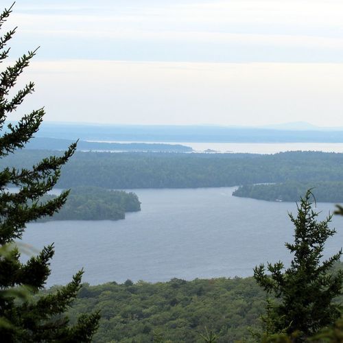
This loop offers views of Long Pond and the west side of Mount Desert Island (including Mansell Mountain), traversing a mix of forested paths and rocky trail sections. The summit includes a fire tower with panoramic views. It's a popular spot for sunset hikes, so plan accordingly and bring appropriate gear.

Beehive Trail

Beehive Trail

Difficult1.5 mi

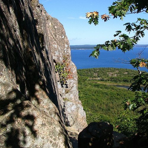
The Beehive Trail is a short, scenic but exposed hike on the granite cliffs of Acadia National Park. It features steep rock scrambles and sections with iron rungs and ladder-like steps, offering panoramic coastal and island views. While it is a shorter and somewhat less-exposed alternative to the Precipice Trail, the cliff sections can be strenuous and may be intimidating for hikers uncomfortable with heights.

Bubbles Trail

Bubbles Trail

Moderate1.7 mi

This trail offers stunning views of Jordan Pond and surrounding mountains. It features iconic glacial erratics like Bubble Rock and provides a mix of moderate hiking and scenic vistas. The trail includes both South and North Bubbles, each offering unique perspectives on the area's natural beauty.

Giant Slide Trail

Giant Slide Trail

Difficult5 mi

This trail offers a unique blend of rock scrambling, mountain streams, and summit views. It includes climbs to Sargent Mountain, Gilmore Peak, and Parkman Mountain, providing panoramic vistas. The trail features challenging terrain with boulder-strewn valleys and cave-like formations, making it ideal for experienced hikers seeking adventure.

Gorham Mountain Trail

Gorham Mountain Trail

Moderate2.7 mi

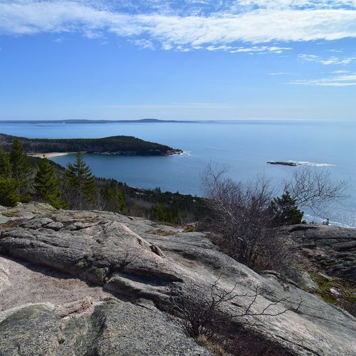
Ascend through a spruce forest to a granite summit offering stunning views of the coastline, including Sand Beach, the Beehive, and Otter Point. The trail features a mix of gentle slopes and rugged terrain, with historical markers like the Waldron Bates plaque. Wild blueberries are a seasonal treat along the way.

Jordan Pond Path

Jordan Pond Path

Easy3.2 mi

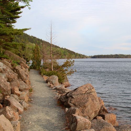
The Jordan Pond Path is a scenic loop that circles Jordan Pond, offering views of surrounding mountains and access to nearby hikes such as the Bubbles. The trail is largely a narrow, hard‑packed dirt path with sections that include exposed rocks and roots, granite steps, gaps, and narrow boardwalks and bridges. A short section near Jordan Pond House is partially accessible, but much of the loop is uneven in places. The loop is popular with families and visitors seeking a leisurely walk with picturesque views; typical access points are Jordan Pond House or the Jordan Pond Boat Launch.

Ocean Path

Ocean Path

Easy4.2 mi

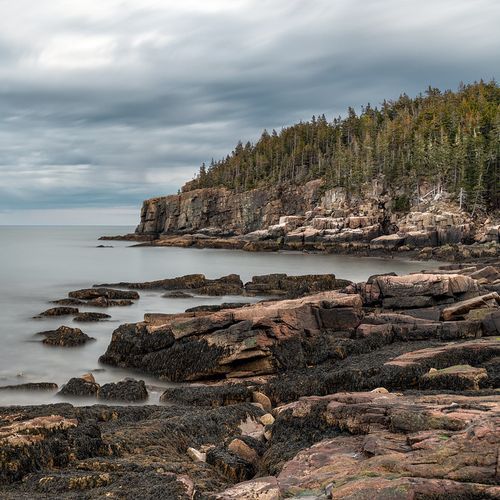
Follow the shoreline along vast slabs of pink granite, picturesque cliffs, and breathtaking ocean views. Highlights include Thunder Hole, where waves create a thundering sound, and Monument Cove, with its unique sea stack. The trail offers numerous viewpoints and is surrounded by a mix of spruce and fir forests.

Precipice Trail

Precipice Trail

Difficult2.5 mi

Rise over 1,000 feet via iron rungs and ladders on sheer cliffs, offering breathtaking views of the ocean and surrounding mountains. The ascent involves navigating boulder fields, narrow ledges, and wooden bridges, culminating in a thrilling climb to the summit. The route is reminiscent of European via ferrata routes, requiring physical and mental strength. It's not suitable for those with a fear of heights or small children, and descending is not recommended.

Cadillac North Ridge Trail

Cadillac North Ridge Trail

Moderate4.2 mi

This trail offers a moderately challenging hike with stunning views of Bar Harbor, Frenchman Bay, and the Schoodic Peninsula. The path features granite slopes, rocky trails, and stairs, providing a rewarding experience with sweeping vistas, especially during sunrise and sunset.

Cadillac South Ridge Trail

Cadillac South Ridge Trail

Moderate7.5 mi

Ascend through a forested path to a meadow-like area, then continue on an exposed granite ridgeline offering spectacular ocean views. Highlights include Eagle's Crag for panoramic views and The Featherbed, a serene pond. The trail culminates at the summit with 360-degree vistas.

Cadillac South Ridge Trail Access

Cadillac South Ridge Trail Access

Easy0.3 mi

This trail offers a scenic hike through forested paths and exposed granite ridgelines, culminating in panoramic views of the Atlantic Ocean. Highlights include Eagle's Crag for early ocean views and The Featherbed, a serene pond. The trail's rugged terrain and scenic vistas make it a popular choice for hikers seeking a challenge and breathtaking scenery.

Carriage Road

Carriage Road

Difficult6.2 mi

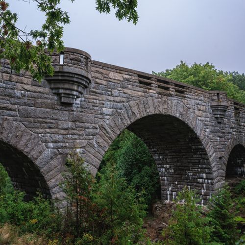
Experience the beauty of historic carriage roads, originally built by John D. Rockefeller Jr. for horse-drawn carriages. These gravel paths offer stunning views of mountains, lakes, and forests, perfect for biking or walking. The roads are lined with granite blocks and feature picturesque bridges, creating a serene and peaceful atmosphere.
Flying Mountain Trail

Flying Mountain Trail

Moderate1.4 mi

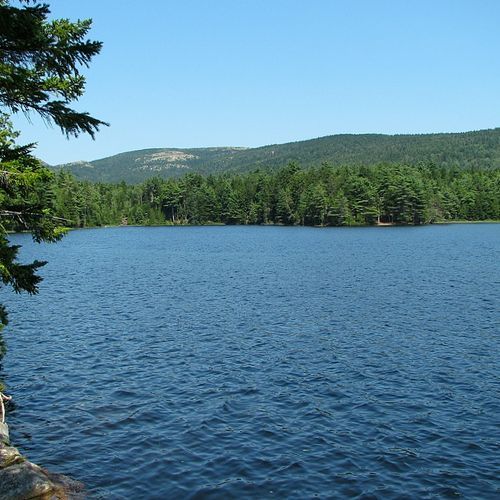
This loop hike ascends a small mountain, offering stunning views of Somes Sound and the Atlantic Ocean. The trail features a mix of forested terrain and exposed ledges, leading to a secluded ocean cove. It's a popular choice for those seeking a short, scenic hike with rewarding views.

Great Head Trail

Great Head Trail

Moderate1.5 mi

This trail offers stunning views of the rocky coastline, Sand Beach, and surrounding mountains. It wraps around the Great Head Peninsula, providing ample opportunities to enjoy the ocean scenery and unique geological formations. The trail includes remnants of an old tea house and offers a mix of forest and coastal landscapes.

Jordan Pond House Trail

Jordan Pond House Trail

Easy0.4 mi

Offers a leisurely stroll around a pristine, glacier-formed pond, with opportunities to spot local wildlife such as beavers, loons, and frogs. The trail is largely flat, making it accessible for visitors of all ages and abilities. Halfway through the journey, hikers encounter the historic Jordan Pond House, famous for its traditional afternoon tea and popovers. The trail also provides stunning views of the Bubbles, two distinctive rounded mountains. An ideal choice for those seeking a blend of natural beauty, wildlife spotting, and a touch of local history.

Jordan Pond Loop

Jordan Pond Loop

Difficult8.7 mi

Surrounded by Penobscot and Pemetic Mountains, the trail follows the shores of a glacial-carved lake, offering stunning views of the Bubbles. The path features wooden boardwalks, footbridges, and rocky terrain, with opportunities to spot wildlife like loons and peregrine falcons. The scenic route passes through a mix of forested areas and open boulder fields, providing a unique blend of natural beauty and tranquility.

Jordan Pond Nature Trail

Jordan Pond Nature Trail

Easy0.6 mi

This trail offers a peaceful walk through a forested area along the shore of a picturesque pond, providing scenic views of surrounding mountains and opportunities to observe wildlife such as loons and beavers. The path includes wooden boardwalks and bridges, enhancing the natural experience.

Ship Harbor

Ship Harbor

Easy1.4 mi

This trail offers a serene journey through spruce forests and along a picturesque shoreline, featuring numerous tide pools at low tide. It is a haven for birdwatchers, with sightings of loons, eiders, and eagles. The trail's figure-eight loop allows for a leisurely exploration of the area's diverse habitats, including mudflats and rocky coastlines.

A Murray Young Path

Easy1.2 mi

This trail traverses a deep gorge between Dorr and Cadillac Mountains, offering scenic views and a challenging climb. It connects with other trails, making it part of a larger hiking loop in the area.

Alder Trail

Alder Trail

Easy0.6 mi

This trail offers a peaceful walk through a mix of alder bushes and fruit trees, leading from the Blueberry Hill parking area. It's a great spot for birdwatching and observing butterflies amidst the coastal scenery.

Amphitheater Loop

Moderate3.8 mi

Winding through a picturesque valley between Cedar Swamp Mountain and Penobscot Mountain, this loop features some of the most iconic stone bridges, including the majestic Amphitheater Bridge. The trail offers stunning views of the surrounding mountains and traverses through lush landscapes, providing a glimpse into the area's wild beauty. Visitors can enjoy the intricate stonework of the bridges and the serene natural surroundings, making it a standout experience in the region.

Asticou & Jordan Pond Path

Asticou & Jordan Pond Path

Easy1.5 mi

This trail offers a casual hike through a nice wooded forest, featuring stone stairs and wooden bridges. It connects two of the area's most notable spots, providing a serene and picturesque experience for hikers.

Bald Peak Trail

Moderate1.7 mi

This challenging hike ascends two mountains over 900 feet, offering stunning ocean views of Somes Sound and Northeast Harbor. The trail features steep granite sections, carriage road crossings, and scenic vistas of Upper Hadlock Pond and surrounding islands. It's ideal for sunset hikes with proper gear and headlamps.

Bass Harbor Head Lighthouse Trail

Bass Harbor Head Lighthouse Trail

Easy0.1 mi

This short path leads to a picturesque lighthouse perched on the edge of a cliff, offering breathtaking views of the Atlantic Ocean and surrounding landscape. Visitors can descend stairs to the shoreline for spectacular photo opportunities, especially during sunset.

Beachcroft Path

Easy1.2 mi

Ascend through a forested path with steep, exposed rocky sections and cut stone steps to reach the summit of Champlain Mountain. Enjoy panoramic views of Mount Desert Island, Frenchman Bay, and the outlying islands. The trail offers a challenging yet rewarding hike with scenic vistas.

Beech Cliff Trail

Easy0.9 mi

This trail features a series of iron ladders leading up to breathtaking views of Echo Lake and the Atlantic Ocean. It offers a mix of challenging sections with ladders and easier loops at the top, providing panoramic views of the surrounding landscape.

Beech Mountain South Trail

Easy0.7 mi

Wander through a forested valley before ascending to a summit featuring a historic fire tower. The ascent offers varied landscapes, including mossy woodlands and steep stone steps. At the summit, enjoy panoramic views of the surrounding mountains, Echo Lake, and Long Pond. The return journey provides scenic vistas of the ocean and outlying islands, making it a rewarding hike with diverse natural beauty.

Beech West Ridge Trail

Easy0.9 mi

This trail provides a scenic route with views of Long Pond and the surrounding mountains. It is part of a network of trails in the area, offering options for hikers to explore the diverse landscapes of the region. The trail's proximity to other popular hikes like the Beech Mountain Loop makes it an attractive choice for those seeking varied scenery.

Bernard Mountain Trail

Bernard Mountain Trail

Moderate2 mi

This hike follows a wooded route to the top of Bernard Mountain, offering limited western views along the way. Some sections are steep and rocky, and trail markings are sparse, with the route primarily indicated by Bates-style cairns rather than tree blazes. The trailhead is reached from Seal Cove Pond Road.

Bowl Trail

Bowl Trail

Easy0.6 mi

This trail provides a peaceful walk through a natural setting, perfect for those seeking a brief escape into nature. The dirt surface and gentle elevation change make it accessible for most hikers.

Bubble & Jordan Ponds Path

Bubble & Jordan Ponds Path

Moderate3.6 mi

This trail offers a tranquil walk along the shores of a serene pond, surrounded by mountains and offering stunning views. The area is known for its unique geological formations and is a popular spot for both leisurely strolls and more challenging hikes to nearby summits.

Bubbles Divide

Moderate2 mi

This trail offers stunning views from the summits of North and South Bubble, including the iconic Bubble Rock. The hike traverses forested paths and steep granite sections, providing breathtaking vistas of Jordan Pond and the surrounding mountains.

Buck Cove Mountain Trail

Moderate2.9 mi

Buck Cove Mountain Trail begins near the group sites in Schoodic Woods and passes through forested areas and highbush blueberry fields as it climbs to the summit of Buck Cove Mountain, then continues up the north face to Schoodic Head summit. The route skirts the edge of Birch Harbor Mountain and connects with other trails in the Schoodic network, offering options for extended exploration. At just over 3 miles and with notable elevation gain, it is the network's longest trail and involves more climbing than many other local trails, rewarding hikers with extensive scenic views from the summits.

Cadillac Summit Loop

Cadillac Summit Loop

Easy1.2 mi

Circle the summit of the tallest mountain in the region, offering breathtaking vistas of surrounding peaks and Frenchman Bay. The trail features informational plaques about geology and history, with accessible pathways suitable for all visitors.

Cadillac West Face Trail

Cadillac West Face Trail

Easy0.8 mi

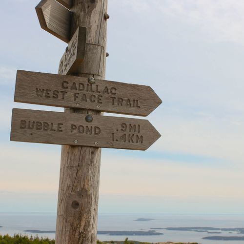
This demanding route climbs steeply over exposed granite ledges and boulder fields on one of the most challenging paths to the summit of Cadillac Mountain. Beginning near Bubble Pond, the trail quickly becomes a hands-and-feet scramble across slabs that can be extremely slick due to naturally occurring pink algae. With no iron rungs or constructed aids, the route offers a raw, high-exposure Class 3 hiking experience. Because of the steep, vertical sections and slippery rock, it is not suitable for dogs or hikers uncomfortable with heights.

Canada Cliffs Trail

Easy0.7 mi

This trail offers a gentle descent through a forested area, providing a serene contrast to the more strenuous Beech Cliffs ascent. It winds through spruces and pines, occasionally crossing minor creeks, and offers brief views through the trees before returning to the Echo Lake parking area.

Canon Brook Trail

Moderate1.9 mi

This trail offers a serene journey through wooded areas, passing small ponds and streams. It connects to other paths, providing access to scenic spots like Jordan Pond and the summits of Dorr and Cadillac mountains. The route includes a mix of tranquil brookside walks and more challenging climbs over rocky terrain.

Champlain North Ridge Trail

Champlain North Ridge Trail

Easy1 mi

This trail offers a challenging hike along granite surfaces with steep grades, providing dramatic views of the surrounding landscape. It is often used as part of a loop hike to the summit of Champlain Mountain, offering a unique blend of rugged terrain and scenic vistas.

Champlain South Ridge Trail

Champlain South Ridge Trail

Easy1.3 mi

This trail ascends through lush forests and granite formations, offering stunning views of the Atlantic Ocean and surrounding mountains. It connects with other trails, providing options for longer hikes or scenic variations. The trail is particularly photogenic during fall when blueberry leaves turn red.

Compass Harbor Trail

Easy0.4 mi

This trail offers a serene walk through a forested estate, leading to a dramatic shoreline with views of Frenchman Bay and Ironbound Island. It features the historic ruins of George B. Dorr's Old Farm estate, including a foundation, stone steps, and remnants of gardens. The trail provides a quieter experience compared to more popular park sites.

Day Mountain Carriage Road

Day Mountain Carriage Road

Easy1.5 mi

This historic carriage road winds its way to the summit, offering a leisurely hike with scenic views of the Atlantic Ocean and surrounding landscapes. The trail features well-maintained gravel paths and is suitable for a family-friendly outing or a casual bike ride. The summit provides a peaceful spot to enjoy panoramic views.

Day Mountain Loop

Moderate2.9 mi

This loop hike ascends a minor peak, offering beautiful views across Mount Desert Island. The trail features a unique carriage road that spirals to the summit, providing multiple viewpoints. The hike can be extended by exploring nearby peaks, offering a mix of forested landscapes and granite exposures. The area is particularly vibrant during fall, with the lower elevation making it ideal for enjoying the foliage. The loop concludes by returning via scenic carriage roads, offering additional perspectives on the surrounding landscape.

Day Mountain Trail

Day Mountain Trail

Easy1.2 mi

This trail offers a family-friendly hike through a forested landscape with increasing views as it rises. The trail crosses carriage roads multiple times before reaching the summit, providing scenic views to the south, east, and west. It connects with other trails for longer options, making it suitable for various hikers.

Dorr Mountain North Ridge Trail

Easy0.9 mi

This trail ascends through a forest of evergreens and birches, eventually clearing to bare granite formations with stunning views of Bar Harbor and the Porcupine Islands. The summit offers great vistas of the surrounding landscape.

Dorr Mountain South Ridge Trail

Easy1.2 mi

This trail offers a strenuous climb up a forested path and granite ridgeline, featuring iron rungs and ladders. The descent through the forest provides a contrast to the exposed summit, offering panoramic views of the surrounding landscape.

Duck Harbor Mountain Trail

Moderate2.6 mi

Enjoy wonderful views of the island and harbor on this hike, which leads to a cool, rocky beach. The trail offers a fun experience with its ups and downs, culminating in scenic vistas.

Duck Harbor Trail

Duck Harbor Trail

Moderate4.2 mi

The Duck Harbor trail on Isle au Haut leads to Duck Harbor and provides access to coastal shoreline and wooded uplands, serving as a route into the island’s trail network and to Duck Harbor Campground. Duck Harbor is a primary starting point for hiking around the island; the campground is remote, accessible by foot or paddle, and requires reservations.

Eagle Lake Loop

Moderate5.9 mi

The Eagle Lake Loop follows Acadia’s historic carriage roads around Eagle Lake, offering scenic views of the water and surrounding woods. The loop is part of the park’s carriage road system and is traveled by hikers and cyclists, but carriage roads may include loose sand, gravel, and rocks and can be uneven or steeper in places (there is a notable steep hill at the southwest end of the lake). The loop connects with other carriage roads that lead north toward Breakneck Pond, Half Moon Pond, and Witch Hole Pond. The Eagle Lake parking area on Route 233 provides parking and wheelchair-accessible restrooms. Note: swimming at Eagle Lake is not permitted.

Eagle Lake Trail

Eagle Lake Trail

Easy0.6 mi

Eagle Lake is accessed from the Eagle Lake parking area on Route 233, which has wheelchair-accessible parking and restrooms. This trail offers scenic views of a serene lake surrounded by natural beauty. It is a relatively short hike that provides a peaceful experience amidst the park's diverse landscapes. The route uses park carriage roads: to the south the carriage roads loop around Eagle Lake (about 6 miles round trip) with a steep hill at the lake's southwest end; to the north the carriage road leads toward Breakneck Pond, Half Moon Pond, and Witch Hole Pond (about 5.3 miles round trip).

Eagles Crag Trail

Easy0.3 mi

Winds through a dense forest of spruce and fir trees, gradually ascending to a rocky outcrop known as Eagles Crag. The trail offers panoramic views of the surrounding landscape, including the Atlantic Ocean, offshore islands, and the park's distinctive glacially carved mountains. Along the way, hikers may encounter a variety of wildlife, including deer, squirrels, and a wide array of bird species. The trail's moderate difficulty and relatively short length make it a popular choice for families and less experienced hikers. Despite its accessibility, the trail offers a sense of seclusion and tranquility, making it a perfect escape from the park's busier areas.

Echo Lake Ledges

Echo Lake Ledges

Easy0.1 mi

This trail offers a scenic hike through woods and along rocky ledges, providing beautiful views of Echo Lake. The trail is part of Acadia National Park's diverse network of trails, offering a mix of forest and open ledge experiences.

Emery Path

Easy0.6 mi

This path offers a brief yet engaging hike, starting near the Sieur de Monts Nature Center. It provides a glimpse into the natural beauty of the area, with its dramatic stone steps leading partway up the east face of Dorr Mountain.

Goat Trail

Goat Trail

Moderate4.5 mi

Winds along the rugged coastline, offering breathtaking views of the Atlantic Ocean. Known for its steep and rocky terrain, it provides a challenging yet rewarding experience for hikers. A variety of wildlife, including deer and various bird species, can often be spotted along the route. The trail also features a unique mix of vegetation, from dense forests to colorful wildflower meadows. Despite its challenging nature, the panoramic ocean views and diverse wildlife make it a favorite among adventurous hikers.

Gorge Path

Gorge Path

Easy1.5 mi

Follow a narrow, rocky gorge with steep cliff walls and small cascades. The trail includes granite steps and stream crossings, offering views of the gorge walls and a memorial plaque. It connects to other trails for longer hikes.

Grandgent Trail

Easy1.3 mi

Boasts a unique blend of natural beauty, from dense forests to rocky outcrops, with panoramic views of Mount Desert Island and the Atlantic Ocean. The ascent is steep and challenging, but the reward is a breathtaking vista. Along the way, hikers can spot a variety of wildlife, including deer, foxes, and a multitude of bird species. The trail also features a variety of plant life, including spruce, fir, and a variety of wildflowers. A highlight is the trail's namesake, the Grandgent, a massive rock formation that provides a stunning backdrop for photos. Despite its challenges, the trail is a favorite among visitors for its diverse scenery and rewarding views.

Great Meadow Loop

Great Meadow Loop

Easy1.7 mi

This mostly level loop in the Sieur de Monts area connects the Jesup Path and Hemlock Path, passing through stands of white birch and hemlock and into the Great Meadow. The Jesup section includes a narrow wooden boardwalk that runs through a boggy white birch forest with interpretive waysides and benches. The trailhead is just before the entrance to the Wild Gardens of Acadia at Sieur de Monts, and the route connects to Park Loop Road.

Great Notch Trail

Moderate2.6 mi

This trail offers a pleasant hike through a forested area, culminating at the Great Notch, a pass between Mansell and Bernard Mountains. It is part of a larger loop that includes the Long Pond Trail, providing scenic views of the surrounding landscape and a chance to explore the quieter side of the park.

Hadlock Brook Trail

Easy1.4 mi

This trail offers a scenic hike through the woods, featuring historic carriage road bridges and the picturesque Hadlock Falls. It provides access to other trails like the Bald Peak Trail, allowing hikers to explore more of the park's natural beauty.

Hadlock Loop

Hadlock Loop

Moderate3.8 mi

Wander around two serene glacier-carved ponds, Upper and Lower Hadlock, nestled in a picturesque landscape of woods and historic carriage roads. The trail offers a tranquil stroll with minimal elevation changes, providing a peaceful escape from the crowds. It features boardwalks, bridges, and scenic views along the water's edge, making it an ideal choice for those seeking a relaxing hike. The area is rich in wildlife, with frequent sightings of birds and frogs, adding to its natural charm.

Hadlock Ponds Trail

Hadlock Ponds Trail

Easy1.3 mi

This trail offers a serene hike around Upper and Lower Hadlock Ponds, nestled between Norumbega Mountain and Cedar Swamp Mountain. The scenery is enhanced by the backdrop of Bald Peak and Parkman Mountains. Although the trail is close to a road, it provides a peaceful forested walk along Hadlock Brook, with opportunities to extend the hike via carriage roads or connect to other trails for more adventure.

Hemlock Road

Easy0.7 mi

Wander through a serene landscape of hemlock and white birch trees as the trail transitions into the expansive Great Meadow beyond Sieur de Monts. The route includes a mix of narrow wooden boardwalks (with benches and interpretive pullouts) and a wide gravel road, making it a mostly level, family-friendly stroll accessible to many visitors. Interpretive waysides offer insights into the local wildlife and ecology, and benches provide places to rest and reflect.

Hemlock Trail

Hemlock Trail

Easy0.4 mi

Hemlock Path is part of the Jesup and Hemlock Loop near Sieur de Monts. The mostly level figure‑8 loop includes a narrow wooden boardwalk section that passes through a boggy white birch forest with benches and interpretive waysides, and a wider gravel Hemlock Road section that runs through stands of hemlock and white birch into the Great Meadow. The loop connects to the Jesup Path and the Park Loop Road and is accessed near the Wild Gardens of Acadia at Sieur de Monts.

Homans Path

Easy0.4 mi

Ascend through a forested area with steep and rocky sections, featuring intricate granite steps. The trail offers a challenging climb with narrow passages between granite slabs, providing views of Frenchman Bay. It connects with other trails to reach Dorr Mountain's summit.

Jesup Path

Jesup Path

Easy1 mi

This trail offers a serene stroll through stands of white birch and hemlock, with a picturesque boardwalk traversing a boggy forest. The path leads into the Great Meadow, providing views of Dorr Mountain. It is ideal for families and those seeking a wheelchair-accessible route, with interpretive signs and benches along the way.

Jordan Cliffs Trail

Jordan Cliffs Trail

Easy4.6 mi

This challenging loop traverses rugged terrain, offering stunning views of a serene pond below. The trail includes steep sections, iron rungs, and exposed cliff bands, making it a thrilling adventure for experienced hikers. The scenic route rewards hikers with panoramic views from mountain summits.

Kane Path

Easy0.8 mi

This trail offers a gentle stroll through a picturesque landscape, featuring stepping stones and memorial paths. It is part of a larger network of trails that provide access to various scenic views and natural points of interest.

Kebo Brook Trail

Kebo Brook Trail

Easy1 mi

This trail offers a mix of quiet forested areas and rocky sections, culminating in a summit with partial views of Frenchman Bay. The hike includes crossing over Kebo Brook and navigating steep, short rocky sections. It's a pleasant, moderately challenging hike suitable for those seeking a less strenuous experience.

Kebo Mountain Trail

Kebo Mountain Trail

Easy0.8 mi

This trail offers a brief climb through a scenic pitch pine forest, though the views from the summit are somewhat obscured by trees. The surrounding landscape provides a pleasant hiking experience, especially when combined with other nearby trails.

Kurt Diederichs Climb

Easy0.4 mi

This historic trail features a steep ascent via hundreds of granite steps, offering views across the Tarn and towards Huguenot Head. It was built in memory of Kurt Diederich and played a significant role in the establishment of Acadia National Park. The trail connects with Schiff Path for access to Dorr Mountain's summit.

Ladder Trail

Ladder Trail

Easy0.4 mi

Features a steep climb with the aid of iron rungs and ladders embedded in the rock face. The ascent offers panoramic views of the surrounding mountains and the ocean. Known for its challenging nature, it provides an adrenaline rush for adventure seekers. The trail passes through dense forest and rocky terrain, offering a unique blend of natural beauty and physical challenge. The summit offers a breathtaking view of the park's diverse landscape, making the strenuous climb worth the effort.

Ledge Trail

Easy0.5 mi

This trail passes through coastal woods of pitch pine, cedar, birch, and spruce with exposed rocky outcrops typical of the Schoodic Head area. Expect some steep, rocky sections and coastal viewpoints along the route. The trail is suitable for birdwatching and for families seeking a shorter hike with interesting geology and coastal scenery.

Mansell Mountain Trail

Mansell Mountain Trail

Difficult2 mi

This trail features a steep ascent up Mansell Mountain via the Perpendicular Trail, known for its meticulously crafted stone steps. The hike offers scenic views of Long Pond and Beech Mountain, though the summit itself is forested. The trail connects to other routes, allowing for a loop hike through diverse landscapes.

Maple Spring Trail

Easy0.1 mi

This short trail offers a tranquil forest experience with varied terrain, providing a peaceful escape into nature. The trail's compact length makes it accessible for a quick visit, allowing hikers to enjoy the surrounding landscape without extensive commitment.

Orange & Black Path

Easy0.8 mi

This short trail offers a gentle hike on a rock surface, providing scenic views of the surrounding landscape. It is suitable for families and beginners due to its easy difficulty level.

Paradise Hill Carriage Road

Paradise Hill Carriage Road

Easy1.1 mi

This loop offers a scenic ride through a historic carriage road system, featuring ocean views from Paradise Hill and passing by Witch Hole Pond. The trail is well-suited for biking and walking, offering a glimpse into the park's natural beauty and historic landscapes.

Parkman Mountain Trail

Easy0.1 mi

This trail offers a moderately trafficked hike through a forested area, leading to a mountain peak with great views. It connects to several other trails, providing options for extended exploration. The trail features granite shelves and a mix of wooded and exposed terrain.

Pemetic Mountain Northwest Trail

Pemetic Mountain Northwest Trail

Easy0.4 mi

Hike up a steep granite trail with scrambling sections, offering panoramic views of the ocean and surrounding mountains. The trail culminates at an open summit with excellent vistas, then descends through a forested area.

Pemetic South Ridge Trail

Moderate1 mi

Ascend through forests and across granite ridges to reach a summit offering breathtaking views of Jordan Pond, Eagle Lake, and the Atlantic Ocean. The trail features uneven terrain with short rock scrambles, providing a challenging yet rewarding hike.

Penobscot Mountain Trail

Penobscot Mountain Trail

Difficult4.2 mi

Hike through dense forests and along picturesque streams to reach the summit, offering stunning views of Jordan Pond, the surrounding mountains, and the Atlantic Ocean. The trail features diverse terrains, including rocky scrambles and open ledges, providing a challenging yet rewarding experience.

Perpendicular Trail

Easy0.8 mi

This trail features a dramatic climb up Mansell Mountain using hundreds of cut granite steps, offering views of Long Pond and Beech Mountain. The summit is forested, but a short spur trail provides scenic overlooks. The trail is part of a larger loop that includes other challenging sections.

Quarry Trail

Easy0.3 mi

This trail offers a glimpse into the past, winding through areas that once served as quarries. The scenery includes remnants of historical quarry operations and potentially scenic views of surrounding landscapes. While specific features may vary, the trail provides an opportunity to explore the natural and historical aspects of the area.

Razorback Trail

Easy0.7 mi

Hike along an exposed granite ridgeline, offering stunning views of Bernard Mountain and the Atlantic Ocean. The trail features interesting rock formations and provides opportunities for side trips to nearby peaks like Mansell Mountain and Knight Nubble.

Saint Sauveur Mountain Trail

Easy1.8 mi

Ascend through a forested area to the summit of St. Sauveur Mountain, then continue to Valley Peak for breathtaking views of Somes Sound and surrounding islands. The trail offers a mix of gradual climbs and scenic overlooks, making it a rewarding hike despite the lack of views from the summit itself.

Sargent Mountain South Ridge Trail

Sargent Mountain South Ridge Trail

Moderate6.7 mi

This trail offers stunning views of the surrounding mountains and valleys, featuring a mix of forested paths and granite slopes. The hike is part of a larger network of trails that allow hikers to explore multiple peaks, including Penobscot Mountain and Sargent Mountain Pond.

Sargent South Ridge Trail

Easy0.7 mi

This trail offers a challenging yet rewarding ascent up Sargent Mountain, featuring stunning views of the surrounding landscape. The path includes steep sections and iron rungs, making it suitable for experienced hikers. The trail connects with other paths in the area, providing options for extended exploration.

Schiff Path

Easy1 mi

This trail offers stunning views of Frenchman Bay and the Tarn as it winds along the east face of Dorr Mountain. It connects several trails starting at Sieur de Monts, leading to the summit of Dorr Mountain. The path features granite steps, steep inclines, and exposed ridgelines, providing a challenging yet rewarding hike.

Sluceway Trail

Moderate0.9 mi

Descend through a thickly forested valley, offering a serene walk in the woods. The trail connects with the Bernard Mountain Trail, providing an option for a loop hike that includes the summit of Bernard Mountain and its sub-peak, Knight Nubble. The forested landscape offers a peaceful experience, though scenic views are limited. A connector trail to the Gilley Trail allows for longer loop options, exploring more of the area's natural beauty.

Spring Trail

Easy0.2 mi

This trail leads to a tranquil spring, offering a peaceful escape amidst nature. The area is perfect for relaxation and reflection, providing a serene atmosphere for visitors. The trail's easy difficulty makes it accessible for a wide range of hikers.

Stratheden Path

Easy0.7 mi

This trail offers a peaceful walk through a forested area, providing scenic views and a chance to connect with nature. The path is well-suited for those seeking a gentle hike with minimal elevation change.

Sundew Trail

Easy0.7 mi

This trail offers a peaceful walk through the woods with boardwalks and multiple viewpoints along the coast. It features access to a bog with carnivorous plants and provides scenic views of the ocean. The trail is suitable for families and offers a leisurely experience with opportunities to explore the coastline.

Tri Lakes Loop

Difficult11 mi

Rolling hills and scenic vistas define this quintessential route, which passes by three picturesque lakes: Eagle Lake, Bubble Pond, and Jordan Pond. The journey offers stunning views of the surrounding landscape, with opportunities to stop at Jordan Pond House for refreshments. The route is well-marked and features several historic bridges, making it a highlight of the area's carriage roads. The ride is characterized by gentle inclines and declines, offering a mix of forested and open areas with frequent glimpses of the lakes.

Triad Trail

Easy0.9 mi

This trail winds through a wooded landscape, twisting and turning to reach the peaks of The Triad. The hike offers ocean views and a chance to explore lesser-visited areas, with several trail options for a more in-depth experience. The scenery includes granite formations and varied forested terrain.

Valley Cove Trail

Easy0.9 mi

This trail offers a scenic route along the rugged shoreline, providing stunning views of Somes Sound. It traverses through a boulder field and offers secluded spots like Valley Cove, perfect for relaxation. The trail's proximity to Flying Mountain and other peaks makes it part of a larger hiking network with diverse landscapes.

Valley Peak Trail

Moderate1.5 mi

This trail offers a steep ascent through the woods, culminating in breathtaking views of Somes Sound and Flying Mountain. The hike traverses the forested edge of Valley Peak, providing occasional glimpses of Somes Sound before opening up to impressive views from a cliff overlooking Valley Cove. The descent is rugged, featuring an open granite section that should be avoided in wet weather.

Valley Trail

Moderate1.6 mi

This short trail offers a gentle introduction to the park's diverse landscapes, featuring a mix of terrain and scenic views. It provides an accessible option for visitors looking for a quick and easy hike.

West Ledge Trail

Easy0.9 mi

This trail offers a steep ascent up the western side of Bernard Mountain, providing beautiful views of the western and southern parts of Mount Desert Island. It is a less crowded option for those seeking scenic views without the crowds found at more popular peaks.

Witch Hole Pond Loop

Moderate4.1 mi

Surrounding an hourglass-shaped pond, this route passes through marshlands and features scenic views of beaver activity and wildlife. The trail is part of a well-maintained carriage road system, offering a peaceful experience amidst the natural beauty of the area. Visitors can enjoy spotting beaver lodges and diverse birdlife, with opportunities to extend the route to other nearby attractions.

Wonderland

Wonderland

Easy1.3 mi

Follow an old gravel road through a pine forest to a rugged coastal outcropping, where tide pools filled with hermit crabs and other marine life await exploration. The shoreline offers stunning ocean views and a chance to explore large sheets of pink granite. The area is ideal for families, providing a leisurely and safe experience along the coast. Be cautious on slick rocks and respect the delicate ecosystem. The trail ends in a small loop, allowing visitors to enjoy the shoreline from multiple angles.

Anemone Cave Trail

Easy0.2 mi

This short path leads to a remarkable sea cave, home to colorful anemones and diverse marine life. The cave can only be accessed at low tide, offering a glimpse into a unique intertidal ecosystem. The surrounding area is rich in geological and biological diversity, making it a fascinating destination for nature enthusiasts.

Asticou Ridge Trail

Easy0.7 mi

This trail offers a serene hike through a wooded forest, providing a peaceful escape with scenic views. While specific details about this trail are limited, it likely shares the natural beauty typical of the area.

Aunt Betty Pond Carriage Road

Moderate5.8 mi

This trail offers a peaceful journey through a natural setting, featuring a serene pond surrounded by scenic landscapes. The gravel surface makes it suitable for hiking and biking. The trail's moderate difficulty ensures a pleasant experience for a variety of visitors.
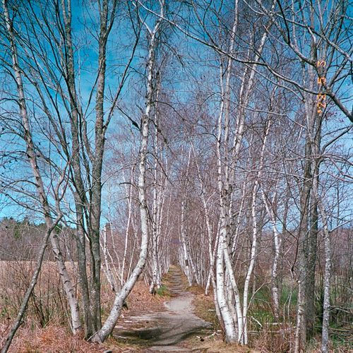
Aunt Betty Pond Connector

Easy1.1 mi

This trail offers a serene hike through a natural setting, leading to Aunt Betty Pond. The gravel surface makes it accessible for hikers seeking a casual, easy-going experience. The surroundings provide a peaceful atmosphere, ideal for those looking to immerse themselves in nature.

Birch Harbor Mountain Bike Path

Moderate2.9 mi

Birch Harbor Mountain Bike Path on the Schoodic Peninsula links with the Schoodic Loop Road and 8.3 miles (13.4 km) of bike paths, offering steep, winding routes and spectacular coastal views. Riders should obey one-way traffic on the road, ride single-file on narrow, hilly paths with blind curves, yield to walkers, and be alert for emergency or maintenance vehicles; fare-free Island Explorer buses can carry bikes for access.

Bowditch Trail

Difficult6.6 mi

This trail offers a peaceful journey through the island's interior, featuring wooded landscapes and marshes. It is one of the less crowded trails, providing a unique opportunity to connect with nature in solitude.

Bunker Harbor Bike Path

Easy0.8 mi

Bunker Harbor Bike Path on the Schoodic Peninsula is part of the park's 8.3 miles of bike paths, with steep, winding stretches that deliver spectacular coastal views; bicyclists must obey the one-way traffic flow on Schoodic Loop Road and may use the fare‑free Island Explorer buses. Sources don't include trail-specific details for Bunker Harbor, but nearby Lower Harbor Trail is flat, follows the coast through pine forest, and offers extensive waterfront views, suggesting the variety of scenery you might encounter.

Cold Brook Trail

Easy0.4 mi

This trail connects with Long Pond Trail and Bernard Mountain Trail to form the longest loop option in the Western Mountains, beginning at the Pumping Station parking area and covering roughly seven miles. The route includes extended stretches along the Long Pond shoreline, notable elevation gain, scenic viewpoints, and varied forest terrain. One junction west of Great Notch requires attention, where the trail to Knight’s Nubble turns left while a well-worn but unmarked path continues straight and can be easy to overlook.

Fern Trail

Easy0.2 mi

This trail offers a peaceful journey through a forested area, featuring lush ferns and interpretive displays that highlight the local ecosystem. The elevated boardwalks provide accessibility and protection from seasonal flooding, making it suitable for families and visitors with mobility challenges.

Frazer Creek Bike Path

Easy1.9 mi

Frazer Creek Bike Path on the Schoodic Peninsula is an active, narrow route with hilly stretches and blind curves; riders should travel single-file, yield to walkers, announce passes, and keep speeds down. Intersection numbers mark junctions and visitors must be alert for emergency or maintenance vehicles and keep track of their route. Sources do not provide detailed scenery descriptions, exact length, or access points for this trail.

Gilley Trail

Easy0.1 mi

This trail offers a serene hike through a lush forest filled with ferns, providing a peaceful and natural experience. It is a part of the network of trails in the area, connecting hikers to other scenic routes.

Hio Road Trail

Easy2 mi

This trail offers a peaceful journey through deep forest, featuring birds singing in the treetops and potential wildlife sightings. It connects to Adams Bridge and is near Bass Harbor Marsh, making it a great choice for nature lovers.

Hunters Beach Trail

Easy0.3 mi

This brief hike ends at a peaceful shoreline cove known for its vividly colored stones. It’s a popular choice for families and those hiking with dogs, though extra care is needed because the rocks can be very slick when wet. The cove offers a calm place to pause and spend time beside the Atlantic Ocean.

Hunters Brook Trail

Moderate2.4 mi

This trail takes hikers through a dense forest setting near Jordan Pond, offering a serene and natural experience. The path follows Hunters Brook and offers scenic views, making it a unique choice for those seeking a less crowded trail.

Long Pond Trail

Easy0.2 mi

This trail follows the shoreline of a beautiful glacier-carved pond, offering scenic views and opportunities to spot wildlife. The hike combines lakeside tranquility with forested sections, leading to a pass between mountains. It's a less strenuous alternative to more dramatic trails in the area, making it suitable for those seeking a peaceful experience.

Lower Harbor Trail

Easy1.4 mi

This trail offers scenic waterfront views, winding through pine forests along the coastline. It is a flat and easy route, making it accessible for all skill levels. The trail provides opportunities to spot sea birds and enjoy the serene coastal environment.

Median Ridge Trail

Easy1 mi

This trail traverses through varied terrain, providing hikers with opportunities to enjoy natural scenery. It is a less crowded option for those seeking a peaceful hike.

Murphy Lane

Easy0.3 mi

Murphy Lane is a calm, tree-shaded trail that provides a restful break from more heavily traveled routes in the park. The path winds through forested terrain with soft groundcover underfoot, creating an unhurried and welcoming atmosphere. It also links with nearby trails, making it a pleasant option for exploring some of Acadia’s quieter sections while staying immersed in the natural surroundings.

Otter Cove Trail

Easy0.4 mi

This trail offers scenic views of the ocean and surrounding granite formations. It is part of a network of trails that provide access to various points along the coast, including Otter Cove. The trail's proximity to the ocean and its relatively easy terrain make it accessible for a variety of visitors.

Pemetic East Cliff Trail

Easy0.3 mi

This trail offers a challenging hike with steep rock scrambles, culminating in breathtaking views of the Atlantic Ocean and surrounding landscape. The route is less crowded than some of the park's more popular trails, providing a more secluded hiking experience.

Pemetic Mountain North Ridge Trail

Easy1 mi

Ascend through a forested path to reach the open granite summit, offering stunning views of Jordan Pond, Eagle Lake, and the surrounding mountains. The trail features diverse terrain, including wooded sections and rocky outcrops, making it a rewarding hike for those seeking scenic vistas.

Satterlee Trail

Easy0.3 mi

This short trail offers a gentle stroll through the woods near Seal Harbor, providing a peaceful escape with minimal elevation change. It is suitable for families or those looking for a quick, easy hike.

Schooner Head Path

Moderate2.7 mi

This trail winds through deciduous forests and wetlands, offering a tranquil hike with glimpses of the ocean. It connects to other trails, providing opportunities to explore the coastline and surrounding woods. The path is generally flat and suitable for a variety of visitors.

Triad Trail

Easy0.1 mi

The Triad is a lightly used route in the Jordan Pond area that still delivers scenic views of Jordan Pond and nearby peaks, including Pemetic and Penobscot Mountains. The trail starts from Park Loop Road and connects with the Bubble and Jordan Ponds Path. For those seeking a more demanding hike, it also provides access to the Pemetic East Cliffs Trail, which leads up to the summit of Pemetic Mountain.

Witch Hole Connector Carriage Road

Easy1.2 mi

This carriage-road connector provides access to Witch Hole Pond and links into Acadia's larger historic carriage-road network, including the Witch Hole Pond Loop. The route features the park's characteristic crushed-rock carriage roads and offers picturesque views of Witch Hole Pond and the surrounding landscape, with connections to other scenic areas. It is commonly used by hikers and bicyclists. Note: horse and pack-animal use is restricted on the Witch Hole Pond Loop and certain carriage-road segments, so check park guidance for permitted uses.

Wonsqueak Bike Path

Easy2 mi

This route starts at the public parking area near Schoodic Woods Campground and follows a crushed-gravel surface to Buck Cove. When dry, the trail can accommodate road bikes, but it becomes unsuitable in wet conditions. Cyclists should take care to notify hikers as they approach, using a bell or a courteous verbal warning.

Access Trail

Access Trail

Moderate2 mi

This short trail offers a peaceful walk through a scenic area, providing an easy introduction to the park's natural beauty. It is suitable for families and those looking for a brief, relaxing stroll.
Around the Mountain Loop

Difficult10.6 mi

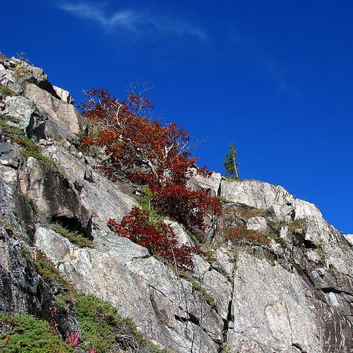
Around the Mountain Loop is one of Acadia's eight historic carriage road loops — a gravel, wooded loop that frames distant mountain views and offers a quieter, more intimate way to experience Mount Desert Island's forests and scenery. As part of the non-motorized carriage road system it provides a peaceful alternative to the busy, narrow Park Loop Road, but sources do not provide specific difficulty, distance, or access-point details.

Buck Cove Bike Path

Easy0.3 mi

Cadillac Cliffs Path

Easy0.2 mi

This trail follows a dramatic granite wall along cliffs, featuring a sea cave and requiring the use of iron rungs to reconnect with the Gorham Mountain Trail. The scenic route offers stunning views of the ocean and surrounding landscape, making it a popular choice for hikers seeking adventure.

Deep Cove Trail

Easy0.1 mi

This trail offers a short, family-friendly hike through a densely forested area, providing glimpses of a beautiful cove. The terrain includes rocks and roots, making it a fun adventure for kids. After completing the loop, visitors can enjoy the nearby village and its amenities.

Duck Brook Trail

Easy0.5 mi

Follow the gentle flow of a brook through a tranquil forest, punctuated by tiny waterfalls that create a soothing melody. The trail begins at a historic carriage bridge, offering a glimpse into the past. Wildlife sightings are common, adding to the trail's charm.

Glacial Rock Trail

Easy0.1 mi

This trail provides an accessible route through a glacial environment, featuring unique rock formations and potentially offering insights into glacial history. The short distance makes it suitable for families or those seeking a brief introduction to glacial landscapes.

Golf Course Trail

Easy1.2 mi

This trail offers a gentle hike through varied landscapes, providing opportunities to observe local flora and fauna. The easy terrain makes it accessible for a wide range of visitors.

Great Pond Trail

Easy2.7 mi

The provided trail data does not correspond to any known trail within a national park. The search results highlight different trails named 'Great Pond Trail' in various locations, but none are explicitly linked to a national park.

Head Harbor Trail

Easy0.9 mi

Located on the southern end of Isle au Haut, this preserve offers secluded hiking trails with opportunities to observe wildlife and capture stunning views of the coastline. The trails wind through a mix of pitch pine and maritime spruce-fir forests, leading to a dramatic rocky shoreline.

Mountain Brook Bike Path

Easy0.7 mi

Mountain Brook Bike Path on the Schoodic Peninsula is part of the park's 8.3 miles of bike paths and offers steep, winding sections that reward riders with spectacular coastal views. Paths are often narrow, hilly and have blind curves, so riders should travel single-file, yield to walkers, watch for maintenance or emergency vehicles, obey posted intersection numbers, and consider using the nearby one-way Schoodic Loop Road or fare-free Island Explorer buses for access.

Quarry Path

Easy0.9 mi

This trail connects through a lush green forest, passing a vernal pool, offering a serene and natural experience. It serves as an alternative route to avoid steeper sections on other trails, providing a moderately challenging hike with scenic views.

Western Head and Cliff Trail

Moderate4.6 mi

This trail meanders through wooded sections and open areas, revealing broad views of the Atlantic as it goes. Starting near Duck Harbor Campground, it travels past Deep Cove, Western Ear Island, and Duck Harbor. Isle au Haut is a peaceful area of Acadia National Park and is often chosen by visitors seeking a less crowded experience than Mount Desert Island.

Wild Gardens Path

Easy0.3 mi

Meander through thirteen sections representing diverse habitats, including mountain, heath, seaside, and coniferous forest. Over 400 native plant species are labeled, offering a living field guide to Acadia's unique flora. The gardens are maintained by community volunteers and feature a small stream, benches, and educational signage.

Get offline trail maps and detailed hiking info in the Parka app

Download Parka — It's Free

Get offline trail maps for Acadia National Park

Free on the App Store

Get Parka

Why Park Lovers Choose Parka

Trip Planner

All the tools for epic adventures

Works Offline

Fully functional without cell service

Updated Weekly

Trail conditions, alerts, and closures

Try Risk-Free

7-day free trial, cancel anytime

Start Your 7-Day Free Trial

Unlock everything you need for your next national park trip. Your first week is on us!

National Park vista

Start your adventure today

Download Parka and plan your perfect national park trip in minutes.