ParkaDownload
Canyonlands National Park

Trails in Canyonlands National Park

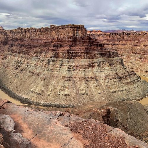
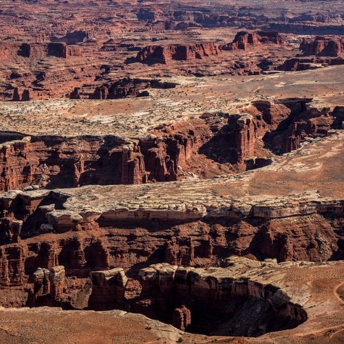
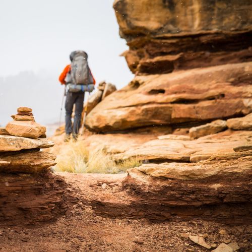
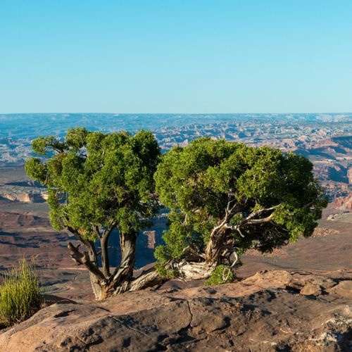
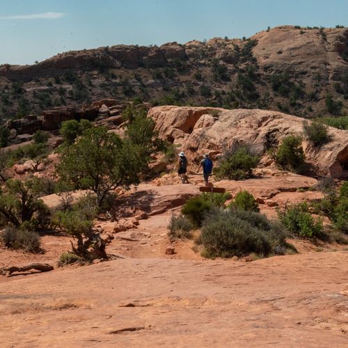
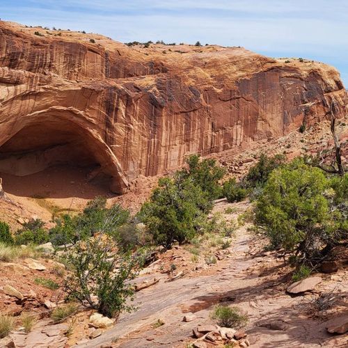
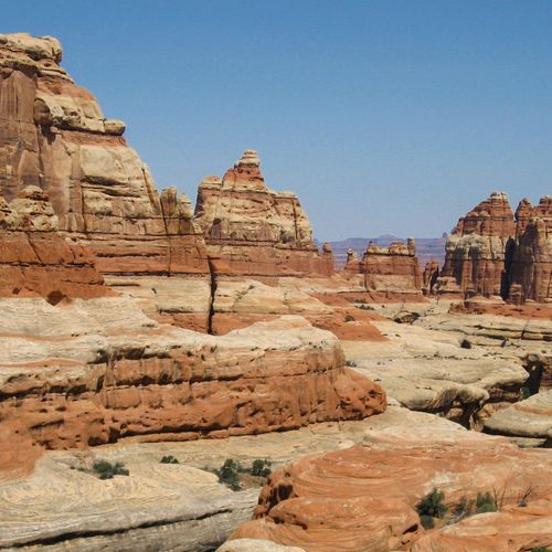
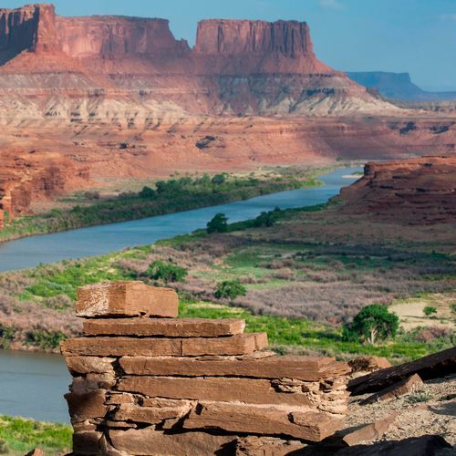
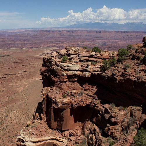
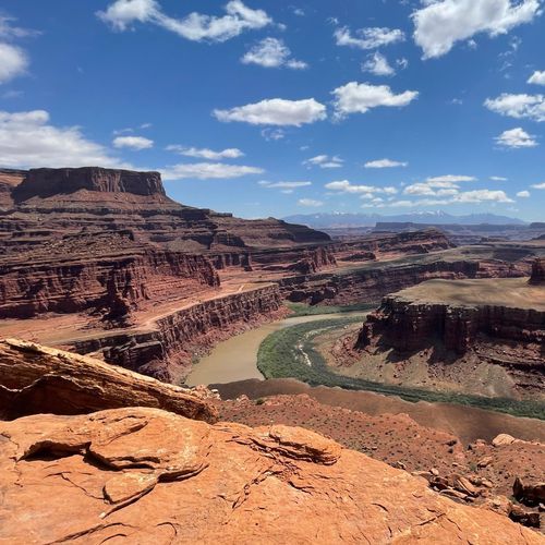
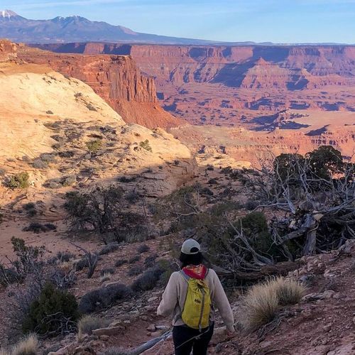
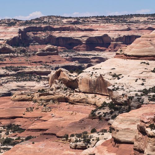
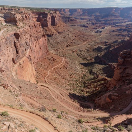
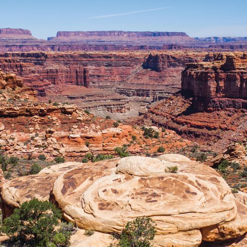
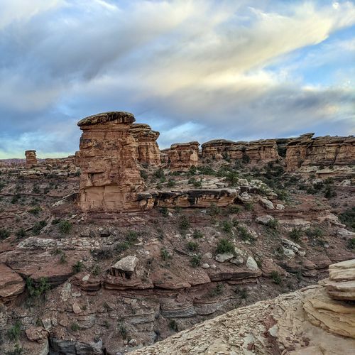
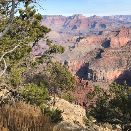
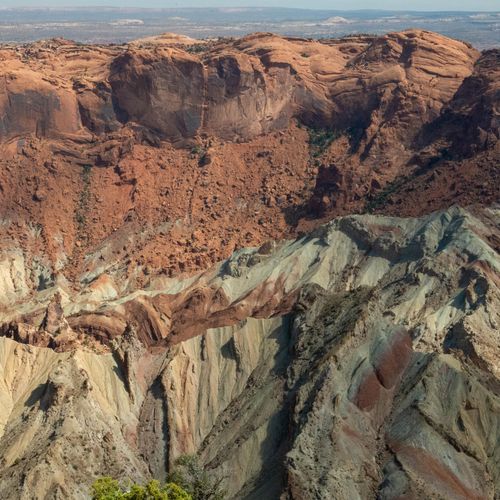
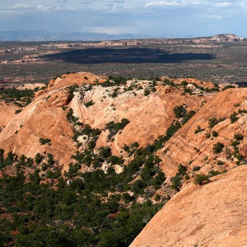
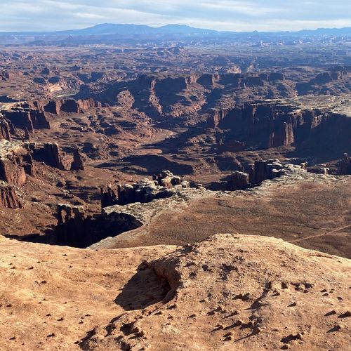
Hiking in Canyonlands National Park spans the full spectrum, from short, easy walks to exposed, route-finding-intensive adventures that demand strong legs, desert savvy, and respect for the terrain. With 49 trails in the park, the balance tilts toward accessible outings—26 easy hikes and 13 moderate ones—so first-time visitors have plenty of options for big scenery without committing to an all-day ordeal. At the same time, Canyonlands never feels tame. Even its easier trails unfold through a raw landscape of sandstone benches, sheer drop-offs, and vast, river-carved emptiness, while the park’s difficult and extreme routes push into a far more serious backcountry defined by steep descents, heat, loose rock, and long stretches of solitude. The standout hikes reflect the park’s distinct personalities. In Island in the Sky, short trails deliver outsized drama, with routes like Grand View Point and White Rim Overlook serving up sweeping canyon panoramas almost immediately. For hikers who want to drop below the rim, Gooseberry Trail offers a more immersive descent toward the White Rim. In The Needles, the experience shifts from overlooks to intricate desert terrain, where striped sandstone spires, backcountry junctions, and longer day hikes create some of the park’s most memorable foot travel. For a true challenge, the Syncline Trail near Upheaval Dome is one of the park’s most demanding outings, with steep switchbacks, scrambling, boulder fields, and a reputation that makes clear Canyonlands is not a place to underestimate. What makes hiking here special is the sense of scale and remoteness. Canyonlands is not a park of one signature trail so much as a park of immersion—of walking into a geologic maze where horizons feel endless and the silence can be as striking as the views. The terrain is primitive, sun-blasted, and beautifully severe, and every hike feels shaped by the forces that carved the Colorado Plateau into canyons, buttes, domes, and fins. Whether you choose a quick rim walk or a demanding backcountry route, hiking in Canyonlands delivers the rare feeling that you are moving through a landscape still very much in command.

Chesler Park Trail

Chesler Park Trail

Difficult10.2 mi

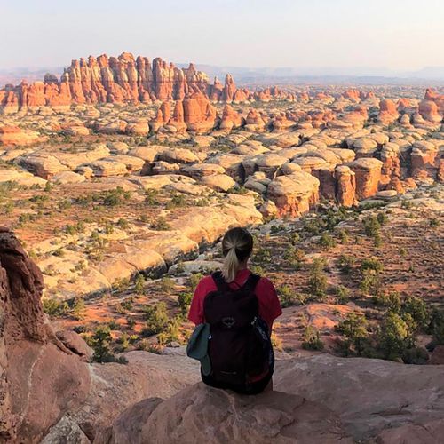
This trail offers a unique blend of grassy meadows and sandstone formations, featuring a walk through narrow rock fractures known as the Joint Trail. The area is dotted with cryptobiotic soil and sparse vegetation, providing a serene backdrop to the dramatic rock formations. Hikers can enjoy stunning views of the Needles District's characteristic spires.

Confluence Overlook Trail

Confluence Overlook Trail

Difficult9.8 mi

This trail offers breathtaking views of the confluence of the Green and Colorado Rivers, set amidst the dramatic landscapes of Canyonlands. The hike traverses through canyons, over ridges, and across open spaces, featuring geological formations like hoodoos and the Needles. Scenic vistas include the Island in the Sky and Maze Districts.

Grand View Point Trail

Grand View Point Trail

Easy1.8 mi

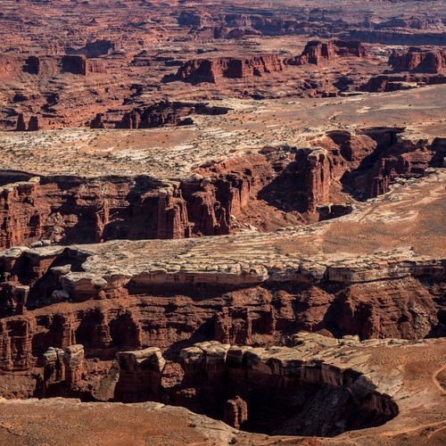
Follow the canyon edge for spectacular views across miles of rugged landscape, including the White Rim four-wheel-drive road and features in The Needles District. This trail offers breathtaking vistas, especially during sunset.

Lost Canyon Trail

Lost Canyon Trail

Moderate8.2 mi

This trail offers a scenic loop through lush Lost Canyon and Squaw Canyon, featuring diverse vegetation and stunning red sandstone formations. The hike includes navigating through sandy washes, climbing slickrock benches, and crossing steep ridges with breathtaking views of sculpted sandstone monoliths and distant mountains.

Mesa Arch Loop

Mesa Arch Loop

Easy0.7 mi

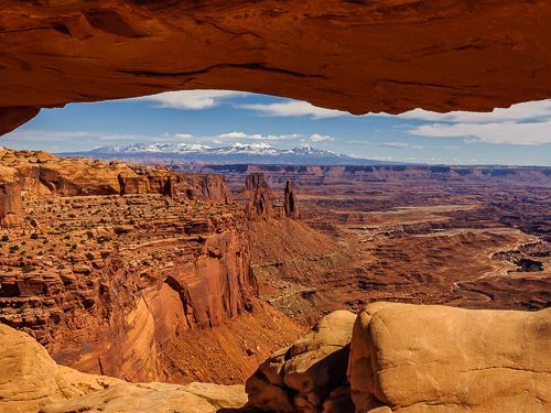
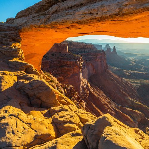
This short loop offers breathtaking views through a natural arch, framing the rugged canyon landscape and distant La Sal Mountains. The trail is especially renowned for its spectacular sunrises and sunsets, making it a must-visit for photographers and nature enthusiasts alike.

Murphy Point Trail

Murphy Point Trail

Easy3.3 mi

This trail offers stunning views of the Henry Mountains, Green River, and prominent rock formations like Candlestick Tower. The easy hike is perfect for families and those seeking a peaceful outing with spectacular vistas.

Syncline Loop Trail

Syncline Loop Trail

Difficult7.8 mi

This loop trail offers stunning views of Upheaval Dome, a crater-like formation with intriguing geological features. The trail descends into Upheaval Canyon and ascends through the Syncline Valley, providing opportunities to explore the dome's crater and connect with the White Rim Trail. It features diverse landscapes, including desert scrub and cottonwoods, with occasional pools of water along the washes.

Horseshoe Canyon Trail

Horseshoe Canyon Trail

Difficult5.1 mi

Descend into a remote canyon to witness some of North America's most significant rock art, including the renowned Great Gallery. The trail offers stunning views of sheer sandstone walls and mature cottonwood groves along an intermittent stream. Spring wildflowers add vibrant colors to the landscape.

Alcove Spring Trail

Alcove Spring Trail

Moderate5.8 mi

This trail leads to a picturesque spring, once a favorite campsite for emigrants on the Oregon and California Trails. The area features carvings from past travelers and offers a glimpse into the region's rich history. Surrounded by tallgrass prairie and hardwood forest, it provides scenic views and opportunities for nature exploration.

Angel Arch Trail

Angel Arch Trail

Extreme19 mi

This trail leads to the largest natural arch within the park, offering breathtaking views of a unique sandstone formation. The hike involves navigating through scenic canyons and involves a short scramble to reach the arch itself. The area is rich in geological history, with formations dating back to the early Permian period.

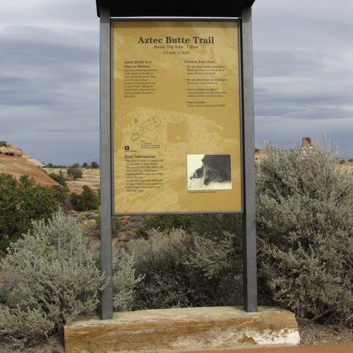
Aztec Butte Trail

Aztec Butte Trail

Easy0.6 mi

This trail offers a steep ascent up a sandstone dome, leading to ancestral Puebloan granaries and expansive views of Taylor Canyon. The hike includes scrambling on slickrock and visiting historical sites, providing a unique blend of natural beauty and cultural significance.

Cave Spring Trail

Cave Spring Trail

Easy0.6 mi

This short loop trail offers a glimpse into the region's ranching past with a preserved cowboy camp and ancient rock art. The trail features a natural spring and requires climbing two ladders to reach panoramic views of the surrounding landscape.

Colorado / Green River Overlook Trail

Colorado / Green River Overlook Trail

Moderate3.3 mi

Enjoy breathtaking vistas of the Colorado and Green Rivers from this overlook trail. The trail offers stunning views of deep red rock canyons and is a great spot to appreciate the natural beauty of the area. While not specifically documented in official sources, it aligns with the scenic appeal of similar trails in the region.

Elephant Canyon Trail

Elephant Canyon Trail

Moderate5 mi

This trail offers stunning views of the Needles District, culminating in the breathtaking Druid Arch. The hike traverses a wide canyon with varied landscapes, including sandstone formations and desert scrub. The final ascent to the arch involves a steep climb and some scrambling.

Fort Bottom Ruin Trail

Fort Bottom Ruin Trail

Easy1.7 mi

This trail traverses a narrow mesa to reach the historic Fort Bottom Ruin, an ancient stone structure built by ancestral Puebloan people. The path offers stunning views of the Green River as it makes a 230-degree turn around Bighorn Mesa. Visitors must respect the site by viewing it from a distance to preserve its integrity.

Gooseberry Trail

Gooseberry Trail

Moderate2.1 mi

This trail plunges down the east face of a mesa, offering breathtaking views of jagged canyons carved by flash floods. It connects to the White Rim Trail, a former mining road now popular with jeeps and mountain bikes. The steep descent requires strong knees and good conditioning, but frequent breaks provide stunning panoramic views.

Gooseneck Overlook Trail

Gooseneck Overlook Trail

Easy0.3 mi

Enjoy breathtaking views of Sulphur Creek as it carves its way through the landscape, creating a stunning canyon. The trail offers a glimpse into the geological history of the area, with visible layers of sandstone and limestone. It's a short, accessible hike suitable for families and those seeking panoramic vistas without a strenuous climb.

Granary Trail

Granary Trail

Easy1.1 mi

Venture through the rugged, arid landscape to reach an ancient Puebloan granary. These historic structures, nestled in a high alcove, were used for storing corn and other crops. The trail offers a glimpse into the past, showcasing the ingenuity of the Puebloan people who once inhabited this harsh desert environment. Along the way, enjoy sweeping views of the surrounding canyons and the distant La Sal Mountains. The trail ends at the granary, allowing for close-up views of these well-preserved structures. It's a journey that combines natural beauty with historical intrigue.

Joint Trail

Joint Trail

Easy0.6 mi

This trail takes you through a stunning meadow encircled by vibrant sandstone formations. The hike features a distinctive passage through a deep, narrow fracture in the rock, offering breathtaking views of the surrounding landscape. The terrain includes varied sections of slickrock, grassy mounds, and dramatic rock spires.

Lathrop Trail

Lathrop Trail

Difficult6 mi

This trail offers a diverse landscape, starting in a grassland before descending through badlands and slickrock to reveal stunning canyon vistas. It passes near the Airport Tower and historic uranium mining sites, providing a glimpse into the region's past. The trail's varied terrain includes switchbacks and a final stretch along an old mining road, leading to the White Rim Road and potentially down to the Colorado River.

Murphy Hogback Trail

Murphy Hogback Trail

Moderate3.9 mi

Descend from a grassy plateau into a vast amphitheater, then traverse the Murphy Hogback, a narrow, flat-topped ridge offering expansive views of Junction Butte, Grand View Point, and the White Rim. The trail connects to the White Rim Road, providing stunning vistas of the Green River and surrounding canyons.

Murphy Wash Trail

Murphy Wash Trail

Easy2.6 mi

Descend into a picturesque wash, offering stunning views of the surrounding landscape. The trail is ideal for backpacking and hiking, providing a moderately challenging experience with opportunities to explore the natural beauty of the area.

Neck Spring Trail

Neck Spring Trail

Moderate5.6 mi

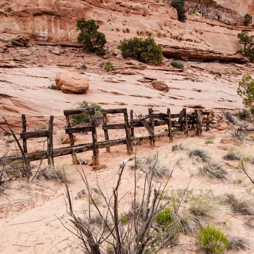
Pass through a landscape of Navajo Sandstone cliffs, where ancient springs like Neck and Cabin Spring provided vital water sources for early ranchers. The area is dotted with remnants of old watering troughs and fencing, remnants of a bygone era. Hikers traverse a mix of sandy benches and shallow ravines, offering views into Taylor Canyon and glimpses of cryptobiotic soil crust. The trail also reveals evidence of prehistoric occupation, with flint chips scattered along the path. As the route winds back up to the rim, it offers expansive views of the surrounding canyons and distant mountain peaks.

Pothole Point Trail

Pothole Point Trail

Easy0.6 mi

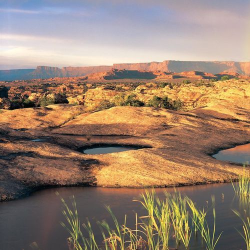
Wander across a barren expanse of sun-bleached slickrock dotted with numerous shallow potholes, which occasionally fill with water after rainstorms. These natural basins support a surprising array of life, transforming into microcosms of biodiversity. The trail offers panoramic views of the surrounding landscape, including The Needles in the distance.

Salt Creek Canyon Trail

Salt Creek Canyon Trail

Moderate3.6 mi

Descend into a vast canyon filled with archaeological sites, including Ancestral Puebloan ruins and natural wonders like Angel Arch. The trail offers solitude and breathtaking views of Navajo Sandstone formations. It requires a shuttle due to its point-to-point nature.

Shot Canyon Trail

Shot Canyon Trail

Easy1.7 mi

Venture into a remote, rugged landscape, where historic cowboy camps and Native American rock art tell the story of the area's past. The trail descends into the depths of the canyon, offering a unique perspective of the park's geology. Along the way, hikers can explore a variety of side canyons, each with its own unique features and secrets to discover. The trail's isolation adds to its allure, offering a peaceful and immersive experience in the wilderness. Despite its remote location, the trail is well-marked and maintained, making it a rewarding challenge for those seeking an off-the-beaten-path adventure.

Slickrock Trail

Slickrock Trail

Easy1.7 mi

This trail offers panoramic views of the surrounding landscape, including the La Sal Mountains and the unique formations of Big Spring Canyon. It features four distinct viewpoints, each providing a different perspective on the region's geological landmarks. The trail is well-marked with cairns, making it accessible for beginners learning to navigate slickrock terrain.

Spanish Bottom Trail

Spanish Bottom Trail

Moderate1.1 mi

This challenging hike begins along the Colorado River and ascends steep switchbacks to a breathtaking viewpoint. The trail offers spectacular vistas, especially at sunrise or sunset, and is a great spot to rest or set up camp.

Trail To Colorado River Overlook

Trail To Colorado River Overlook

Easy0.1 mi

This trail offers breathtaking views of the Colorado River and surrounding landscapes, including Ekker and Elaterite Buttes. It features a mix of rocky terrain and sandy stretches, making it suitable for both high-clearance vehicles and mountain bikers. A short hike to Lower Jump reveals a picturesque waterfall when water flows in Salt Creek.

Upheaval Dome Trail

Upheaval Dome Trail

Easy0.6 mi

This trail offers stunning views of a unique geologic formation, where rock layers are dramatically deformed. Hikers can explore two overlooks, each providing a distinct perspective on the dome's intriguing structure. The trail is popular due to its accessibility and the fascinating geological theories surrounding the dome's origin.

Whale Rock Trail

Whale Rock Trail

Easy0.4 mi

Climb a distinctive whale-shaped sandstone fin, enjoying panoramic views of Upheaval Dome and surrounding landscapes. The trail is short and easy, making it suitable for families and those seeking a quick adventure. Handrails assist with the ascent, though many choose to free climb. The summit provides expansive views, especially during sunrise and sunset.

White Rim Overlook Trail

White Rim Overlook Trail

Easy0.9 mi

This trail offers breathtaking views of the canyons below, including the White Rim and Monument Basin. It is a flat and easy hike, ideal for those seeking a less crowded spot to enjoy the sunrise or sunset. The trail ends at a scenic peninsula with expansive views of the surrounding landscape.

Chocalate Drops Trail

Moderate4.4 mi

This trail offers a journey through a unique landscape featuring large dark red sandstone formations and the iconic Chocolate Drops, four vertical columns of Organ Shale. The trail follows Chocolate Drop Ridge, providing a relatively flat path with stunning views of the surrounding formations.

Cyclone Canyon Trail

Difficult7 mi

This trail offers breathtaking views of the canyon's unique rock formations and stunning vistas. It traverses through sand surfaces, providing a moderate hiking experience. The trail's setting amidst the natural beauty of the area makes it a worthwhile visit for those seeking scenic landscapes.

False Kiva Trail

Easy0.8 mi

Green River Overlook Trail

Easy0.1 mi

Enjoy breathtaking vistas of the Green River as it winds through the landscape, offering stunning views of the White Rim and distant Henry Mountains. This overlook is a prime spot for sunset photography and provides a glimpse into the region's unique geological formations.

Lavender Canyon Trail

Easy0.5 mi

This trail winds through a picturesque valley surrounded by Wingate Sandstone cliffs. It offers a mix of 4WD adventure and short hikes, featuring natural arches and archeological sites. The canyon's unique landscape provides a peaceful escape from crowds, with opportunities to explore ancient ruins and enjoy the serene beauty of the area.

Pete's Mesa Route

Moderate9 mi

This hike takes you across a vast, undulating peninsula, offering stunning views of surrounding rock formations like Chimney Rock and the Chocolate Drops. The trail alternates between white slickrock and dark red dirt, passing through sage and stunted juniper landscapes. The path is moderately well-marked, making it relatively easy to follow.

Upheaval Canyon Trail

Upheaval Canyon Trail

Moderate3.6 mi

No description available

Wilhite Trail

Wilhite Trail

Difficult5.4 mi

This trail begins on a rolling mesa before descending steeply into a dramatic canyon landscape. Hikers traverse a talus-filled chute and follow a wash to the White Rim Road, offering stunning views of red rock formations, including Candlestick Tower and distant vistas of False Kiva. The trail ends near a scenic slot canyon leading towards the Green River.

Castle Arch Trail

Easy0.5 mi

No description available

Cleft Arch Trail

Easy0.2 mi

This trail offers a brief yet engaging hike through the park's distinctive sandstone landscape. It provides an opportunity to experience the unique geological features of the area without requiring extensive hiking experience.

Devils Kitchen Trail

Easy0.1 mi

This trail traverses through lush meadows and forests, leading to a hydrothermal area featuring boiling mudpots and steam vents. The path includes boardwalks over marshy areas and offers scenic views of the surrounding landscape.

Fortress Arch Trail

Easy0.5 mi

No description available

Horse Canyon

Difficult14.8 mi

Salt Flat Loop

Moderate6.9 mi

South Fork Horse Canyon

Extreme13.1 mi

The Plug

Easy1 mi

Trail To Gothic Arch

Easy0.3 mi

No description available

Get offline trail maps and detailed hiking info in the Parka app

Download Parka — It's Free

Get offline trail maps for Canyonlands National Park

Free on the App Store

Get Parka

Why Park Lovers Choose Parka

Trip Planner

All the tools for epic adventures

Works Offline

Fully functional without cell service

Updated Weekly

Trail conditions, alerts, and closures

Try Risk-Free

7-day free trial, cancel anytime

Start Your 7-Day Free Trial

Unlock everything you need for your next national park trip. Your first week is on us!

National Park vista

Start your adventure today

Download Parka and plan your perfect national park trip in minutes.