ParkaDownload
Channel Islands National Park

Trails in Channel Islands National Park

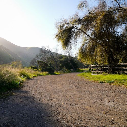
Hiking in Channel Islands National Park is defined less by mileage than by atmosphere: windswept bluffs, empty horizons, sea-sculpted cliffs, and the sense that you’ve stepped onto a far more remote California. The trail system skews refreshingly accessible, with most routes falling into the easy category, so first-time visitors can quickly reach dramatic overlooks without committing to an all-day trek. Short walks such as Inspiration Point deliver one of the park’s signature panoramas, while Pinniped Point packs lighthouse views and a sea lion rookery into a brief outing. On Santa Rosa Island, the Historic Ranch Hike and Becher’s Bay Coastal Trail offer easy terrain with a mix of cultural history and broad coastal scenery. That said, Channel Islands also rewards hikers willing to push farther. Moderate options like Arch Point add a little more effort for standout sunset views, spring wildflowers, and a striking sea-cliff arch. The park’s more demanding hikes, including Elephant Seal Cove Overlook and Webster Point, venture into wilder terrain where volcanic cliffs, marine terraces, offshore rock formations, and the chance to spot seals and sea lions make the exertion worthwhile. What makes hiking here special is the combination of raw coastal beauty and genuine isolation: there are no roads full of traffic, no crowded viewpoint circuits, and very little separation between you and the landscape. You hike through open island terrain where ocean, wind, wildlife, and geology dominate every mile.

Point Bennett Trail

Difficult12.8 mi

This trail leads to one of the world's most diverse and largest pinniped rookeries. Visitors can observe northern elephant seals, California sea lions, and other marine mammals in their natural habitat. The trail traverses rolling hills and offers stunning ocean views, culminating at Point Bennett, a rocky outcropping connected by a sandy spit. Due to the presence of unexploded ordnance, hikers must be accompanied by a ranger.

Scorpion Canyon Loop Trail

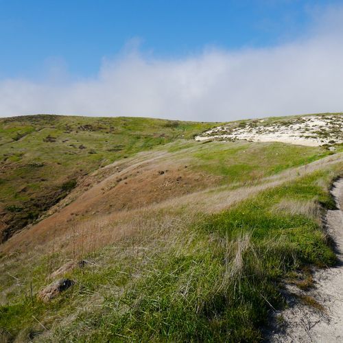
Scorpion Canyon Loop Trail

Moderate3.9 mi

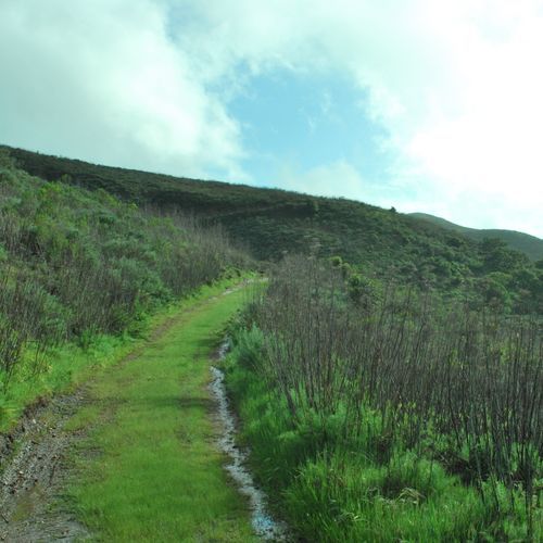
This loop offers breathtaking views of the Pacific Ocean and the surrounding high chapparal hills. It traverses through Scorpion Canyon, providing opportunities to spot unique wildlife like the island fox. The trail includes a steep ascent and descent, offering dramatic vistas of Montañon Ridge and the Anacapa Islands.

Cavern Point Loop Trail

Cavern Point Loop Trail

Easy3 mi

This trail offers stunning views of the Pacific Ocean and surrounding cliffs, with stops at Cavern Point and Potato Harbor Overlook. The hike passes through historic Scorpion Ranch and offers opportunities to see native plants and wildlife. The trail is part of a larger network that explores the island's diverse landscapes.

Cherry Canyon Trail

Easy1.9 mi

This trail winds through a small canyon filled with unique island flora, leading to a vista point with stunning views of the surrounding islands and shoreline. The hike offers a glimpse into the island's ranch history and combines well with the Coastal Trail for a scenic loop back to the pier.

Cuyler Harbor Beach

Easy1.7 mi

Walk along a stunning beach with crystal-clear waters, surrounded by the unique wildlife and geological features of San Miguel Island. The trail offers breathtaking views of the island's rugged coastline and is a great spot for observing marine life.

Del Norte Trail

Moderate3.8 mi

This trail offers a mix of coastal scenery, including beaches and rocky bluffs, along with diverse landscapes such as ancient vegetated dunes and redwood forests. It provides opportunities to observe wildlife in remote areas like Redwood National Park and Tolowa Dunes State Park.

Elephant Seal Cove Trail

Elephant Seal Cove Trail

Easy1.4 mi

This trail offers a scenic hike to a viewpoint where elephant seals can be observed along the rocky shoreline. The area provides a unique opportunity to witness these marine mammals in their natural habitat, often accompanied by other sea life like California sea lions and harbor seals.

Lobo Canyon

Lobo Canyon

Easy1.6 mi

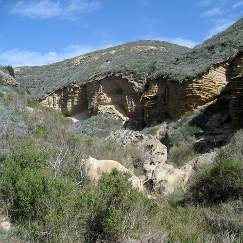
This trail offers a unique blend of riparian plants and sculpted rock formations, leading to a small beach with ocean views. The presence of flowing water and diverse vegetation creates a lush oasis, contrasting with the surrounding landscape.

Montañon Ridge Trail

Difficult4.7 mi

Winds along a rugged ridge, providing hikers with panoramic views of the Pacific Ocean and the Channel Islands. The trail is known for its diverse flora, including endemic Island Scrub-Jay and Island Fox. It also offers a unique opportunity to observe the island's geological history, with exposed, weathered bedrock and marine terraces. The trail's high elevation points offer breathtaking views of the surrounding islands and mainland California, making it a favorite among photographers and nature enthusiasts.

Signal Peak Loop Trail

Moderate3.6 mi

Offers a unique opportunity to traverse through a variety of ecosystems, including coastal sage scrub, chaparral, and pine forests. As the trail winds up to the highest point on Santa Rosa Island, hikers are rewarded with panoramic views of the Pacific Ocean and the Channel Islands. Along the way, keep an eye out for the island's unique wildlife, including the endemic Island Fox and the Island Scrub-Jay. The trail's diverse flora and fauna, combined with its stunning ocean views, make it a must-visit for nature lovers and photography enthusiasts alike.

Skunk Point

Easy1.6 mi

This trail offers stunning views of white sand beaches and protected dunes, which serve as critical nesting grounds for snowy plovers. The area is rich in marine life, with nearby kelp forests and tidepools providing habitats for diverse species. Hikers can enjoy birdwatching and exploring the unique coastal ecosystems.

Torrey Pines Trail

Torrey Pines Trail

Easy1 mi

This trail offers breathtaking views of the Pacific Ocean and showcases the unique Torrey pine trees. Hikers can enjoy the dramatic coastal scenery, including cliffs and ravines, while exploring the diverse flora and fauna of the area.

Arch Point Loop Trail

Easy0.9 mi

No description available

Harris Point Trail

Easy2.6 mi

This trail offers a moderately challenging hike with diverse scenery. It is suitable for hikers seeking a mix of terrain and views, though it does not specifically highlight unique natural landmarks like giant sequoias or notable wildlife habitats.

Bechers Bay Coastal Trail

Easy1.1 mi

This coastal trail offers scenic views of the surrounding landscape and access to Torrey Pines, a unique feature of the area. The trail's proximity to the coastline provides a serene hiking experience.

Canada de la Calera

Easy1 mi

No description available

Canyon View Nature Trail

Easy0.3 mi

This trail offers a scenic view of unique geological formations, potentially including glacial or water-carved landscapes. The easy terrain makes it accessible for a variety of visitors, providing an opportunity to observe natural landmarks.

Cardwell Point Trail

Moderate2.9 mi

This trail passes through non-native grassland dotted with coyote brush, giant coreopsis, lupine, and dudleya. It ends at a bluff overlooking a beach where visitors can watch California sea lions and Northern elephant seals. The views extend eastward towards Santa Rosa Island.

Loma Pelona Loop Road

Moderate4 mi

This trail winds through a remote and rugged area, offering scenic views and a chance to experience the wild beauty of the wilderness. The terrain is varied, with some challenging sections that reward hikers with unique vistas.

Native Plant Garden

Easy0.1 mi

Stroll through a compact yet vibrant garden showcasing a variety of native plants. This short walk offers an intimate connection with nature, ideal for those seeking a tranquil experience.

cow canyon bluff trail

Easy0.6 mi

This trail offers a mix of natural beauty and historical significance, though its exact location and features are unclear. It may involve traversing through canyons with unique geological formations and possibly historical sites.

Get offline trail maps and detailed hiking info in the Parka app

Download Parka — It's Free

Get offline trail maps for Channel Islands National Park

Free on the App Store

Get Parka

Why Park Lovers Choose Parka

Trip Planner

All the tools for epic adventures

Works Offline

Fully functional without cell service

Updated Weekly

Trail conditions, alerts, and closures

Try Risk-Free

7-day free trial, cancel anytime

Start Your 7-Day Free Trial

Unlock everything you need for your next national park trip. Your first week is on us!

National Park vista

Start your adventure today

Download Parka and plan your perfect national park trip in minutes.