ParkaDownload
Sequoia & Kings Canyon National Parks

Trails in Sequoia & Kings Canyon National Parks

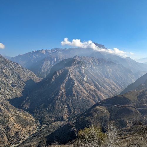
Hiking in Sequoia and Kings Canyon spans nearly every style of mountain walking, from short, family-friendly loops to punishing High Sierra routes that feel truly wild. With 91 trails spread across the parks, the range is impressive: plenty of easy walks through sequoia groves and meadow country, a strong middle tier of moderate day hikes, and a serious collection of difficult and extreme routes that climb into remote alpine terrain. That variety is part of the appeal. You can spend the morning on a gentle trail beneath the world’s largest trees, then look up at the granite walls and high passes that draw backpackers and strong hikers deep into the wilderness. The standout hikes showcase the parks’ remarkable contrasts. In the Giant Forest and Lodgepole areas, trails weave through cathedral-like stands of giant sequoias, open meadows, and classic Sierra viewpoints. Around Grant Grove, easier hikes deliver big trees with a quieter feel, while Cedar Grove and Zumwalt Meadow shift the mood entirely, trading forested plateaus for sheer canyon walls, roaring rivers, and dramatic glacial scenery. Beyond the front-country highlights, the trail system stretches for hundreds of miles into a vast backcountry of alpine lakes, exposed passes, and rugged peaks, where the scale becomes unmistakably Sierra Nevada. What makes hiking here special is the sheer sweep of landscapes packed into one destination. Few park systems let you move so quickly from hot foothill terrain to cool conifer forest, from tranquil groves to raw granite country, from accessible sightseeing trails to serious wilderness travel. Sequoia and Kings Canyon reward every level of hiker, but they are especially memorable for the sense of grandeur they deliver on foot: immense trees, deep canyons, high mountain light, and the feeling that every trail leads deeper into something ancient and immense.

Alta Trail

Alta Trail

Extreme13.5 mi

This trail descends nearly 1,000 feet from Wolverton to Giant Forest, offering breathtaking views of the forest's giant sequoias. It connects with several other trails, providing a challenging yet rewarding experience through some of the park's most stunning natural landscapes.
Big Trees Trail

Big Trees Trail

Easy1.2 mi

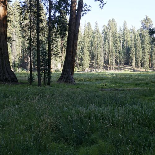
This trail offers a serene walk around a picturesque meadow, surrounded by numerous giant sequoias. Highlights include unique tree formations and a beautiful natural setting, making it an ideal choice for those seeking a tranquil experience amidst nature's grandeur.

Crystal Lake Trail

Difficult9.5 mi

This trail leads through a white pine forest to a picturesque mountain lake. The area is rich in history with remnants of past mining activities. The lake offers opportunities for fishing and camping, making it a tranquil retreat for nature lovers.

Franklin Lakes Trail

Difficult11.6 mi

This trail ascends through a picturesque valley lined with willows, red firs, and junipers. It offers stunning views of the East Fork Kaweah River and culminates in a rugged basin surrounded by the imposing peaks of the Great Western Divide. Highlights include the vibrant mineral-stained slopes and the serene Lower Franklin Lake.

Moro Rock Trail

Moro Rock Trail

Moderate0.5 mi

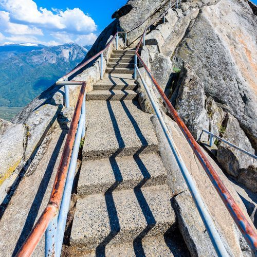
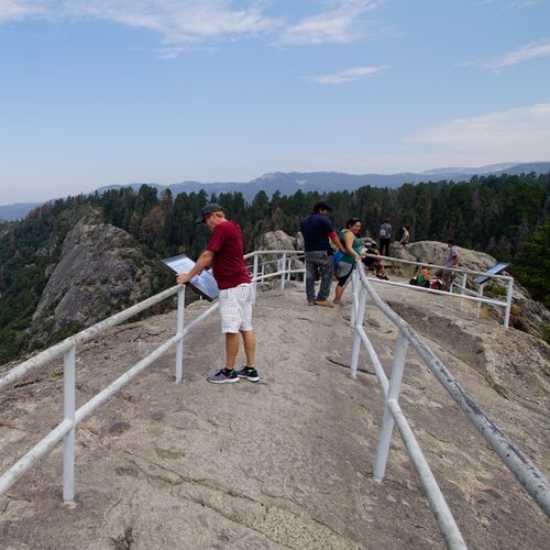
Ascend a 350-step stairway to the summit of a majestic granite dome, offering breathtaking 360-degree views of the surrounding landscape. The climb provides stunning vistas from the foothills to deep into the wilderness, making it a must-visit attraction.

Mosquito Lakes Trail

Mosquito Lakes Trail

Difficult6.6 mi

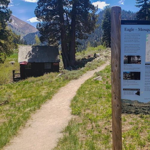
This trail offers scenic views of mountain lakes and surrounding forests. It is part of a larger network of trails that allow hikers to explore diverse landscapes, including meadows and ridges. The trail's moderate difficulty makes it accessible for a variety of hikers.

Sherman Tree Trail

Sherman Tree Trail

Easy1.1 mi

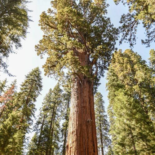
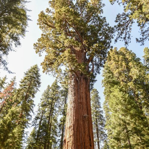
Descend through a grove of giant sequoias to reach the General Sherman Tree, a natural wonder that is the largest tree on Earth by volume. The trail offers stunning views of other massive sequoias and unique photo opportunities, including a tree tunnel and sequoia tree rings. Visitors can learn about the natural history of these trees through exhibits along the trail.

Sunset Rock Trail

Sunset Rock Trail

Easy1.5 mi

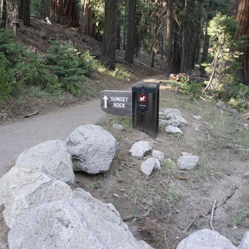
This trail leads to a scenic overlook of Marble Fork Canyon, offering stunning views, especially during sunset. The area was affected by the 2021 KNP Complex Fire, which altered the landscape. It's a popular spot for sunset viewing within the Giant Forest.

Congress Trail

Congress Trail

Easy1.9 mi

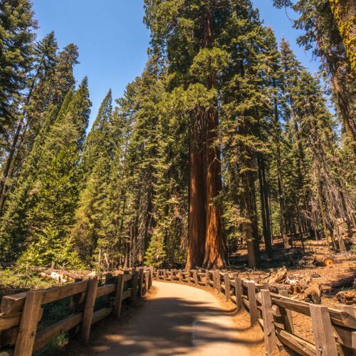
Wander through a stunning grove of giant sequoias, including the House and Senate Groups, the President Tree, and other notable trees named after U.S. historical figures. The trail offers a paved path suitable for all visitors, making it an ideal introduction to the park's natural wonders.

High Sierra Trail

High Sierra Trail

Extreme48 mi

This trail traverses diverse landscapes, from the giant sequoia groves of Crescent Meadow to the alpine peaks of the Great Western Divide. It crosses Kaweah Gap and descends into Big Arroyo before joining the John Muir Trail, offering breathtaking views and challenging terrain.

Little Baldy Trail

Little Baldy Trail

Moderate3.3 mi

Ascend through a mixed forest of conifers to reach a granite dome offering breathtaking 360-degree views of the high Sierras and the Central Valley. This moderately difficult hike rewards with stunning vistas, making it a great alternative to more crowded trails.

Mount Whitney Trail

Mount Whitney Trail

Extreme21.1 mi

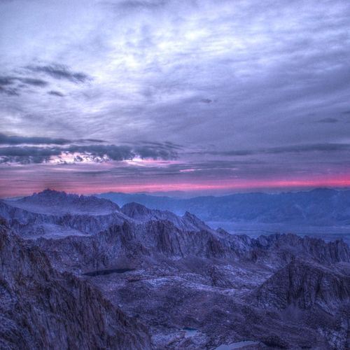
This trail offers breathtaking views of the High Sierra as it ascends to the summit of Mount Whitney. The hike involves a significant elevation gain and is known for its challenging yet rewarding experience. The trail is well-maintained during peak season and requires a permit due to its popularity.

Tokopah Falls Trail

Tokopah Falls Trail

Easy1.9 mi

Follow the Marble Fork of the Kaweah River through a scenic canyon to the base of an impressive waterfall. The trail offers stunning views of granite cliffs and is surrounded by lush vegetation. It's a popular spot for hiking and running, with opportunities to see wildlife like marmots.

Alta Meadow Trail

Easy1.7 mi

This trail winds through a picturesque meadow, providing a peaceful experience amidst nature. The surroundings offer a chance to observe local flora and fauna, making it a great option for those seeking a serene hike.

Atwell-Hockett Trail

Difficult8.9 mi

Descend through a forest of pines, firs, incense cedars, and occasional giant sequoias to a footbridge over the East Fork Kaweah River. Beyond the bridge, the trail ascends through the East Fork Grove, known for its well-preserved sequoias. Further along, it passes through sparse Jeffrey pine and white fir forests, denser red fir groves, and hillside meadows vibrant with wildflowers. The trail eventually reaches Hockett Meadow, a subalpine gem teeming with wildlife and offering stunning views.

Black Rock Pass Trail

Black Rock Pass Trail

Extreme7.8 mi

This trail offers breathtaking views as it traverses through rugged terrain, featuring diverse landscapes and challenging climbs. It is ideal for experienced hikers seeking a demanding adventure with rewarding scenery.

Colby Pass Trail

Difficult7.8 mi

Colby Pass offers a challenging route through the Sierra Nevada, connecting remote areas of the wilderness. The trail is known for its rugged terrain and requires experienced navigation skills. It is less traveled, providing solitude in a breathtaking mountain environment.

Crystal Cave Trail

Crystal Cave Trail

Easy0.4 mi

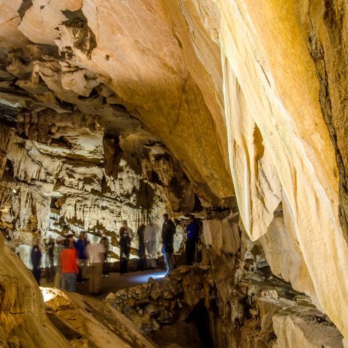
Descend through a lush forest of cedars and pines to reach the entrance of a remarkable marble cave. Inside, discover an underground world of glittering calcite formations and learn about the unique ecosystem from knowledgeable guides. The trail offers scenic views of Yucca Creek and its seasonal waterfall before entering the cave.

Dorst/Lost Grove Trail

Moderate2.1 mi

This trail winds through a dense community of sequoias, lush meadowlands, and alongside a gentle creek. It offers a peaceful escape into nature, featuring carpets of ferns and blooming wildflowers. The trail begins at Dorst Creek Campground and ends near Generals Highway, providing a tranquil experience with opportunities to spot wildlife.

Elizabeth Pass Trail

Extreme14.9 mi

This trail ascends through Deadman Canyon, offering breathtaking views of granite walls and access to Elizabeth Pass. It features a mix of forested slopes and open alpine landscapes, with historical markers like the grave of Alfred Moniere. The trail connects to other scenic routes, providing a gateway to the high country of the Sierra Nevada.

Farewell Gap Trail

Farewell Gap Trail

Extreme15.8 mi

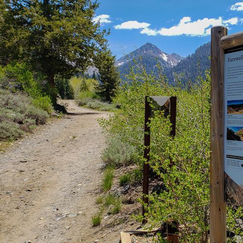
This trail ascends through diverse landscapes, including aspen groves and pine forests, before reaching the barren yet scenic Farewell Gap. The route offers stunning views of distant peaks and valleys, making it a rewarding hike for those seeking solitude and natural beauty.

Jennie Lake Trail

Jennie Lake Trail

Extreme8.4 mi

Winds through dense forests of fir and pine, opening up to expansive alpine meadows dotted with vibrant wildflowers in the spring and summer. The trail culminates at a stunning high-altitude lake, nestled in a bowl-shaped basin surrounded by towering peaks. Known for its solitude and tranquility, the lake provides a serene spot for picnicking, fishing, or simply soaking in the breathtaking mountain views. Wildlife sightings, including black bears, mule deer, and various bird species, are common along the trail. In the winter, the trail transforms into a popular route for snowshoeing and cross-country skiing.

Lodgepole-Sherman Tree Trail

Lodgepole-Sherman Tree Trail

Easy1.6 mi

This trail descends through a serene white fir forest before entering a grove of towering sequoias, culminating at the General Sherman Tree. The path offers a unique opportunity to experience the grandeur of these natural giants, with options to continue exploring via the Congress Trail.

Lower to Upper Crabtree Meadows Trail

Easy1.2 mi

This gentle trail takes you through a picturesque meadow, offering serene views and a peaceful hiking experience. The trail is ideal for those seeking a relaxing walk without the need for strenuous climbs or descents.

Marble Falls Trail

Marble Falls Trail

Moderate2.9 mi

Hike through a diverse landscape of chaparral and oak woodlands, featuring vibrant wildflowers in spring. The trail culminates at a stunning waterfall, where the Marble Fork of the Kaweah River cascades over white marble. The scenic route offers views of granite monoliths and smaller cascades along the river.

Middle Fork Kaweah Trail

Extreme11.3 mi

This trail winds through scenic river valleys, offering stunning views of mountain vistas and diverse flora. It features challenging terrain, including river crossings and steep sections, making it suitable for experienced hikers. The trail passes through areas with abundant wildflowers and offers opportunities to explore the natural beauty of the region.

Miter Basin Route

Miter Basin Route

Easy1.7 mi

This trail offers breathtaking views of granite peaks and alpine lakes. It traverses through lush meadows and rugged terrain, providing a challenging yet rewarding experience for hikers. The area is known for its stunning vistas and diverse wildlife.

Mount Whitney Mountaineer's Route

Mount Whitney Mountaineer's Route

Extreme4.8 mi

This route offers a more direct, albeit technical, ascent to the summit. It involves navigating through scenic terrain, including the approach to Iceberg Lake and the challenging 'Final 400' section. The route is popular among experienced climbers seeking a shorter alternative to the main trail.

Muir Grove Trail

Muir Grove Trail

Easy2.1 mi

Hike through a mixed-conifer forest to a stunning sequoia grove, named after John Muir. The trail offers scenic views of Big Baldy and Chimney Rocks, with a highlight of giant sequoias at the end. The journey includes a granite dome viewpoint and occasional wildflowers, making it a tranquil experience.

Panther Gap Trail

Easy1 mi

This trail traverses through diverse landscapes, providing opportunities to experience the natural beauty of the area. It is part of a network of trails that allow hikers to explore deeper into the wilderness.

Paradise Trail

Paradise Trail

Difficult4.3 mi

Pass through lush meadows and enjoy breathtaking views of surrounding mountains. The trail offers a serene hike with opportunities to spot wildflowers and wildlife, though the exact features depend on the specific trail in question.

Shepherd Pass Trail

Extreme14 mi

This trail offers a demanding journey through remote wilderness, featuring stunning alpine vistas and significant elevation changes. It is ideal for experienced hikers seeking solitude and breathtaking scenery.

Sugar Pine to Crescent Meadow Cutoff

Easy0.1 mi

This trail passes through a lesser-known sequoia grove and offers scenic views of the Middle Fork Canyon. It connects popular areas like Moro Rock and Crescent Meadow, providing an alternative route for those seeking a quieter experience.

Tharp's Log Trail

Tharp's Log Trail

Moderate3.8 mi

This trail leads to Tharp's Log, a historic cabin built inside a hollowed giant sequoia log. The area is rich in history, with connections to early settlers like Hale Tharp and naturalist John Muir. The trail is surrounded by the majestic Giant Forest, providing a unique blend of natural beauty and historical significance.

Timber Gap Trail

Extreme5.3 mi

This trail follows an old mining route, offering views of the surrounding mountains and access to Black Rock Pass and Redwood Meadow trails. The forested area is notable for its red fir trees, which were used by miners for fuel and structural support. The trail provides a glimpse into the region's mining history while offering breathtaking views of the High Sierra.

Twin Lakes Trail

Twin Lakes Trail

Difficult4.9 mi

This trail ascends through mixed-conifer forests and meadows, offering views of the Twin Peaks and the Kings Canyon high country. The lakes are set in a picturesque basin, with the southern lake being larger and more typical of subalpine lakes, while the northern lake is smaller and swampier. Climbing to Silliman Pass provides stunning views of the surrounding peaks and valleys.

Upper Big Five Lakes Trail

Upper Big Five Lakes Trail

Easy0.8 mi

Nestled in the high Sierra Nevada mountains, this trail offers breathtaking alpine scenery, pristine lakes, and diverse wildlife. The area is renowned for its crystal-clear waters surrounded by rugged peaks and lush meadows, providing opportunities for solitude and wildlife viewing.

White Chief Trail

Moderate3.7 mi

This trail offers a moderate hike through the Mineral King area, featuring stunning alpine landscapes and opportunities for both day use and overnight stays. The trail's high elevation provides breathtaking views, making it a popular choice for those seeking a challenging yet rewarding experience.

Wolverton Cutoff Trail

Wolverton Cutoff Trail

Moderate3.5 mi

This trail provides a unique experience, traversing a remote corner of the forest, passing through Long Meadow, and offering a stunning viewpoint before descending to the High Sierra Trail. It connects Wolverton with Crescent Meadow, requiring a shuttle or car for return.

Alta-High Sierra Cutoff

Alta-High Sierra Cutoff

Moderate2.1 mi

This trail offers a moderate hike through diverse landscapes, providing a unique experience with its varied terrain and scenic views.

Bearpaw Cutoff Trail

Moderate1.6 mi

This trail offers a chance to experience varied natural settings. However, specific details about its features and attractions are not available due to limited information.

Big Arroyo Trail

Extreme8.8 mi

This trail offers a scenic descent through Big Arroyo, featuring lush vegetation and beautiful water features. It connects with the High Sierra Trail, offering stunning views of the surrounding mountains and valleys. The trail is part of a larger network that traverses the Sierra Nevada, providing access to diverse landscapes.
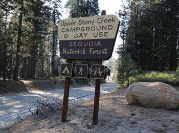
Cold Spring Nature Trail

Cold Spring Nature Trail

Easy1.3 mi

This trail offers a peaceful walk through a natural environment. It features a dirt surface and is generally easy to navigate, making it suitable for casual hikers. The trail's serene atmosphere and natural beauty provide a relaxing experience for visitors.

Crabtree Lakes Trail

Moderate2.1 mi

This trail leads to a secluded lake, providing a peaceful hiking experience amidst a forested landscape. The route is moderately challenging, with scenic views and opportunities for birding and nature observation. The trail's overgrown sections add to its natural charm, though they may require some navigation skills.

John Dean Cutoff Trail

Difficult3.2 mi

This trail offers a rugged experience, connecting hikers to the Kern River canyon. It is an unmaintained stock trail that requires careful navigation. The scenery includes diverse landscapes typical of the Sierra Nevada, though it may not be as frequently visited as other trails in the area.

Ladybug Trail

Ladybug Trail

Moderate2 mi

This trail winds through lush forests, crosses creeks, and climbs to reach giant sequoias. It offers excellent fishing spots and secluded camping areas, making it a haven for nature lovers. The trail's lower elevation means snow melts earlier in spring, providing an ideal setting for early-season hikes.

Paradise Creek Trail

Easy2.5 mi

Follow a gentle path along a shaded creek, offering serene pools and wildflowers in late spring. The trail is perfect for a relaxing hike or a refreshing swim in the creek's calm waters.

Paradise Ridge - Redwood Meadow Trail

Paradise Ridge - Redwood Meadow Trail

Difficult5.9 mi

This trail offers scenic views of the surrounding mountains and forests, though specific details about its features are not available from the provided sources.

Potwisha Hospital Rock Trail

Moderate2.3 mi

This trail leads to Hospital Rock, a site rich in Native American history, featuring pictographs and bedrock mortars used by the Monache tribe. The trail passes through diverse landscapes, including oak woodlands and chaparral, offering glimpses of the region's cultural and natural heritage.

Silliman Lake Use Trail

Easy1.4 mi

Soda Creek Trail

Extreme14 mi

This trail offers a demanding hike with significant elevation changes, traversing varied landscapes that showcase the park's natural beauty. The route provides opportunities to observe diverse flora and fauna, although specific features may vary based on the trail's exact location.

Upper Crabtree Meadow Trail

Easy0.1 mi

This short trail leads to a picturesque meadow, offering a tranquil escape amidst the grandeur of the Sierra Nevada mountains. The area is known for its natural beauty and accessibility, making it a great stop for those exploring the region.

Wuksachi Trail

Wuksachi Trail

Moderate1.8 mi

This trail meanders through a lush forest, crossing Clover Creek and Siliman Creek on quaint wooden bridges. It offers a serene hike with opportunities to connect with the Twin Lakes Trail or head towards Lodgepole Campground. The trail is lined with ferns and features scenic creek crossings, making it a peaceful escape.

Army Pass Trail

Extreme10.7 mi

This trail offers a scenic route through mountainous terrain, featuring diverse landscapes and challenging climbs. It is part of a larger network of trails that connect various lakes and mountain peaks, providing opportunities for both solitude and breathtaking views.

Bear Hill Trail

Moderate2.8 mi

This trail winds through a serene forest of giant sequoias and mixed conifers, offering a peaceful escape from the crowds. The path gently climbs to the summit of Bear Hill before descending, providing a scenic experience amidst wildflowers and ferns.

Bear's Bathtub Trail

Easy0.4 mi

This trail offers a peaceful walk through a natural setting, providing a chance to connect with the outdoors in a tranquil environment.

Beetle Rock Trail

Easy0.5 mi

This granite dome provides stunning views of the surrounding foothills with minimal effort. It's a great spot to watch the sunset and features unique flora growing in its cracks. Nearby educational facilities enhance the experience.

Bobcat Point Trail

Easy0.7 mi

This trail leads to a stunning overlook with views comparable to Moro Rock, offering a scenic panorama of the Sierra Nevada Mountain Range. It is a short and accessible hike suitable for various skill levels.

Colony Mill Trail

Extreme11.1 mi

This trail follows a historic route that once served as a primary access to the giant sequoia groves. It offers a glimpse into the park's past while traversing through dense forest areas. The terrain is challenging, reflecting its origins as a rugged wagon road.

Coyote Lakes Trail

Moderate2.8 mi

No description available

Cyclone Meadow Trail

Moderate2.4 mi

This trail traverses through forested slopes and open meadows, offering scenic views and varied landscapes. It is characterized by its moderate difficulty and elevation changes, making it suitable for hikers seeking a challenge without extreme terrain.

Hidden Springs Road

Extreme13.2 mi

This trail offers a demanding hike with significant elevation changes. The journey takes you through diverse environments, culminating in a scenic destination. However, specific details about the trail's features are not available from the provided sources.

Huckleberry Trail

Easy1.2 mi

No description available

Lake South America Trail

Extreme14.7 mi

This trail offers a scenic hike through a sequoia forest, providing stunning mountain views and a chance to experience the natural beauty of the High Sierras. The trail is suitable for hikers looking for a moderate challenge with rewarding scenery.

Lakes Trail

Lakes Trail

Extreme7.8 mi

This trail takes you through a tranquil environment, offering scenic views of nearby lakes. The moderate terrain makes it accessible for a variety of hikers, providing a peaceful escape into nature.

Lewis Camp Trail

Extreme14 mi

This trail offers a rugged journey through varied terrains, including forests and meadows. It is known for its steep inclines and scenic vistas, making it a challenging yet rewarding experience for hikers.

Log Meadow Loop

Easy0.5 mi

This loop trail offers a peaceful walk through a forest of giant sequoias, providing a serene escape into nature. The trail is well-suited for families and those seeking a gentle hike with scenic views.

Lone Pine Creek Trail

Moderate2 mi

na

Long Meadow Loop Trail

Moderate2.1 mi

This loop trail offers a tranquil hike through a meadow, ideal for spotting wildlife, particularly early in the morning or late in the evening. The trail is less frequented, making it a peaceful choice for those seeking solitude.

Lost Canyon Trail

Extreme14.5 mi

This loop traverses through three scenic canyons, offering breathtaking views of sandstone formations and canyons. The trail includes sandy washes, slickrock benches, and steep sandstone ridges, providing an immersive experience in the high desert landscape. With opportunities for backpacking and multiple backcountry campsites, it's an ideal choice for those seeking a deeper connection with nature.

Lower Kern Trail

Difficult8.4 mi

This area features a narrow, steep canyon with occasional foothill pines, buckeye, oaks, and grasses. The river's edge supports large sycamores and willows, creating a unique landscape. While not specifically a trail, the Lower Kern River offers scenic views and outdoor activities like fishing and whitewater boating.

Lower Rattlesnake Trail

Difficult8 mi

This trail offers a challenging hike through a beautiful canyon, featuring a mix of rocky terrain and steep inclines. The trailhead is located along the Walnut Canyon Desert Drive, providing access to a unique landscape with notable elevation changes.

Lower Whitney Creek Trail

Easy0.8 mi

No description available

Newlywed Trail

Difficult5.2 mi

No description available

Over The Hill Trail

Moderate2 mi

This trail offers a moderate hike through diverse landscapes, with a total elevation change of 418.9 meters. The dirt surface provides a natural and immersive experience for hikers, though specific features and attractions are not detailed.

Quinn Trail

Easy2.1 mi

This trail offers a journey through diverse natural settings, though specific features are not detailed due to lack of information.

Redwood Meadow Cutoff Trail

Moderate1.7 mi

This trail offers a peaceful walk through a forested landscape, providing an opportunity to connect with nature. While specific features are not detailed, it presents a serene environment for hikers.

Rimrock Trail

Moderate1.6 mi

No description available

Rock Creek Lake Trail

Difficult5.2 mi

This trail offers a journey through diverse natural settings, with its unpaved surface providing a more rugged experience. The trail's moderate difficulty ensures it's accessible to a range of hikers while still offering a challenge.

Rock Creek Ranger Station Trail

Easy0.2 mi

This short trail offers a gentle hike suitable for all skill levels, providing an opportunity to enjoy the surrounding natural beauty.

Siberian Pass Trail

Moderate5.3 mi

This trail offers a scenic high-altitude journey through alpine landscapes, featuring rugged terrain and expansive views. It connects to other trails, providing access to diverse ecosystems and vistas within the Sierra Nevada range.

Soldier Lake Trail

Easy2.7 mi
Stony Creek Trail

Stony Creek Trail

Moderate3.5 mi

No description available

Summit Trail

Moderate3.5 mi

This trail offers scenic mountain views and alpine landscapes. Hikers can enjoy the beauty of nature with potential wildlife sightings. The trail's features are typical of mountainous regions, with varying terrain that includes both forested areas and open meadows.

Touhy Trail

Extreme17.6 mi

No specific description available due to lack of trail details.

Trail of the Sequoias

Moderate3.6 mi

Traverse through a dense forest of giant sequoias, featuring some of the oldest and largest trees. The trail offers a serene hike past notable landmarks like the General Sherman Tree and Tharps Log, providing a glimpse into the natural history of these ancient giants.

Wallace Lake Trail

Moderate2.6 mi

This trail winds through a picturesque forest, offering stunning views of surrounding mountains and lakes. The journey takes you along rivers and past waterfalls, showcasing the region's natural beauty. It provides a serene escape into nature, with opportunities for camping and wildlife viewing.

Washington Tree Trail

Easy0.6 mi

Hike through a stunning forest of giant sequoias, culminating in the Washington Tree, the largest in the park. The trail offers breathtaking views of these natural giants, including the Grizzly Giant and other notable trees. The hike is accessible for a variety of visitors, showcasing the park's most impressive natural landmarks.

Whiskey Log Trail

Easy1.2 mi

This trail leads to a secluded campsite near granite gorges, offering scenic views of the surrounding landscape. The area is known for its challenging terrain and diverse geology, including marble bands that create unique river features.

Wright Creek Trail

Moderate2.9 mi

This trail offers a challenging hike through diverse natural settings. It is generally considered a more difficult route due to its length and terrain, making it suitable for experienced hikers. The trail provides opportunities to observe local flora and fauna, offering a rewarding experience for those who complete it.

Yucca Creek Trail

Easy0.9 mi

No description available

Get offline trail maps and detailed hiking info in the Parka app

Download Parka — It's Free

Get offline trail maps for Sequoia & Kings Canyon National Parks

Free on the App Store

Get Parka

Why Park Lovers Choose Parka

Trip Planner

All the tools for epic adventures

Works Offline

Fully functional without cell service

Updated Weekly

Trail conditions, alerts, and closures

Try Risk-Free

7-day free trial, cancel anytime

Start Your 7-Day Free Trial

Unlock everything you need for your next national park trip. Your first week is on us!

National Park vista

Start your adventure today

Download Parka and plan your perfect national park trip in minutes.