ParkaDownload
Shenandoah National Park

Trails in Shenandoah National Park

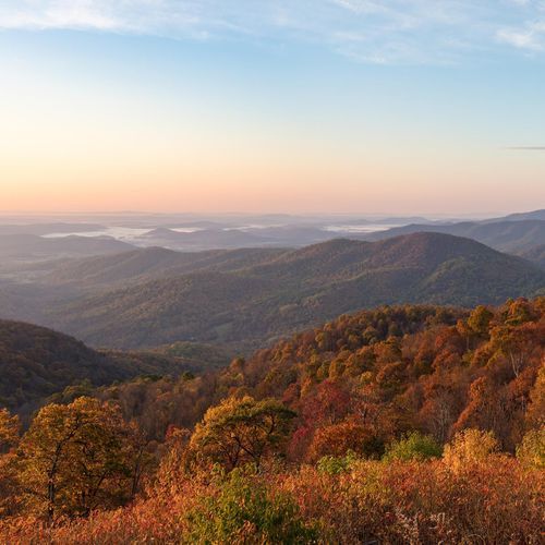
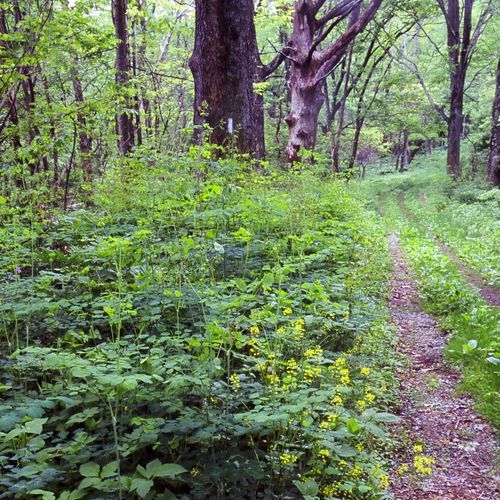
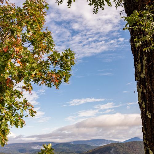
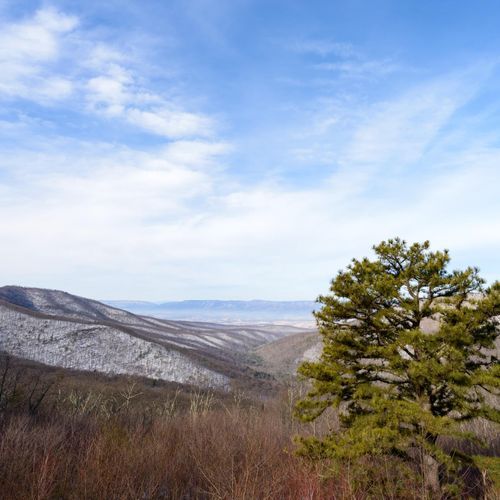
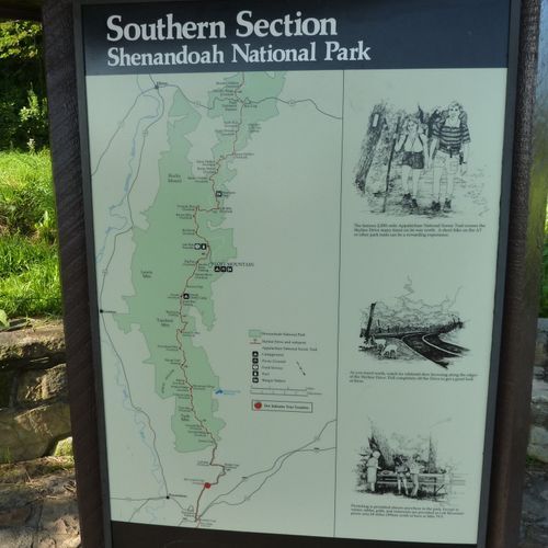
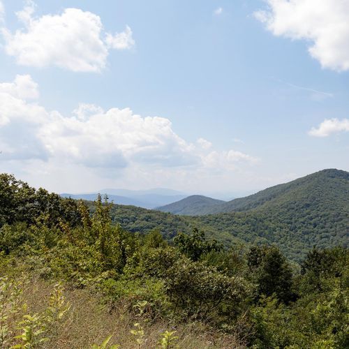
Hiking is the essential Shenandoah experience, and the park’s trail network makes it easy to tailor a day to almost any ability level. With 141 named trails and more than 500 miles of footpaths overall, Shenandoah offers everything from gentle rambles to strenuous mountain climbs. The balance is especially appealing: plenty of easy and moderate options for casual walkers, families, and scenic day hikers, plus a strong lineup of difficult routes for those who want a real workout. You can spend the morning on a short summit walk or waterfall trail, then commit to a longer ridge hike in the afternoon without ever leaving the park’s spine along Skyline Drive. The standout hikes are the ones that capture Shenandoah’s signature variety. Old Rag is the park’s marquee challenge, a classic, all-out adventure known for its demanding ascent and memorable summit experience. Hawksbill, the highest point in the park, delivers one of the best summit rewards for the effort, while Stony Man is a favorite for a shorter, easier payoff with expansive Blue Ridge views. Bearfence adds a touch of fun and exposure with its light rock scramble, and waterfall routes like Dark Hollow Falls and the Rose River Falls Loop bring hikers into the cooler, greener world of cascades, pools, and streamside forest. This is a park where a single trip can include panoramic ridgelines, rocky overlooks, and shaded hollows. What makes hiking in Shenandoah special is the way the landscape keeps unfolding in layers. The park stretches for more than 100 miles along the crest of the Blue Ridge, so many trails lead quickly to overlooks with long views across the Shenandoah Valley and Piedmont, while others drop into quiet woods rich with birdsong, rushing water, and seasonal wildflowers. It feels accessible without ever feeling tame: the trailheads are convenient, the scenery is immediate, and even shorter hikes often end with a genuine sense of arrival. For hikers, Shenandoah delivers that rare combination of range, beauty, and ease of exploration that keeps people coming back trail after trail.

Bearfence Mountain Trail

Bearfence Mountain Trail

Moderate1 mi

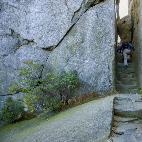
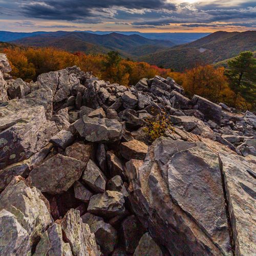
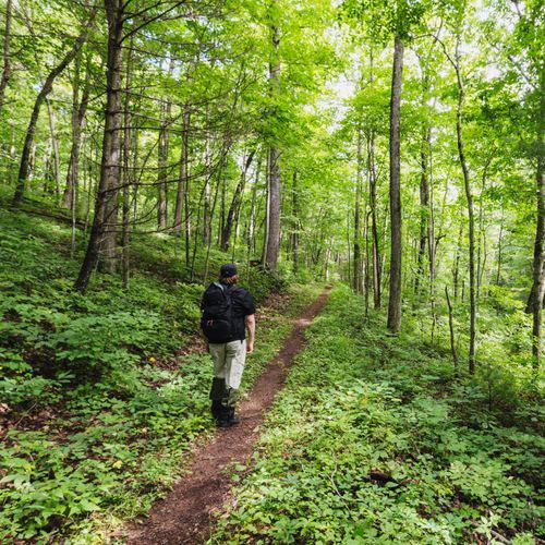
This trail offers a short but challenging hike with a rock scramble leading to panoramic views of the surrounding mountains. The route is popular for its scenic vistas and is not suitable for those with a fear of heights or pets. The trail's unique rock formations and diverse flora make it a standout in the region.

Dark Holllow Falls Trail

Dark Holllow Falls Trail

Moderate1.6 mi

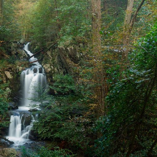
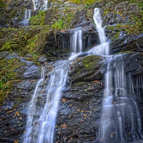
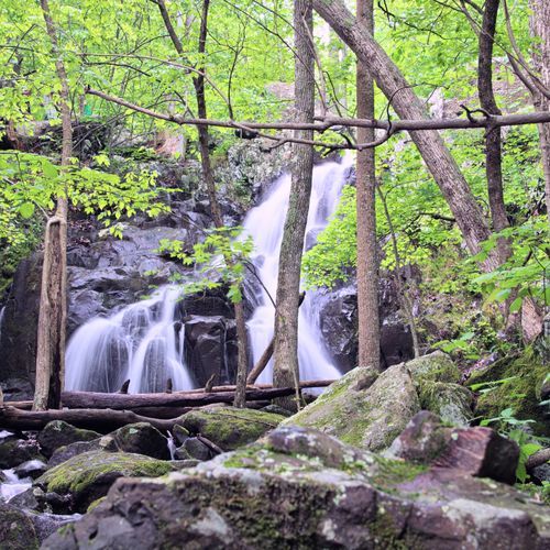
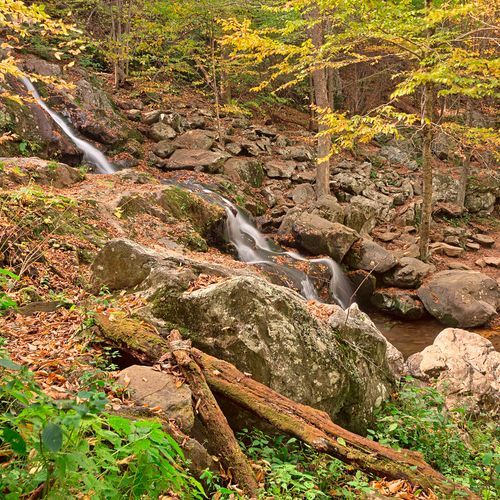
Follow a well-maintained path along a stream, surrounded by vibrant vegetation and the soothing sounds of water. The trail features a series of cascades down a rocky slope, creating a serene and picturesque setting. Wildlife such as white-tailed deer and black bears may be spotted, adding to the natural allure. The area is rich in birdlife, including species like ovenbirds and scarlet tanagers, and offers a tranquil escape into the forest.

Doyles River Trail

Doyles River Trail

Difficult3.4 mi

Follow a mountain stream to two picturesque waterfalls, offering scenic views and opportunities to explore the surrounding wilderness. The trail features Upper and Lower Falls, each unique and breathtaking. Along the way, enjoy the cool, clear waters and the serene forest environment.

Jones Run Trail

Jones Run Trail

Moderate4.7 mi

This trail descends through a forested area to a picturesque waterfall, offering scenic views of cascading streams. The hike includes a stream crossing and can be extended to include nearby Doyles River Falls for a more comprehensive experience.

Little Devils Stairs Trail

Little Devils Stairs Trail

Difficult5.3 mi

This trail features a scenic hike through a narrow gorge along Keyser Run, known for its numerous small waterfalls and cascades. The route includes a steep climb, requiring occasional use of hands. The trail also passes by the historic Bolen Cemetery, offering a glimpse into the area's past.

Lower Hawksbill Trail

Easy1.4 mi

Ascend to the highest point for breathtaking 360-degree views of the surrounding mountains and valleys. The trail features a steep climb through a dense forest canopy, culminating at a viewing platform with stunning vistas.

Mill Prong Trail

Mill Prong Trail

Moderate3.6 mi

Follow the Mill Prong Trail to President Hoover's historic Rapidan Camp, a former presidential retreat nestled along the Rapidan River. The trail features scenic water crossings, including Big Rock Falls, and offers insights into the camp's rich history. Explore restored cabins like the Brown House and Prime Minister's Cabin, and enjoy the serene surroundings.

Old Rag Mountain Loop

Old Rag Mountain Loop

Extreme5 mi

Offers a journey along the spine of the Appalachian Mountains, providing panoramic views of the Shenandoah Valley and Piedmont. Known for its diverse wildlife, it's common to spot black bears, deer, and numerous bird species. The trail meanders through hardwood forests, showcasing the region's rich biodiversity. In spring, enjoy the bloom of wildflowers, while autumn brings a vibrant display of fall foliage. A highlight is the opportunity to witness stunning sunrises and sunsets from various overlooks along the path.

Passamaquoddy Trail

Moderate2 mi

This loop hike offers stunning views of the surrounding mountains and valleys. It traverses through diverse forest landscapes, providing a mix of leafy canopies and open vistas. The trail includes sections of the Appalachian Trail and offers panoramic views from several viewpoints, including Little Stony Man and Big Stony Man.

Riprap Trail

Riprap Trail

Difficult9.4 mi

This loop trail offers stunning views of the surrounding mountains and valleys, featuring waterfalls, swimming holes, and scenic overlooks like Chimney Rock and Calvary Rocks. The trail includes several stream crossings and traverses through lush forests, making it a rewarding hike for those seeking diverse landscapes.

Rose River Loop Trail

Rose River Loop Trail

Moderate3.7 mi

This trail features stunning waterfalls and cascades along the Rose River, passing through a federally designated Wilderness area. The hike offers beautiful scenery and opportunities for photography. It is a popular destination, especially on weekends, and is suitable for those looking for a moderate day hike with scenic rewards.

South River Falls Trail

South River Falls Trail

Moderate4.3 mi

Descend through a lush forest alongside the South River to reach the base of an 83-foot waterfall. The trail offers scenic views and is ideal for nature enthusiasts, with opportunities to spot wildflowers and birds. The loop hike allows for a varied experience, returning via a fire road.

Stony Man Trail

Stony Man Trail

Moderate1.5 mi

Enjoy a short, pleasant hike to an outstanding viewpoint offering breathtaking vistas of the Shenandoah Valley and Massanutten Mountain. The trail features diverse flora, including red spruce and balsam fir, and offers opportunities to spot wildlife such as white-tailed deer and various bird species.

Appalachian Trail Access

Appalachian Trail Access

Easy0.4 mi

This short trail provides access to the renowned Appalachian Trail, offering a glimpse into the vast wilderness and scenic beauty of the Appalachian Mountains. It's an ideal starting point for those looking to experience a small section of the trail.

Cedar Run Trail

Cedar Run Trail

Moderate2.8 mi

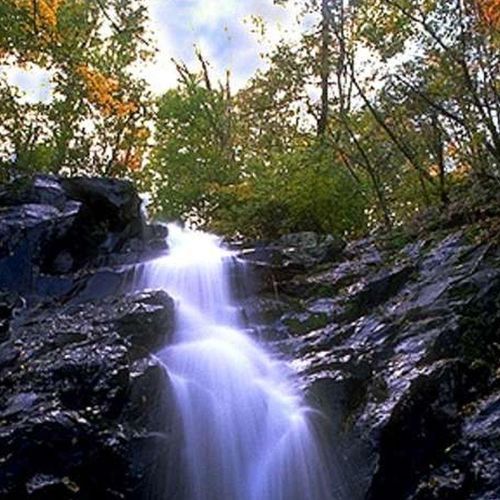
This circuit hike features numerous waterfalls and cascades, including the spectacular falls of White Oak Canyon and Cedar Run. The trail involves several stream crossings and steep inclines, offering breathtaking views and a natural water slide. It's a popular choice for those seeking a challenging yet rewarding hike.

Dark Hollow Trail

Dark Hollow Trail

Easy0.7 mi

Descend through a shaded forest alongside a stream to a stunning waterfall, where water cascades seventy feet down the mountain. The trail offers views of the falls from both upper and lower vantage points, with a fence protecting visitors from getting too close. The area is rich in wildlife, including white-tailed deer and various bird species. While the trail is well-maintained, it can be steep and rocky, especially on the return climb. The surrounding landscape features blooming wildflowers and diverse tree cover, making it a popular destination for nature enthusiasts.

Upper Hawksbill Trail

Upper Hawksbill Trail

Moderate2 mi

Reach the highest point in Shenandoah National Park via a gentle hike. The trail leads to a stone viewing platform with 360-degree views of the surrounding mountains and valleys. Nearby is Byrd's Nest No. 2 Shelter, a historic landmark. The summit is notable for its unique flora, including balsam fir.

White Oak - Cedar Run Loop

White Oak - Cedar Run Loop

Extreme7.7 mi

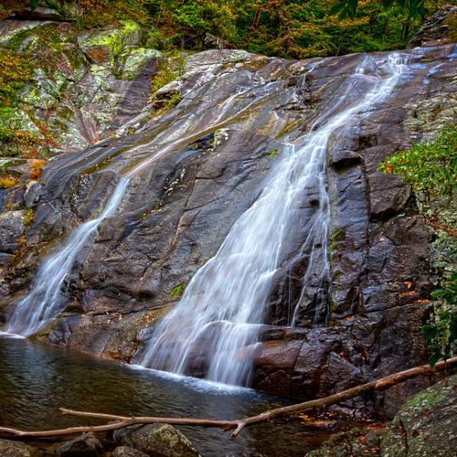
The hike features a series of breathtaking waterfalls, including the Upper Whiteoak Falls, one of the highest in the area. The trail follows alongside rolling streams, offering serene views and numerous water crossings. The terrain shifts from steep climbs to gentle descents, with scenic vistas and diverse forest landscapes. The route includes a less eventful connector section before descending through a picturesque valley with photogenic cascades, culminating in a beautiful box canyon. The natural beauty and variety of landscapes make this hike a standout experience.

White Oak Canyon Trail

White Oak Canyon Trail

Difficult4.8 mi

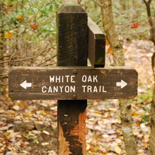
Follow the trail through a scenic forest, passing alongside the Robinson River, and witness six breathtaking waterfalls. The trail offers both easy and challenging sections, making it suitable for a variety of hikers. Highlights include natural swimming holes and the option to combine with the Cedar Run Trail for an epic loop adventure.

Austin Mountain Trail

Moderate2.7 mi

This trail offers a steep climb through a diverse forest, culminating in stunning views from the summit. The route is part of a larger network of trails that can be combined for longer hikes, offering flexibility for hikers of varying interests and abilities.

Beecher Ridge Trail

Moderate3.1 mi

This trail features the highest waterfall in the park, along with scenic streams and meadows. It passes through areas known for a high concentration of black bears, offering a unique wildlife experience. The trail includes cascades and swimming holes, making it a popular choice for those seeking both natural beauty and adventure.

Big Devils Stairs

Easy1.3 mi

This trail offers a serene walk through the woods, leading to stunning views from the canyon rim. The hike features a steep descent into a gorge, providing an exciting adventure for those willing to tackle the challenging terrain. It's a great option for hikers seeking solitude and breathtaking vistas.

Big Run Loop Trail

Moderate4.1 mi

Descend through a forest of fallen leaves and cross a tranquil stream, then ascend to join the Appalachian Trail. The hike offers solitude, backcountry camping opportunities, and scenic views, including granite cliffs and the Doyles River Overlook. Wildlife sightings are common, with deer and various bird species often seen. The trail's lesser-visited status provides a peaceful experience amidst rugged terrain.

Big Run Portal Trail

Moderate4.6 mi

This trail serves as a connector for various loop hikes, offering scenic views and diverse terrain. It drops down from the Big Run Loop Trail, providing a unique hiking experience within the park.

Bluff Trail

Moderate3.7 mi

This trail traverses through a forest of loblolly and longleaf pine trees, offering a glimpse into the park's efforts to restore longleaf pine habitats. It features a mix of cultural history and wildlife, including deer and various bird species. The trail also provides access to campgrounds and showcases the park's use of controlled burns to manage vegetation.

Broad Hollow Trail

Broad Hollow Trail

Moderate2.2 mi

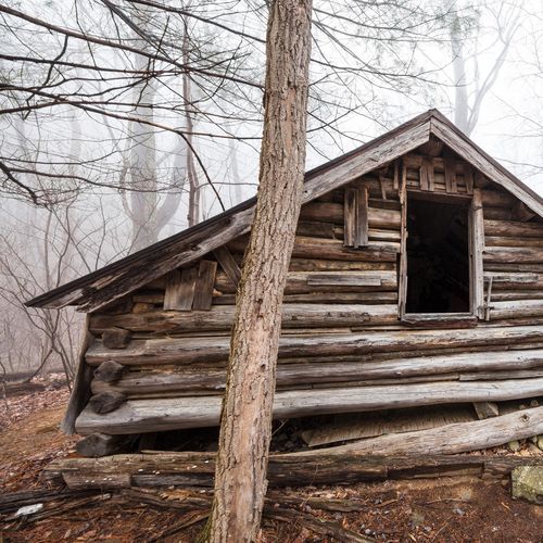
This trail offers a peaceful forest experience, featuring gentle streams and the remains of an old wooden cabin. The hike is characterized by its solitude and scenic forest surroundings, making it an ideal choice for those seeking tranquility.

Brown Mountain Trail

Difficult4.9 mi

This trail offers scenic views of surrounding mountains and valleys, featuring diverse flora such as wildflowers and berry bushes. It traverses through varied landscapes, including old-growth forests and lava flows, providing a rich hiking experience.

Buck Hollow Trail

Buck Hollow Trail

Moderate2.7 mi

Descend into a lush forest along a stream, then ascend steeply up a ridge. The trail features mature forests, occasional wildlife sightings, and scenic views from the ridge. It includes challenging sections like the infamous stairs and offers a serene backcountry campsite at the hollow's bottom.

Buck Ridge Trail

Moderate2.9 mi

Descend into a forested hollow along a stream, then ascend steeply to a ridge with scenic views of surrounding mountains. The trail features diverse wildlife and varied forest ecosystems, including mushrooms and woodland birds. The challenging climb is rewarded with vistas from atop rocky formations.

Cat Knob Trail

Cat Knob Trail

Easy0.5 mi

This short trail connects through the scenic Blue Ridge Mountains, providing a glimpse into the region's natural beauty. It serves as an alternate route, offering hikers a chance to explore diverse landscapes within a short distance.

Catlett Mountain Trail

Catlett Mountain Trail

Easy1.1 mi

This trail offers a scenic hike through less traveled areas, known for its vibrant fall colors. It features historic sites and natural beauty, including cascading streams and remnants of past settlements. The trail is part of a larger network that includes Nicholson Hollow and Hot-Short Mountain, providing opportunities to explore diverse landscapes and wildlife.

Corbin Cabin Cutoff Trail

Easy1.4 mi

This trail offers a steep but scenic descent to Corbin Cabin, a historic log structure nestled deep within the forest. The cabin, once home to George Corbin, provides a glimpse into the lives of early mountain settlers. The hike is relatively short but includes a notable elevation change, making it a moderate challenge.

Corbin Hollow Trail

Moderate2 mi

This trail offers a mix of natural beauty and historical significance, featuring varied terrain that includes streams and scenic overlooks. It provides an opportunity to explore the park's diverse ecosystems while experiencing its rich cultural heritage.

Crescent Rock Trail

Easy1 mi

This trail leads to a scenic overlook with stunning views of Hawksbill Peak, the highest point in the area. The hike begins on the accessible Limberlost Trail before ascending through a serene forest to reach the overlook. It offers options for hikers of varying abilities, making it a great choice for groups.

Dickey Ridge Horse Trail

Dickey Ridge Horse Trail

Easy0.6 mi

This trail offers a glimpse into the park's rich history, passing through areas once inhabited by local families. The trail's easy terrain makes it suitable for casual riders, providing a serene experience amidst nature.

Dickey Ridge Trail

Dickey Ridge Trail

Difficult8.6 mi

This trail offers a mix of forested paths and open views, featuring remnants of the Snead Farm and the Fox Family Cemetery. The hike provides opportunities to see wildlife and enjoy the scenic beauty of the surrounding mountains.

Elkwallow Trail

Elkwallow Trail

Easy1.9 mi

This trail traverses through a picturesque landscape parallel to Skyline Drive, providing easy access and scenic views of the Blue Ridge Mountains. It is well-suited for families and casual hikers looking to enjoy the natural beauty of the area.

Fork Mountain Trail

Easy1.2 mi

This trail traverses through a remote and scenic area, offering a journey through dense mountain laurel and rhododendron forests. It ascends and descends along the northern flanks of Fork Mountain, crossing numerous coves and ravines. The trail eventually connects with other trails, providing options for extended hikes.

Fox Hollow Trail

Fox Hollow Trail

Easy1.1 mi

This loop trail offers a glimpse into the past, passing by historic rock walls and the Fox family cemetery. The trail is rich in cultural history, featuring remnants of the Fox family's homestead and periwinkles planted by former residents. It's a short, accessible hike suitable for families and nature enthusiasts alike.

Frazier Discovery Trail

Frazier Discovery Trail

Easy1.1 mi

This circuit hike passes through woodlands of varying ages, offering picturesque overlooks. The trail is well-suited for families and those seeking a short, scenic hike with notable views.

Furnace Mountain Trail

Moderate3.2 mi

This trail offers stunning views from multiple summits, including Blackrock and Trayfoot Mountain. The hike features a mix of dense forests, rock scrambles, and expansive vistas across the valley. It's a less crowded option for those seeking a quieter hiking experience.

Gap Run Trail

Moderate3.1 mi

This trail offers a scenic hike through varied forest landscapes, featuring Gap Run and connecting with other trails in the area. It provides opportunities for backcountry camping and is part of a larger circuit that includes more challenging ascents and panoramic views.

Graves Mill Trail

Easy2.1 mi

This trail parallels the beautiful Rapidan River, offering scenic views and opportunities to spot native brook trout. The trail passes through varied forest habitats and includes historic sites like the old mill area. It's a great option for those looking to enjoy both nature and history.

Hannah Run Trail

Moderate3.5 mi

Winding through a landscape of cascading streams and historic sites, this trail offers secluded backcountry camping opportunities. The journey includes traversing through dense forests and along ridges, with access to swimming holes and waterfalls. The area is rich in park history, and during weekdays, visitors can often enjoy solitude in this wilderness setting. The trail connects with other paths, providing flexibility for longer explorations or shorter excursions.

Harris Hollow Trail

Harris Hollow Trail

Moderate2.2 mi

This trail offers a tranquil journey through a natural setting, providing a chance to connect with nature. The area is known for its scenic beauty and diverse wildlife.

Hazel Mountain Trail

Hazel Mountain Trail

Moderate4 mi

This hike leads through a deciduous forest, featuring wildflowers and easy water crossings. The trail culminates at Hazel Falls, a picturesque waterfall with adjacent caves, offering a tranquil setting for a picnic or exploration.

Hazel River Trail

Hazel River Trail

Difficult3.5 mi

This trail takes you through a rugged section of the forest to an exceptional waterfall. The setting is picturesque, with the falls nestled among rock formations and caves. It offers a serene environment for relaxation and nature observation.

Heiskel Hollow Tral

Moderate3.4 mi

Experience wilderness solitude on narrow trails, passing remnants of old homesteads and fireplaces. The trail follows East Fork Creek, offering scenic views and small waterfalls. It gradually ascends, providing opportunities to see native wildflowers like Rue-anemone and the invasive garlic mustard. Historical sites include stone walls and old shacks, adding to the trail's charm. The area is rich in biodiversity, though caution is advised due to the presence of wildlife.

Indian Run Trail

Moderate1.6 mi

This trail traverses through a wetland area, offering insights into historical events like the Battle of the Great Meadows. The terrain includes gradual climbs and descents, with a notable creek crossing. Wildlife sightings can include salamanders and other local species.

Jarmans Gap Road

Easy0.6 mi

This trail offers a gentle stroll through the forest, providing a serene escape into nature. The surrounding landscape is dotted with scenic overlooks and diverse wildlife, making it an ideal choice for those seeking a peaceful hike.

Jenkins Gap Trail

Easy1.4 mi

This trail offers scenic views of rolling hills and is part of the broader Appalachian Trail network. It provides a pleasant, easy hike suitable for most visitors. The surrounding landscape includes forested areas and occasional wildlife sightings.

Jeremys Run Trail

Jeremys Run Trail

Difficult6.4 mi

This trail features picturesque streams, including Jeremy's Run, and offers scenic mountain vistas. The hike involves traversing through forests and along streams, with multiple water crossings. Wildlife sightings are common, and the trail offers a mix of forested areas and open views.

Jones Mountain Trail

Jones Mountain Trail

Difficult5.1 mi

This trail offers stunning views from Bear Church Rock and Cat Knob, traversing through diverse landscapes within the national park. The challenging route rewards hikers with breathtaking vistas, making it a popular choice for experienced adventurers.

Keyser Run Road

Difficult4.3 mi

This trail offers a moderately challenging hike through a mix of forested areas and open landscapes. The unpaved surface provides a rustic experience, and the route is suitable for those seeking a less crowded trail with varied scenery.

Knob Mountain Cutoff Trail

Knob Mountain Cutoff Trail

Easy0.6 mi

This trail connects to the Knob Mountain Trail, offering a scenic route through a less crowded section of the park. It is part of a larger loop that includes Jeremy's Run, featuring picturesque streams and varied terrain.

Knob Mountain Trail

Knob Mountain Trail

Difficult7 mi

This loop takes you through one of the most picturesque areas, featuring Jeremy's Run and offering opportunities to see wildlife like black bears. The trail includes steep ascents and descents with occasional views of the valley below.

Lands Run Gap Road

Moderate1.9 mi

Winding through the Virginia countryside, this trail offers a moderate hike with opportunities for both hiking and trail running. The path is dog-friendly and features a mix of terrain, providing scenic views of the surrounding landscape. While not directly associated with the popular waterfall hikes in the area, it offers a distinct experience with its singletrack design and varied terrain.

Laurel Prong Dam Trail

Laurel Prong Dam Trail

Easy0.2 mi

Winds through a lush forest, leading to the historic Civilian Conservation Corps-constructed dam. The trail offers a serene environment, abundant with wildlife such as white-tailed deer, black bears, and a variety of bird species. The dam itself, a testament to early 20th-century engineering, adds a unique historical element to the trail. The surrounding area is rich with laurel shrubs, adding a splash of color during blooming season. The trail's tranquility and natural beauty make it a must-visit for nature enthusiasts.
Laurel Prong Trail

Laurel Prong Trail

Moderate2.3 mi

Winds through a serene hardwood forest, offering hikers a peaceful journey. The trail leads to the site of an old cabin, providing a glimpse into the area's past. Along the way, hikers may encounter a variety of wildlife, including deer and a multitude of bird species. In the spring, the trail is adorned with blooming wildflowers, adding a splash of color to the landscape. The trail's gentle slopes make it a pleasant walk for hikers of all levels. A tranquil escape into nature's beauty, offering a mix of historical intrigue and natural splendor.

Lewis Mountain Trail

Easy0.5 mi

Experience a vibrant display of spring trillium along this route, where the forest floor is carpeted with these ephemeral flowers. The trail meanders through open, grassy woods and features a gentle ascent to a small rocky summit with partially obstructed views. Wildlife sightings are common, including birds, deer, and bears. The hike offers a serene, less crowded experience, ideal for those seeking a peaceful connection with nature.

Lewis Spring Falls Trail

Lewis Spring Falls Trail

Moderate1.8 mi

Descend through a dense forest to an 81-foot waterfall, with a viewing platform offering a glimpse of the falls. The trail features steep, rocky sections and scenic overlooks. Wildlife sightings are common, and the hike concludes with a return via the Appalachian Trail, offering additional mountain views.

Lewis Trail

Lewis Trail

Easy0.8 mi

Winds through a diverse landscape of hardwood forests, rocky outcrops, and open areas with panoramic views. The trail offers a variety of flora and fauna, including wildflowers and wildlife such as deer, birds, and occasionally black bears. The trail's rocky terrain and steep sections provide a challenging but rewarding hiking experience. A highlight of the trail is the panoramic views of the surrounding mountains and valleys, particularly stunning during fall when the leaves change color. Despite its challenges, the trail's beauty and diversity make it a favorite among hikers.

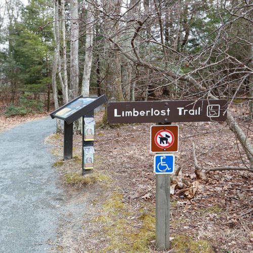
Limberlost Trail

Limberlost Trail

Easy1.3 mi

This trail offers a peaceful stroll through a forest once dominated by Eastern Hemlocks, now featuring spruce trees and mountain laurel. It includes a boardwalk section and intersects with other trails like Whiteoak Canyon. The trail is fully accessible and part of the TRACK Trails program, making it ideal for families and those seeking a gentle, nature-filled experience.

McDaniel Hollow Trail

McDaniel Hollow Trail

Easy0.4 mi

This trail winds through a variety of forest habitats, providing opportunities to connect with nature and history. It is part of a larger circuit that includes historic sites like Rapidan Camp and Jones Mountain Cabin, offering a mix of natural beauty and cultural significance.

Meadow Springs Trail

Easy0.6 mi

Winding through dense forests and alongside meandering streams, the trail offers panoramic views of the surrounding landscape. It features a diverse array of native flora and fauna, with frequent sightings of deer and various bird species. The path connects to other scenic trails, providing access to additional viewpoints and natural wonders. The trail is accessible year-round, allowing visitors to experience the changing seasons, from vibrant autumn foliage to serene winter landscapes.

Mill Prong Horse Trail

Mill Prong Horse Trail

Moderate1.9 mi

Wander through a mix of open forest and mountain laurel thickets to President Herbert Hoover's rustic getaway, featuring exhibits and serene stream scenery. The trail offers views from Hazeltop Mountain and the beauty of Big Rock Falls.

Millers Head Trail

Millers Head Trail

Easy0.7 mi

This trail offers stunning 180-degree views of the Luray Valley and surrounding park landscapes. It's a family-friendly hike with a mix of rocky and dirt surfaces, making it suitable for all ages. The trail features a former fire tower site now converted into a scenic viewpoint.

Mount Marshall Trail

Difficult5.5 mi

Immerse in a dense forest canopy, traversing a loop that offers serene backcountry experiences and spectacular views from rocky outcrops. The trail crosses Skyline Drive multiple times, providing access to both North and South Marshall viewpoints. Highlights include the chance to spot wildlife like deer and birds, and the opportunity to explore the Gravel Springs Hut. The trail's varied terrain includes steady climbs and descents, with occasional water crossings, making it a comprehensive hiking experience.

Neighbor Mountain Trail

Difficult5 mi

This trail offers a mix of wilderness, beautiful views, and stunning stream scenery, including a small waterfall. The hike features a variety of landscapes, from forested ridges to scenic valleys, making it a popular choice for backpackers and day hikers alike.

Nicholson Hollow Trail

Nicholson Hollow Trail

Difficult5.5 mi

Follow the Nicholson Hollow Trail alongside the Hughes River, passing through a serene forest with historic sites like the Corbin Cabin. Enjoy scenic water crossings, cascades, and secluded swimming holes. The trail offers a glimpse into the area's past, with remnants of old cabins and a peaceful atmosphere.

North Fork Moormans River Trail

Moderate5.5 mi

Follow the North Fork Moormans River through a lush forest, offering scenic views of waterfalls and swimming holes. The trail is popular for its natural beauty and recreational opportunities, including fishing and hiking. It is part of a larger trail system that connects to Shenandoah National Park.

Overall Run Trail

Overall Run Trail

Extreme5.5 mi

This trail leads to the tallest waterfall in the park, standing at 93 feet. The hike offers stunning views of surrounding mountains and forests, though water flow may vary. The trail includes steep sections and scenic overlooks, making it a popular choice for those seeking both natural beauty and a moderate challenge.

Overall-Beecher Connector Trail

Overall-Beecher Connector Trail

Easy0.7 mi

This connector trail links key sections of the park, providing access to waterfalls like Overall Run Falls and offering scenic mountain views. It is part of a larger network that includes the Beecher Ridge Trail and Overall Run Trail, known for its cascades and swimming holes.

Paine Run Trail

Moderate3.7 mi

Experience solitude along less-traveled paths, with stunning views of the surrounding mountains and the opportunity to explore a beautiful mountain stream. The trail features fascinating rock formations and offers a chance to connect with nature in a serene environment.

Pass Mountain Hut Road

Easy1.5 mi

This dirt/gravel road winds through forested terrain, connecting to a historic stone hut built in 1939. The area offers views of rolling hills and access to nearby hiking trails, including the Appalachian Trail. The surrounding landscape is dotted with wildflowers and wildlife, making it a picturesque route for hikers and nature enthusiasts.

Piney Branch Trail

Piney Branch Trail

Difficult5.7 mi

This trail offers a serene hike through the woods, following a creek that features small waterfalls. The path includes multiple stream crossings and offers views of a cascading mountain stream. It is a great example of the natural beauty found in the area, with opportunities to spot wildlife like black bears.

Pocosin Trail

Pocosin Trail

Easy1.2 mi

This trail descends along a gravel fire road to the historic Upper Pocosin Mission ruins and passes by the Pocosin Cabin, a primitive cabin built by the Civilian Conservation Corps. The mission once served local mountain communities, offering a glimpse into the area's past.

Robertson Mountain Trail

Robertson Mountain Trail

Moderate2.3 mi

This challenging hike offers breathtaking views of Old Rag Mountain without the crowds. The trail includes steep sections and scenic vistas, making it a rewarding experience for those seeking a less-traveled route.

Rocky Mount Trail

Difficult5 mi

Winds through a dense forest, leading to a summit with panoramic views of the Shenandoah Valley and Massanutten Mountain. Along the way, hikers encounter remnants of old homesteads, providing a glimpse into the area's history. The trail's steep inclines and rocky terrain make for a challenging hike, but the rewarding views at the top make the effort worthwhile. Wildlife sightings are common, with deer, birds, and even black bears often spotted along the route. The trail is particularly beautiful in the fall, when the leaves change color, creating a stunning backdrop for the hike.

Rockytop Trail

Difficult5.5 mi

Experience stunning 360-degree views from the summit, surrounded by rhododendron tunnels and mountain laurel. The trail offers a challenging hike through scenic meadows and grassy knolls, culminating in breathtaking vistas of nearby lakes and historic valleys.

Salamander Trail

Easy0.6 mi

This trail offers a peaceful journey through natural landscapes, though specific features are not detailed in available sources.

Skyland-Big Meadows Horse Trail

Difficult6.6 mi

This trail offers a scenic journey through varied landscapes, providing opportunities to experience the natural beauty of the area. It is part of a larger network of trails, allowing for a range of hiking and horseback riding experiences.

Snead Farm

Snead Farm

Easy1.4 mi

Visit a preserved farmstead, featuring a well-maintained barn and remnants of rural life from the early 20th century. The site includes a root cellar and the foundation of the former family home. The trail offers a glimpse into the lives of those who once called this area home, with options for shorter or longer hikes through a mix of forest and fire roads.

Staunton River Trail

Moderate3.8 mi

This trail traverses through varied landscapes, providing scenic views and opportunities to experience local wildlife and vegetation. However, it is not located within Staunton River State Park.

Story of the Forest Trail

Story of the Forest Trail

Easy0.9 mi

This trail offers a serene stroll through a lush forest, featuring ferns and wildflowers. It crosses a small stream and passes near communication towers before looping back through the woods. The trail is suitable for families and provides a peaceful pre-dinner walk.

Sugarloaf Trail

Sugarloaf Trail

Easy1.4 mi

Winds through a variety of landscapes, from hardwood forests to open meadows. The trail offers stunning panoramic views of the surrounding mountains and valleys. Wildlife sightings are common, with opportunities to spot deer, birds, and other native species. The trail's moderate incline makes it a manageable challenge, while its diverse ecosystems and scenic overlooks make it a rewarding journey. A peaceful retreat into nature's beauty, offering a unique perspective on the diverse ecosystems of Shenandoah.

Thompson Hollow Trail

Thompson Hollow Trail

Easy0.7 mi

This trail winds through a forested area, offering a tranquil hike to a series of small waterfalls and swimming holes. It's an ideal spot for families and those seeking a refreshing dip during warmer months. The trail's gentle slope makes it accessible to beginners and pet owners alike.

Thorton River Trail

Moderate4.5 mi

Winds through a lush hardwood forest, following the course of the Thornton River. The trail offers a serene experience with the soothing sounds of the river's cascades and the chance to spot diverse wildlife. Along the way, hikers encounter remnants of old homesteads and copper mines, adding a historical dimension to the journey. The trail's moderate difficulty and varied terrain make it a rewarding choice for those seeking both natural beauty and a glimpse into the area's past.

Traces Nature Trail

Easy1.6 mi

Wander through a forest dotted with remnants of past mountain life, including stone walls and overgrown old roads. The trail offers glimpses of the Shenandoah River and Massanutten Mountain through the trees. Historical artifacts and old home sites are scattered along the path, providing insight into the lives of former residents. The area is also home to a wildlife study area, where fencing helps researchers understand the impact of deer on local flora. The trail is well-maintained and suitable for families and novice hikers.

Trayfoot Mountain Trail

Trayfoot Mountain Trail

Difficult4.7 mi

This loop offers breathtaking views from Blackrock Summit and the chance to spot wildlife, especially black bears, in a less crowded area of the wilderness. The trail winds through beautiful forests and along mountain streams, providing a serene hiking experience.

Turk Gap Trail

Turk Gap Trail

Moderate1.9 mi

This hike offers a steep ascent through a shaded forest, culminating in a spectacular view from the summit. The trail is less crowded than some of the park's other hikes, providing a more secluded experience. Wildlife sightings are common, including deer and various bird species.

Turk Mountain Trail

Easy1 mi

A short ascent leads to a rocky summit offering expansive western views of the valley below. The trail begins with a gentle section of the Appalachian Trail before branching off onto a narrower path, which becomes increasingly rocky as it approaches the summit. The summit itself is characterized by a talus slope of loose boulders, providing a unique perch from which to enjoy the vistas. While the views are not as expansive as some other nearby peaks, the trail offers a peaceful, wooded hike with opportunities to spot local wildlife.

White Rocks Trail

White Rocks Trail

Moderate2.3 mi

This trail offers a scenic climb through varied terrain, culminating in expansive views from the summit. The ascent involves navigating rocky sections, providing opportunities for rock scrambling. The trail's preservation ensures a pristine natural environment for hikers.

Wildcat Ridge Trail

Wildcat Ridge Trail

Easy2.6 mi

This circuit hike traverses through pristine forest, offering stunning views of surrounding hollows and valleys. It includes several stream crossings and features notable landmarks like Cavalry Rocks and Chimney Rocks. The trail is known for its challenging terrain and picturesque vistas.

Browntown Trail

Moderate3.1 mi

This trail offers a scenic view of historic rural landscapes and surrounding hills. It traverses through areas that were once part of Lord Thomas Fairfax's land grant, now transformed into a quiet community. The trail provides a mix of natural beauty and historical significance.

Cave Falls

Easy0.2 mi

This trail offers a quick and easy access to a beautiful waterfall, making it suitable for families and beginners. The surrounding landscape provides a serene environment for a short hike.

Conway River Trail

Easy1.9 mi

This trail offers a serene walk through a forested landscape, providing opportunities to observe local wildlife and enjoy the natural beauty of the surrounding environment. The trail's proximity to a river adds to its appeal, making it a peaceful destination for nature lovers.

Corbin Mountain Trail

Moderate4.3 mi

This trail offers a glimpse into the region's past with historic cabins and remnants of old homesteads. It features scenic river crossings and steep ascents through mountain laurel, providing a challenging yet rewarding hike with opportunities to explore the area's rich history.

Elkwallow Picnic Ground Trail

Easy0.2 mi

This trail leads to a picturesque picnic area nestled on a knoll surrounded by mature forest. The site features historic structures built by the Civilian Conservation Corps, including a log comfort station and stone water fountains. It serves as a tranquil stop along Skyline Drive, offering partial views of the surrounding mountains.

Furnace Spring Trail

Easy0.5 mi

This trail offers a gentle stroll through a forested area, providing a peaceful escape for those seeking a short, easy hike. The surroundings are typical of the region's natural beauty, with minimal elevation change and an unpaved surface.

Hickerson Hollow Trail

Moderate1.2 mi

This trail follows an older horse trail route, gradually descending through a forest with historical significance. It passes by areas where several homesites once existed, offering a glimpse into the past. The trail's serene environment makes it suitable for those seeking a tranquil hike.

Hot Short Mountain Trail

Moderate2.1 mi

This trail offers a mix of ground surfaces and varied elevation changes, providing a moderate challenge for hikers. The scenic views and diverse landscapes make it an attractive option for those seeking a less crowded experience. However, the lack of detailed information and its absence from popular trail lists suggest it may not be as well-known or frequently visited.

Hull School Trail

Moderate4.3 mi

This trail descends from Skyline Drive, offering a peaceful hike through the woods. It connects with other trails, providing options for longer hikes or exploring the surrounding landscape.

Jordan River Trail

Easy1.4 mi

This trail offers a unique blend of urban and natural environments, following the Jordan River through various parks and communities. It provides opportunities for hiking, biking, and wildlife viewing, with scenic vistas of the surrounding landscape.

Laurel Prong Horse Trail

Easy0.5 mi

This trail is part of a larger network leading to Rapidan Camp, a historic retreat once used by President Herbert Hoover. It offers a glimpse into the area's rich history and natural beauty, though it is relatively short and less frequently visited compared to other trails in the area.

Leading Ridge Trail

Moderate1.1 mi

This trail offers a scenic hike along a ridge, providing panoramic views of the surrounding landscape. It traverses through varied terrain, offering a mix of forested areas and open vistas. The trail's features make it appealing for those seeking a diverse hiking experience.

Pass Mountain Loop Trail

Pass Mountain Loop Trail

Easy0.2 mi

This trail offers a unique blend of natural beauty, though specific details are unclear due to discrepancies in trail data. Typically, such trails provide scenic views and varied terrain, making them appealing to hikers seeking a mix of challenge and scenery.

Pass Mountain Trail

Pass Mountain Trail

Moderate3 mi

This trail offers a diverse range of desert landscapes, featuring unique rock formations and a variety of flora and fauna. The hike provides opportunities to observe wildlife and enjoy scenic views, though it may not be located within a national park.

Patterson Ridge Trail

Moderate3 mi

Pine Hill Gap Trail

Moderate2.3 mi

This trail winds through a forested area, providing a peaceful escape with views of nearby mountains. It features remnants of old structures and varied flora, including Mountain Laurel. The trail's serene atmosphere makes it an ideal choice for those seeking solitude near popular hiking spots.

Piney Ridge Trail

Moderate3.3 mi

This trail features scenic cascading mountain streams and small waterfalls, set against the backdrop of wooded ridgetops. The hike involves multiple stream crossings, which can be challenging during high water periods. The trail offers a mix of forested areas and open vistas, providing a diverse hiking experience.

Pole Link Bridge Trail

Easy0.8 mi

This trail offers a chance to experience diverse natural settings, connecting different parts of the park. It is suitable for those looking for a shorter, more leisurely hike.

Range View Access Trail

Easy0.1 mi

This trail leads to a historic stone cabin built in 1932, featuring an outdoor fireplace and picnic area. The cabin is surrounded by forest, with nearby access to a spring and an outdoor privy. The grounds offer a serene atmosphere, though views are somewhat marred by power lines.

Ridge Access Trail

Easy0.4 mi

This trail provides a gentle hike through scenic landscapes, suitable for families and beginners. The dirt surface and easy difficulty make it accessible for a wide range of hikers.

Rocky Branch Trail

Moderate3.4 mi

This trail offers a journey through diverse landscapes, providing opportunities to experience nature's beauty. The terrain varies, offering a mix of challenges and scenic views.

Saddleback Mountain Trail

Easy1.7 mi

This trail offers a peaceful walk through the woods, with opportunities to spot wildlife and enjoy solitude. While it lacks grand views, it provides a serene hiking experience, especially during snowy days when other trails may be closed.

Skyland Stables Trail

Easy0.6 mi

Experience the timeless allure of horseback riding through wooded trails and historic areas like the Limberlost and an old apple orchard. This guided ride offers a serene and unique perspective on the natural beauty of the surroundings.

Slaughter Trail

Moderate3.9 mi

This trail offers a scenic hike through the rolling hills and countryside of Greene County, providing a peaceful escape into nature. The loop allows hikers to enjoy varied landscapes without needing to backtrack.

Stony Man Horse Trail

Stony Man Horse Trail

Easy0.6 mi

This trail takes you through varied landscapes, providing opportunities to observe local flora and fauna. It is suitable for horseback riding and offers a moderate challenge with its terrain.

Stony Mountain Trail

Stony Mountain Trail

Easy1.1 mi

This trail offers a secluded hike with great views of the valley. It includes a swimming hole along the Rose River and passes through historic areas like an old cemetery. The trail features a mix of fire roads and steeper sections, providing a varied hiking experience.

Tanners Ridge Road

Easy1.4 mi
Turk Branch Trail

Turk Branch Trail

Moderate2.4 mi

This trail follows an old road, offering a connection between the Appalachian Trail and the south branch of Moormans River. It provides a tranquil experience through the natural landscape, though specific details about its features within the national park are limited.

Weddlewood Trail

Moderate2 mi

This trail offers a mix of wilderness solitude and scenic views, featuring long stretches of rough, rocky paths. It's part of a larger circuit that includes other trails like Heiskell Hollow and Beecher Ridge, providing options for both hikers and horseback riders.

Beldor Ridge Trail

Difficult4.1 mi

Cat Knob Access Trail

Easy0.8 mi

This trail offers a gentle hike through the forest, providing an opportunity to connect with nature. The route is suitable for casual hikers looking for a peaceful experience.

Crusher Ridge Trail

Moderate2.4 mi

This trail offers a diverse hiking experience with its varied terrain and scenic views. It is suitable for hikers looking for a challenging yet rewarding looped trail. The trail's location provides opportunities to observe local flora and fauna.


Devil's Ditch Trail

Easy0.7 mi

No description available

Eaton Hollow Trail

Easy0.5 mi

This trail provides a serene forest experience, linking Skyline Drive to private cabins owned by the Potomac Appalachian Trail Club. It offers a peaceful hike through the woods, suitable for those seeking a brief, easy excursion.

Entry Run Trail

Moderate2.4 mi

Fork Mountain Horse Trail

Easy1.2 mi

Front Royal Connector Trail

Easy0.4 mi

This trail offers a safe passage for hikers, providing a natural corridor through the landscape. It complements existing transportation options and enhances the hiking experience by avoiding busy roads.

Hightop Hut Road

Easy0.7 mi

Horse traill

Easy0.3 mi

This trail offers a gentle ride through a forested area, ideal for those seeking a leisurely horseback experience. The terrain is relatively flat, making it accessible for beginners.

Meadows School Trail

Easy1.4 mi

No description available

Onemile Run Trail

Moderate3.3 mi

This trail offers a challenging hike through steep terrain, culminating in a dramatic descent into a picturesque valley. The landscape features dense forests and potentially rugged terrain, making it a rewarding experience for those prepared for the challenge.

Powell Mountain Trail

Moderate3.5 mi

This trail offers a mix of terrain and scenic views, providing a challenging yet rewarding experience for hikers. The trail traverses through diverse landscapes, offering opportunities to observe local flora and fauna.

Rocky Mountain Trail

Moderate2.5 mi

This trail offers a mix of rugged terrain and scenic mountain vistas, providing a moderate challenge for hikers. The unpaved surface requires sturdy footwear, and the elevation changes offer breathtaking views of the surrounding landscape. Hikers can expect a diverse range of ecosystems along the route.

Sams Ridge Trail

Moderate2.1 mi

Springhouse Trail

Easy0.6 mi

Twomile Ridge Trail

Moderate2.1 mi
Upper Dark Hollow Trail

Upper Dark Hollow Trail

Moderate2 mi

This trail offers a moderately challenging hike through the forested areas of Shenandoah, featuring diverse flora and fauna. The trail's terrain includes varied ground surfaces, making it suitable for intermediate hikers. The scenic views and natural surroundings provide a rewarding experience for those who venture along this path.

Get offline trail maps and detailed hiking info in the Parka app

Download Parka — It's Free

Get offline trail maps for Shenandoah National Park

Free on the App Store

Get Parka

Why Park Lovers Choose Parka

Trip Planner

All the tools for epic adventures

Works Offline

Fully functional without cell service

Updated Weekly

Trail conditions, alerts, and closures

Try Risk-Free

7-day free trial, cancel anytime

Start Your 7-Day Free Trial

Unlock everything you need for your next national park trip. Your first week is on us!

National Park vista

Start your adventure today

Download Parka and plan your perfect national park trip in minutes.