ParkaDownload
Big Bend National Park

Areas in Big Bend National Park

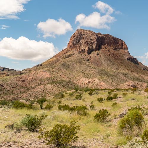
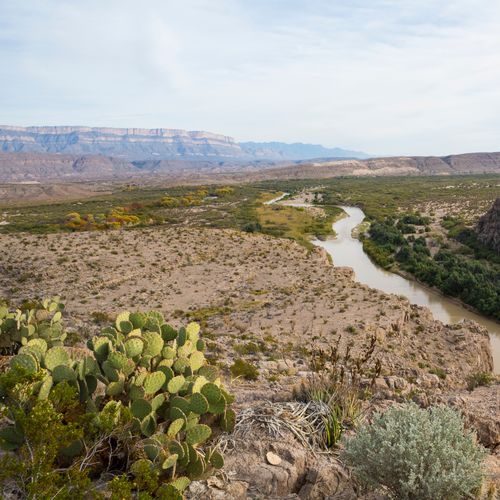
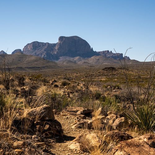
Big Bend is easiest to understand as five distinct park experiences: the central Chisos Mountains, the west side along Ross Maxwell Scenic Drive and Santa Elena Canyon, the east side around Rio Grande Village and Boquillas Canyon, the broad desert lowlands that stitch everything together, and the immense backcountry reached by dirt roads and primitive routes. The Chisos are the park’s high-country heart, a cooler, greener mountain island rising out of the Chihuahuan Desert. This is where many visitors go for classic hikes, dramatic views, and a more concentrated national-park feel. The west side is the park’s most cinematic drive, unfolding in a sequence of volcanic scenery, desert overlooks, and some of Big Bend’s signature stops before ending at Santa Elena Canyon, one of the most memorable places in Texas. The east side feels quieter and more open, anchored by the Rio Grande at Rio Grande Village and shaped by river scenery, hot springs history, and access to Boquillas Canyon. The desert lowlands are not just the space between the famous attractions; they are one of Big Bend’s defining regions. Here, the scale of the park truly registers: long horizons, ocotillo and cactus, lonely trailheads, and a silence that makes even a short stop feel immense. Visitors who rush past the desert on their way to the mountains or the canyons miss the point. Then there is the backcountry, where Big Bend becomes a wilderness park in the fullest sense. Rough roads, remote campsites, primitive trails, and vast uninterrupted views reward prepared travelers with solitude that is increasingly rare in the national park system. The smartest way to explore Big Bend is to treat it less like a checklist and more like a collection of separate landscapes linked by long drives. Pick one region for each half day or day, and give yourself time for the distances, the changing light, and the temptation to stop often. First-time visitors usually do best by pairing the Chisos with either the Ross Maxwell corridor or the Rio Grande Village side, then adding desert viewpoints and short walks along the way. With more time, the park opens up dramatically: the river, the mountains, the desert, and the backroads each reveal a different Big Bend, and seeing more than one region is what makes the park feel complete.

Persimmon Gap

Persimmon Gap

1 trails

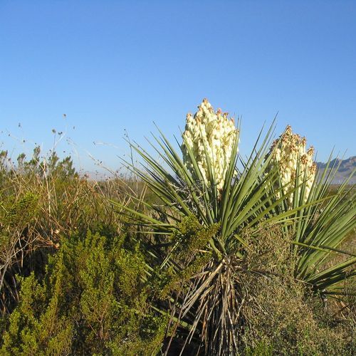
Persimmon Gap serves as the northern entrance to the park, providing a scenic introduction to the diverse landscape. It features a visitor center with interpretive exhibits, offering insights into the region's natural and cultural history. Unlike the more rugged terrains in the park, Persimmon Gap presents a gentle transition from desert plains to mountainous areas. Its accessibility and informative displays make it a compelling stop for understanding the park's ecological significance.

Chisos Mountains

14 trails1 campgrounds

The Chisos Mountains offer a distinct contrast to the surrounding desert landscape, providing cooler temperatures and diverse ecosystems. Visitors can explore a variety of hiking trails, ranging from moderate to challenging, with opportunities to observe unique wildlife like black bears and mountain lions. The area features panoramic views and is the only mountain range completely within a national park boundary.

Castolon

Castolon

5 trails1 campgrounds

Castolon is a historic district offering insight into early 20th-century life along the U.S.-Mexico border. It features preserved structures like the Alvino House and the former site of the La Harmonia Store. Unlike the more rugged and remote areas of the park, Castolon provides accessible cultural and historical context. The nearby Santa Elena Canyon offers scenic views, blending natural beauty with human history. Visitors often appreciate its educational exhibits and tranquil setting.

Rio Grande Village

Rio Grande Village

7 trails2 campgrounds

Rio Grande Village offers a unique experience with its proximity to the river, providing opportunities for birdwatching and wildlife observation. It serves as a popular camping spot, featuring a well-equipped campground. Unlike the rugged mountainous areas, the village provides accessible hiking trails along the riverbank. The nearby hot springs and the lush riparian environment along the Rio Grande contrast sharply with the arid expanses elsewhere, making it a distinct visitor attraction.

Panther Junction

Panther Junction

4 trails

Panther Junction serves as a key hub within Big Bend National Park, offering essential visitor services, including a visitor center and park headquarters. It provides a strategic starting point for exploring the diverse landscapes of the park. Unlike more remote areas, Panther Junction offers convenient access to information, maps, and park staff. Its central location makes it an ideal spot for planning hikes and excursions to other regions within the park.

Explore all areas with offline maps in the Parka app

Download Parka — It's Free

Explore Big Bend National Park areas with offline maps

Free on the App Store

Get Parka

Why Park Lovers Choose Parka

Trip Planner

All the tools for epic adventures

Works Offline

Fully functional without cell service

Updated Weekly

Trail conditions, alerts, and closures

Try Risk-Free

7-day free trial, cancel anytime

Start Your 7-Day Free Trial

Unlock everything you need for your next national park trip. Your first week is on us!

National Park vista

Start your adventure today

Download Parka and plan your perfect national park trip in minutes.