ParkaDownload
Big Bend National Park

Trails in Big Bend National Park

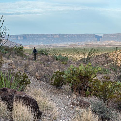
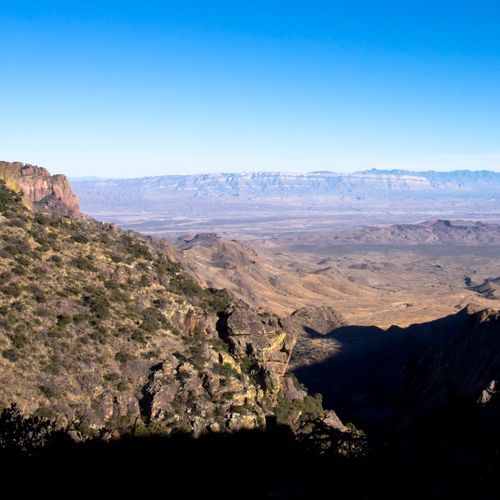
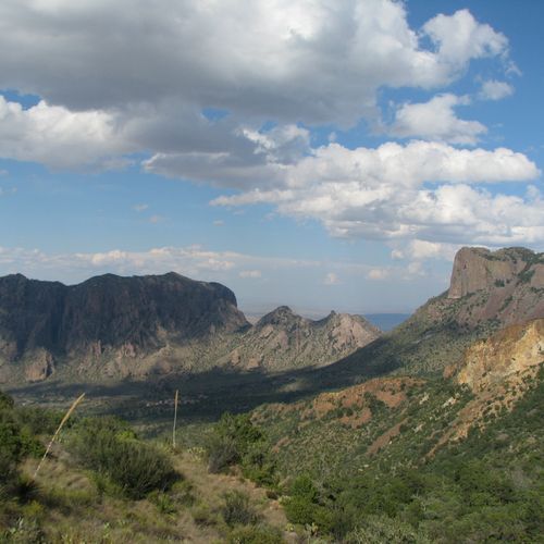
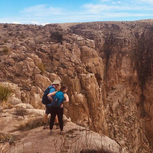
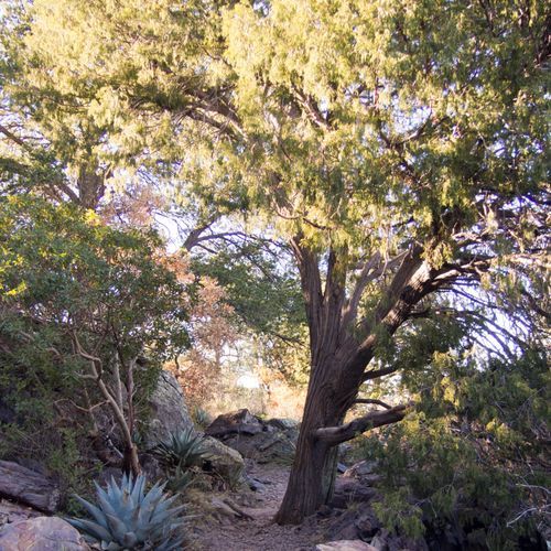
Big Bend National Park is one of the Southwest’s great hiking destinations, with trails that span nearly every style of desert adventure. The park’s lineup leans approachable, with plenty of easy walks and a solid mix of moderate routes, but it also delivers a handful of truly punishing outings for hikers who want steep climbs, exposure, and serious mileage. That range is part of the appeal: in one park, you can stroll a short interpretive path through the Chihuahuan Desert, climb into the cool heights of the Chisos Mountains, or set out toward river canyons where sheer walls and the Rio Grande reshape the landscape. Few parks offer such dramatic elevation change, and that constant shift in terrain makes every hike feel like a move into a different world. For classic day hikes, Lost Mine Trail is a perennial favorite, with mountain scenery, sweeping views, and a rewarding sense of altitude without requiring an all-day sufferfest. The Window Trail is another standout, drawing hikers into the heart of the Chisos before opening onto one of the park’s signature pour-offs and vistas. Over on the west side, the Santa Elena Canyon Trail is short but unforgettable, leading into one of Big Bend’s most photogenic river corridors beneath towering limestone walls. Hikers looking for a bigger challenge gravitate to Emory Peak, the park’s high point, while more remote routes in the desert and backcountry reward strong legs and careful planning with solitude that feels almost absolute. What makes hiking in Big Bend special is not just the scenery, but the scale and isolation of the experience. This is a park where trails cross desert basins, climb through oak and pine in a sky-island mountain range, and trace the edge of a life-giving river in a matter of hours. The light is sharper, the silence deeper, and the sense of remoteness more complete than in most national parks. Big Bend rewards hikers who come prepared and pay attention: the heat, dry air, and distances are real, but so is the payoff. For travelers who want hikes that feel expansive, elemental, and genuinely wild, Big Bend is in a class of its own.

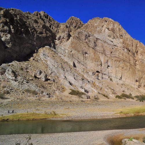
Boquillas Canyon Trail

Boquillas Canyon Trail

Easy1.4 mi

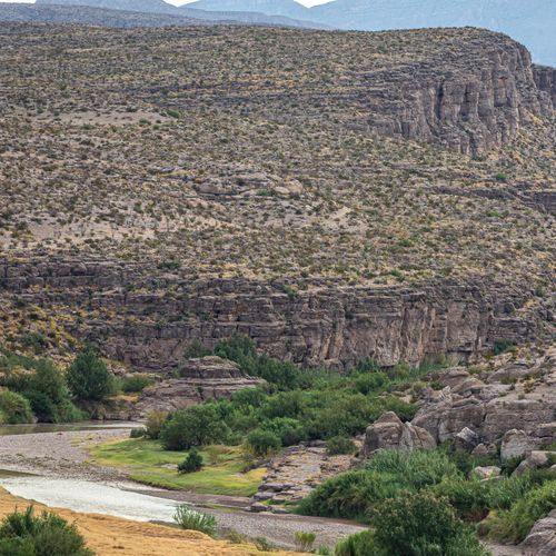
Follow a path that leads to the edge of a stunning canyon carved by the Rio Grande. Ancient mortar holes dot the landscape, remnants of past inhabitants. The trail offers breathtaking views of sheer cliffs and meandering riverfront, with opportunities to spot diverse bird species and desert wildlife. Visitors may catch a glimpse of locals from across the river, adding a unique cultural element to the natural beauty of the area.

Dog Canyon Trail (Devil's Den)

Dog Canyon Trail (Devil's Den)

Easy4.3 mi

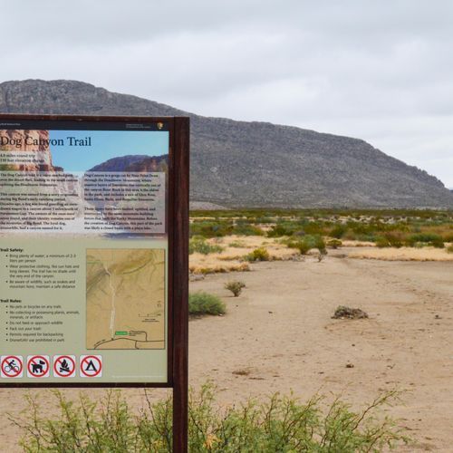
This trail leads to two contrasting ravines: Dog Canyon, a deep but wide gorge, and Devil's Den, a narrow limestone slot canyon. The hike traverses desert landscapes and offers views of unique geological formations. Vegetation varies, with greener areas in Devil's Den due to better water retention.

Hot Springs Historic Trail

Hot Springs Historic Trail

Moderate7 mi

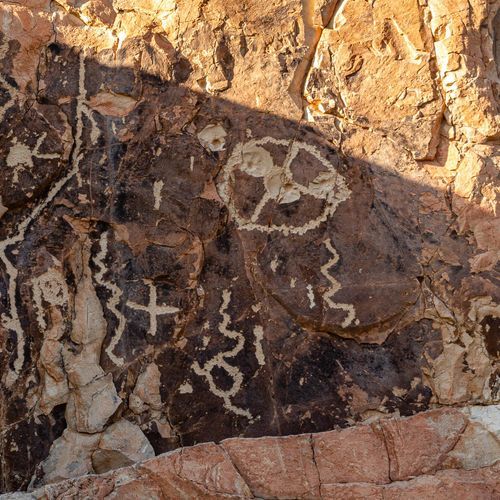
Step back in time to experience the remains of J.O. Langford's Hot Springs resort, including a picturesque store and post office. The trail leads to a natural hot spring within a historic bathhouse and offers views of ancient pictographs. The scenic route follows the Rio Grande, providing a unique blend of history and natural beauty.

Lost Mine Trail

Lost Mine Trail

Moderate4.6 mi

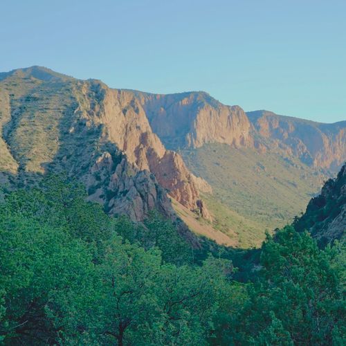
This hike ascends to a dramatic ridge offering breathtaking views of the Chisos Mountains, Juniper and Pine canyons, and distant vistas into the Chihuahuan desert. The trail features a mix of wooded areas and exposed sunlit sections, with switchbacks leading to the summit. It's a popular choice for its scenic payoff and moderate challenge.

Santa Elena Canyon Trail

Santa Elena Canyon Trail

Easy1.9 mi

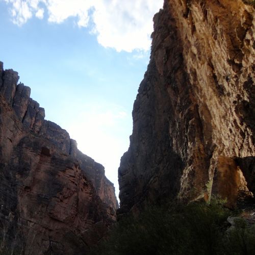
Towering cliffs rise 1500 feet above the Rio Grande, creating a dramatic canyon that separates the United States from Mexico. The trail descends into the canyon's shaded depths, offering stunning views and opportunities to observe wildlife. Hikers cross Terlingua Creek and ascend a series of steps before reaching the river's edge, where the canyon walls provide ample shade. The Rio Grande acts as a natural border, offering a unique perspective on the international boundary. Beyond the trail's end, kayakers and rafters can explore further into the canyon, enjoying spectacular scenery and diverse ecosystems.

South Rim Trail

South Rim Trail

Difficult12.3 mi

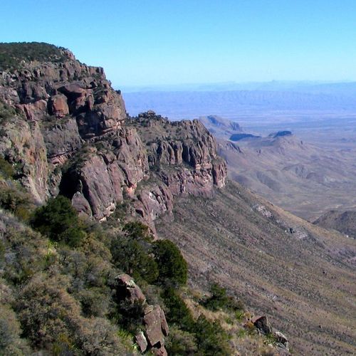
This trail offers stunning views of the inner canyon from the rim, providing a relatively easy and accessible hiking experience. The trail is suitable for families and those looking for a less strenuous hike while still enjoying the breathtaking vistas of the canyon.

Ward Spring Trail

Ward Spring Trail

Easy2.9 mi

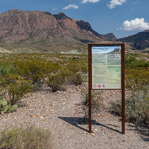
This trail offers spectacular views and a unique opportunity to explore a lush spring area surrounded by diverse plant life, including various cacti and wildflowers. The hike also features intriguing geological formations, such as volcanic dikes, adding to its natural appeal.

Window Trail

Window Trail

Moderate5.6 mi

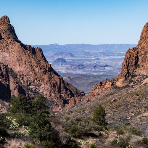
This trail descends through a canyon, offering stunning views of layered rock walls and diverse desert flora. The highlight is the natural window, a pour-off carved by water, providing a breathtaking view of the surrounding landscape. The trail is popular for its scenic beauty and wildlife, including bird species like the Mexican Blue Jay.

Balanced Rock Trail

Balanced Rock Trail

Easy1 mi

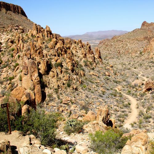
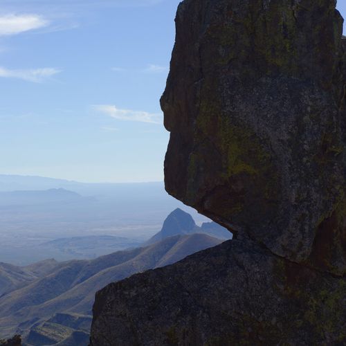
Navigate through a picturesque desert terrain, punctuated by unique rock formations and volcanic pinnacles. The trail culminates at a striking hoodoo, where a massive boulder appears delicately balanced on a slender pedestal. The hike offers stunning views of the surrounding landscape and opportunities to observe wildlife and unique desert flora. As the sun sets, the formation transforms into a vibrant red-orange hue, making it an ideal spot for photography and stargazing.

Boquillas Crossing

Boquillas Crossing

Easy0.1 mi

Experience a unique international crossing by rowboat or wading across the Rio Grande River. Once in Mexico, explore the charming village of Boquillas, known for its local handicrafts and authentic Mexican dining. The journey offers a blend of cultural immersion and scenic beauty, set against the backdrop of the Sierra del Carmen Mountains.

Burro Spring Trail

Burro Spring Trail

Easy1.2 mi

Wander through the Chihuahuan desert, surrounded by vibrant cactus flowers in the spring. The path follows natural water flows, passing intriguing geological formations and a variety of desert flora like ocotillos. The hike culminates at a water-carved stone reservoir and a spring, often marked by cottonwood and willow trees. The dramatic descent offers breathtaking views extending to distant landscapes, making it a perfect spot for a serene sunset.

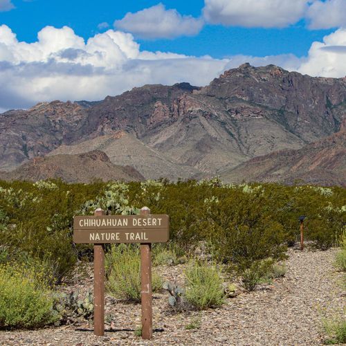
Chihuahuan Desert Nature Trail

Chihuahuan Desert Nature Trail

Easy0.5 mi

Winding through a typical Chihuahuan Desert landscape, this short loop showcases the region's unique flora. Small metal signs along the way highlight common desert plants, while the trail offers excellent bird-watching opportunities, especially in the morning. The desert environment, though seemingly barren, is teeming with life, including termite nests, animal scat, and reptile tunnels. In the spring, vibrant wildflowers like bluebonnets and ocotillo add color to the arid landscape.

Chimneys Trail

Chimneys Trail

Moderate5.6 mi

Venture through the desert to reach a group of towering volcanic rock formations, known as 'The Chimneys.' These formations serve as a prominent landmark for local Native American tribes, adorned with ancient pictographs. The trail offers a unique blend of cultural history and natural beauty, with the opportunity to spot wildlife such as roadrunners, jackrabbits, and lizards. The vast, open desert provides unobstructed views of the surrounding landscapes and a clear view of the night sky, making it a popular spot for stargazing. Despite the harsh desert environment, a variety of hardy plants thrive here, including creosote bushes, lechuguilla, and ocotillo.

Dorgan-Sublett Trail

Dorgan-Sublett Trail

Easy0.4 mi

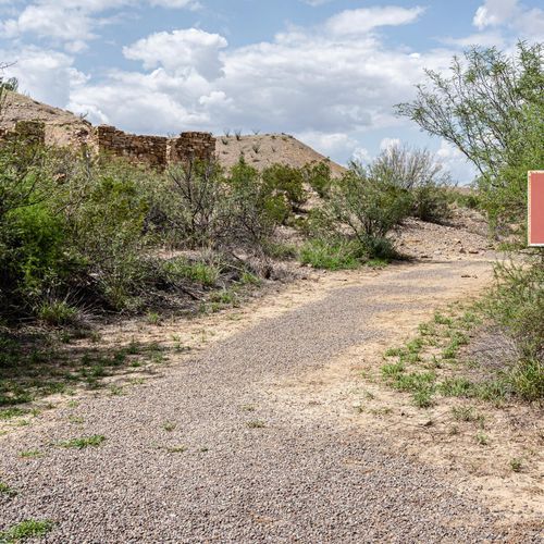
This trail explores the remnants of early farming endeavors, featuring the ruins of historic homes like the Sublett and Dorgan houses. It offers scenic views of the Chisos Mountains and Santa Elena Canyon, set against the backdrop of the Chihuahuan Desert.

East Rim Trail

Easy1.2 mi

Experience breathtaking vistas overlooking Juniper Canyon, Boot Canyon, and the rugged Sierra Quemada desert. The trail offers a secluded and panoramic experience, with spectacular views extending into Mexico. Although the campsites are nestled within the trees, a short walk reveals stunning vistas. The area is known for its solitude and dramatic landscapes, making it a gem for those willing to undertake the challenging hike to reach it.

Elephant Tusk Trail

Elephant Tusk Trail

Moderate2.9 mi

The trail traverses the desert floor, offering a rugged and remote hiking experience beneath the imposing Elephant Tusk monolith. It requires navigating through a challenging terrain of loose rocks and steep inclines, culminating in a dramatic ascent to a prominent notch. The landscape is characterized by sparse vegetation and vast desert vistas, providing a unique blend of solitude and natural beauty.

Juniper Canyon Trail

Juniper Canyon Trail

Extreme18 mi

Descend from mountain forests into a vast desert landscape, passing through lush vegetation and offering stunning views of the surrounding canyons and distant mountains. The trail traverses a variety of terrains, from steep mountain slopes to flat desert grasslands, providing a dramatic shift in scenery. Along the way, the landscape transitions from dense tree cover to open vistas, revealing the Sierra Del Carmen Mountains in the distance. The trail's remote nature ensures a peaceful, less crowded hiking experience.

Laguna Meadows Trail

Laguna Meadows Trail

Extreme10.7 mi

This trail offers stunning mountain vistas on the ascent before leveling out into a grassy meadow and forested area. It serves as a primary route to the South Rim Trail, providing access to one of the park's most breathtaking views.

Lower Burro Mesa Pouroff Trail

Lower Burro Mesa Pouroff Trail

Moderate2.3 mi

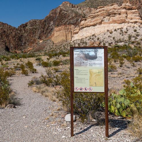
Descend into a scenic wash surrounded by vibrant volcanic hills and diverse desert vegetation, including Mexican Persimmon and Desert Hackberry trees. The trail leads to a stunning box canyon, where smooth, polished walls rise around a 100-foot dry waterfall. This natural wonder is a testament to the power of water in shaping the landscape. During rainy seasons, the pour-off transforms into a breathtaking waterfall, offering a unique experience in the heart of the desert.

Mariscal Rim Trail

Mariscal Rim Trail

Moderate3.2 mi

This challenging hike offers breathtaking views of the Chihuahuan Desert from the rim of Mariscal Canyon. The trail features a steep climb, culminating in a dramatic drop to the river below. Rare flora like the silverspine cholla can be spotted along the way, adding to the trail's unique charm. 4x4 vehicle with high clearance is recommended to access the trailhead.

Mule Ears Trail

Mule Ears Trail

Extreme11.9 mi

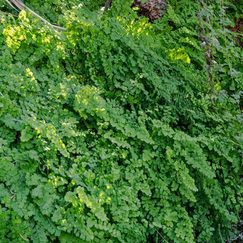
Rolling desert terrain gives way to historic ranch ruins and a tranquil spring, where cottonwoods and maidenhair ferns thrive. The trail descends into dry washes and climbs over low divides, offering views of unique volcanic formations, including the iconic twin peaks known as the Mule Ears. These formations are remnants of explosive eruptions, now standing as striking natural landmarks. Along the way, diverse desert plant life and wildlife, such as leopard frogs and dragonflies, add to the trail's allure.

Ore Terminal Trail

Extreme13.8 mi

This trail leads through a historic mining area, offering insights into the region's past ore extraction and transportation methods. The trail's surroundings highlight the natural beauty and rugged terrain of the desert landscape.

Pine Canyon Trail

Easy1.3 mi

The journey begins on a desert floor, gradually ascending through meadows and crossing stream-beds that can be dry or wet depending on recent rainfall. As the terrain shifts, it enters a forested area with dense trees, including cedars and oaks, offering vibrant colors during seasonal changes. The trail is surrounded by canyon walls and ends below a high pouroff, which flows after rains. The diverse landscape provides opportunities to spot wildlife, such as deer and black bears, adding to the trail's natural allure.

Pinnacles Trail

Pinnacles Trail

Extreme5.4 mi

This trail traverses through a unique volcanic landscape, offering stunning views of towering rock formations and diverse wildlife, including the iconic California condor. The area is rich in geological history and supports a wide range of flora and fauna.

Río Grande Village Nature Trail

Río Grande Village Nature Trail

Easy0.7 mi

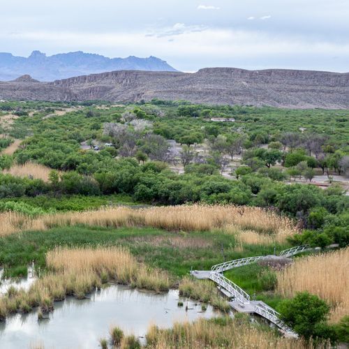
Begin with a boardwalk crossing a spring-fed wetland, rich in birdlife and aquatic activity. The path then ascends to a panoramic lookout offering stunning vistas of the Rio Grande, Chisos Mountains, and Sierra del Carmen. This scenic route is ideal for birdwatchers and photographers, especially during sunrise and sunset when the landscape is bathed in vibrant colors.

Sam Nail Ranch Trail

Sam Nail Ranch Trail

Easy0.3 mi

Wander through a desert oasis created by the remnants of an early homestead. The site features the remains of an adobe house and a working windmill that pumps water, supporting a variety of non-native trees like pecan and fig, alongside native plants. This haven attracts diverse birdlife, including painted buntings and mockingbirds. Visitors can sit in the shade of giant trees and imagine life as a pioneer in this arid landscape, where settlers once thrived despite challenges like drought and isolation.

Strawhouse Trail

Easy0.9 mi

This trail traverses through challenging terrain, featuring an arroyo lined with rocks, boulders, cacti, and thorn bushes. It offers scenic views of the surrounding landscape, including canyons and unique geological formations. The trail's diverse flora and fauna provide a rich experience for hikers.

Tuff Canyon Trail

Tuff Canyon Trail

Easy0.6 mi

Descend into a canyon with walls composed of volcanic ash welded into rock, showcasing a unique geological past. The trail offers views from multiple overlooks and a walk along the canyon floor, where the softer volcanic material contrasts with harder layers of solidified lava. The canyon's walls display erosion patterns, with the softer ash layers eroding more quickly than the harder rock, leaving behind holes and indentations. The hike provides insight into the region's volcanic history amidst the desert landscape.

Cattail Falls Trail

Easy1 mi

This trail leads to a secluded waterfall surrounded by pools and lush vegetation, including oak trees and unique flowering plants. The path traverses undulating desert hills before entering a dense woodland, offering a serene natural experience.

Panther Path

Easy0.1 mi

Amphitheater Trail

Moderate3.5 mi

This trail ascends through forests and open hillsides, offering breathtaking views of the surrounding mountains. It leads to two pristine alpine lakes, Surprise and Amphitheater, nestled beneath dramatic peaks. The scenic backdrop and challenging climb make it a popular destination for hikers.

Get offline trail maps and detailed hiking info in the Parka app

Download Parka — It's Free

Get offline trail maps for Big Bend National Park

Free on the App Store

Get Parka

Why Park Lovers Choose Parka

Trip Planner

All the tools for epic adventures

Works Offline

Fully functional without cell service

Updated Weekly

Trail conditions, alerts, and closures

Try Risk-Free

7-day free trial, cancel anytime

Start Your 7-Day Free Trial

Unlock everything you need for your next national park trip. Your first week is on us!

National Park vista

Start your adventure today

Download Parka and plan your perfect national park trip in minutes.