ParkaDownload
Black Canyon Of The Gunnison National Park

Trails in Black Canyon Of The Gunnison National Park

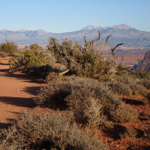
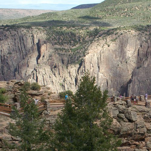
Hiking in Black Canyon of the Gunnison is all about contrast: short, accessible walks to astonishing overlooks on one hand, and more demanding rim routes and rugged canyon descents on the other. The park’s 16 trails lean friendly overall, with a strong showing of easy hikes complemented by a solid set of moderate options, so it works just as well for casual sightseers as it does for hikers who want to earn their views. Along both the South Rim and North Rim, many trails deliver dramatic payoffs quickly, revealing a canyon that feels darker, narrower, and more vertical than almost anywhere else in the national park system. Standout hikes include the South Rim’s Rim Rock Nature Trail and Oak Flat Loop Trail, both excellent introductions to the canyon’s scale, as well as the Chasm View Nature Trail for a short walk with outsized drama. On the North Rim, the North Vista Trail is a classic, leading to some of the park’s most exhilarating perspectives, including views toward the famous Painted Wall, while the Warner Point Nature Trail adds a slightly longer, more expansive ramble with a strong sense of isolation. What makes hiking here special is not mileage for mileage’s sake, but the intensity of the landscape: sheer walls, ancient rock, the river far below, and viewpoints that seem to drop straight into shadow. Even brief hikes feel bold here, and the park’s relatively uncrowded trails only heighten the sensation that you’re walking the edge of something immense and raw.

North Vista Trail

North Vista Trail

Moderate6.7 mi

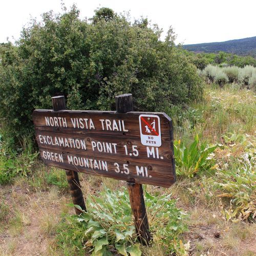
This trail traverses through Sagebrush-Gambel Oak-Pinyon Pine plateaus along the rim, offering stunning views of the canyon. Highlights include Exclamation Point, known for its breathtaking vistas, and Green Mountain, which provides elevated views of the surrounding landscape. The trail is well-maintained and less crowded compared to other areas of the park.

Warner Point Nature Trail

Moderate1.5 mi

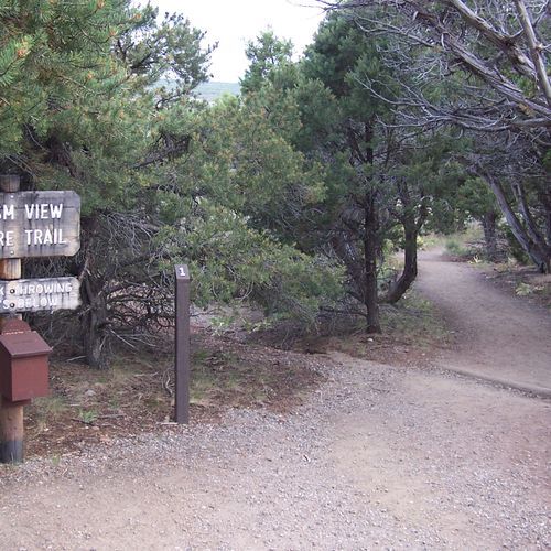
This trail winds through mountain mahogany, serviceberry, pinyon pine, and juniper, offering stunning views of the San Juan and West Elk Mountains. Interpretive signs provide insights into the ecosystem and history of the area, culminating in breathtaking vistas of the canyon and surrounding landscape.

Painted Wall View Trail

Painted Wall View Trail

Easy0.1 mi

This short walk leads to a breathtaking viewpoint of the Painted Wall, the tallest cliff in Colorado. The trail offers an easy, scenic path to an overlook where visitors can marvel at the sheer scale and geological beauty of this natural wonder.

Cedar Point Nature Trail

Easy0.2 mi

This short trail offers stunning views of the river and Painted Wall, the tallest cliff in Colorado. Guideposts along the way provide insights into local flora. The trail ends with two overlooks, offering panoramic views.

Chasm View Trail

Chasm View Trail

Easy0.5 mi

This loop trail offers stunning views of the Gunnison River and surrounding landscape. It features two main viewpoints, providing unique perspectives on the deep and narrow canyon. The trail is ideal for capturing photographs, especially during early morning light.

Dead Horse Loop Trail

Dead Horse Loop Trail

Easy1.4 mi

This trail offers breathtaking views of Shafer Canyon and the Colorado River. It traverses the mesa top, connecting several overlooks, including Meander, Shafer Canyon, Rim, and Basin Overlooks. The landscape features pinyon and juniper pines, cacti, and wildflowers, with stunning vistas of the surrounding red rock formations.

Dead Horse Trail

Easy2.2 mi

Winds through a juniper woodland, offering hikers a chance to experience the park's unique ecosystem. The trail provides panoramic views of the Gunnison River and the surrounding canyon. Along the way, keep an eye out for the park's diverse wildlife, including mule deer, golden eagles, and peregrine falcons. The trail ends at a historic corral, a remnant of the park's ranching past. A great choice for those seeking a peaceful hike with stunning views and a glimpse into the park's history.

Gunnison Route

Gunnison Route

Moderate0.5 mi

This trail offers a dramatic descent into the canyon, featuring steep slopes and scrambling sections. The route includes an 80-foot chain for rappelling down rocks and involves navigating loose rocks and gravel. At the bottom, hikers can enjoy the serene river environment, though views from the river are limited. The ascent is equally challenging, requiring careful footwork and handholds.

Long Draw

Moderate0.4 mi

This route plunges into a narrow, shaded ravine, offering breathtaking views of the canyon's vertical walls. The trail is characterized by a constant, steep gradient and requires careful navigation over loose rocks and boulders. The descent ends at the Gunnison River, where the canyon's unique geology is on full display.

Oak Flat Loop Trail

Easy1.2 mi

This loop trail offers breathtaking views of the canyon, with a narrow path that encourages hikers to gaze out at the scenery. The trail's moderate challenge is rewarded with stunning vistas, making it a worthwhile hike for those seeking to experience the natural beauty of the area.

Pinyon Draw

Moderate1.1 mi

This trail offers a challenging descent into the inner canyon, providing breathtaking views and access to the river. Hikers must navigate steep terrain and be prepared for self-rescue. The route is known for its scenic overlooks and is a popular choice for those seeking adventure and solitude.

Red Rock Canyon Route

Moderate1.9 mi

This trail offers a mix of desert landscapes and geological formations, typical of Red Rock Canyon's diverse terrain. Hikers can expect to see a variety of rock formations and possibly wildlife, depending on the season. The trail's moderate difficulty makes it accessible to a wide range of hikers.

Rim Rock Nature Trail

Easy0.8 mi

This trail offers stunning views of the canyon below, with numerous spots to safely approach the edge. It passes through a forested area, providing opportunities to see wildlife such as deer and elk. The trail is well-suited for families and those looking for a moderate hike with spectacular vistas.

Uplands Trail

Uplands Trail

Easy0.9 mi

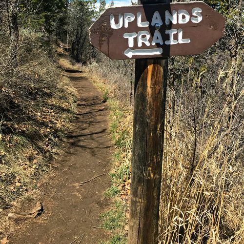
This trail offers a gentle journey through diverse natural settings, providing opportunities to observe local flora and fauna. The terrain is generally easy to navigate, making it suitable for casual hikers.

Warner Route

Moderate1.5 mi

This trail involves a steep descent into a canyon with significant elevation change, requiring careful navigation and preparation. The route is not marked, and hikers must be prepared for self-rescue. Features include dramatic views of the canyon walls and access to the river below, though water purification is necessary due to Giardia presence.

Pulpit Rock Overlook 184 Yards

Easy0.2 mi

Enjoy panoramic views from this overlook, offering a glimpse into the surrounding landscape. The short distance makes it accessible for a quick visit, though it might be part of a larger trail system.

Get offline trail maps and detailed hiking info in the Parka app

Download Parka — It's Free

Get offline trail maps for Black Canyon Of The Gunnison National Park

Free on the App Store

Get Parka

Why Park Lovers Choose Parka

Trip Planner

All the tools for epic adventures

Works Offline

Fully functional without cell service

Updated Weekly

Trail conditions, alerts, and closures

Try Risk-Free

7-day free trial, cancel anytime

Start Your 7-Day Free Trial

Unlock everything you need for your next national park trip. Your first week is on us!

National Park vista

Start your adventure today

Download Parka and plan your perfect national park trip in minutes.