ParkaDownload
Capitol Reef National Park

Trails in Capitol Reef National Park

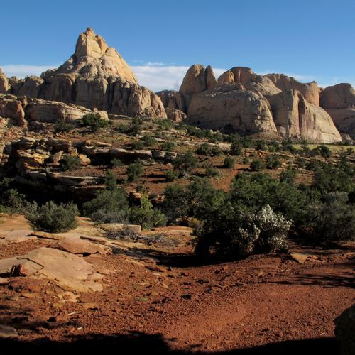
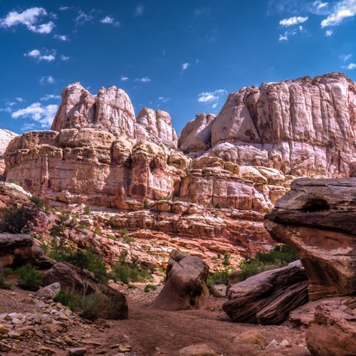
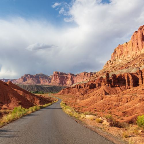
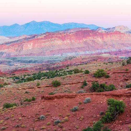
Capitol Reef is one of Utah’s most rewarding hiking parks, with a trail lineup that skews wonderfully accessible without ever feeling tame. Most of the park’s routes are easy to moderate, which makes it a superb place for casual walkers, families, and travelers who want big scenery without committing to an all-day sufferfest. Short classics like Hickman Bridge deliver exactly what Capitol Reef does best: a manageable hike through sculpted red rock country to a dramatic natural landmark. Grand Wash is another standout, an easy canyon walk that immerses you in towering stone walls and the quiet, open grandeur that defines the park. Even on simpler trails, the sense of space, color, and geology is extraordinary. For hikers looking to push a little harder, Capitol Reef has just enough bite to keep things interesting. Cassidy Arch is one of the park’s signature adventures, combining slickrock scenery, a touch of exposure, and the thrill of standing on a real sandstone arch. Cohab Canyon, Chimney Rock, and other moderate routes add overlooks, cliffs, and wide-angle views across Fruita and the Waterpocket Fold. More strenuous options like Golden Throne bring bigger climbs and bigger rewards, while the park’s toughest routes appeal to experienced hikers who want a more rugged desert outing. What makes hiking here special is the combination of variety and solitude: arches, narrow canyons, monoliths, domes, and sweeping overlooks, often with far fewer crowds than you’ll find in Utah’s better-known parks. The one thing Capitol Reef never lets you forget is that this is true desert hiking. Many trails offer little shade, trailheads rarely have water, and the park’s elevation and heat can make even shorter outings feel tougher than they look on paper. Start early, carry more water than you think you need, and treat every hike with respect. Do that, and Capitol Reef rewards you with some of the most quietly spectacular walking in the Southwest—an experience defined less by crowds and checkpoints than by silence, stone, and the feeling that you’ve found a park still willing to surprise you.

Capitol Gorge

Capitol Gorge

Moderate4.7 mi

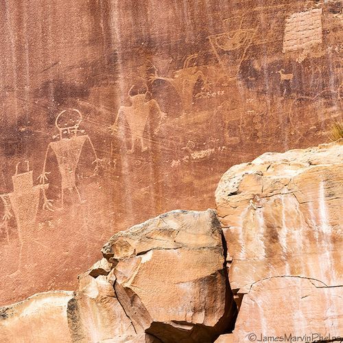
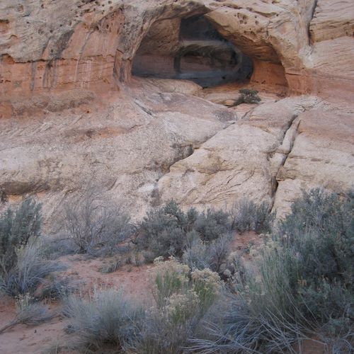
Follow the historic route through a deep, narrow canyon, passing by ancient petroglyphs and a pioneer register etched into the walls. The trail leads to natural water tanks, large potholes carved by centuries of water flow, and offers a glimpse into the region's rich cultural and geological history. Towering canyon walls provide shade and shelter, making the hike accessible year-round. A short side trail ascends to the tanks, offering a closer look at these natural wonders.

Cohab Canyon Trail

Cohab Canyon Trail

Moderate3.3 mi

This trail ascends steeply into a secluded canyon, offering panoramic views of orchards and the surrounding landscape. The path follows a wash and features unique rock formations, including a natural arch. It connects to other trails like the Frying Pan Trail, providing options for extended exploration.

Grand Wash Trail

Grand Wash Trail

Easy4.8 mi

Cutting through the upper portion of the Waterpocket Fold, this gorge offers stunning views of towering canyon walls. The trail follows a wash, providing a flat and easy path through a landscape carved by ancient water flows. A highlight is the short but spectacular narrows section, reminiscent of a miniature Zion Narrows. The surrounding rock formations are honeycombed with holes, offering numerous spots for exploration and photography. The trail connects two main roads, allowing for either a round trip or a shuttle hike, making it accessible for various hiking preferences.

Hickman Bridge Trail

Hickman Bridge Trail

Moderate1.7 mi

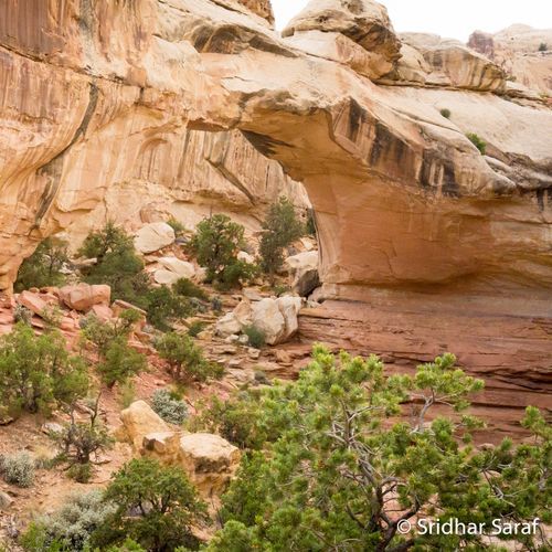
This trail offers a scenic hike to a large natural bridge, with views of the Fremont River and surrounding landscape. Along the way, hikers can explore a smaller arch and historical sites like a Fremont pit house ruin and granary. The trail is well-maintained and suitable for most hikers.

Lower Cathedral Valley Overlook Route

Lower Cathedral Valley Overlook Route

Easy1.7 mi

The route leads through open desert terrain to a viewpoint offering a bird's-eye perspective of the iconic Temples of the Sun and Moon. These towering sandstone formations rise dramatically from the valley floor, creating a breathtaking landscape. The overlook provides a unique vantage point to appreciate the natural beauty and grandeur of these monolithic structures, set against the backdrop of a vast desert expanse.

Rim Overlook Trail

Rim Overlook Trail

Moderate4.3 mi

This trail offers stunning vistas over the park's unique geological features, including the Waterpocket Fold and Castle Rock. The hike involves a steady ascent with little shade, culminating in breathtaking 360-degree views from the top of Navajo Knobs.

Sulphur Creek Top-Down Route

Moderate5.9 mi

Winding through a deep canyon carved by a perennial stream, the route features two miles of scenic narrows and three small waterfalls. The hike involves creek crossings and wading, with water depths varying from shallow to knee-deep, depending on conditions. The canyon walls rise dramatically, offering stunning views of layered sandstone formations. The unique narrows section, reminiscent of slot canyons, provides a memorable experience with its overhanging channels and deep pools.

Sulphur Creek Waterfall Trail

Easy1.5 mi

This hike offers a unique blend of canyoneering, wading, and rock scrambling through a stunning gorge with sheer walls and several waterfalls. The trail follows a perennial creek, providing opportunities to explore ancient rock formations and enjoy the natural beauty of the area.

Cassidy Arch Trail

Cassidy Arch Trail

Easy1.5 mi

This trail ascends steeply through a scenic canyon, leading to a stunning natural arch. The hike offers breathtaking views of the surrounding landscape and is a highlight for photography enthusiasts. The trail includes a mix of canyon walking and slick rock navigation, with sheer drop-offs adding to the adventure.

Burro Wash Trail

Moderate3.1 mi

Deep within the Waterpocket Fold, a series of narrow canyons cut through the sandstone, creating dark, eerie passages and frequent pools. The route includes obstacles like chokestones and dryfalls, requiring occasional wading or climbing. The surrounding landscape shifts from jumbled red strata to smooth, whitish Navajo sandstone, offering stunning views of massive domes and strata. The canyon's floor often features colorful pebbles and boulders, with occasional open areas offering respite from the narrows.

Cathedrals Trail

Cathedrals Trail

Easy1.2 mi

This trail follows a low ridgeline parallel to a series of striking Entrada sandstone monoliths, offering panoramic views of the surrounding landscape. It ascends through juniper and basalt boulders, providing a unique perspective on the Cathedrals, including Needle Mountain and Cathedral Mountain.

Chimney Rock Canyon Trail

Chimney Rock Canyon Trail

Extreme18.5 mi

This trail ascends steeply to the top of a low mesa, offering stunning views of colorful badlands, tall cliffs, and the Waterpocket Fold. It passes close to Chimney Rock, a solitary Moenkopi sandstone pillar, before looping back down through a diverse landscape of red rock formations.

Chimney Rock Loop Trail

Moderate3.1 mi

Hike to the top of a low mesa, offering stunning views of the surrounding landscape. The trail circles Mummy Cliff, providing a unique perspective on the geological formations of the area. The natural spire of Chimney Rock stands out against the backdrop of the Waterpocket Fold.

Cottonwood Tanks Trail

Easy0.4 mi

Follow an old wagon road down Halls Creek to visit a historic watering hole used by early pioneers. The area features large pools that once served as a vital rest stop for settlers and cowboys. The trail offers a glimpse into the region's past, with faint graffiti on the cliffs and a serene riparian environment. It provides a family-friendly experience, allowing visitors to connect with the natural and historical aspects of the area.

Cottonwood Wash Trail

Moderate3.2 mi

Carved through towering white Navajo sandstone, this canyon features narrow passages interrupted by chokestones, dryfalls, and pools. The route requires navigating boulder jams, tight squeezes, and potentially deep water pools, especially after rainfall. The canyon's scenic narrows are punctuated by dramatic rock formations and offer a challenging yet rewarding experience for hikers. Beyond the obstacles, the canyon opens into a maze of twisting passages, culminating in an impassable dryfall that marks the turnaround point for most adventurers.

Fremont Gorge Overlook Trail

Moderate2 mi

This trail leads to a scenic overlook with stunning views of Fremont Gorge, offering a moderate hike through varied terrain. The trail's surface is primarily ground, providing a natural hiking experience.

Fremont River Trail

Fremont River Trail

Easy1.3 mi

Follow the river upstream through lush orchards filled with apricot, cherry, and peach trees, where visitors can pick fresh fruit during harvest seasons. The path transitions from a flat, riparian environment to a steeper climb offering panoramic views of the surrounding landscape, including red sandstone cliffs and the Waterpocket Fold. The trail ends at an overlook, providing a stunning vista of the valley below, contrasting green orchards with red rock formations.

Frying Pan Trail

Moderate3 mi

This trail offers a unique traverse across the Waterpocket Fold, providing spectacular views of Navajo sandstone domes and distant ranges like the Henry Mountains. It connects Grand Wash with Cohab Canyon, featuring diverse landscapes and rock formations. The trail includes opportunities to explore side canyons and notable landmarks like Cassidy Arch.

Halls Creek Overlook Trail

Halls Creek Overlook Trail

Moderate2.2 mi

Descend into a dramatic canyon carved through Navajo sandstone, where towering cliffs rise over 1,200 feet above. The hike follows a perennial stream, requiring wading and occasional swimming through water-filled narrows. The route is largely unmarked, winding through a shaded oasis that contrasts with the arid desert surroundings. Early spring and late fall offer solitude and stunning vistas, while summer brings extreme heat. Numerous side canyons provide additional exploration opportunities.

Headquaraters Canyon Route

Easy1.3 mi

Winding through the Waterpocket Fold, this route features sheer, vertical walls of Navajo sandstone streaked with color. The path follows a sandy wash, leading to short, narrow slot canyons that provide a scenic and intimate experience. The canyons are generally gloomy due to limited sunlight, adding to their mystique. Beyond the slots, the canyon opens into a box-like formation with trees and boulders, ending at a steep dryfall. The area is characterized by its remote, rugged beauty and offers a unique glimpse into the geological history of the region.

Jailhouse Rock and Temple Rock Route

Easy2.4 mi

The route passes by two striking sandstone formations, Jailhouse Rock and Temple Rock, set against the backdrop of a vast desert valley. These monoliths, composed of Entrada Sandstone, are remnants of a Jurassic sand sea. The trail offers a family-friendly hike through a rugged yet scenic landscape, with views of these natural wonders. Access is via a rugged, unmaintained road, requiring a vehicle with high clearance and 4WD. The hike is best enjoyed during spring and late fall when weather conditions are favorable.

Lower Muley Twist - Burr Trail to Post Trail

Moderate4 mi

Wind through a canyon known for its deep undercuts and high walls, carved from red Wingate sandstone and white Navajo sandstone. The route passes by the historic Cowboy Camp, filled with relics from over a century ago. Seasonal water pools and unique rock formations add to the scenic beauty. The canyon's twists and turns offer breathtaking views, especially in the spring and fall seasons when the desert landscape is most vibrant.

Lower Plesant Creek Trail

Easy0.4 mi

Follow routes along a perennial stream that has carved a deep, scenic canyon. The area is rich in rock art panels, including pictographs and petroglyphs from the Archaic Period, and features narrows in side canyons. As the canyon winds through the landscape, it reveals interesting geological formations and offers opportunities to explore both up and downstream, with numerous stream crossings required for longer hikes.

Old Wagon Trail Loop

Easy2.8 mi

Follow an old wagon route used by early settlers, climbing through a pinyon-juniper forest on Miners Mountain. The trail offers panoramic views of the Waterpocket Fold and the Henry Mountains. Ancient rock formations, including the Moenkopi and Kaibab limestone, are visible along the route. A scenic viewpoint provides expansive vistas of the surrounding landscape, including Meeks Mesa and Thousand Lake Mountain.

Red Canyon Route

Red Canyon Route

Easy2.8 mi

The trail begins at Cedar Mesa Campground, winding southwest across a sagebrush flat before climbing a low ridge that offers views of the Henry Mountains. Descending into a sandy wash, it follows the creekbed into an amphitheater enclosed by high, red Wingate sandstone walls. The hike features multiple sedimentary rock layers and ends at a fork in the drainage, where boulders obstruct further progress. A notable detour leads to a double arch, adding to the geological and scenic appeal of this unique landscape.

Sheets Gulch Trail

Moderate9.8 mi

Navigate through a series of slot sections, each offering unique challenges and breathtaking views. The terrain shifts from sandy washes to narrow, red-tinted slickrock passages, punctuated by obstacles like chockstones and boulder jams. A stunning arch and diverse plant life, including Russian thistle and Douglas firs, add to the trail's allure. The canyon's walls display intricate crossbedding and honeycomb weathering, making it a photographer's delight. As the canyon opens up, towering sandstone domes come into view, marking the transition to less confined landscapes.

Sunset Point Trail

Sunset Point Trail

Easy0.5 mi

This trail offers scenic views from a rocky outcropping, potentially similar to those found in Zion National Park. The trail features a short hike with some elevation change, providing a glimpse into the natural beauty of the area.

Surprise Canyon Trail

Easy1 mi

This hike offers a leisurely journey into a scenic canyon, featuring pleasant narrows that cut into the Waterpocket Fold. The trail is generally dry and suitable for families, with a short, easy route that ends at a dryfall, offering a fun challenge for more adventurous hikers.

Tanks Trail

Easy0.2 mi

This trail offers a scenic walk through a natural landscape featuring unique rock formations and water tanks. The trail's short length and easy difficulty make it accessible for a variety of visitors. However, specific details about this trail in the national park context are limited.

The Post Cut-Off Trail

Difficult10.8 mi

Navigate through a dramatic landscape marked by the Waterpocket Fold, a geological feature that stretches across the terrain. The route involves climbing over red rock formations and traversing white Navajo sandstone slickrock, providing stunning vistas from the top. The trail is marked with cairns and signs but requires careful navigation, especially when crossing Halls Creek. It offers a unique blend of rugged terrain, scenic overlooks, and the opportunity to explore the natural beauty of this remote area.

Upper Cathedral Valley Overlook Trail

Easy0.1 mi

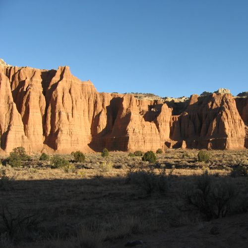
A short, rolling path leads to a stunning viewpoint overlooking a valley dominated by a line of monolithic rock formations known as the Cathedrals. The panorama highlights these towering structures, offering a breathtaking perspective on the natural beauty of this remote area. The trail is easily accessible and provides a quick glimpse into the dramatic landscapes characteristic of this region.

Upper Muley Twist Canyon Trail

Upper Muley Twist Canyon Trail

Moderate8 mi

Cutting lengthwise along the spine of the Waterpocket Fold, this colorful canyon exposes layers of Navajo and Wingate sandstone, sculpted by millions of years of erosion. The Wingate sandstone, stripped of its protective cap, has eroded into unique forms, including numerous large arches. The trail offers breathtaking views of the surrounding landscape, featuring narrow canyons, expanses of slickrock, and dramatic vistas. Natural arches, such as Saddle Arch, are scattered throughout the canyon walls, adding to the trail's allure.

Upper South Desert Overlook Trail

Easy0.2 mi

This short hike offers stunning vistas of the Upper South Desert, with views of Entrada sandstone formations and distant landscapes like the Henry Mountains. The trail is kid-friendly and provides a quick ascent to a viewpoint with a 360-degree panorama.

Hamburger Rocks Trail

Easy0.1 mi

Morrell Cabin Trail

Easy0.2 mi

Bypass

Easy0.7 mi

Fruita Overlook Trail

Easy0.2 mi

Grand Gulch Trail

Extreme22 mi

Hike through a vast, archeologically rich canyon featuring numerous Anasazi ruins and pictographs. The trail offers stunning natural scenery and diverse hiking options, from day trips to multi-day backpacking adventures.

Muley Tanks Trail

Easy0.1 mi

Get offline trail maps and detailed hiking info in the Parka app

Download Parka — It's Free

Get offline trail maps for Capitol Reef National Park

Free on the App Store

Get Parka

Why Park Lovers Choose Parka

Trip Planner

All the tools for epic adventures

Works Offline

Fully functional without cell service

Updated Weekly

Trail conditions, alerts, and closures

Try Risk-Free

7-day free trial, cancel anytime

Start Your 7-Day Free Trial

Unlock everything you need for your next national park trip. Your first week is on us!

National Park vista

Start your adventure today

Download Parka and plan your perfect national park trip in minutes.