ParkaDownload
Death Valley National Park

Trails in Death Valley National Park

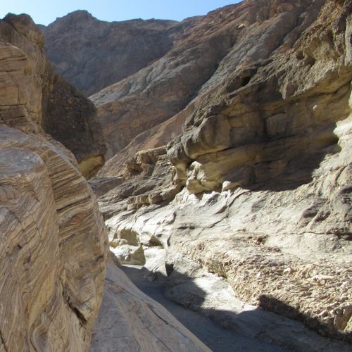
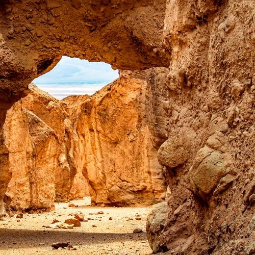
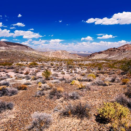
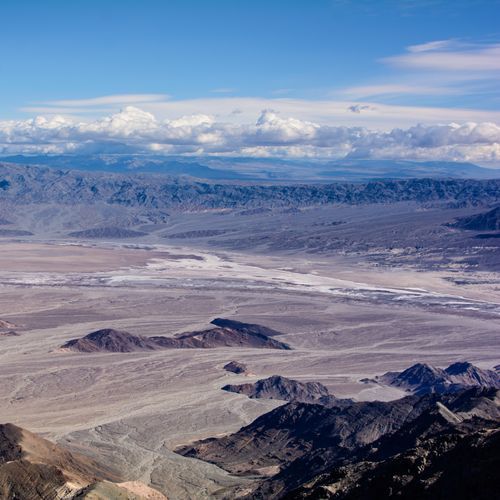
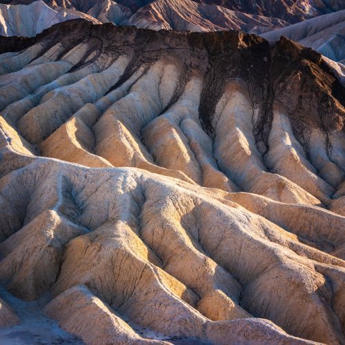
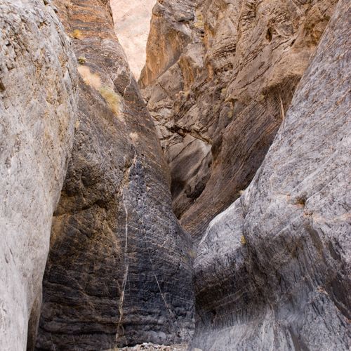
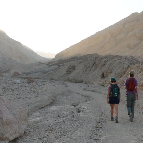
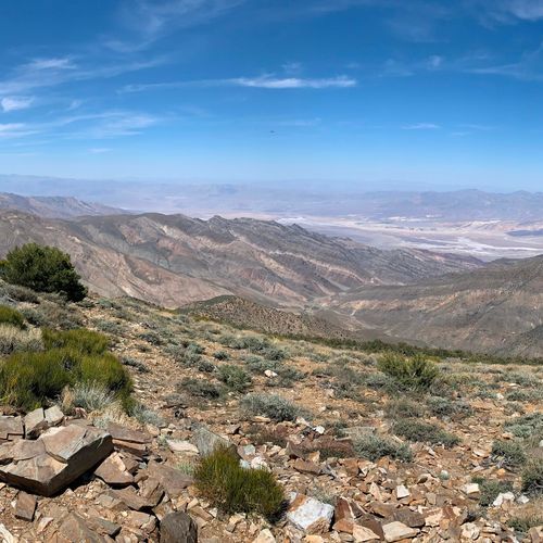
Death Valley’s hiking scene is unlike that of almost any other national park: this is a place where formal trails are only part of the story, and the landscape itself often feels like the route. With 34 hikes spanning easy walks to difficult backcountry outings, plus one truly extreme route, the park offers a wide range of experiences. Beginners can step straight into the drama at Badwater Basin, Mesquite Flat Sand Dunes, Natural Bridge, or the short walk through Harmony Borax Works, where the terrain is approachable but the scenery is anything but ordinary. Moderate hikers have some of the park’s best outings, including Mosaic Canyon’s polished narrows, the lush surprise of Darwin Falls, the colorful volcanic terrain around Ubehebe Crater, and the ever-popular Golden Canyon area, where sculpted badlands and glowing rock make even a half-day hike feel cinematic. What makes Death Valley special is that hiking here is as much about texture, scale, and atmosphere as it is about mileage. You move through marble-like canyon walls, salt flats that seem to stretch forever, dune fields that shift with the wind, and raw desert basins framed by mountain walls. More ambitious hikers can venture into trail-less canyons and rugged ridgelines where the park’s isolation becomes part of the appeal, but even short walks deliver a sense of immensity that few places can match. This is a landscape that rewards curiosity and respect: the beauty is stark, the terrain often unmarked, and the conditions demand smart planning. Hike here in the cooler season, carry more water than you think you’ll need, and Death Valley reveals itself as one of the most distinctive and unforgettable hiking destinations in the American West.

Darwin Falls Trail

Darwin Falls Trail

Moderate6.7 mi

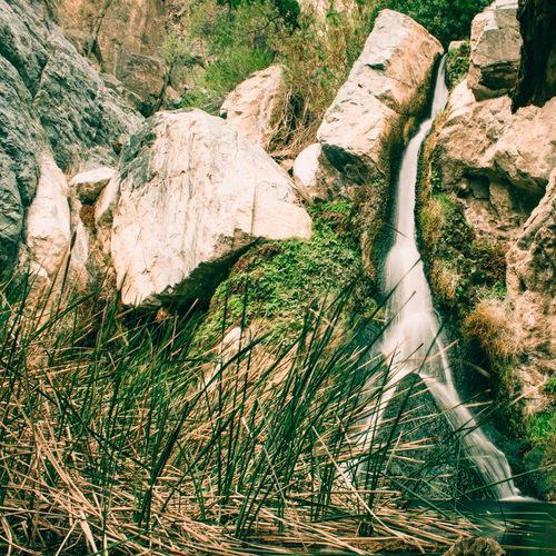
This trail leads to a unique oasis, featuring a year-round waterfall surrounded by lush vegetation, including trees and ferns. The hike traverses a narrow canyon, providing a stark contrast to the arid desert environment. The trail is relatively short and accessible, making it a must-visit for those exploring the western edge of the park.
Fall Canyon Trail

Fall Canyon Trail

Moderate6.1 mi

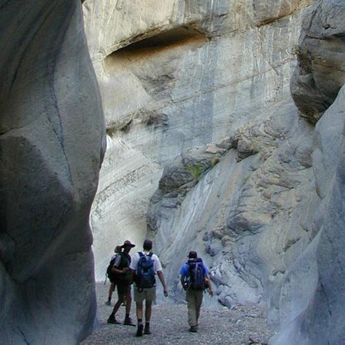
Hike through a stunning gorge carved into the Grapevine Mountains, featuring vibrant rock formations and narrows. The trail offers breathtaking views of the surrounding landscape, including towering walls and unique geological patterns. It ends at a picturesque dryfall, making it a memorable experience for hikers.

Golden Canyon Trail

Golden Canyon Trail

Moderate3 mi

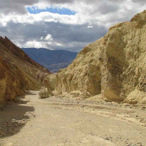
Navigate through a labyrinth of golden hills, badlands, and narrow canyons. The trail offers stunning vistas and unique rock formations, including the Red Cathedral. Hikers can experience a variety of landscapes typical of Death Valley, making it a must-do adventure.

Mosaic Canyon Trail

Mosaic Canyon Trail

Moderate3.5 mi

This trail offers a unique experience through a slot canyon, featuring beautiful mosaic breccia formations and polished marble walls. The hike involves rock hopping and scrambling, making it a great adventure for those interested in geology and challenging terrain. Located near Stovepipe Wells, it provides a family-friendly option compared to other more advanced trails in the area.

Natural Bridge Trail

Natural Bridge Trail

Moderate1.4 mi

This short hike leads to a unique natural bridge, crafted by the erosive power of flash floods over thousands of years. The trail offers a glimpse into Death Valley's fascinating geological history, with opportunities to explore beyond the bridge into the canyon's rugged landscape.

Telescope Peak Trail

Telescope Peak Trail

Difficult12.3 mi

This trail ascends through alpine meadows and ancient bristlecone pine forests to the summit, offering breathtaking views of the lowest and highest points in North America. The hike includes a dramatic ridge walk before the final ascent to the peak.

Surprise Canyon hiking route

Difficult10.6 mi

This short hike offers a leisurely experience through a narrow canyon, featuring scenic views of the surrounding landscape. It's an ideal route for families or those seeking a brief, easy adventure. The canyon remains generally dry but may have puddles after storms.

Aguereberry Point

Aguereberry Point

Easy0.1 mi

Experience breathtaking 360-degree views of Death Valley from Aguereberry Point, a scenic overlook perched on the Panamint Range. The journey involves a rugged, unpaved road that passes through historic mining sites, including the remains of Harrisburg and the Eureka Mine. This viewpoint offers spectacular vistas, especially during sunset.

Badlands Loop

Badlands Loop

Moderate2.3 mi

Wander through a maze of colorful badlands, carved from an ancient lakebed. The trail winds through narrow drainages, offering stunning views of the unique geological formations. It's a popular spot for observing the park's diverse landscapes.

Corkscrew Peak Trail

Difficult3.6 mi

This trail features a unique spiraling ascent through a narrow canyon, culminating in breathtaking views of the surrounding landscape. The hike includes a challenging climb with loose gravel and a natural window near the summit, providing a dramatic backdrop for hikers.

Cottonwood Marble Canyon Trail

Cottonwood Marble Canyon Trail

Extreme14.9 mi

This loop traverses two distinct canyons, offering a mix of dirt roads, trails, and cross-country hiking. It features reliable water at upper Cottonwood Springs and seasonal water sources. The trail is known for its scenic beauty, including Marble Canyon's narrows and petroglyphs, as well as encounters with wild horses. The route requires good navigation skills and is best hiked during the cooler seasons.

Desolation Canyon Trail

Desolation Canyon Trail

Moderate2 mi

Hike through a colorful canyon with wineglass-shaped walls, offering opportunities to explore short side canyons. The trail features interesting geological formations similar to those found along Artist’s Drive. The hike culminates in an expansive view over the surrounding landscape.

Gower Gulch Trail

Gower Gulch Trail

Easy2 mi

Hike through narrow canyons and explore the vibrant badlands, featuring golden mudstone hills and a scenic wash. The trail offers panoramic views from Manly Beacon and passes through historic mining areas.

Harmony Borax Works Trail

Harmony Borax Works Trail

Easy0.4 mi

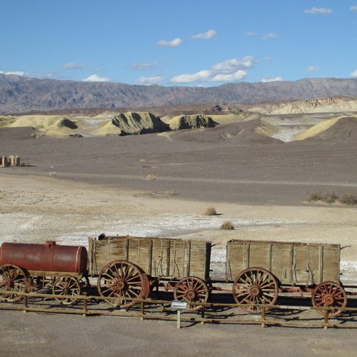
Walk through the remnants of a historic borax mining operation, featuring interpretive signs detailing its significance in the late 1800s. The site showcases a preserved twenty-mule team wagon, symbolizing the innovative transportation methods used during that era. Located near Furnace Creek, it offers a glimpse into the region's industrial past.

Keane Wonder Mine Trail

Keane Wonder Mine Trail

Moderate1.2 mi

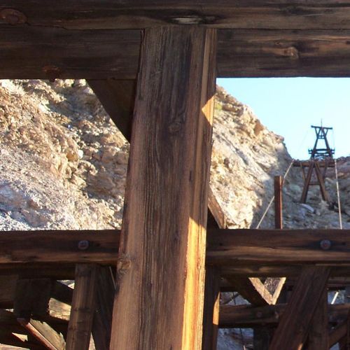
Follow in the footsteps of Death Valley's mining history by visiting the Keane Wonder Mine, a site renowned for its innovative aerial tramway. This trail offers breathtaking views of the desert landscape and a glimpse into the region's rich mining past. The remains of the mine and its machinery are a testament to the ingenuity of early miners, who overcame harsh conditions to extract gold from this unforgiving terrain.

Sidewinder Canyon

Difficult2.9 mi

This demanding hike involves navigating through tight spaces and climbing over vertical ledges, offering solitude and adventure. The trail features three slot canyons, each with unique challenges and breathtaking scenery. The canyons require scrambling and crawling, with some sections so narrow that backpacks must be removed. The scenic views and sense of accomplishment make this trail a hidden gem for experienced hikers.

Upper Marble Canyon Trail

Difficult6.1 mi

This trail winds through a stunning network of canyons, featuring vibrant rock formations, numerous side canyons, and a rich collection of petroglyphs. The varied landscape includes narrows, springs, and historical inscriptions, making it a compelling destination for those interested in both natural beauty and cultural heritage.

Wildrose Trail

Wildrose Trail

Difficult3.9 mi

Hike through juniper and pinyon pine forests to reach the summit, offering breathtaking views of Death Valley, the Sierra Nevada, and surrounding peaks like Telescope Peak. The trailhead begins at the historic Wildrose Charcoal Kilns, a unique piece of mining history.

Willow Canyon

Moderate2.1 mi

This trail leads to one of Death Valley's rare year-round waterfalls, offering a unique contrast between lush vegetation and arid desert surroundings. The hike involves traversing a wide alluvial fan before entering a narrow canyon where the water cascades over rocks, creating a serene oasis in the desert.

X-country route to Rogers Peak

Easy0.3 mi

This short trail offers a brief glimpse into the high desert landscape but lacks the dramatic views and extensive natural features found on longer trails in the area. It is suitable for those seeking a quick, easy hike.

Chloride Cliff Trail

Moderate0.8 mi

This rugged route leads to the remnants of Chloride City, an early mining town, offering breathtaking views of Death Valley's vast expanse. The journey involves navigating steep, rocky terrain and exploring abandoned mines and structures. The area is known for its historical significance and natural beauty, with views extending to the Panamint and Amargosa ranges.

Funeral Canyon hiking route

Moderate3.5 mi

This trail leads through a less crowded area of the park, offering a chance to experience unique geological formations and enjoy the solitude of a less visited canyon. The hike features interesting rock formations and provides an opportunity to explore the natural beauty of the area without the crowds found at more popular sites.

Grotto Canyon Trail

Moderate1.9 mi

This trail offers a leisurely stroll through natural beauty, suitable for all ages. It connects key points in the park, providing opportunities to observe local wildlife and enjoy the surroundings.

Hanaupah Canyon hiking route

Moderate3 mi

Hike through Hanaupah Canyon, known for its scenic views and historical sites like Shorty's mine. The trail follows a 4x4 road and gravel wash, offering a moderately strenuous hike with access to year-round springs. It's a less crowded option for those seeking solitude and unique geological features.

Kit Fox Hills Trail

Moderate5.3 mi

Lemoigne Canyon Road

Easy0.7 mi

This trail traverses a rugged, unpaved road through a remote canyon, offering access to historic mining sites like the Lemoigne Mine. The area is known for its challenging terrain and unique geological features. Visitors must be prepared for backcountry travel and potential solitude.

Lower Monarch Canyon Trail

Easy0.9 mi

This canyon offers a unique blend of geological formations and natural beauty, featuring a multi-stage waterfall and diverse desert landscapes. The hike involves cross-country walking and navigating through the canyon's scenic terrain.

Thimble Peak Trail

Moderate1.5 mi

Ascend through a series of switchbacks to reach the summit, offering breathtaking views that rival those from Telescope Peak. The trail's final approach involves steep and partially exposed scrambles, requiring caution. Located near Titus Canyon Road, it provides a high-return hike with minimal effort in a unique desert landscape.

Upper Monarch Canyon Trail

Easy0.9 mi

Descend into a rugged canyon, passing through a unique desert landscape to reach a small natural spring. The trail offers a striking contrast between the arid surroundings and the lush vegetation around the spring, making it a fascinating hike in the desert.

Anvil Springs Canyon

Easy0.1 mi

This trail offers a short, easy hike through a canyon with interesting geological features. The area is known for its natural beauty and can be a great spot for a quick outdoor adventure.

Copper Canyon

Easy1.8 mi

No description available

Corridor Canyon

Moderate5.1 mi

No description available

SADDLE PEAK HILLS

Moderate2.1 mi

This trail offers a challenging ascent through rugged terrain, providing panoramic views of the surrounding landscape. The area is marked by geological features such as faults and varied elevations, making it a unique hiking experience.

bypass

Easy0.1 mi

This short trail offers a straightforward route, ideal for those seeking a quick and easy path through the park's landscape.

Get offline trail maps and detailed hiking info in the Parka app

Download Parka — It's Free

Get offline trail maps for Death Valley National Park

Free on the App Store

Get Parka

Why Park Lovers Choose Parka

Trip Planner

All the tools for epic adventures

Works Offline

Fully functional without cell service

Updated Weekly

Trail conditions, alerts, and closures

Try Risk-Free

7-day free trial, cancel anytime

Start Your 7-Day Free Trial

Unlock everything you need for your next national park trip. Your first week is on us!

National Park vista

Start your adventure today

Download Parka and plan your perfect national park trip in minutes.