ParkaDownload
Yellowstone National Park

Trails in Yellowstone National Park

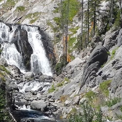
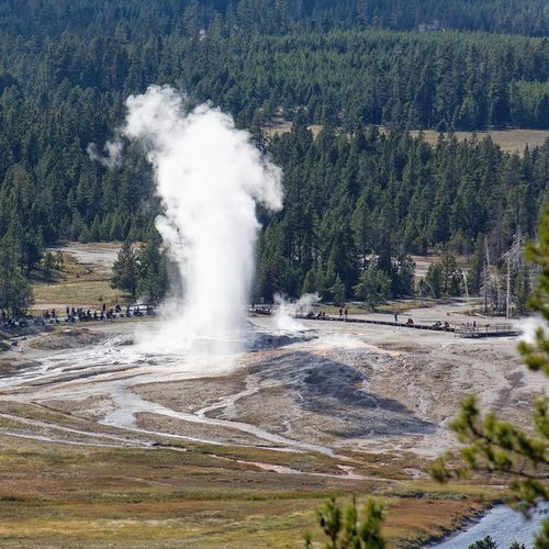
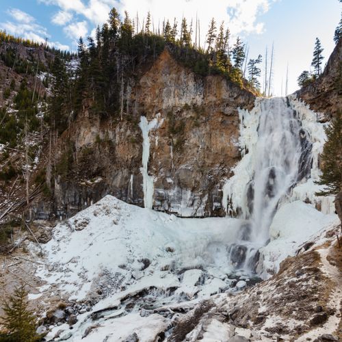
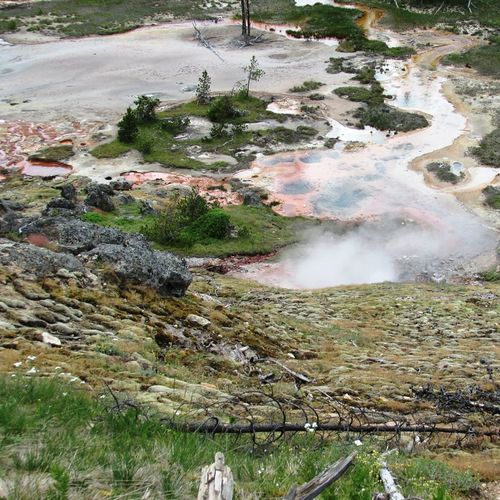
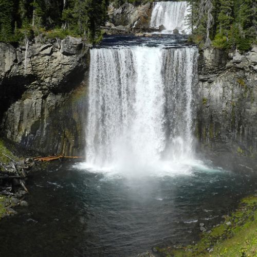
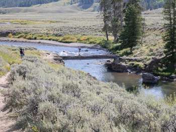
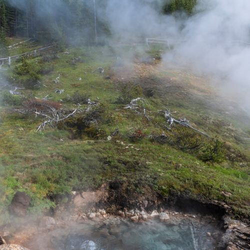
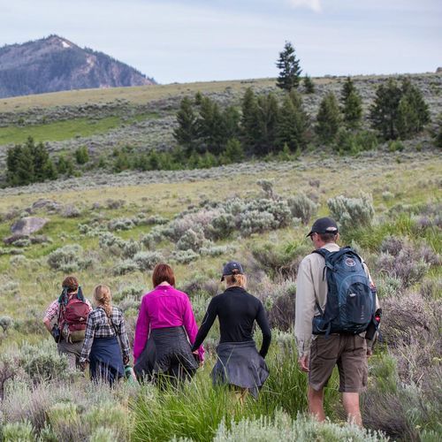
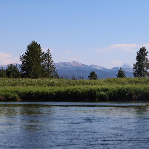
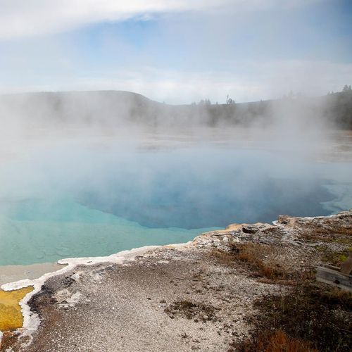
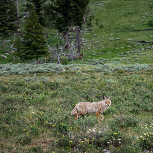
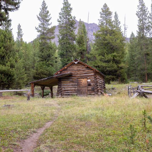
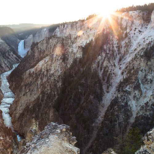
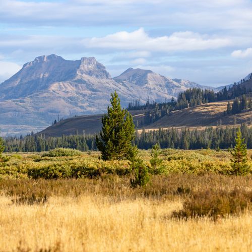
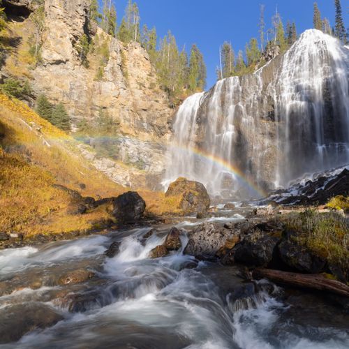
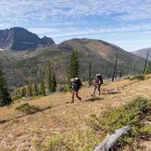
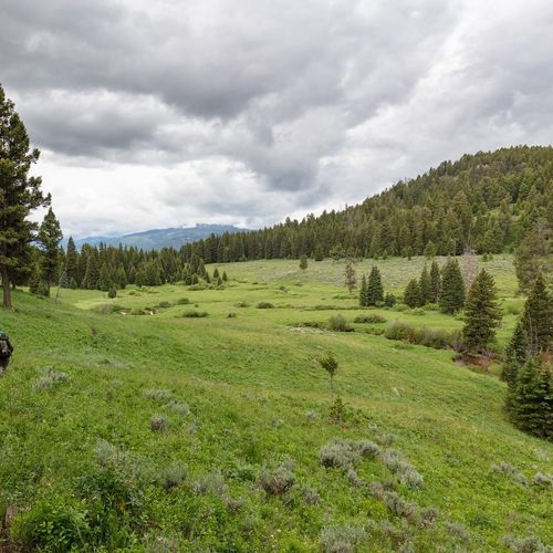
Yellowstone is one of the great hiking parks in America, with a trail system vast enough to satisfy everyone from casual walkers to seasoned backcountry hikers. The park’s 182 trails span the full spectrum: plenty of easy routes for families and first-timers, a deep bench of moderate day hikes, and a serious share of difficult and extreme outings for those looking to earn solitude, elevation, and long wilderness miles. That variety is one of Yellowstone’s strengths. You can spend the morning on a short path to a geyser basin overlook or a canyon viewpoint, then devote another day to a longer climb, a waterfall trek, or a remote valley route that feels a world away from the roadside crowds. The standout hikes are as iconic as the park itself. Around Old Faithful and the Upper Geyser Basin, trails pair steaming thermal terrain with surprisingly peaceful viewpoints away from the busiest boardwalks. At the Grand Canyon of the Yellowstone, short hikes to dramatic rims and waterfall overlooks deliver some of the park’s most unforgettable scenery. In the Mammoth area, Bunsen Peak is a classic moderate climb with sweeping views, while trails such as Mystic Falls and Observation Point offer rewarding mileage without demanding an all-day commitment. Hikers looking for more ambitious outings can set their sights on routes like Osprey Falls, Union Falls, Dunanda Falls, or the Black Canyon of the Yellowstone, where distance, exposure, and a stronger sense of remoteness define the experience. What makes hiking in Yellowstone special is not just the scenery, but the sheer range of environments packed into one park. Few places let you move so quickly between geyser basins, river canyons, high meadows, lodgepole forest, mountain overlooks, lakeshore, and wildlife-rich valleys. This is a landscape that feels active and untamed, shaped by fire, water, geothermal heat, and roaming herds. Every hike carries the possibility of seeing bison, elk, or even bears, and even relatively short trails can feel like an immersion in true wilderness. Yellowstone doesn’t offer just one style of hiking; it offers an entire world of it.

Avalanche Peak Trail

Avalanche Peak Trail

Difficult4.6 mi

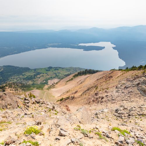
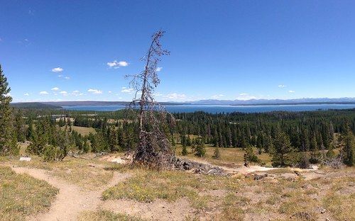
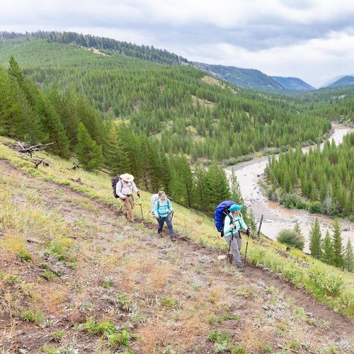
A steep ascent through a lodgepole pine forest gives way to expansive views of alpine peaks and Yellowstone Lake. The trail crosses scree slopes and switchbacks, culminating in a narrow ridgeline with breathtaking vistas. Grizzly bears frequent the area, particularly in autumn, as they feed on whitebark pine nuts. The summit offers stunning 360-degree views, including distant mountain ranges and the Teton Range on a clear day.

Bunsen Peak Trail

Bunsen Peak Trail

Moderate4.5 mi

Climb through sagebrush meadows and patches of trees to reach the summit, offering panoramic views of Swan Lake Flat, the Gallatin Mountain Range, and the Blacktail Deer Plateau. The trail features steep switchbacks and exposed sections near the summit.
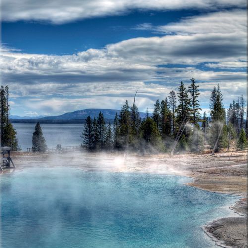
Chittenden Road - Mount Washburn Trail

Chittenden Road - Mount Washburn Trail

Moderate5.7 mi

Climb a gradual, gravel road offering expansive views of surrounding hillsides, valleys, and grasslands. The route shares the path with service vehicles and bicyclists, providing opportunities to spot bighorn sheep and enjoy wildflowers. At the summit, a fire lookout tower offers shelter from wind and panoramic views of the surrounding landscape. The area is rich in alpine vegetation, but visitors must be mindful of fragile ecosystems and potential wildlife encounters.

Dunraven Pass - Mount Washburn Trail

Dunraven Pass - Mount Washburn Trail

Moderate7 mi

Ascend through diverse alpine landscapes, featuring vibrant wildflowers and potential bighorn sheep sightings. The trail offers spectacular views from the summit, including vistas of the Grand Canyon and surrounding mountains. A fire lookout tower provides additional insight into the area's natural beauty. Be mindful of weather changes and wildlife, particularly grizzly bears in the fall.

Fairy Falls Loop Trail

Fairy Falls Loop Trail

Moderate8.9 mi

This trail offers a family-friendly hike through a lodgepole pine forest, culminating in a breathtaking view of the 200-foot Fairy Falls. The route also provides opportunities to see wildlife like bison and elk. For a longer adventure, hikers can extend their journey to Imperial Geyser. The trail is well-maintained and relatively flat, making it accessible to hikers of all ages.

Fairy Falls Trail

Fairy Falls Trail

Easy4.9 mi

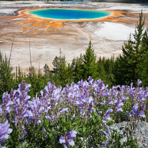
This trail leads to a stunning 200-foot waterfall and offers a serene hike through meadows and along the edge of the Midway Geyser Basin. Along the way, you can take a side-hike to the Grand Prismatic Overlook for a unique view of Grand Prismatic Spring. Two trailheads (a northern one at the end of Fountain Flat Drive and a southern one at the Fairy Falls parking area) provide access for those who want a longer or shorter route.

Heart Lake Trail

Heart Lake Trail

Moderate15.2 mi

This trail leads to a large backcountry lake, offering stunning views of Mount Sheridan. It is part of the Heart Lake Bear Management Area and features access to the Heart Lake Geyser Basin. The area is renowned for its hydrothermal features and diverse wildlife.

Hellroaring Creek Trail

Hellroaring Creek Trail

Moderate9.7 mi

Follow the Hellroaring Creek Trail as it descends through mature forest and sagebrush toward the Yellowstone River. The route passes through stands of Douglas fir and provides opportunities to spot wildlife such as elk and moose. The trail reaches the confluence of Hellroaring Creek and the Yellowstone River.

Lone Star Trail

Lone Star Trail

Easy5.3 mi

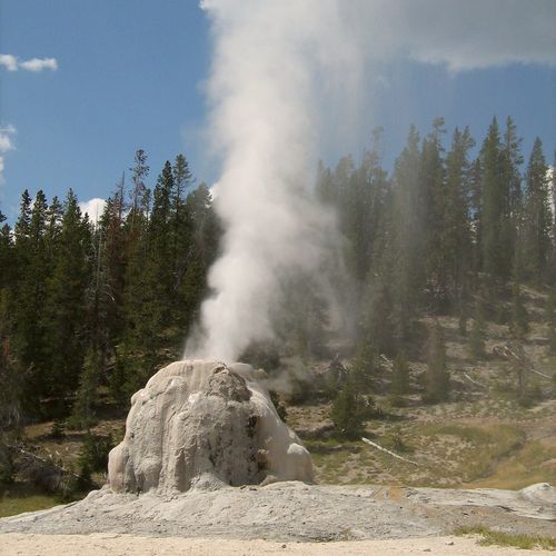
Follow an easy, flat, unpaved trail along the Firehole River through lodgepole pine forest to a secluded clearing with Lone Star Geyser. Lone Star erupts about every three hours, typically reaching 30–45 feet. The area offers picturesque views of the river and riparian plant life, making it a pleasant spot to pause. Bicycles are permitted on the trail, but cycling is not allowed beyond the barrier near the geyser.
Mystic Falls Trail

Mystic Falls Trail

Easy2.3 mi

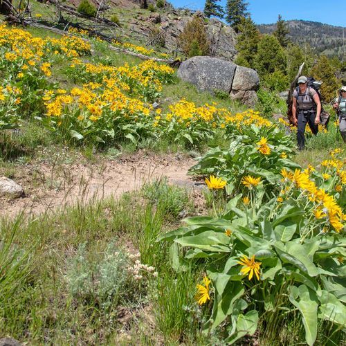
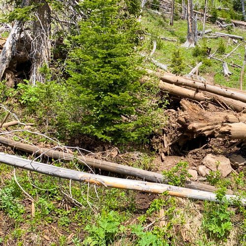
Follow the Little Firehole River through a lush forest to the 70-foot Mystic Falls. The trail offers an optional climb to an overlook with panoramic views of the Upper Geyser Basin. It's a beginner-friendly hike with rolling hills and scenic river views.

Observation Point

Observation Point

Moderate1.4 mi

This trail offers breathtaking views of the canyon, standing 800 feet above Angels Landing. The hike takes you through diverse landscapes, including Echo Canyon, with its dark slot canyon formations. The final viewpoint provides a stunning 270-degree panorama of the surrounding red rock formations.

Osprey Falls Trail

Osprey Falls Trail

Difficult9 mi

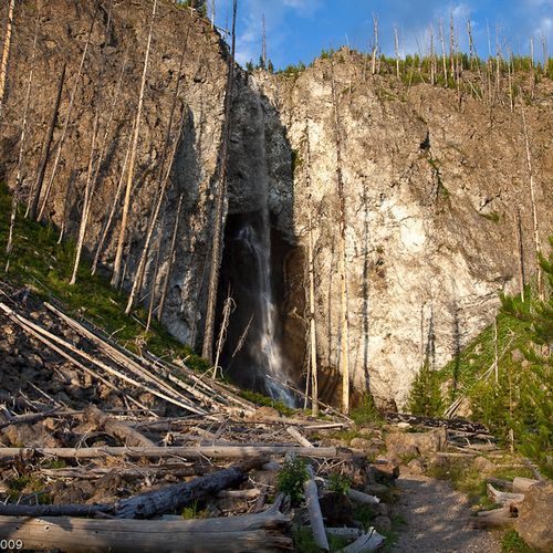
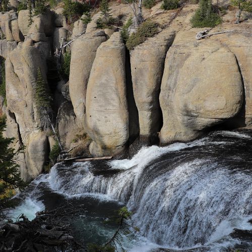
This trail offers a scenic hike around Bunsen Peak, leading to the impressive Osprey Falls in Sheepeater Canyon. The route passes through open meadows and forests, providing views of the Gardner River and basalt columns. The steep descent into the canyon requires caution and offers stunning views of the waterfall.

Sky Rim

Sky Rim

Difficult18.1 mi

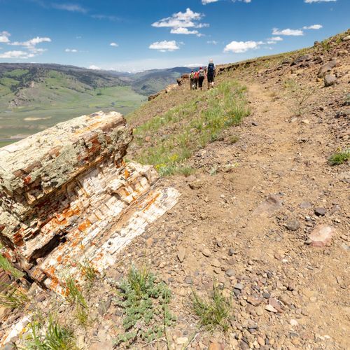
This challenging hike follows the boundary ridge, offering breathtaking views of surrounding mountain ranges. The trail traverses rugged ridgelines, includes summits like Bighorn Peak, and features petrified trees along the way. Wildlife spotting opportunities are abundant, with frequent sightings of elk and bighorn sheep.

Storm Point Trail

Storm Point Trail

Easy4.1 mi

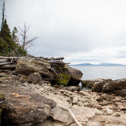
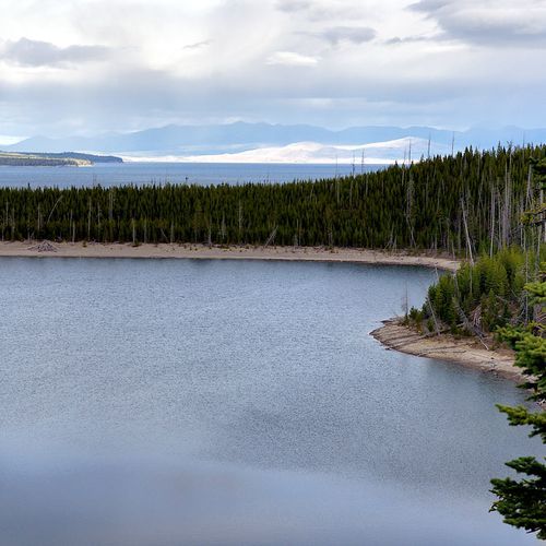
This trail offers scenic views of Yellowstone Lake, passing through forest and meadows. It is good for wildlife viewing (for example, waterfowl and occasionally bison) and culminates at Storm Point, which provides expansive views of the lake and surrounding landscape.
Trout Lake

Trout Lake

Easy1.2 mi

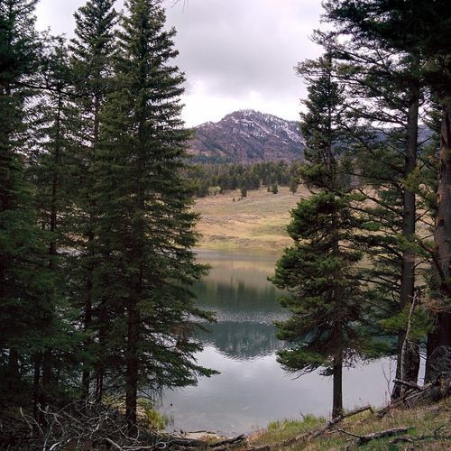
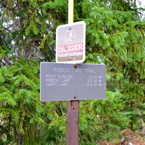
This trail ascends through a forest of Douglas-fir trees to a picturesque lake, offering stunning mountain views. The hike is ideal for beginners and provides opportunities to observe wildlife, especially in the surrounding Lamar Valley. The trail's lollipop shape allows hikers to loop around the lake, enjoying its serene beauty.

Wraith Falls trail

Wraith Falls trail

Easy0.8 mi

This trail winds through sagebrush meadows and mixed conifer forests, leading to an overlook of the picturesque Wraith Falls. The area is rich in wildflowers during early summer, and the waterfall offers a unique cascading effect. The trail's gentle slope makes it accessible for most hikers.

Yellowstone River Overlook

Yellowstone River Overlook

Easy3.8 mi

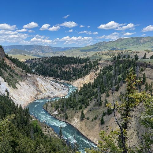
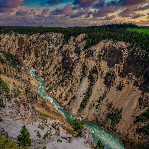
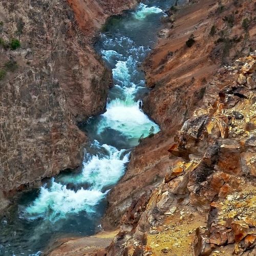
This overlook provides expansive views of the Yellowstone River and the Grand Canyon of the Yellowstone, including nearby hydrothermal features and steep, columnar basalt cliffs across the river. The gorge and cliffs offer habitat for species such as bighorn sheep and raptors (for example, red-tailed hawks and osprey). For an alternative canyon-edge walk and additional viewpoints of the canyon terminus, the Yellowstone River Picnic Area Trail on the opposite side of the river follows the canyon edge.

Artist Point;Artist Point Overlook

Artist Point;Artist Point Overlook

Easy1.5 mi

Enjoy stunning vistas of the Grand Canyon of the Yellowstone River from this accessible viewpoint. The trail offers a glimpse into the park's geological history and is a popular stop for those exploring the area.

Artists' Paintpot Trail

Artists' Paintpot Trail

Easy0.8 mi

This trail winds through a partially burned lodgepole pine forest and across a wet meadow on boardwalks, showcasing colorful hot springs and active mudpots. Visitors can enjoy the unique sounds and sights of these hydrothermal features while staying safe on designated paths.

Bechler River

Bechler River

Extreme20.6 mi

Located in the southwest corner of the park, the Bechler region is a low‑visitation, wetter area known for abundant waterfalls, wide meadows, and mountain vistas. The Bechler River trails offer a remote backcountry hiking and camping experience through scenic cascades and river corridors.

Brink of the Lower Falls Trail

Brink of the Lower Falls Trail

Easy0.8 mi

A paved, often steep path with many steps leads from the North Rim to the Brink of the Lower Falls, where you can view the dramatic Lower Falls and the Grand Canyon of the Yellowstone. The route provides stunning canyon vistas but includes numerous steps that may be difficult for people with mobility limitations; accessible viewpoints and parking are available nearby on the North Rim Trail.

Grand Prismatic Overlook Trail

Grand Prismatic Overlook Trail

Easy0.3 mi

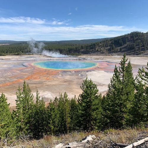
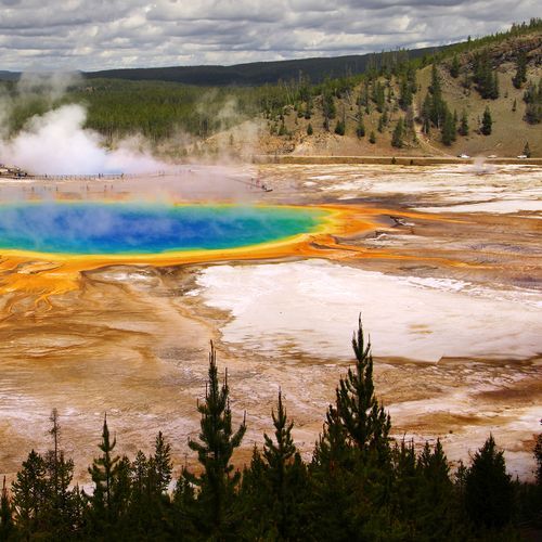
This trail offers breathtaking views of the Grand Prismatic Spring, the largest hot spring in the United States. The spring's vibrant colors, created by microbial life and mineral particles, make it a must-visit attraction. The trail is part of a larger network that includes access to Fairy Falls, one of the park's tallest waterfalls.

Lamar Valley Trail

Lamar Valley Trail

Extreme22.7 mi

Hike through a valley renowned for its abundant wildlife, including bison, elk, and predators like wolves and grizzly bears. The trail offers scenic views of the surrounding landscape and a chance to experience the natural beauty of this wildlife haven. It is a popular spot for hiking and backpacking during the warmer months.

Mammoth Hot Springs

Mammoth Hot Springs

Easy0.1 mi

Walk through a surreal landscape of travertine terraces and thermal pools, colored by heat-loving bacteria and algae. The area features numerous hot springs, including the iconic Minerva Terrace and Liberty Cap. The boardwalks provide easy access to these unique formations.

Mammoth Terraces

Mammoth Terraces

Moderate1.5 mi

Walk along boardwalks through a series of vibrant hot springs and travertine formations, offering breathtaking views of the surrounding mountains. The area is known for its unique geological features and diverse wildlife, making it a must-visit destination for nature enthusiasts.

Midway Geyser Basin

Midway Geyser Basin

Easy0.6 mi

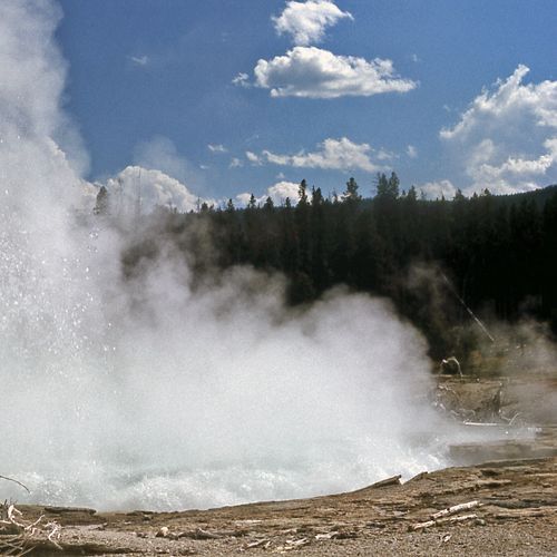
Boardwalks take you past several impressive hot springs and geysers in Midway Geyser Basin. The boardwalk loop highlights Grand Prismatic Spring, Yellowstone’s largest hot spring, known for its vivid colors, and passes the massive Excelsior Geyser Crater, which continuously discharges large volumes of water into the Firehole River and is now considered dormant. A short nearby trail leads to an elevated overlook with a broad view of Grand Prismatic.

Natural Bridge Trail

Natural Bridge Trail

Easy3.1 mi

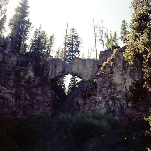
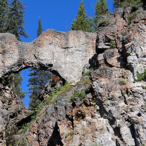
Meandering through a forest, the path leads to a natural bridge formed by erosion of a rhyolite outcrop, where Bridge Creek flows beneath a span approximately 51 feet (16 m) above the creek. The trail follows an old/service road and offers views of the surrounding woods and creek. A short, steep switchback leads to the top of the bridge; travel across the bridge is prohibited to protect the feature. The area is also known for wildlife, including bears that frequent the creek during trout-spawning season.

Upper Geyser Basin Trail

Upper Geyser Basin Trail

Easy0.3 mi

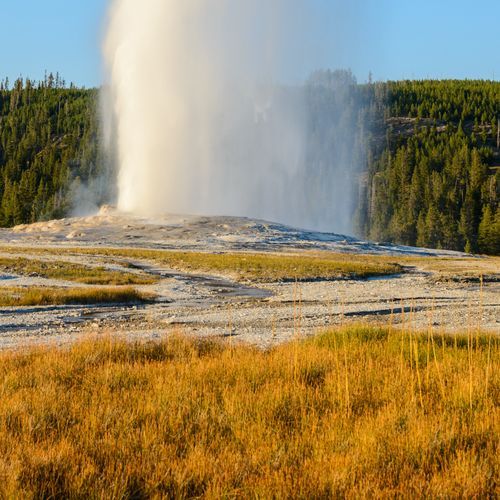
This trail offers a unique opportunity to explore the world's most concentrated geyser area, featuring famous geysers like Old Faithful and Grand Geyser. The path is generally easy to navigate, with wide paths and wooden stairs, allowing visitors to immerse themselves in the natural wonders of this hydrothermal landscape.

West Thumb Geyser Basin Trail

West Thumb Geyser Basin Trail

Easy0.8 mi

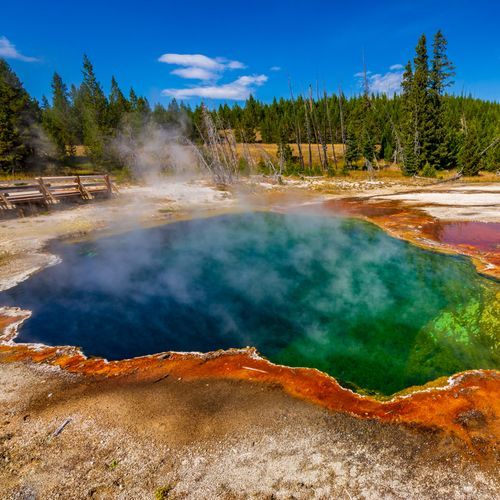
The West Thumb Geyser Basin Trail is a scenic boardwalk that meanders along the edge of Yellowstone Lake, showcasing a variety of stunning hydrothermal features. Visitors can marvel at the vivid blue pools, bubbling hot springs, and both shoreline and underwater thermal activity. With breathtaking views of the lake and the Absaroka Range, this easy, interpretive walk is perfect for all to enjoy, though some sections may require assistance for wheelchair users.

Agate Creek Trail

Moderate4.2 mi

This trail offers a serene journey through sagebrush-filled grasslands and forested sections, with opportunities to see elk and bison. The route follows Agate Creek and features riparian and meadow scenery typical of Yellowstone.

Bacon Rind Creek

Bacon Rind Creek

Easy2.1 mi

This trail offers a serene walk along a creek, ideal for families and those seeking a leisurely hike. The surroundings are peaceful, with minimal elevation change, making it accessible for a wide range of visitors.

Bannock Ski Trail

Easy1.7 mi

This trail follows Soda Butte Creek and offers a tranquil winter experience through mixed conifer forests and open meadows. Skiers may spot wildlife like bison, moose, and fox. The trail extends beyond the park into the Absaroka-Beartooth Wilderness, providing a longer adventure option.

Beaver Ponds Trail

Beaver Ponds Trail

Difficult5.3 mi

This trail passes through meadows and stands of aspen interspersed with forested areas, with a series of ponds that support diverse wildlife including elk, mule deer, pronghorn, moose, and waterfowl. Look for beaver dams and lodges, though beaver sightings are occasional. The scenic views and varied landscapes make it a rewarding hiking experience.

Bechler Meadows

Bechler Meadows

Easy2.2 mi

This trail provides a tranquil experience through meadows, offering a chance to connect with nature away from the crowds. It is part of a larger network of trails in the Bechler region, known for its remote wilderness and solitude.

Bechler Meadows Cutoff

Easy2.5 mi

This trail offers breathtaking views of the surrounding meadows and the distant Tetons. It provides an alternate route to the Boundary Creek Trail, allowing hikers to avoid creek crossings and enjoy more time in open meadows. The trail's moderate difficulty makes it accessible for a variety of hikers seeking scenic vistas.

Bechler River Cutoff

Bechler River Cutoff

Moderate4.4 mi

This trail connects the Bechler Ranger Station with the Bechler River Trail, offering a peaceful journey through forests and meadows. It is ideal for those looking for a short, easy hike in a less crowded area of the park.

Bighorn Pass

Bighorn Pass

Moderate0.5 mi

This trail traverses varied landscapes from grass and willow river valleys to dense forests and high meadows. It offers opportunities to see wildlife such as grizzlies, moose, and elk. The trail culminates at Bighorn Pass, providing stunning views of the Gallatin River Valley.

Biscuit Basin

Biscuit Basin

Easy0.2 mi

This trail offers a serene walk through a vibrant hydrothermal area, featuring pools like Sapphire and Black Opal, along with the frequently erupting Jewel Geyser. The boardwalks provide an intimate view of these natural wonders, making it a unique experience amidst the diverse geothermal landscapes.

Black Butte

Black Butte

Difficult6 mi

This trail offers a steep climb through volcanic landscapes, culminating in panoramic views of surrounding mountains and valleys. The ascent is challenging, but the vistas from the summit are rewarding.

Black Butte-Daly Creek Cutoff

Black Butte-Daly Creek Cutoff

Moderate2.2 mi

This trail offers a moderate hike through varied landscapes, connecting the Black Butte Trail with the Daly Creek Trail. It features a mix of forested areas and meadows, providing a less crowded alternative for those exploring the northwest region of Yellowstone.

Black Sand Basin

Black Sand Basin

Easy0.3 mi

Discover the stunning Black Sand Basin, home to vibrant hot springs and impressive geysers like the active Cliff Geyser and Rainbow Pool, all set against the backdrop of the striking black sand. Located northwest of Old Faithful, this area is easily accessible by car, with a convenient parking area, or by walking along the scenic trail network of the Upper Geyser Basin. Enjoy the experience of viewing these remarkable hydrothermal features up close via the well-maintained boardwalks.

Blacktail Deer Creek Trail

Blacktail Deer Creek Trail

Difficult4.1 mi

This trail traverses broad sagebrush meadows, offering frequent bison sightings. It follows Blacktail Deer Creek, descending through willows and basalt formations to the Yellowstone River. A suspension bridge crosses the river, and the trail continues through forests and meadows, eventually reaching Knowles Falls. The area is rich in wildlife, including grizzly bears.

Bliss Pass Trail

Bliss Pass Trail

Difficult19 mi

This trail traverses striking wildflower meadows and offers vantage points of Pebble Creek. It involves a challenging climb to Bliss Pass, providing breathtaking views of the surrounding landscape.

Boiling River [CLOSED]

Boiling River [CLOSED]

Easy0.1 mi

This trail leads to a natural hot spring area where warm waters from an underground source mix with the cold Gardner River, creating a comfortable temperature for bathing. The short, easy walk along the river offers scenic views and a chance to relax in a natural hot tub setting.

Boundary Creek Trail

Boundary Creek Trail

Difficult14 mi

Boundary Creek Trail provides access to Dunanda Falls. The route includes multiple stream crossings and passes through a mix of forested and more open sections.

Bridge Bay Campground-Natural Bridge Trail

Bridge Bay Campground-Natural Bridge Trail

Easy0.9 mi

Located just south of Bridge Bay Campground and Marina, this route follows a semi‑paved bicycle trail that transitions to a rocky natural surface and leads to a natural bridge carved in rhyolite by Bridge Creek.

Buffalo Fork Trail

Difficult6.5 mi

This trail offers a scenic journey through varied landscapes, including meadows and forests. It begins within the national park and extends into the Custer Gallatin National Forest, providing opportunities to observe wildlife and enjoy natural beauty.

Buffalo Plateau Trail

Buffalo Plateau Trail

Moderate8.4 mi

This trail offers breathtaking views of the surrounding landscape, including the Yellowstone River. It features a mix of switchbacks, forests, and open meadows filled with wildflowers in the spring. Wildlife sightings are common, making it a great choice for nature enthusiasts.

Cache Lake Trail

Easy0.8 mi

This trail leads to a picturesque lake surrounded by reeds and meadows, offering a tranquil escape. The backdrop of Electric Peak provides stunning views, making it a scenic destination for hikers seeking solitude.

Cascade Creek Trail

Cascade Creek Trail

Easy0.3 mi

This scenic trail leads through mixed pine forests and over creeks, offering views of granite outcrops and charming cascades. The path gently descends before reaching a steep section, providing a diverse experience of flora and fauna.

Cascade Lake Trail

Cascade Lake Trail

Moderate5.6 mi

The trail to Cascade Lake passes through open meadows, marsh, and forests, providing views of surrounding mountains and abundant wildflowers. It is a good area for wildlife viewing; elk and bears have been reported in the broader area. Cascade Lake is commonly reached via routes such as the Howard Eaton Trail or the Observation Peak approach.

Casecade Lake Trail

Easy2.1 mi

Wander through woods and meadows to a stunning glacial lake, where wildflowers abound and wildlife such as bison, elk, and moose are often seen. The trail passes through open meadows, offering scenic views of the surrounding mountains. It's a great spot for fishing, with cutthroat trout and Arctic grayling available. The area is also known for its variety of wildflowers and potential bear sightings, making it a unique and engaging experience.

Clagett Butte

Clagett Butte

Easy1 mi

This trail offers a scenic hike with a steep ascent over Clagett Butte, providing panoramic views of the surrounding area. It connects with other trails, allowing for extended exploration of the region's diverse landscapes.

Clear Lake - Ribbon Lake Trail

Easy3.2 mi

This loop trail connects Clear Lake and Ribbon Lake, passing through forested areas and meadows and offering lakeside scenery. Highlights include Clear Lake's distinctive coloring and the quiet surroundings of Ribbon Lake.

Clear Lake Trail

Clear Lake Trail

Easy0.7 mi

This trail offers a peaceful hike through a scenic area, providing an opportunity to enjoy the tranquility of nature. The trail's easy difficulty makes it accessible for a wide range of visitors.

Crescent Lake-High Lake

Difficult21.5 mi

This trail offers a challenging hike through rugged mountain terrain, featuring two serene alpine lakes. The journey begins with a steep ascent to Crescent Lake, nestled in a cirque beneath an 800-foot cliff. From there, the path leads to High Lake, a secluded gem offering breathtaking views and a sense of accomplishment. The environment is fragile, so care is needed to preserve these natural wonders.

Cygnet Lakes Trail

Cygnet Lakes Trail

Moderate4.1 mi

This mostly flat walk passes through a mix of mature lodgepole pines, younger growth, and areas shaped by recent fire before reaching quiet, marsh-filled meadows around a pair of small lakes. Along the way, a few open meadows and scattered ponds break up the forested stretches, but much of the route remains shaded by trees. The hike concludes in a broad meadow with the lakes set back at the far edge, where soggy ground and vegetation limit access to the shoreline and keep views fairly modest.

Daly Creek

Daly Creek

Difficult4.9 mi

This trail traverses through broad meadows and forests, offering scenic views of the surrounding mountains. While specific details are unclear, it likely connects with other trails in the area, providing access to diverse landscapes and wildlife habitats.

Divide

Moderate3.5 mi

This trail offers a gentle hike through a diverse forest landscape, providing scenic views and a chance to experience the natural beauty of the area. The trail's terrain varies, making it suitable for those looking for a leisurely walk or a more challenging hike.

Duck Lake Trail

Duck Lake Trail

Easy0.9 mi

This trail leads through a conifer forest to the shores of a tranquil lake. A short climb provides expansive views of the surrounding lakes and the remnants of past wildfires. The trail is moderately strenuous and offers a glimpse into the region's natural history.

Electric Peak-Southeast Ridge Trail

Electric Peak-Southeast Ridge Trail

Difficult3.1 mi

The Electric Peak Southeast Ridge route follows the southeast ridge of Electric Peak, gaining substantial elevation from the trailhead to the ridge crest. As you hike, you'll transition from forested slopes into open, rocky alpine terrain, encountering steep climbs and exposed ridge sections that provide broad panoramic views. This route is best suited for experienced hikers in good condition, so be prepared for uneven, rocky footing and some route-finding challenges.

Elephant Back Mountain Trail

Elephant Back Mountain Trail

Moderate3.8 mi

A forested ascent leads to a summit with panoramic views of Yellowstone Lake and the Absaroka Range. The hike begins in an open, older forest before climbing through a dense lodgepole pine forest. Switchbacks bring hikers to a plateau where the trees part to reveal stunning vistas of the lake and surrounding mountains. The trail forms a loop, allowing hikers to descend via a different path, offering varied perspectives on the landscape.

Fairy Creek Trail

Fairy Creek Trail

Difficult11 mi

This route climbs steeply to a lofty overlook above one of the world’s most active geyser basins before rolling across a broad plateau shaped by fire and ice. After passing through burned forest and subtle high points, it descends to a trout-filled river and an expansive meadow where multiple creeks merge, offering one of the most scenic stretches of the hike. The final miles cross quieter, less varied terrain before dropping into a valley marked by glacial buttes and a dormant geyser that hints at the powerful forces still at work beneath the surface.

Fan Creek Trail

Fan Creek Trail

Difficult7 mi

This trail closely follows Fan Creek, providing a tranquil forest experience. It is part of a larger network of trails in the area, offering opportunities to connect with other routes like the Fawn Pass Trail. The serene surroundings make it a peaceful choice for those seeking a less crowded experience.

Fawn Pass Spur/Bacon Rind TH

Fawn Pass Spur/Bacon Rind TH

Easy1.3 mi

The Fawn Pass Spur from the Bacon Rind trailhead is a connector route that climbs through forest and meadow and gains higher alpine country as it approaches Fawn Pass and the Fawn Cabin area. It provides hikers with access to nearby backcountry routes and high-country views. The route is also used by stock where the tread has been cleared.

Fawn Pass Trail

Fawn Pass Trail

Easy0.1 mi

This challenging trail offers breathtaking views as it traverses through a bear management area. Hikers must be prepared for encounters with grizzly bears and adhere to strict regulations. The trail features diverse landscapes and is suitable for experienced hikers looking for a remote wilderness experience.

Fawn Pass-Bighorn Pass Cutoff Trail

Fawn Pass-Bighorn Pass Cutoff Trail

Easy0.9 mi

This trail offers a short yet scenic connection between the Fawn Pass and Bighorn Pass trails. It traverses through mountainous terrain, providing views of the surrounding landscape. The area is known for wildlife sightings, including bison and elk, and requires caution due to potential avalanche risks in nearby areas.

Fountain Paint Pot Trail

Fountain Paint Pot Trail

Easy0.5 mi

This trail showcases Yellowstone’s four major hydrothermal features, including mud pots, geysers, hot springs and fumaroles, and highlights the colorful Fountain Paint Pots and nearby Silex Spring. The area is also near Firehole Lake Drive, where you can view geysers such as the Great Fountain Geyser and White Dome. Portions of the boardwalk are wheelchair-accessible (the first section is level and provides easy access to Silex Spring), but other sections include steep portions and stairs; designated-accessible parking is available.

Garnet Hill Loop

Garnet Hill Loop

Moderate9.9 mi

Garnet Hill is a moderately difficult loop beginning just north of Tower Junction on the Northeast Entrance Road (park in the large parking area east of the service station at Tower Junction). The trail follows an old dirt stagecoach road about 1.5 miles to a cookout shelter, then continues north along Elk Creek toward the Yellowstone River, where the trail divides near the river. The route passes through sagebrush and meadow areas and provides opportunities to see elk and other wildlife.

Grebe Lake Trail

Grebe Lake Trail

Easy6.1 mi

Wander through a mature forest stand and an old burn area, transitioning into a trail that leads to a picturesque lake. The lake is home to a variety of waterfowl, including swans and grebes. The surrounding meadows offer beautiful views and are ideal for picnics or camping. The trail continues through a mix of forest and meadows, providing opportunities to explore further lakes in the area. Backcountry campsites are available for those wishing to extend their stay.

Grizzly Lake

Grizzly Lake

Moderate4.2 mi

This trail leads to a long, narrow, heavily wooded lake reached via a route that passes through meadows and a lodgepole pine stand that burned in past wildfires. The lake and nearby shorelines are marshy and can be mosquito-heavy early in the season, and anglers commonly find brook trout here. Access beyond the trail end can be difficult (a log-jam crossing is required to continue), and the area is prime grizzly bear habitat; wildlife sightings are common.

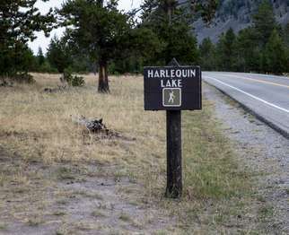
Harlequin Lake Trail

Harlequin Lake Trail

Easy0.5 mi

This short hike leads to a picturesque lake, offering a tranquil setting amidst lodgepole pines and rocky hills. The trail is suitable for families and those seeking a brief, easy excursion into nature.

Hoodoo Basin Trail

Hoodoo Basin Trail

Extreme9.8 mi

This trail leads through high meadows and past unique rock formations known as hoodoos, offering breathtaking views of deeply cut valleys and steep ravines. The area is rich in wildlife, including elk, deer, and grizzly bears, and features remnants of Native American presence. The challenging hike involves significant elevation gain and traverses remote wilderness areas.

Howard Eaton Trail

Howard Eaton Trail

Difficult10.9 mi

Pass through varied landscapes, including forest, meadow, and marsh, with options to visit several lakes. The trail offers opportunities for bird watching, nature photography, and wildlife viewing. It can be wet and muddy during the early summer months, with abundant biting insects. Wildlife, including bears, are common, emphasizing the need for bear safety precautions.

Howard Eaton Trail

Howard Eaton Trail

Moderate13.5 mi

This trail traverses along the Yellowstone River, offering scenic views of the surrounding landscape. It passes through varied terrain, including forests and meadows, and provides access to several lakes in the area. The trail is known for its challenging conditions and requires careful preparation due to its remote nature and potential wildlife encounters.

Howard Eaton-Cascade Lake-Norris Campground

Howard Eaton-Cascade Lake-Norris Campground

Moderate3.5 mi

This trail offers a varied landscape experience, passing by lakes, forests, and meadows. It provides opportunities to observe wildlife and enjoy wildflowers, though it requires planning for transportation between trailheads. The trail's diverse habitats make it appealing for nature enthusiasts.

Lava Creek

Lava Creek

Difficult2.7 mi

Follow the Lava Creek Trail to where it meets the Gardner River to enjoy scenic river and canyon views and observe the area's volcanic geology. The trail offers opportunities to see wildlife such as elk and bison, and the hike can be extended to explore more of the canyon and river confluence.

Lava Creek Trail

Lava Creek Trail

Difficult5.9 mi

Lava Creek Trail winds through a captivating mix of lush meadows and dense forests, immersing hikers in Yellowstone's rich ecosystems. Following the serene Lava Creek, visitors can spot an array of aquatic wildlife and bird species, making it an excellent location for birdwatching. With gentle terrain and tranquil surroundings, this trail provides a peaceful escape, complemented by stunning views of the majestic mountain ranges.

Lost Lake

Lost Lake

Moderate3 mi

This trail leads to a picturesque alpine lake, offering breathtaking views of surrounding mountains and meadows. The area is known for its scenic beauty and diverse wildlife, making it a popular destination for hikers seeking solitude and natural splendor.

Mallard Creek

Mallard Creek

Moderate8.5 mi

This trail winds through a forest of small lodgepole pines, occasionally offering glimpses of osprey nests and distant views of the Grand Prismatic Spring. As it ascends, the trail passes through stands of mature trees before reaching the picturesque Mallard Lake, where hikers can enjoy a peaceful atmosphere.

Mallard Lake

Mallard Lake

Moderate6.7 mi

This trail offers a scenic hike through a forest of lodgepole pines, crossing the Firehole River and passing by Pipeline Hot Springs. It provides a bird's eye view of the Old Faithful area before reaching the tranquil Mallard Lake, where hikers can enjoy peaceful surroundings amidst jagged rock formations.

Mary Mountain-Nez Perce

Extreme20.2 mi

This trail follows a segment of the Nez Perce's historic flight, offering a glimpse into the tribe's journey through Yellowstone's diverse landscapes. The route traverses scenic valleys and mountainous terrains, providing insights into both natural beauty and historical significance.

Monument Geyser Basin

Monument Geyser Basin

Moderate2.5 mi

This trail leads to a lesser-known thermal area featuring distinctive sinter cones and steaming vents. The basin is notable for its unique geological formations, resembling oceanic 'black smoker' deposits. Despite lacking active geysers, it offers a fascinating glimpse into Yellowstone's hydrothermal diversity.

Mount Holmes-Winter Creek

Mount Holmes-Winter Creek

Extreme10.8 mi

Climb through varied terrain to reach a historic fire lookout, offering breathtaking 360° views of surrounding landscapes. The trail traverses forests, meadows, and talus slopes, providing a challenging yet rewarding experience.

Mount Sheridan Trail

Mount Sheridan Trail

Difficult23.5 mi

This trail offers a scenic hike through old-growth forests and past thermal features to the shores of a large mountain lake. The ascent to the summit provides breathtaking views of surrounding lakes and mountain ranges, making it a highlight of the region.

Mud Volcano

Mud Volcano

Easy1.1 mi

This trail offers a fascinating walk through a unique geothermal area, featuring bubbling mud pools (mudpots) and steaming fumaroles rather than typical hot springs. Highlights include Dragon's Mouth Spring, Black Dragon's Cauldron, and Sour Lake. The boardwalk path and a lower accessible loop provide visitor access while showcasing some of the park's most acidic hydrothermal features.

Norris Campground Trail

Norris Campground Trail

Easy0.7 mi

This trail offers a glimpse into the dynamic geothermal features of the area, with nearby access to the Norris Geyser Basin. The surrounding landscape is characterized by lodgepole forests and meadows, providing a diverse natural setting. The trail's proximity to the basin allows hikers to experience the unique thermal activity and vibrant colors of the mineral-rich environment.

North Rim Trail

North Rim Trail

Moderate2.6 mi

The North Rim Trail follows the canyon rim and provides multiple scenic overlooks and canyon views, including access to Lookout Point and the Brink of the Lower Falls, with additional views between overlooks toward Red Rock and Inspiration/Grand View areas. Accessible portions of the North Rim Trail connect several viewpoints, and the longest accessible stretch can be reached from the parking areas at Lookout or Grand View. The route passes through conifer forest and includes paved and partially stepped sections near the Brink of the Lower Falls.

Observation Peak Trail

Observation Peak Trail

Moderate9.4 mi

A strenuous ascent that climbs from the Tower–Canyon Road into open meadows and up to a high mountain summit offering outstanding panoramic views of the Yellowstone wilderness. The route passes through forest and open meadow sections and continues toward Cascade Lake; hikers should be alert for bears and moose along the way. The trail’s high viewpoint provides wide-ranging views, but specific distant landmarks are not consistently reported from the summit.

Osprey Falls

Osprey Falls

Easy0.1 mi

Descend into Sheepeater Canyon to witness the stunning Osprey Falls, where the Gardner River plunges over a lava flow. The trail offers panoramic views of meadows and mountains before steeply descending into the canyon, featuring basalt columns and diverse wildlife.

Pebble Creek

Pebble Creek

Moderate12 mi

This trail traverses through forests and meadows, offering breathtaking views of rugged peaks like Barronnette Peak and Mt. Hornaday. It crosses the Montana-Wyoming state line and features diverse wildlife habitats, making it ideal for those seeking solitude and natural beauty.

Pelican Creek Nature Trail

Pelican Creek Nature Trail

Easy0.8 mi

This trail winds through a forest of lodgepole pines to a sandy beach on the north shore of a vast lake, offering a habitat for diverse waterfowl and scenic views. It is an ideal introduction to the area's natural beauty and wildlife, particularly suitable for birdwatching.

Pelican Valley Trail

Pelican Valley Trail

Moderate8.3 mi

This trail offers a scenic journey through a large grassland valley, featuring Pelican Creek and a variety of wildlife such as bison and waterfowl. The path winds through meadows and lodgepole pine forests, offering views of the surrounding landscape. It is a Bear Management Area with specific restrictions to ensure safety.

Pitchstone Plateau Trail

Pitchstone Plateau Trail

Extreme17.1 mi

This trail traverses the high-altitude Pitchstone Plateau, offering breathtaking views of vast meadows, numerous waterfalls, and unique thermal features like Phantom Fumarole. The route involves challenging off-trail sections and steep climbs, making it suitable for experienced hikers.

Purple Mountain Trail

Purple Mountain Trail

Moderate6.7 mi

This moderately difficult trail begins about 0.25 miles north of Madison Junction on the Madison–Norris Road (limited parking) and climbs roughly 1,500 feet through intermittent, burned lodgepole pine forest to a summit viewpoint. From the top you get views of the Firehole Valley and the lower Gibbon Valley, with some views toward the Madison Junction area.

Red Point Trail

Red Point Trail

Easy0.4 mi

This trail offers a brief, easy walk through a wooded area, suitable for families. It features a wooden surface and is relatively flat, making it accessible for casual hikers. However, specific details about its features or attractions are not available.

Rescue Creek Trail

Rescue Creek Trail

Difficult7.3 mi

Rescue Creek Trail traverses meadows and sagebrush and passes through stands of forest, with opportunities to see grazers such as bison and pronghorn and views of Electric Peak. It is part of the park's northern trail network and connects with nearby routes.

Ribbon Lake trail

Ribbon Lake trail

Easy0.3 mi

This trail offers stunning views of the Grand Canyon and leads to serene lake environments. It traverses through forests and meadows, providing opportunities to spot wildlife. The trail includes hydrothermal areas and scenic overlooks, making it a diverse and engaging hike.

Riddle Lake Trail

Riddle Lake Trail

Easy4.8 mi

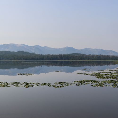
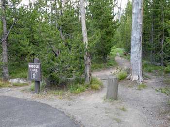
This peaceful trail leads through mixed forests and meadows to the shores of a picturesque lake, offering opportunities to spot wildlife like bears and moose. The lake is adorned with thousands of lily pads and provides a serene backdrop of volcanic peaks.

Sentinel Meadows Trail

Sentinel Meadows Trail

Moderate3.4 mi

Sentinel Meadows Trail is a short scenic loop through thermal meadows north of Old Faithful that includes a visit to the Queen's Laundry thermal basin. The trailhead is accessed from Fountain Flat Drive (about 10 miles north of Old Faithful). The hike passes thermal features and meadow habitat, offers wildlife-viewing opportunities, and highlights aspects of the park's early history.

Sepulcher Mountain Trail

Sepulcher Mountain Trail

Extreme6.8 mi

A strenuous hike that begins at the Beaver Ponds Trail junction and climbs through forest and meadows to the summit of Sepulcher Mountain. The route continues as a loop along the opposite side of the mountain to the Snow Pass Trail junction, which descends toward the Howard Eaton Trail and back to Mammoth Terraces. Hikers can expect steep, challenging terrain and meadow/forest environments; wildlife such as elk, mule deer and moose are reported in the area, and both black and grizzly bears may occur. The summit provides broad views of the surrounding landscape.

Seven Mile Hole Trail

Seven Mile Hole Trail

Difficult9.9 mi

This strenuous, steep trail descends to the bottom of the local canyon and the river’s edge, providing a secluded experience with canyon views and access to backcountry campsites. It is the only trail in this area that leads to the canyon bottom.

Shoshone Lake Trail

Shoshone Lake Trail

Easy6 mi

This trail offers a serene journey to the shores of a pristine backcountry lake, featuring stunning views and unique thermal features like the Shoshone Geyser Basin. The trail winds through dense lodgepole pine forests and along the lake's shoreline, providing opportunities to spot wildlife and enjoy the tranquility of nature.

Snow Pass

Snow Pass

Extreme21.6 mi

This trail ascends through a dense forest, offering steep grades and icy curves, before reaching Snow Pass. It continues over rolling terrain and follows Glen Creek, providing scenic views of the surrounding landscape. The trail is known for its challenging sections and encounters with wildlife like bison and elk.

Solfatara Creek

Solfatara Creek

Moderate14 mi

This trail offers a journey across diverse terrains, featuring wood surfaces and thermal areas nearby. It's a moderate hike suitable for those seeking a mix of natural beauty and geological interest.

South Rim

Easy1.7 mi

The South Rim Trail follows the rim of the Grand Canyon of the Yellowstone and provides multiple overlooks and viewpoints of the Upper and Lower Falls. Visitors can see the Lower Falls from points such as Artist Point and sections of the South Rim Trail, and view the Upper Falls from Upper Falls Viewpoints and the Brink of the Upper Falls area. Accessible walkways and designated parking provide viewpoints at Artist Point, Upper Falls Viewpoints, Discovery Overlook, and other overlooks along the rim, and the trail offers views of additional canyon features such as Crystal Falls.

Specimen Creek

Specimen Creek

Difficult8.1 mi

This trail winds through rolling forests and meadows, offering scenic views of alpine lakes like Crescent Lake and High Lake. Wildlife such as bison and elk are common, and the area is known for its diverse habitats. The trail includes steep sections and requires careful navigation, especially in winter conditions.

Specimen Ridge Trail

Specimen Ridge Trail

Difficult17.8 mi

This challenging loop offers breathtaking views of the Lamar Valley and Mirror Plateau. It features an abundance of petrified wood and amethyst, showcasing the geological richness of the area. The trail passes through diverse landscapes, including sagebrush habitats and forests, providing opportunities to spot wildlife like bison and birds.

Terraced Falls

Terraced Falls

Easy2.3 mi

Follow Cascade Creek and the Fall River to witness a series of waterfalls, including Terraced Falls. The trail offers scenic views of cascades and rapids, set amidst vibrant fall colors. The hike is relatively easy but requires caution due to steep drop-offs and potential wildlife encounters.

Thorofare Cabin Trail

Thorofare Cabin Trail

Easy1.4 mi

Thorofare Cabin Trail is a backcountry route through the remote Thorofare region of Yellowstone, offering solitude and opportunities for wildlife viewing. The trail is part of the park's backcountry trail network (often discussed together with the Nine Mile and Mountain Creek routes) and is open to stock use. Because it traverses very remote terrain, it receives few visitors and requires appropriate backcountry preparation and navigation.

Thorofare-South Boundary Cutoff Trail

Easy1 mi

This trail provides a tranquil connection between two larger trails, offering a glimpse into the remote and less visited areas of the park. It is ideal for those seeking solitude and a taste of untouched wilderness. The trail's short length makes it accessible for a quick detour or as part of a longer backpacking itinerary.

Trilobite Lake

Trilobite Lake

Moderate2.3 mi

This trail leads through varied landscapes to a secluded alpine lake, offering scenic views and opportunities to observe wildlife. The route traverses mountainous terrain, providing a challenging yet rewarding experience for hikers.

Turbid Lake Trail

Turbid Lake Trail

Extreme29.2 mi

The Turbid Lake Trail leads you through a beautiful landscape to Turbid Lake. Along the trail, you'll encounter typical park vegetation and wildlife, offering a great opportunity to enjoy the natural beauty of the area. Keep an eye out for various species, including the possibility of grizzly bears in the region.

UGB-Biscuit Basin

UGB-Biscuit Basin

Easy1.4 mi

This trail offers a unique experience through hydrothermal features like Sapphire Pool and Jewel Geyser. The area is known for its colorful thermophiles and diverse geothermal activity, making it a popular destination for those interested in geology and natural wonders.

Union Falls

Union Falls

Easy2.1 mi

This trail winds through a lush forest and offers stunning views of the surrounding landscape. It features a significant river crossing and traverses varied terrain, including dense forests and rocky slabs. The highlight is the breathtaking Union Falls, known for its complex waterfall system.

Upper Geyser Hill trail

Upper Geyser Hill trail

Easy0.3 mi

This trail offers a short, easy loop through the Upper Geyser Basin, featuring numerous geysers and hot springs. It provides a unique opportunity to observe the park's diverse thermal features up close.

Wapiti Lake Trail

Wapiti Lake Trail

Extreme42.6 mi

Wapiti Lake Trail offers a captivating backcountry wilderness experience in the beautiful Wapiti Lake and Broad Creek area, close to Pelican Valley. As you hike, you'll traverse both forested and meadow landscapes, bringing you closer to the area's stunning natural beauty and serene wildlife. This trail is suitable for stock use, allowing for a diverse range of adventures in the heart of the wilderness.

West Thumb Overlook Loop Trail

West Thumb Overlook Loop Trail

Easy1.5 mi

This loop trail ascends through lodgepole pines and meadows, offering stunning views of Yellowstone Lake's West Thumb and the distant Absaroka Mountains. Along the way, hikers encounter hydrothermal features, adding a unique element to the scenic hike.

Wolf Lake Trail

Wolf Lake Trail

Easy1.3 mi

This trail winds through a mix of meadows and lodgepole pine forests, offering scenic views of the Gibbon River and Little Gibbon Falls. The path leads to a peaceful lake surrounded by marshy grasslands, providing a tranquil escape from the crowds. Wildlife spotting opportunities are abundant, making it a great choice for nature enthusiasts.

Beula Lake Trail

Moderate2.7 mi

This trail ascends through lodgepole pines, offering brief views of the Grassy Lake Reservoir before traversing a plateau and descending to Beula Lake. The lake is lined with lily pads and is a haven for waterfowl. It's a good spot for fishing cutthroat trout.

Colter/Wolverine Trailhead Trail

Colter/Wolverine Trailhead Trail

Easy0.4 mi

This short trail connects the South Boundary Trail to USDA Forest Service lands south of the park, offering a brief but scenic hike through the area's natural beauty.

Cougar Cabin

Easy2.3 mi

This trail leads to the Cougar Creek Cabin, a historic structure built in 1935. The route passes through large meadows and offers scenic views of the surrounding landscape. Along the way, hikers may encounter wildlife such as bison and wolves. The cabin, situated atop a small hill, provides a picturesque stopover with views down the Cougar Creek drainage.

Coyote Creek Trail

Coyote Creek Trail

Moderate5.1 mi

Coyote Creek Trail follows Coyote Creek through primarily natural and rural settings, offering opportunities to observe local wildlife and scenic creek views. The trail is part of a larger regional trail network and is commonly used by hikers.

Crevice Creek Trail

Difficult4 mi

This trail offers a serene hike through natural landscapes, featuring a creek that adds to its scenic beauty. The trail's setting provides a peaceful environment for hikers to enjoy nature.

Fern Cascade Loop Trail

Moderate2.4 mi

This challenging loop trail winds through dense forests and crosses small bridges, culminating in a scenic overlook of cascades. The trail requires advanced skiing skills due to steep sections and variable snow conditions. Wildlife such as bison and elk are common along the route.

Fish Lake-Mount Ash Cutoff

Easy1.9 mi

The Fish Lake–Mountain Ash Cutoff is a short connector linking the Fish Lake Trailhead to the South Boundary Trail near Mountain Ash Creek. It provides a shortcut for hikers traveling between Fish Lake and the Union Falls / Cave Falls area and passes through stands of mountain ash and mixed forest.

Forces of the Northern Range Trail

Easy0.4 mi

This trail traverses a grassland area, home to one of the largest and most diverse communities of free-roaming large animals. The boardwalk features exhibits highlighting the region's unique ecosystem and wildlife.

Gneiss Creek

Gneiss Creek

Difficult13.9 mi

This trail traverses open valleys and meadows, offering encounters with wildlife like bison and elk. It passes through areas with aspen groves and crosses several creeks, providing scenic views of the surrounding landscape. The trail requires caution due to wildlife presence and creek crossings.

Heart River Trail

Heart River Trail

Easy1.2 mi

This trail offers scenic views of riverine landscapes and diverse wildlife habitats. It traverses through varied terrains, providing opportunities to observe the natural beauty of the area. The trail's moderate difficulty makes it accessible to a wide range of hikers.

Hellroaring Stock Cutoff

Hellroaring Stock Cutoff

Difficult7.3 mi

The Hellroaring Stock Cutoff traverses Buffalo Plateau and follows Hellroaring Creek, offering expansive plateau scenery and peaceful creekside views as you approach the park boundary. The trail is cleared to the park boundary and Hellroaring Creek is crossable; stock use is open (with the published exceptions), making this route a practical option for riders and packtrips.

Howard Eaton-Mammoth-Golden Gate

Extreme24.4 mi

The Howard Eaton–Mammoth–Golden Gate trail follows a historic route linking the Mammoth Hot Springs area with trails toward Golden Gate, Lone Star Geyser, and the Fishing Bridge area. It passes through varied landscapes, including sagebrush valleys, forested stretches and the vicinity of the travertine terraces at Mammoth Hot Springs, and it offers scenic views along a route with historical associations in the Mammoth district.

Ice Lake trail

Ice Lake trail

Easy0.2 mi

Ice Lake Trail leads through forested terrain to Ice Lake and connects with the Solfatara Creek Trail. The route provides access into Yellowstone's backcountry from that junction.

Mount Washburn Spur Trail

Mount Washburn Spur Trail

Difficult8.4 mi

The Washburn Spur Trail branches off at the east side of the Mount Washburn fire lookout (after reaching the summit via one of the Mount Washburn approaches). From that point the spur descends steeply over rough terrain to Washburn Hot Springs, continues south past the Seven Mile Hole turnoff, and ends at the Glacial Boulder pullout on the road to Inspiration Point. The route passes open meadows, sparse forest, and rocky slopes and offers wildlife- and wildflower-viewing opportunities. Note that portions of the spur are steep and in poor condition, and the trail passes through a hydrothermal area at Washburn Hot Springs.

Mountain Ash Creek

Difficult11.2 mi

Mountain Ash Creek is a trail in the Union Falls area and is part of the local trail network that provides access to Union Falls and nearby waterfalls such as Cave Falls. The route connects with the South Boundary Trail and offers connections to the Grassy Lake and Fish Lake trailheads, with varied terrain and scenic views along the way.

Old Bunsen Peak Road

Old Bunsen Peak Road

Easy3.1 mi

Old Bunsen Peak Road skirts the flank of Bunsen Peak between the Youth Conservation Corps camp and the Golden Gate. This old road is used by hikers, mountain-bikers, and skiers in winter and offers scenic views across Swan Lake Flats and toward the Gallatin Mountains. Osprey Falls is reached via a fork that descends to the Gardner River.

Powerline

Easy2 mi

This trail offers a serene walk through a forested area, providing opportunities to spot local wildlife. The terrain is generally flat, making it suitable for casual hikers.

Punch Bowl-Black Sand Basin

Easy1.9 mi

This trail offers a unique blend of geothermal features, including the Punch Bowl Spring and Black Sand Basin's colorful hot springs. The boardwalks provide safe access to view these natural wonders up close. The area is known for its diverse microbial life, which creates vibrant colors in the hot springs.

Rocky Ford Cutoff

Moderate5.7 mi

The Rocky Ford Cutoff offers visitors a scenic hiking experience, featuring diverse landscapes and unique geological formations. Along the trail, hikers can enjoy stunning views and the soothing sound of water crossings, making it a picturesque route for both adventurers and nature enthusiasts. This trail is suitable for hiking and stock use, providing a perfect escape into the great outdoors.

Silver Cord Cascades-4AR2

Easy0.4 mi

This trail winds through a lodgepole pine forest and provides views of the Grand Canyon of the Yellowstone and Silver Cord Cascade, a striking waterfall on the canyon wall. The route is also a good area for wildlife viewing.

South Boundary Trail: Grassy Lake-South Entrance

Difficult8.2 mi

This trail offers a wilderness experience with crossings of the Snake River, thermal areas, and dense forests teeming with wildlife. The route passes through open meadows and alongside the river, providing opportunities to spot diverse fauna. The trail's remote nature ensures solitude, making it ideal for those seeking a backcountry adventure.

Spring Creek Trail

Moderate4.2 mi

No description available

Terrace Springs

Terrace Springs

Easy0.1 mi

Part of the Mammoth Hot Springs travertine terraces, this short boardwalk route lets visitors view steaming, multicolored travertine formations and small thermal pools. Some boardwalk sections and designated viewpoints (for example, access to Canary Spring and parking/short boardwalk at Orange Spring Mound) are accessible, but accessibility varies by location and season and transitions from paved walkways to boardwalks may require assistance. The route provides a brief, educational look at the park's hydrothermal geology.

Three Senses Nature Trail

Easy0.1 mi

This short sensory trail invites visitors to immerse themselves in the sights, sounds, and scents of a magnificent forest. Located near the Big Stump, it offers a unique experience with Braille trail markers, making it accessible to a wide range of visitors.

Thunderer Cutoff

Difficult5 mi

The Thunderer Cutoff is a challenging backcountry route popular for backpacking and camping. This trail traverses varied terrain, offering scenic views and immersive natural experiences. It is also open to stock users, so be prepared for typical backcountry conditions and plan your adventure accordingly.

Twister Falls Trail

Easy0.1 mi

Twister Falls Trail takes you on a beautiful journey to Twister Falls, a stunning waterfall. Enjoy the scenic views and natural beauty along the way. Prepare for a delightful hike as you immerse yourself in the tranquility of the surroundings.

Two Ocean Plateau Trail

Difficult11.5 mi

This trail traverses a remote section of the Teton Wilderness, featuring the unique Parting of the Waters at Two Ocean Pass. Here, a stream divides into two creeks, one flowing to the Atlantic and the other to the Pacific. The area is known for its challenging terrain and rich wildlife, including grizzly bears.

Two Ribbons Trail

Two Ribbons Trail

Easy0.7 mi

A completely boardwalked trail that winds through burned lodgepole pine and sagebrush communities alongside the Madison River, illustrating post-fire recovery and regrowth. The route passes near buffalo wallows and supports small wildlife such as squirrels and chipmunks. Look for wayside exhibits at the large pullouts next to the boardwalk.

Wrangler Lake Trail

Easy2.5 mi

This trail offers a peaceful escape into the wilderness, featuring a serene lake and scenic views. Hikers must be prepared to cross streams and encounter potential mosquito activity during early summer. The trail is less crowded compared to other park attractions, making it ideal for those seeking solitude.

Yellowstone Meadows Cutoff Trail

Easy1.1 mi

No description available

Basin Bay Trail

Easy0.2 mi

Basin Bay Trail offers visitors a scenic journey through stunning natural landscapes. The trail meanders along the bay, providing picturesque views and opportunities for wildlife observation. Hikers can enjoy the fresh air while exploring diverse ecosystems, making it an ideal spot for both relaxation and adventure.

Beattie Gulch Trail

Difficult2.3 mi

This trail offers a demanding yet scenic loop through varied mountain landscapes, providing a challenging hike for experienced adventurers. The route traverses diverse terrain, offering breathtaking views and opportunities to connect with nature.

Cabin Creek Cabin Trail

Easy0.3 mi

na

Calfee Cabin

Easy0.2 mi

This trail leads to Calfee Cabin, a historic outpost in a remote area of the park. The cabin is situated near the Lamar River, providing a peaceful retreat amidst the park's vast wilderness. The surrounding landscape offers scenic views and opportunities for wildlife spotting.

Canoe Lake Trail

Canoe Lake Trail

Extreme45.5 mi

na

Cold Cabin

Easy0.2 mi

This trail offers a brief, easy walk through forested terrain, potentially featuring scenic views and wildlife. However, specific details about the trail's features and attractions are not available due to lack of data.

Cove Cabin

Easy0.1 mi

This trail offers picturesque views of Shoshone Lake and leads to an A-frame National Park Service patrol cabin. The surroundings provide a tranquil setting amidst natural beauty, making it a unique destination for hikers.

Crow Creek Trail

Difficult9.3 mi

This trail follows Crow Creek, offering serene stream fishing and scenic views as it leads into the heart of the Elkhorn Mountains. The area is rich in wildlife and natural beauty, making it ideal for hiking, bird watching, and nature photography.

Dike Creek Trail

Easy0.7 mi

This trail offers a chance to experience varied natural settings, though specific details about its location within a national park are lacking.

Eagle Pass-Mountain Creek

Extreme12.1 mi

This trail traverses through the Shoshone National Forest and into the Washakie Wilderness Area, offering breathtaking views of Eagle Peak, the highest point in the region. The hike is challenging and requires preparation, but it rewards with stunning vistas and diverse wildlife, including moose.

Fern Lake

Moderate3.7 mi

Follow the scenic Big Thompson River past towering cliffs and the Arch Rocks to The Pool. The trail then steeply climbs along Fern Creek to Fern Falls before reaching the lake. The north shoreline offers access to a forested lake with views of the surrounding peaks. Cross the outlet to explore an impressive boulder field on the east side.

Fern Lake Cabin

Easy1.3 mi

This trail leads to a secluded lake, offering breathtaking views of surrounding mountains and forests. It features waterfalls and serene landscapes, making it a popular destination for nature lovers. The trail is known for its challenging ascent but rewards hikers with peaceful surroundings.

Fox-Snake Connector Trail

Easy1.7 mi

Fox–Snake Connector Trail: A short connector trail that links the Fox area (Fox/Thorofare vicinity) with the Snake River/South Boundary corridor. It is used to move between routes near Thorofare, the Lynx divide, and the Snake River/Two Ocean Plateau area. Trail clearing, fords, and stock-use restrictions can change seasonally; check current NPS situation reports and alerts before travel.

Frost Lake Trail

Difficult5.5 mi

Deep in the rugged eastern reaches of the park, the Frost Lake Trail offers an immersive journey into Yellowstone’s most secluded wilderness. This primitive path, primarily used by seasoned backpackers and horse packers, winds through the high-altitude heart of the Absaroka Range. After departing the Lamar River valley and climbing through dense forests of lodgepole pine, the trail opens onto a spectacular subalpine meadow at roughly 9,400 feet, providing what many consider the most breathtaking panoramic view of the vast Lamar Valley below. This is "big wilderness" in every sense: a landscape of dramatic ridgelines and silent glacial lakes where the presence of grizzly bears and wolves is a constant, and the sound of human traffic is replaced by the whistle of the wind across the high peaks.

Grandview Point trail

Easy0.6 mi

Grandview Point is a popular, easily accessible viewpoint located along the North Rim Drive of the Grand Canyon of the Yellowstone. It offers stunning panoramic views of the canyon's colorful, hydrothermal-altered rocks and the Lower Falls.

Hawk's Lake Trail

Easy0.5 mi

This trail leads to a picturesque lake, offering a tranquil escape amidst the rugged landscape. The short hike provides an opportunity to enjoy the natural beauty of the area, making it suitable for families and casual hikers.

Howard Eaton/Lone Star

Easy0.1 mi

This trail meanders through lodgepole and spruce-fir forests, offering scenic views and a chance to see wildlife. It leads to Lone Star Geyser, which erupts approximately every three hours, providing a unique experience amidst Yellowstone's natural beauty.

Lost Lake Horse Spur

Lost Lake Horse Spur

Moderate3.4 mi

This trail climbs from behind Roosevelt Lodge to Lost Lake and is considered moderately difficult, with uneven terrain and about 300 feet of elevation gain. It passes wet meadows and sagebrush benches and provides opportunities to see waterfowl, beavers, wildflowers and occasionally black bears.

Lower Geyser Basin

Lower Geyser Basin

Easy0.5 mi

This trail offers a unique opportunity to explore a vast array of geothermal features, including regularly erupting geysers like Jet Geyser and the fascinating mud pots of Fountain Paint Pots. The area's diverse landscape is dotted with colorful hot springs and pools, creating a surreal environment that captivates visitors.

Mountain Creek Triangle Trail

Easy1.6 mi

This trail serves as a convenient shortcut for hikers navigating the backcountry, providing breathtaking views of the surrounding mountains. It connects key routes, making it a valuable option for those seeking to explore the area efficiently.

One Hour Horse Ride Trail

Moderate2.6 mi

This one-hour guided horseback ride in Yellowstone offers a scenic experience on park trails, typically in the Roosevelt region. Riders can enjoy Yellowstone's meadows, forests, and local wildlife habitat from horseback. A free day-ride permit is required for all stock day rides in Yellowstone.

Pelican Cone Trail

Moderate3.9 mi

Pelican Cone Cabin is nestled in the beautiful Pelican Valley, surrounded by meadows and conifer forests. This picturesque setting provides excellent wildlife viewing opportunities, where bison and a variety of bird species are frequently spotted. The cabin connects to the Pelican Valley trail network, including the Pelican Cone Trail, and is located within the Pelican Valley Bear Management Area, where visitors may encounter active bear advisories.

Pelican Creek-Pelican Valley

Pelican Creek-Pelican Valley

Easy0.2 mi

Offers an immersive experience in nature, with opportunities to spot a variety of wildlife, including grizzly bears, wolves, and herds of bison. The trail winds through lush meadows, forested edges, and along the serene Pelican Creek. The vast, open spaces of Pelican Valley provide breathtaking views and a sense of tranquility. Ideal for those seeking a peaceful, yet adventurous hike amidst Yellowstone's diverse ecosystems.

Pocket Lake Trail

Easy1.1 mi

This trail offers a peaceful journey through a forested landscape, culminating at a picturesque lake. The serene environment makes it ideal for those seeking a tranquil hike.

Robinson Creek

Difficult8.7 mi

This trail offers a diverse landscape, traversing through both Yellowstone National Park and the Caribou-Targhee National Forest. It provides a medium-difficulty hike with opportunities to experience the natural beauty of these areas.

Snake River Canyon Trail

Difficult8.8 mi

The Snake River Canyon Trail follows the Snake River through the canyon along the park's south boundary. The trail corridor connects with the South Boundary Trail and provides access toward the Two Ocean Plateau/Two Ocean Trail area and nearby features such as Thorofare and Fox. Several fords cross the Snake River along this route. The corridor is also used by stock and links with nearby backcountry trail networks.

Soldier's Trail

Easy1.7 mi

No description available

South Boundary Trail: South Entrance-Harebell

Extreme24.7 mi

This trail offers scenic views along the Snake River, passing by thermal areas and offering a mix of forest and riverine landscapes. It requires a river crossing that can be challenging, even during low water periods.

Summit Lake

Easy0.9 mi

This trail leads to a serene alpine lake, offering breathtaking views of surrounding mountains and an array of wildflowers. The hike typically involves a moderate climb through forests and meadows, culminating in stunning vistas.

Trail Creek Trail

Extreme18.6 mi

Trail Creek-Two Ocean Cutoff Trail

Easy1.6 mi

This trail offers a tranquil journey through conifer forests and sagebrush meadows, passing through areas known for grizzly bear activity. The route provides an opportunity to experience the solitude of the wilderness while being mindful of wildlife presence.

Two Hour Horse Ride Trail

Moderate1.8 mi

Experience the beauty of Yellowstone on a two-hour horseback ride led by knowledgeable guides. These rides take you through stunning trails that wind through sagebrush, meadows, and forested benches, providing opportunities for wildlife viewing. Be prepared for changing weather conditions and enjoy the adventure of exploring the park on horseback.

Up River Loop

Moderate5.8 mi

This trail offers a serene journey through a snow-covered forest, following the gentle curves of a river. The peaceful environment and natural beauty make it an ideal choice for those seeking a tranquil hike. The trail's loop design allows hikers to enjoy the scenery from multiple angles without needing to backtrack.

Get offline trail maps and detailed hiking info in the Parka app

Download Parka — It's Free

Get offline trail maps for Yellowstone National Park

Free on the App Store

Get Parka

Why Park Lovers Choose Parka

Trip Planner

All the tools for epic adventures

Works Offline

Fully functional without cell service

Updated Weekly

Trail conditions, alerts, and closures

Try Risk-Free

7-day free trial, cancel anytime

Start Your 7-Day Free Trial

Unlock everything you need for your next national park trip. Your first week is on us!

National Park vista

Start your adventure today

Download Parka and plan your perfect national park trip in minutes.