ParkaDownload
Crater Lake National Park

Trails in Crater Lake National Park

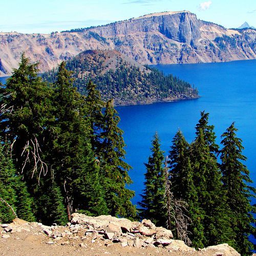
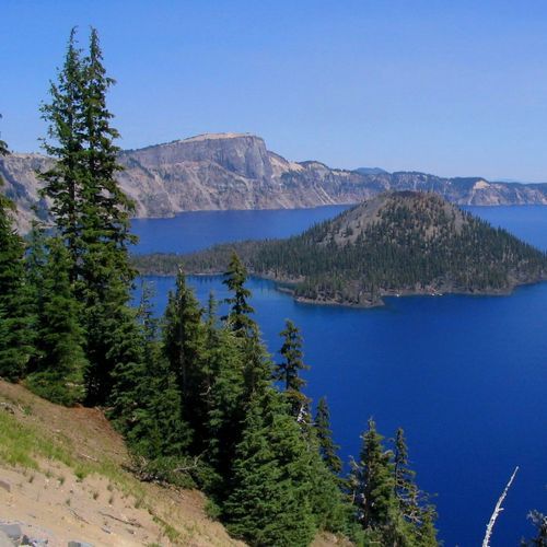
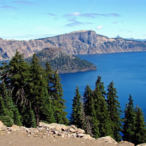
Crater Lake National Park packs an impressive range of hikes into a relatively compact trail system, with 24 trails that span easy walks, moderate summit outings, and a handful of genuinely strenuous routes. That variety makes the park especially satisfying for travelers who want options: quick viewpoint strolls from Rim Drive, half-day hikes along the caldera rim, and longer backcountry routes that push into forests, volcanic slopes, and Pacific Crest Trail country. Most visitors come for the lake, and rightly so, but the real pleasure of hiking here is how often the scenery shifts—from sheer rim overlooks and impossibly blue water to pumice flats, wildflower meadows, and quiet stands of mountain hemlock. The standout hikes are the ones that deliver both drama and perspective. Garfield Peak is a classic for expansive rim views, while Mount Scott offers one of the park’s best high-country panoramas for hikers willing to work for it. Watchman Peak is a favorite for a shorter climb with a big payoff, especially at sunset, and Cleetwood Cove is the essential route for anyone determined to actually reach the shoreline of the lake. Beyond the marquee trails, longer loops tied to the West Rim Trail and Pacific Crest Trail give strong hikers and backpackers a wilder, more remote version of Crater Lake—one defined less by overlooks and more by solitude, volcanic terrain, and the pleasure of moving through a landscape shaped by snow, fire, and eruption. What makes hiking here special is the setting itself. Few parks offer this combination of altitude, volcanic geology, and such an intensely colored lake as a constant visual anchor. Even an easy trail can feel dramatic when it tracks the edge of a collapsed volcano, and a moderate hike often ends with a viewpoint that would be the signature scene in another park. The season is relatively short, with the best hiking concentrated from mid-summer into early fall, which only heightens the sense that Crater Lake is a place to catch at its peak: clear air, open trails, and some of the most memorable day hiking in the Pacific Northwest.

Garfield Peak Trail

Garfield Peak Trail

Moderate3.5 mi

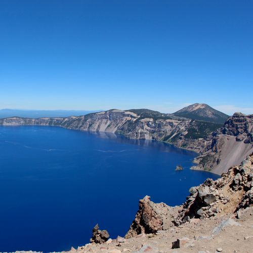
Climb through a forest of hemlocks and Shasta red firs, transitioning to whitebark pines near the summit. Enjoy stunning views of the lake, including Wizard Island and Phantom Ship, with the Klamath Basin stretching to the south. The trail offers a variety of wildflowers and wildlife, including American pikas and yellow-bellied marmots.

Mount Scott Trail

Mount Scott Trail

Moderate4.4 mi

Climb to the highest point, offering breathtaking 360-degree views of the surrounding landscape, including the lake, the High Cascades, and the Klamath Basin. The ascent passes through diverse habitats, from open pumice fields to forests of mountain hemlock and whitebark pine, with vibrant alpine wildflowers in mid-summer. A historic fire lookout tower crowns the summit, providing a unique vantage point for taking in the expansive vistas.

Watchman Peak Trail

Watchman Peak Trail

Moderate1.7 mi

This scenic hike offers breathtaking views of Zion Canyon and the iconic Watchman Peak. Starting near the visitor center, it ascends through desert greenery and offers a panoramic viewpoint. The trail is moderately strenuous and suitable for families, though it requires caution due to full sun exposure and some cliff edges.

Wizard Island Summit Trail

Wizard Island Summit Trail

Moderate2.2 mi

Climb a rocky path to the summit of a volcanic cinder cone, offering breathtaking views of a deep, pristine lake. The summit features a 90-foot-deep crater, known as the Witches Cauldron, surrounded by a loop trail that showcases diverse volcanic rock colors and wildflowers. Accessible only by boat, this hike rewards visitors with stunning vistas of surrounding peaks and bays.

Cleetwood Cove Trail

Cleetwood Cove Trail

Easy1 mi

This trail offers the only legal access to the lake's shoreline, featuring a steep descent through switchbacks. It leads to a marina where visitors can take boat tours or enjoy swimming and fishing. The trail is known for its challenging grade and scenic views of the surrounding landscape.

Annie Creek Trail

Annie Creek Trail

Easy1.6 mi

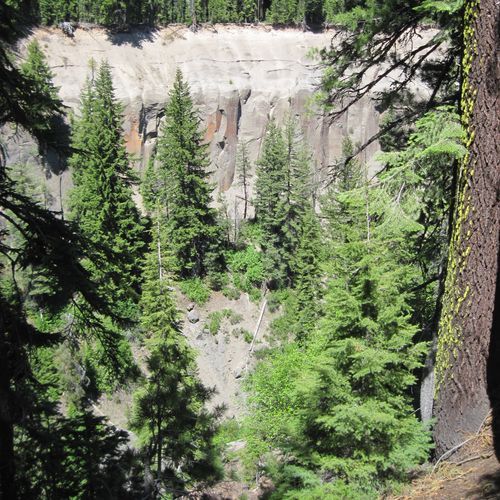
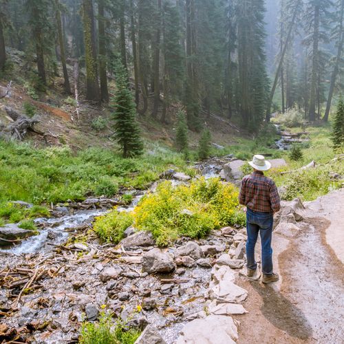
Descend into a deep, wooded canyon, surrounded by mountain hemlock, lodgepole pine, and Shasta red fir. The path follows a stream, passing small cascades and clear pools, and offers views of volcanic pinnacles. Wildflowers like Macloskey’s Violet and broadleaf lupine add color to the forest floor. The canyon's unique geology and diverse flora make it a peaceful and picturesque destination.

Bald Crater Loop Trail

Bald Crater Loop Trail

Difficult12.4 mi

This trail offers a serene journey through a forest of lodgepole pines, providing opportunities to connect with other trails in the area. The landscape is dotted with natural beauty, making it a great choice for those seeking solitude and exploration.

Castle Crest Trail

Castle Crest Trail

Easy0.8 mi

This trail loops through a vibrant wildflower meadow, supported by five natural springs that create a moist environment. The path crosses a small brook via footbridges, offering a serene and picturesque hike amidst a variety of wildflowers during the summer months.

Fumarole Bay Trail

Easy0.7 mi

This trail leads to a picturesque cove on Wizard Island, offering opportunities for swimming and fishing in the crystal-clear waters of Crater Lake. The path is rocky and provides a unique experience amidst volcanic landscapes.

Godfrey Glen Trail

Easy1.1 mi

This short loop trail traverses a wooded promontory between two deep canyons, offering dramatic views of volcanic cliffs and pinnacles. The path winds through a forest of hemlock and red fir trees, with limited undergrowth in drier areas but richer wildflowers in moister sections. The trail is dog-friendly and suitable for all skill levels.

Grayback Road

Difficult8.1 mi

This trail offers a unique blend of scenic views and diverse wildlife, repurposing an existing road for hikers, bikers, and equestrians. It provides access to less crowded areas of the park, promoting a more immersive natural experience.

Lady of the Woods Trail

Lady of the Woods Trail

Easy0.7 mi

Wander through a serene forest featuring large old-growth trees and historic stone structures. The trail highlights a unique boulder carved with a woman, created by Earl Russell Bush in 1917. The area also showcases rustic architecture from the early 20th century, blending seamlessly into the natural landscape. Visitors pass through a residential area for park employees, offering a glimpse into the park's history and design principles.

Lightning Spring Trail

Moderate4.2 mi

Descend through old-growth mountain hemlocks and Shasta red firs, passing patches of pumice from Mount Mazama's eruption. The trail features the emergence of Lightning Springs, fed by melting snow, and offers views of wildlife like mule deer and raptors. It contours beneath the Watchman Lava Flow before meeting the Pacific Crest Trail.

Plaikni Falls Trail

Plaikni Falls Trail

Easy1 mi

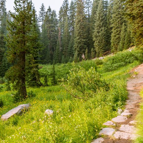
Wander through a serene old-growth forest of hemlock and fir trees, flanked by rocky bluffs and vibrant wildflowers. The path leads to a picturesque waterfall, originating from a spring in the high country. The surrounding landscape is characterized by glacier-carved cliffs and petrified volcanic ash, remnants of ancient volcanic activity. The area's unique geology and diverse flora create a tranquil oasis, perfect for photography and nature appreciation.

Pumice Flat Trail

Difficult5.9 mi

This trail offers a unique blend of natural beauty, featuring varied terrain and scenic views. It provides an opportunity to experience the diverse ecosystems within the park, including forests and potentially barren areas like the Pumice Desert.

Rim Trail

Moderate5.5 mi

This trail provides stunning vistas of natural formations and diverse landscapes. It is designed to showcase the unique geological features of the area, offering a mix of scenic overlooks and varied terrain.

Sun Notch Trail

Easy0.7 mi

A short uphill walk begins in a forest of Mountain Hemlock, then passes through an open pumice meadow to the rim, offering stunning views of Phantom Ship and the surrounding caldera. The trail contours along the rim, providing vistas of the Chaski Slide and Dutton Cliff. Located in a glacial valley, this path is a highlight for its scenic overlooks and unique geological features.

The Pinnacles Trail

The Pinnacles Trail

Easy0.7 mi

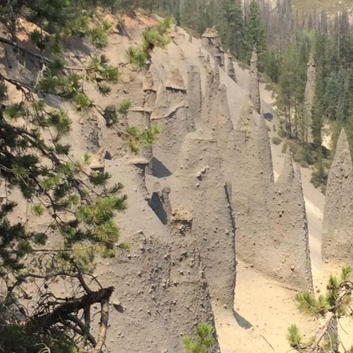
Venture into a landscape of otherworldly spires, remnants of an ancient volcanic eruption. These towering formations, known as the Pinnacles, are made of pumice and were formed by hot gases escaping from fumaroles. Over time, erosion stripped away the surrounding softer material, leaving the hardened pinnacles standing. The trail offers a unique perspective on the park's volcanic history and geology. The vibrant colors of the pinnacles, ranging from pale cream to deep rust, provide a striking contrast to the surrounding greenery and blue skies. A must-see for geology enthusiasts and those seeking a unique hiking experience.

Union Peak Trail

Union Peak Trail

Moderate2.4 mi

This trail offers a scenic hike through a lodgepole pine forest before ascending to a rocky summit with spectacular views. The final climb is steep and rocky, providing panoramic vistas of the surrounding landscape, including Mount McLoughlin and Mount Shasta.

Bert Creek Trail

Easy1.5 mi

No description available

Boundary Springs Trail

Moderate3.5 mi

This trail leads to the headwaters of the Rogue River, originating from snowmelt. It passes through a mix of forest and meadows, offering views of wildflowers and waterfalls. The trail is less crowded, providing a serene hiking experience amidst natural beauty.

Bybee Creek

Easy0.3 mi

This trail offers a serene walk through a forested area, often part of longer backpacking routes. It provides access to campsites like Bybee Creek, which are popular for those hiking segments of the Pacific Crest Trail. The trail's surroundings are rich in natural beauty, with opportunities to see wildlife and enjoy the peaceful atmosphere of the forest.

Rim Promenade

Moderate2.8 mi

Guardrail Trail

Easy0.1 mi

No description available

Get offline trail maps and detailed hiking info in the Parka app

Download Parka — It's Free

Get offline trail maps for Crater Lake National Park

Free on the App Store

Get Parka

Why Park Lovers Choose Parka

Trip Planner

All the tools for epic adventures

Works Offline

Fully functional without cell service

Updated Weekly

Trail conditions, alerts, and closures

Try Risk-Free

7-day free trial, cancel anytime

Start Your 7-Day Free Trial

Unlock everything you need for your next national park trip. Your first week is on us!

National Park vista

Start your adventure today

Download Parka and plan your perfect national park trip in minutes.