ParkaDownload
Great Smoky Mountains National Park

Trails in Great Smoky Mountains National Park

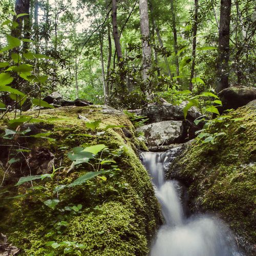
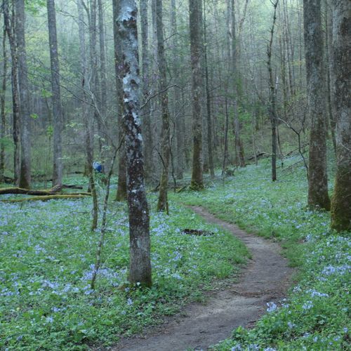
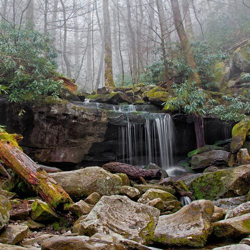
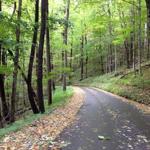
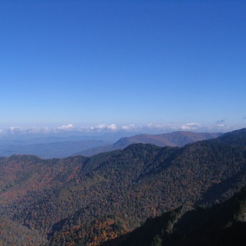
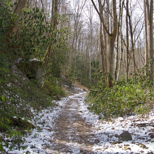
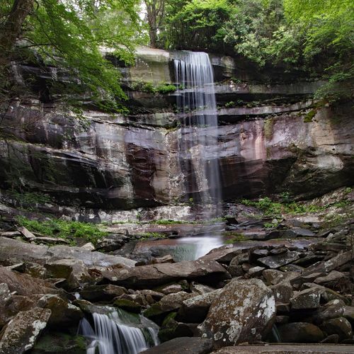
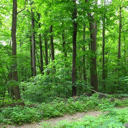
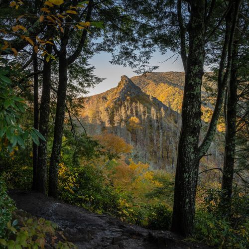
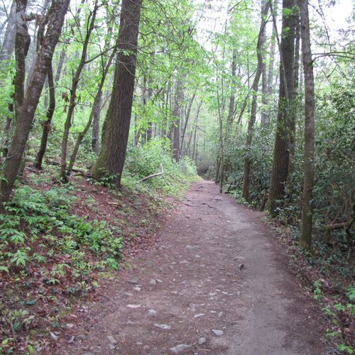
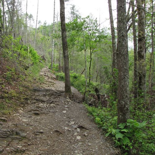
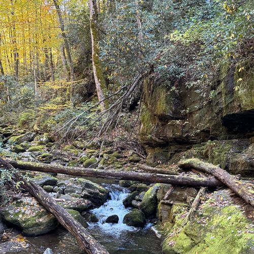
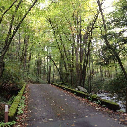
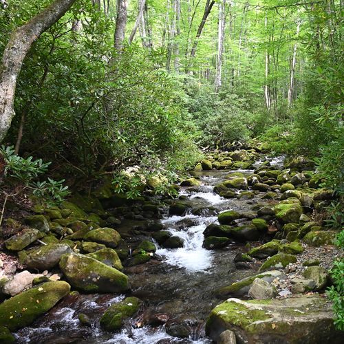
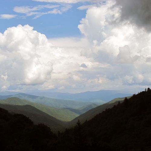
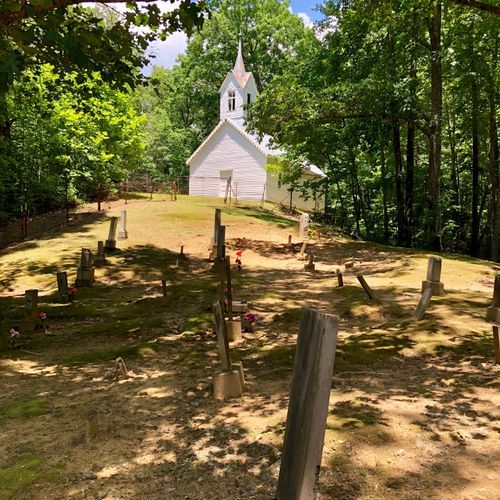
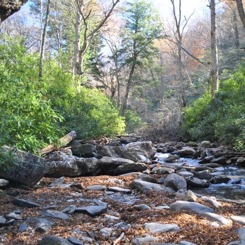
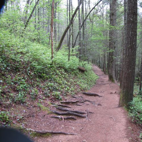
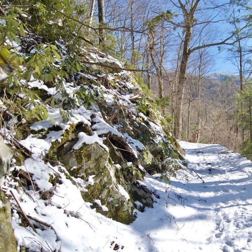
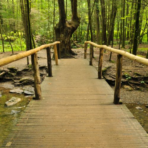
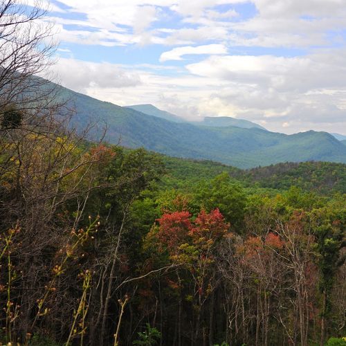
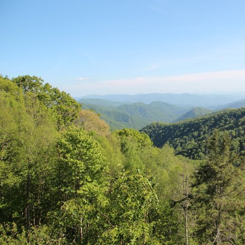
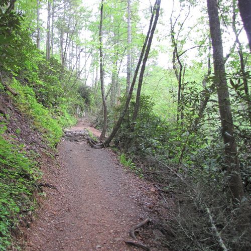
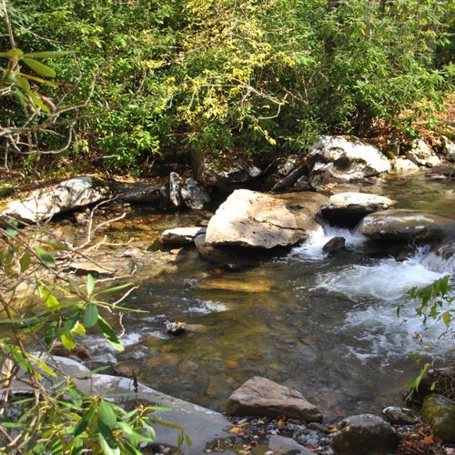
Great Smoky Mountains National Park is one of the country’s deepest hiking parks, with nearly 200 named trails and more than 800 miles of footpaths threading through old-growth forest, high ridgelines, stream valleys, and historic backcountry. The range is impressive: plenty of easy walks for families and casual hikers, a strong lineup of moderate routes, and no shortage of difficult and even extreme trails for ambitious days in the mountains. You can spend a morning on a gentle creekside loop, tackle a steep half-day climb to a major overlook, or set out on a long backcountry traverse that feels truly wild. That variety is one of the Smokies’ greatest strengths: this is a park where beginners and seasoned hikers can both find exactly the right trail. Standout hikes help define the Smokies experience. Alum Cave to Mount LeConte is a classic, pairing dramatic geology with big-mountain atmosphere and some of the most satisfying climbing in the park. Chimney Tops is shorter but punchier, a steep, popular ascent with striking views and a real sense of payoff. For high-country hikers, the Appalachian Trail brings a legendary dimension, tracing the crest of the park for more than 70 miles and linking bald summits, deep gaps, and long-range vistas. Just as memorable, though, are the quieter trails that pass through rhododendron tunnels, hardwood coves, mossy creeks, and remnants of Appalachian homesteads. Hiking here feels immersive in every season—wildflowers in spring, dense green canopy in summer, crisp views and color in fall, and unexpected openness in winter—making the Smokies a park you can return to again and again without repeating the same experience.

Alum Cave Trail

Alum Cave Trail

Moderate5 mi

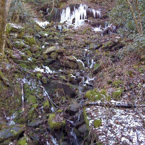
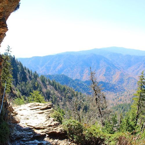
This trail offers a mix of geological formations, historical significance, and breathtaking views. Hikers pass under Arch Rock, a natural arch formed by erosion, and ascend to Inspiration Point for commanding views. The trail continues to Alum Cave Bluffs, a concaved bluff with stunning icicle formations in winter, before reaching the summit of Mt. LeConte.

Gabes Mountain Trail to Hen Wallow Falls

Moderate4.5 mi

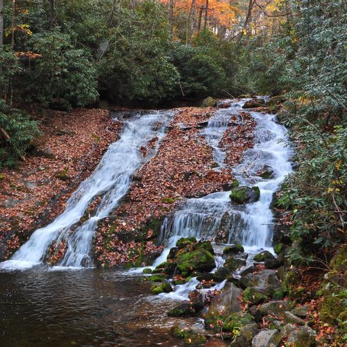
This trail winds through a lush hardwood forest featuring hemlock and rhododendron, culminating in the picturesque Hen Wallow Falls. The hike offers a family-friendly experience with interesting rock formations and creek crossings along the way.

Gregory Ridge Trail

Gregory Ridge Trail

Difficult11.3 mi

This trail leads to a stunning grassy bald, famous for its vibrant flame azaleas that bloom in late June. The hike offers panoramic views of Cades Cove and surrounding mountains. The trail traverses through diverse landscapes, including old-growth forests and scenic ridges, culminating in a breathtaking summit experience.

Indian Creek Trail

Indian Creek Trail

Easy1.7 mi

The Indian Creek Trail offers a scenic hiking experience surrounded by natural beauty. This trail features varied terrain and is suitable for adventurers looking for moderate challenges. With stunning views and diverse wildlife, it provides an excellent opportunity for nature enthusiasts to explore the area.

Kuwohi Trail (Clingman's Dome)

Kuwohi Trail (Clingman's Dome)

Moderate1.3 mi

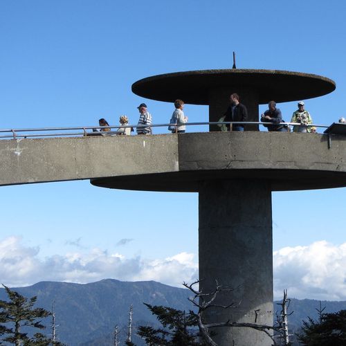
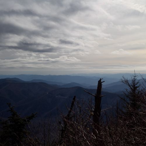
Walk a steep, paved path through high-elevation spruce-fir forest to a round observation tower on Kuwohi (formerly Clingmans Dome), the highest peak in the Smokies, offering panoramic 360-degree views. It connects with the Appalachian Trail and offers stunning vistas, especially during sunrise and sunset.

Laurel Falls Trail

Laurel Falls Trail

Easy2.6 mi

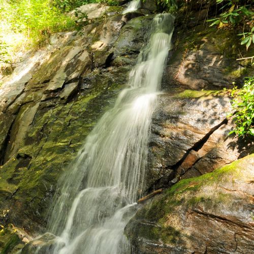
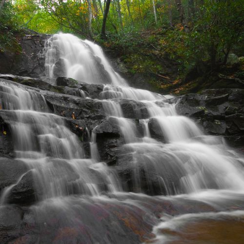
This trail leads to one of the most photographed waterfalls in the Smoky Mountains. The path is paved for the first 1.3 miles, making it accessible for families and offering a gentle walk through a forest adorned with mountain laurel. The waterfall is divided into upper and lower sections by a walkway, providing stunning views and photo opportunities.

Mount Cammerer Trail

Mount Cammerer Trail

Difficult11.3 mi

Ascend through hardwood forests and spruce-fir zones to reach the historic Mount Cammerer firetower. Enjoy panoramic views of the surrounding mountains and valleys, including the Great Smoky Mountains. This hike offers a mix of scenic vistas and historic sites, making it a rewarding challenge for hikers.

Rainbow Falls Trail

Rainbow Falls Trail

Moderate5.2 mi

Descend through a lush forest to reach a stunning 100-foot waterfall. The trail features a unique landscape with burnt trees, offering an otherworldly view. The hike is a reverse trail, meaning it's downhill to the falls and uphill back, making it a moderate challenge.

Ramsey Cascades Trail

Ramsey Cascades Trail

Difficult7.8 mi

This hike traverses through beautiful hardwood forests and follows wild mountain streams, culminating at the 105-foot Ramsey Cascades waterfall. The trail passes through an old-growth forest with giant trees and a thick understory of wild rhododendron, offering a picturesque hiking experience.

Trillium Gap Trail to Grotto Falls

Trillium Gap Trail to Grotto Falls

Moderate2.6 mi

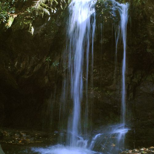
This trail ascends through an old-growth forest, featuring giant hemlocks and wildflowers in the spring. It passes behind Grotto Falls, one of the park's most picturesque waterfalls, and continues to Trillium Gap. The trail offers stunning views of the surrounding mountains and is a popular choice for those seeking a mix of natural beauty and challenging terrain.

Abrams Falls Trail

Abrams Falls Trail

Moderate5 mi

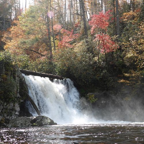
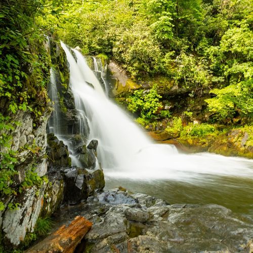
This trail follows Abrams Creek, offering stunning views of a pine-oak forest on the ridges and a hemlock and rhododendron forest along the creek. The hike culminates at Abrams Falls, the most voluminous waterfall in the park, known for its picturesque pool and dangerous currents. Wildlife spotting opportunities abound, including white-tail deer and black bears.

Boulevard Trail

Boulevard Trail

Difficult5.1 mi

This trail offers stunning views from multiple vantage points, including the summit and Myrtle Point. It follows a mountain ridge, providing diverse terrain and scenic vistas of the surrounding mountains. The trail features a mix of balsam firs and red spruce, with notable geological features along the way.

Cades Cove Loop Road

Cades Cove Loop Road

Easy10.5 mi

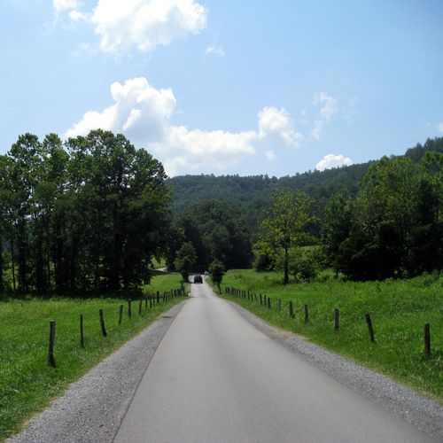
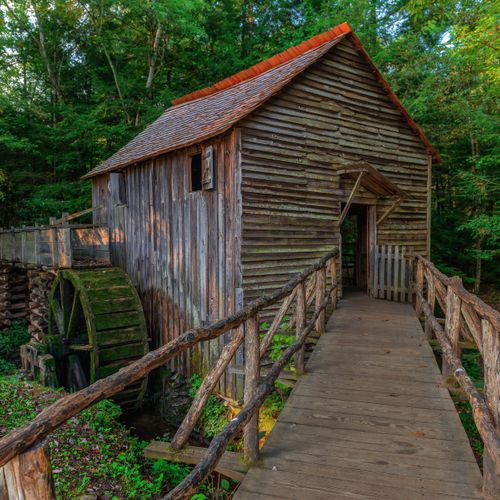
Surrounded by majestic mountains, this scenic drive winds through a valley filled with historic structures, including log cabins, churches, and a working grist mill. The area is renowned for its diverse wildlife, offering frequent sightings of white-tailed deer, wild turkeys, and black bears. Scenic overlooks provide stunning views of the surrounding landscape, while historic sites offer a glimpse into the lives of early settlers. Visitors can explore these sites, enjoy wildlife viewing, and take in the natural beauty of the area.

Chimney Tops Trail

Chimney Tops Trail

Moderate2 mi

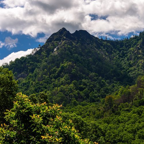
This popular, steep, and often rocky trail climbs through forest to an overlook of the Chimney Tops pinnacles and surrounding mountains. The route includes bridges and stairs and shows lingering signs of the 2016 wildfires. Expect challenging, steep sections and heavy use at the trailhead.

Cucumber Gap Trail

Cucumber Gap Trail

Moderate5.3 mi

This trail offers a scenic loop through a historic district, featuring wildflowers, streamside views, and historic cabins. The path includes sections of old logging roads and narrower trails, with moderate climbs and scenic overlooks. It's a great option for those interested in history and natural beauty.

Deep Creek Trail

Deep Creek Trail

Extreme13.9 mi

This trail follows Deep Creek upstream, offering stunning views of waterfalls and surrounding mountain landscapes. It passes through lush forests and offers access to several backcountry campsites. The trail is rich in history, having been one of the first constructed by the Civilian Conservation Corps in the early 1930s.

Gregory Bald Trail

Gregory Bald Trail

Difficult8.9 mi

This trail leads to a stunning 10-acre grassy meadow, offering breathtaking panoramic views. The path is adorned with vibrant flame azaleas in late June, creating a spectacular display of colors. The meadow's origins are shrouded in mystery, with theories suggesting natural or human intervention. The hike is rewarded with scenic vistas and unique flora, making it a popular destination despite its challenging ascent.

Rich Mountain Loop

Difficult8.3 mi

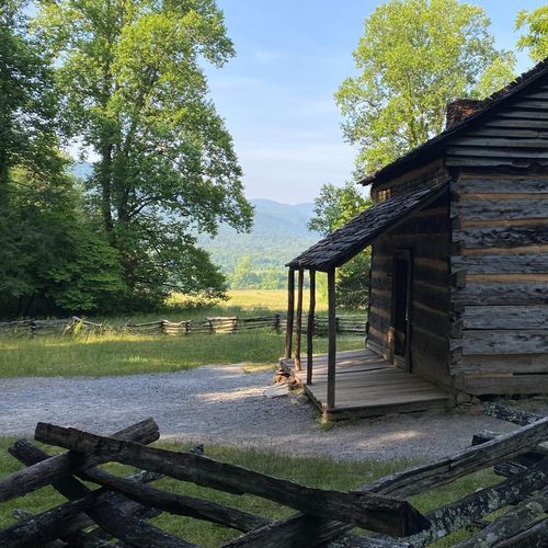
This scenic route offers a peaceful alternative to the busy Loop Road, beginning near its entrance and tracing the edges of open fields before arriving at the historic John Oliver Cabin. From there, the trail climbs steadily toward the crest of Rich Mountain and links up with the Indian Grave Gap and Crooked Arm Ridge trails. Along the way, hikers may spot white-tailed deer grazing in the meadows and, on occasion, a black bear moving through the forest.

Ace Gap Trail

Ace Gap Trail

Difficult5.3 mi

This trail offers a pleasant journey through oak and pine forests, with notable features like the Bull Cave and remnants of an old railroad bed. The trail follows the park's northwestern boundary, offering views of surrounding homes and the occasional wildlife sighting. It's a less crowded option for those seeking a peaceful hike.

Albright Grove Loop Trail

Easy0.6 mi

This trail winds through a stunning old-growth forest, highlighted by towering tulip poplars and eastern hemlocks. The forest is home to some of the park's oldest and tallest trees, offering a glimpse into a largely untouched ecosystem. The trail follows a small creek and offers solitude amidst the natural beauty of the forest.

Anthony Creek Trail

Difficult3.4 mi

This trail offers a scenic hike through mountain laurel tunnels and stunning views from Spence Field. The route follows Anthony Creek, passing by the horse camp and through forests of hemlock and rhododendron. It's a challenging climb but rewards hikers with breathtaking vistas and wildflowers in late spring.

Avent Cabin Access

Easy0.1 mi

Follow the Jakes Creek Trail through remnants of old cottages to reach the Avent Cabin, a historic log cabin built in 1845. This cabin served as the summer studio of artist Mayna Treanor Avent from the 1920s to the 1940s. The path offers a quiet forest hike with a glimpse into the region's past, featuring natural beauty and historical significance.

Balsam Mountain Nature Trail

Easy0.7 mi

This trail offers a serene journey through a high-elevation forest, featuring unique plant species and scenic views. The trail's terrain is varied, with some rocky sections and steps, providing an engaging hike for those interested in nature and wildlife.

Balsam Mountain Trail

Balsam Mountain Trail

Difficult9.9 mi

This trail offers a scenic hike along the ridge, providing excellent views of the surrounding mountains. It is part of a larger network of trails in the area and is known for its relatively level upper section, making it less strenuous compared to other trails in the region.

Balsam Point Quiet Walkway

Easy0.9 mi

This trail provides a peaceful, easy walk through a mixed forest, featuring a variety of wildflowers and scenic views of the river. It is a great option for those looking for a short, accessible hike.

Baskins Creek Cemetery Access Trail

Easy0.1 mi

This short trail leads to a secluded cemetery, offering a glimpse into the region's history. The surrounding landscape features dense forests and mountain vistas, typical of the Smoky Mountains.

Baskins Creek Trail

Baskins Creek Trail

Moderate2.7 mi

This trail winds through a forest of Northern red oaks, Eastern hemlocks, and striped maples, leading to a secluded 40-foot, two-tiered waterfall. The hike offers scenic views of the mountains and Gatlinburg, especially during winter and early spring. The trail features a mix of easy climbs and steep descents, making it a moderate hike suitable for those seeking less crowded paths.

Baxter Creek Trail

Baxter Creek Trail

Difficult6 mi

Climb through stunning old-growth forests, featuring large tulip poplars and diverse flora. The trail offers breathtaking views from the summit of Mt. Sterling, including the surrounding Smoky Mountains and the Cataloochee Valley. The hike culminates at a 60-foot fire tower, built by the Civilian Conservation Corps in 1935.

Bear Creek Trail

Extreme5.7 mi

Winds through a rich hardwood forest, offering glimpses of the park's diverse flora and fauna. The trail follows the course of a cascading creek, providing serene water views and the soothing sound of flowing water. Hikers may spot various species of wildlife, including black bears, which are frequently sighted in this area. The trail also offers access to several backcountry campsites for those seeking a more immersive wilderness experience. In the spring, the trail is adorned with a colorful display of wildflowers, adding to its natural beauty.

Big Creek Trail

Big Creek Trail

Moderate5.2 mi

This trail offers a tranquil forest setting with vibrant wildflowers in early spring. It features a refreshing swimming hole and stunning waterfalls, providing picturesque views of the river. The trail connects to additional scenic routes, making it a versatile option for hikers.

Big Fork Ridge Trail

Moderate3.1 mi

This trail traverses a scenic ridge, offering views of the surrounding valleys. It connects the Caldwell Fork valley with the Cataloochee Valley, an area known for its historic settlements and old-growth forests. Hikers may spot elk and enjoy the diverse landscape of the Smoky Mountains.

Bone Valley Trail

Bone Valley Trail

Difficult7.4 mi

This trail leads through a picturesque valley, offering a serene and easy hike suitable for beginners. The landscape is characterized by a wide, flat plain that was once farmed, providing a unique glimpse into the region's history.

Boogerman Trail

Boogerman Trail

Moderate7.5 mi

Hike through an old-growth forest with some of the tallest trees in the region, including massive tulip poplars and white pines. The trail passes historic sites like the Carson Messer farmstead and Boogerman's homesite, offering insights into the lives of early settlers. Multiple creek crossings add to the adventure, with scenic views of small waterfalls along the way.

Bote Mountain Trail

Difficult6.8 mi

This trail offers a demanding climb through varied landscapes, eventually connecting to the Appalachian Trail. It is popular among hikers and horseback riders, providing a moderate to heavily trafficked experience.

Bradley Fork Trail

Difficult7.2 mi

This trail offers a serene journey along the Bradley Fork, featuring old roadbeds, wooden bridges, and diverse wildflowers in spring. The path is shared with horses and provides access to several campsites, making it a versatile option for hikers and nature enthusiasts.

Brushy Mountain Trail

Difficult4.8 mi

This trail winds through old-growth cove-hardwood forests, featuring large eastern hemlocks and vibrant wildflowers like trillium. The hike culminates at Grotto Falls, where you can walk behind the 25-foot waterfall, and continues to Brushy Mountain for stunning views of the surrounding peaks, including Mount Le Conte and Mount Guyot.

Bull Head Trail

Difficult6.4 mi

This trail offers breathtaking views of the surrounding mountains and features a unique rock structure known as The Pulpit. Hikers pass through rhododendron groves and experience a mix of rugged terrain and scenic vistas. The trail is known for its less crowded paths compared to other trails in the area.

Bullhead View Quiet Walkway

Bullhead View Quiet Walkway

Easy1.1 mi

This trail offers a serene walk along the river, featuring a mix of forest types and seasonal wildflowers. It includes a small wooden bridge and scenic views of the surrounding landscape, making it a pleasant, easy stroll.

Cades Cove Horse Trail

Cades Cove Horse Trail

Moderate2.9 mi

Ride through an old-growth forest, passing historic structures and offering views of mountain streams. Wildlife such as turkeys, deer, and bears are commonly seen. The gentle pace allows for an immersive experience of the natural beauty and cultural heritage of the area.

Cades Cove Nature Trail

Cades Cove Nature Trail

Easy0.8 mi

This trail offers a glimpse into the past with remnants of a once-thriving chestnut grove. It winds through a mix of oak, dogwood, sourwood, and pine trees, providing a serene and educational hike. The trail is particularly beautiful during spring when dogwoods bloom and in fall when sourwoods and maples turn vibrant colors.

Caldwell Fork Trail

Difficult6.2 mi

This trail features historic mountain homesteads with remnants of stone walls and offers scenic creek crossings, including the iconic 'Indiana Jones' bridges. The hike includes several water crossings, requiring preparation for wading. The terrain varies from smooth to steep and rocky, offering a diverse hiking experience.

Camel Gap Trail

Moderate5.1 mi

This trail offers a gradual climb through dense forests, culminating in stunning views from Camel Gap. It features picturesque creek crossings and the chance to spot trout in the streams. The trail is particularly vibrant during the fall months with its colorful foliage.

Cataloochee Divide Trail

Extreme20.9 mi

Experience stunning vistas from mountain ridges, including Gooseberry Knob and Hemphill Bald. The trail offers a mix of forested sections and open balds, providing diverse landscapes and wildlife viewing opportunities. It is particularly scenic during winter, with expansive views unobstructed by foliage.

Chasteen Creek Trail

Difficult4.2 mi

This hike follows the Bradley Fork Trail and then the Chasteen Creek Trail, offering scenic views of a creek and a picturesque waterfall. The trail passes through a hardwood forest with opportunities to see wildflowers in spring. It's a family-friendly hike suitable for all ages, with minimal elevation gain and well-maintained paths.

Chestnut Top Trail

Chestnut Top Trail

Difficult6.5 mi

This trail traverses a mixed forest with abundant wildflowers in the spring, offering views of the surrounding mountains. The path follows a ridge, providing glimpses of Tuckaleechee Cove and the broader mountain landscape. The forest floor, covered with pine needles, provides a soft footing for hikers.

Cliff Top Trail

Cliff Top Trail

Easy0.4 mi

A short, steep climb leads to breathtaking views from a mountain summit. The trail winds through a dense forest, often wet and icy after rain, before reaching the top. Here, hikers are rewarded with stunning vistas, particularly during sunset. The nearby LeConte Lodge offers a convenient resting point, though the trail itself is a highlight for those seeking panoramic views of the surrounding mountains.

Cooper Road Trail

Cooper Road Trail

Difficult10.4 mi

This trail offers a glimpse into the region's rich history as a former Indian trail. It traverses through diverse forest landscapes, providing opportunities to spot local wildlife. The trail's varied terrain makes it suitable for experienced hikers seeking a challenge.

Cove Hardwood Nature Trail

Cove Hardwood Nature Trail

Easy0.7 mi

This trail offers a picturesque journey through a mix of old and new growth forests, featuring some of the best wildflower displays in the area. The scenic loop is perfect for nature enthusiasts and photographers, with its beautiful foliage and diverse wildlife. It's an ideal spot for a family outing or a quick escape into nature.

Cove Mountain Trail

Cove Mountain Trail

Moderate8.6 mi

This trail features waterfalls, old-growth forests, and scenic mountain vistas. It passes through a canopy of rhododendron and offers glimpses of Mount LeConte. The trail culminates at an old fire tower, now used for air quality monitoring.
Crooked Arm Ridge Trail

Crooked Arm Ridge Trail

Moderate2.1 mi

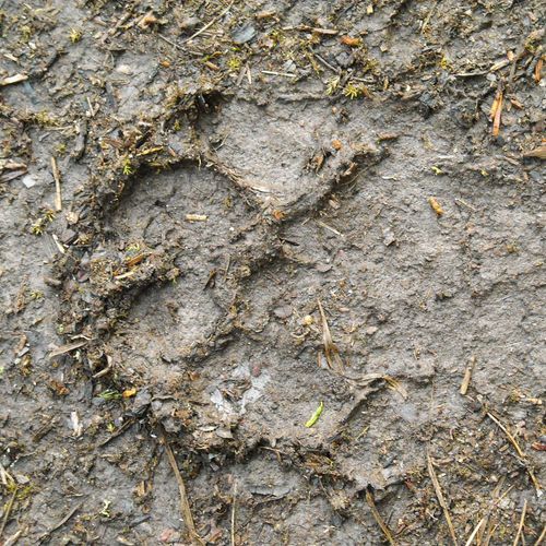
This trail climbs steeply through switchbacks, providing beautiful views of Cades Cove. It connects the Rich Mountain Loop Trail and Indian Grave Gap Trail, offering a challenging hike with scenic rewards.

Curry Mountain Trail

Curry Mountain Trail

Moderate3.4 mi

This trail provides a peaceful hike through a quiet forest, with initial steep climbs offering views into Wears Valley. It features flowering rhododendron and flame azaleas during peak wildflower season. The trail ends at the Meigs Mountain Trail junction, allowing for further exploration or a return hike.

Davenport Gap Shelter access

Easy0.1 mi

This short trail provides easy access to the Davenport Gap Shelter, nestled in the mountains. The shelter is a key stop for hikers on the Appalachian Trail, offering a place to rest and enjoy the surrounding landscape.

Deep Creek Horse Trail

Easy1.8 mi

This trail offers a scenic route behind Juneywhank Falls, providing a tranquil and picturesque experience. It is suitable for horseback riding and offers a serene natural setting.

Deep Low Gap Trail

Difficult5.6 mi

This trail offers a rugged journey through dense forest, featuring challenging terrain typical of the Smoky Mountains. While scenic views are limited, the hike provides an immersive experience with diverse flora and fauna.

E E McCarter Cemetery

Easy0.3 mi

This trail leads to the E.E. McCarter Cemetery, a historic site filled with moss-covered graves and intriguing headstones. The walk is through a valley rich in historical artifacts, offering a glimpse into the past lives of the area's former inhabitants.

Elijah Oliver Cabin Access Trail

Elijah Oliver Cabin Access Trail

Easy0.1 mi

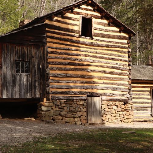
This trail leads to the Elijah Oliver Cabin, a historic dog trot-style cabin featuring a unique stranger room for guests and a springhouse that ensured clean water for the family. The area offers a glimpse into the past life of settlers in the Smoky Mountains, with opportunities to spot wildlife along the way.

Elkmont Nature Trail

Elkmont Nature Trail

Easy0.7 mi

This trail offers a serene walk through a forested area with historical significance, providing a peaceful escape for nature lovers. It is well-suited for families and those seeking a gentle hike. The trailhead is conveniently located near a large campground, making it easily accessible for campers and day visitors alike.

Flat Creek Trail

Moderate2.6 mi

This trail offers a serene hike through a forested area, featuring lush vegetation and the sounds of creeks. The trail's scenic beauty includes diverse tree species and wildlife habitats, although specific views may vary depending on the trail's exact location.

Fork Ridge Trail

Difficult5 mi

This trail offers a steep climb through varied mountain environments, featuring scenic vistas and diverse flora. It is known for its rugged terrain and significant elevation change, making it suitable for experienced hikers seeking a challenging adventure.

Forney Creek Trail

Forney Creek Trail

Extreme11.1 mi

This trail offers a unique blend of natural beauty and historical significance. Starting from a high elevation, it rapidly descends through several forest types, eventually following an old logging railroad bed. The route passes by Forney Creek, which can be swollen after rains, and offers insights into the region's past industrial activities. The trail's varied landscapes and historical artifacts make it a compelling choice for hikers seeking both adventure and educational experiences.

Forney Ridge Trail

Forney Ridge Trail

Moderate3.8 mi

This trail descends through spruce-fir forests, offering a dramatic change in terrain from steep and bouldery to flat and mucky. It features high-quality trail work, including gravel-filled steps and raised boards to prevent erosion. The trail is known for its diverse flora and fauna, including Skunk Goldenrod and various fungi species. Beyond Andrews Bald, the trail becomes more challenging, earning its historical nickname 'Rip-Shin Ridge'.

Gatlinburg Trail

Gatlinburg Trail

Easy1.3 mi

Follow the West Prong of the Little Pigeon River through a forest of second-growth hardwoods and rhododendron thickets. The path offers beautiful river views, including rapids and cascades, and crosses the river via a sturdy footbridge. Remnants of old homesteads, such as stonewalls and chimneys, are visible along the way. This trail is unique for allowing dogs on leashes and bicycles, making it a popular choice for families and those seeking a convenient, scenic hike.

Gold Mine Trail

Easy1 mi

This trail winds through a picturesque forest, offering glimpses into the area's gold mining past. The route passes by the remnants of old mines, providing a unique blend of natural beauty and historical significance. The forest's diverse wildlife and seasonal changes make it an engaging hike year-round.

Goshen Prong Trail

Difficult7.4 mi

This trail ascends through forests, following Fish Camp Prong and Goshen Prong streams, offering scenic views of cascades and waterfalls. The path becomes more challenging as it climbs, featuring diverse plant life and occasional rock formations. The trail ends at the Appalachian Trail, providing access to broader hiking networks.

Grapeyard Ridge Trail

Grapeyard Ridge Trail

Difficult7.5 mi

This trail traverses through rolling hills and ravines, offering scenic views of Rhododendron Creek and its namesake thickets. The highlight is the wreck of a steam engine, a relic from the logging era, lying in Injun Creek. The trail's moderate terrain makes it accessible to a variety of hikers.

Gunter Fork Trail

Gunter Fork Trail

Moderate4 mi

This trail offers a challenging ascent up Balsam Mountain, featuring scenic views and diverse flora, including the Appalachian Chanterelle. The route involves difficult water crossings, especially in spring, and leads to the base of Gunter Fork Cascade, a notable geological feature.

Hazel Creek Trail

Hazel Creek Trail

Extreme9.4 mi

This trail follows a historic valley once home to thriving communities, now reclaimed by nature. It passes through areas of significant logging and mining history, with remnants like old kilns and cemeteries. The trail offers scenic views of streams and forests, including hazel trees that line its banks. It also features historic sites such as the Hall Cabin and the remains of the Kress family's hunting lodge.

High Rocks Trail

High Rocks Trail

Easy0.3 mi

This trail offers a scenic hike to a former fire tower site, providing panoramic views of the surrounding landscape. The area is rich in history and natural beauty, though specific details about this trail are not well-documented in national park sources.

Hughes Ridge Trail

Moderate4.6 mi

This trail offers a scenic journey through Red Spruce forests, featuring undulating terrain that intersects with the Appalachian Trail. It provides stunning views of the surrounding landscape, including the unique drainage patterns of nearby streams. The trail's varied terrain and forest types make it a compelling choice for hikers seeking a mix of natural beauty and physical challenge.

Huskey Gap Trail

Moderate4.1 mi

This trail offers a scenic ascent through a mixed forest, featuring remnants of old homesteads and a variety of spring wildflowers like trillium and violets. The hike culminates at Huskey Gap, where it intersects with the Sugarland Mountain Trail, offering additional exploration options.

Hyatt Ridge Trail

Hyatt Ridge Trail

Moderate2.7 mi

This trail climbs through a variety of forest types, including spruce and hardwoods, offering views of the surrounding mountains. Historical logging operations are evident along the path, and the trail leads to Campsite #44, a peaceful spot amidst wildflowers and wildlife.

Indian Grave Gap Trail

Moderate3.6 mi

This trail offers stunning views of the surrounding mountains and valleys, including Cades Cove. It features a mix of pine and hardwood forests, with notable wildflowers like the flame azalea. The trail includes a steep climb up Double Mountain and passes by the remains of an old fire tower.

Jakes Creek Trail

Jakes Creek Trail

Moderate3.6 mi

Follow the old railroad route once used by the Little River Lumber Company, winding through a forest of maples and tulip trees. The trail offers scenic views and access to backcountry campsite No. 27. It connects to other trails at Jakes Gap, providing options for further exploration.

Jim Carr Place Quiet Walkway

Easy0.1 mi

This trail offers a serene walk through a mixed-mesophytic cove forest, featuring seasonal wildflowers like Bloodroot and Yellow Trillium. Signs of past habitation, such as daffodil and daylily foliage, are scattered along the path. The trail gently descends to the river, providing scenic views of the Little Pigeon River's West Prong.

John Oliver Cabin access

John Oliver Cabin access

Easy0.3 mi

Walk to the historic John Oliver Cabin, a testament to early European settlement in the area. The cabin, built without nails or pegs, showcases traditional construction techniques. The trail is wheelchair-accessible, offering a glimpse into the past amidst the scenic beauty of the surrounding landscape.

Jonas Creek Trail

Jonas Creek Trail

Moderate4 mi

This trail offers a moderate hike through diverse forest landscapes, featuring a mix of terrain that challenges and rewards hikers. The route is suitable for those seeking a scenic adventure with opportunities to connect with nature.

Juney Whank Falls Trail

Juney Whank Falls Trail

Easy0.3 mi

This trail leads to a picturesque waterfall, offering an up-close view from a footbridge. The area is rich in history, with nearby options to explore other waterfalls like Tom Branch Falls and Indian Creek Falls.

Kephart Prong Trail

Kephart Prong Trail

Easy2 mi

This trail offers a glimpse into history with remnants of a Civilian Conservation Corps camp and features scenic mountain views. It crosses several streams via log bridges and ends at the Kephart Shelter, providing opportunities for wildlife viewing and exploring the region's rich cultural heritage.

Lead Cove Trail

Lead Cove Trail

Moderate2 mi

This trail offers scenic views and historic sites, including old homesteads. It follows the Sugar Cove Prong before ascending to meet the Bote Mountain Trail. The area is known for its mountain laurel blooms in June.

Little Bottoms Trail

Little Bottoms Trail

Moderate2.2 mi

Follow this trail through a picturesque landscape, passing by Abrams Creek and an old Smokies homesite. The trail is part of a popular route to Abrams Falls, offering scenic views and access to backcountry campsite #17. It's known for its beautiful creek and historical remnants.
Little Cataloochee Trail

Little Cataloochee Trail

Difficult10.5 mi

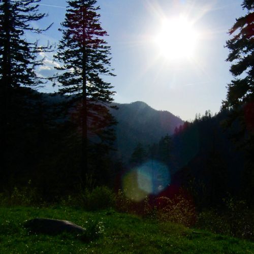
Hike through historic valleys, passing restored homesteads and churches, with opportunities to see wildlife like elk and wild turkeys. The trail features creek crossings and steep climbs, offering a glimpse into the past life of farming families.

Little Greenbrier Trail

Little Greenbrier Trail

Moderate4.3 mi

This trail winds through a hardwood forest, featuring remnants of past residents, including the historic one-room Little Greenbrier School and the preserved Walker family homesite. The area is known for its rich history and natural beauty, offering a glimpse into traditional mountain life.
Little River Trail

Little River Trail

Difficult6.2 mi

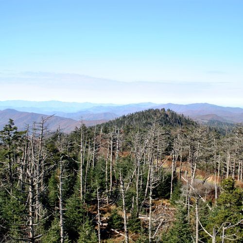
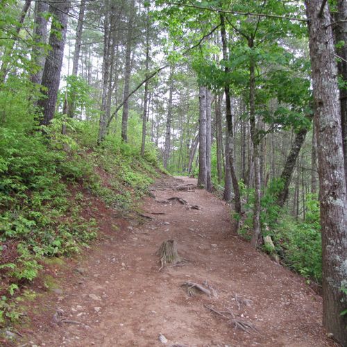
This trail traverses lowland, montane, and subalpine forests, offering stunning river views and a variety of flora. It's a great option for those seeking a mix of forest types and scenic river crossings.

Long Hungry Ridge Trail

Extreme7.3 mi

This trail offers a scenic hike through mountainous terrain, featuring a mix of forested areas and open ridges. The route includes several water crossings and climbs to offer stunning views from the higher elevations. It's part of a larger network of trails leading to notable destinations like Gregory Bald.

Look Rock Trail

Easy0.7 mi

This trail offers a short, paved path leading to an observation tower with stunning 360-degree views of the surrounding mountains and valleys. It's a family-friendly hike suitable for all ages, providing a quick and accessible way to enjoy the scenic beauty of the area. The trail is less crowded than other popular spots, making it an ideal choice for those seeking a peaceful experience.

Lost Cove Trail

Lost Cove Trail

Difficult2.7 mi

Descend into a historic valley once home to a small community, now offering glimpses into the past. The trail features old structures and a cemetery, providing a unique blend of natural beauty and historical significance.

Low Gap Trail

Low Gap Trail

Difficult4.9 mi

This challenging hike offers breathtaking views from the top of Mount Cammerer's historic fire tower. The trail features a steady ascent through a lush forest, with wildflowers blooming along the way. It's a less crowded alternative to other popular summit hikes in the area, offering solitude and panoramic views.

Maddron Bald Trail

Difficult7.1 mi

This trail leads to Maddron Bald, a mountain crowned by one of the park's most substantial heath balds, offering breathtaking views. The route passes through mixed hardwood forests and includes the Albright Grove Loop, featuring old-growth trees like tulip poplars and eastern hemlocks. The trail offers scenic stream crossings and historic sites, including the Baxter Cabin.

Martins Gap Trail

Difficult7.7 mi

This trail offers a scenic hike through mountainous terrain, featuring a mix of forested areas and open vistas. It connects with other trails, providing options for longer hikes or loops. The trail's moderate difficulty makes it suitable for a variety of hikers seeking a challenging yet rewarding experience.

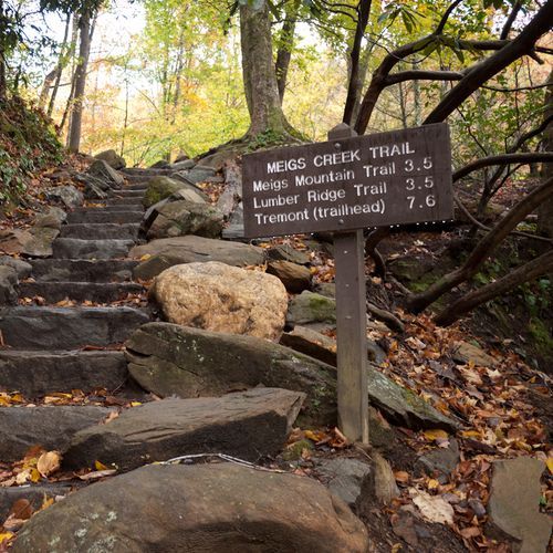
Meigs Creek Trail

Meigs Creek Trail

Easy1.8 mi

This trail offers a serene hike along Meigs Creek, featuring multiple creek crossings and scenic views of waterfalls. It begins at The Sinks, a popular swimming spot, and continues through a lush forest, offering opportunities to explore beyond the main trail at Buckhorn Gap.

Meigs Mountain Trail

Meigs Mountain Trail

Extreme11.6 mi

This trail offers a glimpse into history with remnants of old cottages and a tranquil forest setting. It passes through areas once inhabited by affluent families from Knoxville, featuring remnants like chimneys and stone walls. The trail also offers views of wildflowers such as yellow trillium and Virginia bluebells.

Metcalf Bottoms Trail

Metcalf Bottoms Trail

Easy2.1 mi

This easy trail leads to the historic Little Greenbrier School and Cemetery, offering a glimpse into the region's past. The path is lined with quaint log bridges and features several babbling creeks, making it an ideal choice for families. The trail's gentle slope and short distance ensure a leisurely hike suitable for all ages.

Middle Prong Trail

Middle Prong Trail

Difficult4.2 mi

Follow an old railroad grade through a lush forest, passing multiple waterfalls, including Lower Lynn Camp Falls and Indian Flats Falls. The trail offers a glimpse into the region's logging history, with remnants like old chimneys and railroad beams. It is less crowded than other park trails, making it ideal for those seeking a peaceful hike amidst beautiful scenery.

Mount Sterling Ridge Trail

Moderate5.6 mi

This trail offers breathtaking views from the summit of Mount Sterling, featuring a historic fire tower that provides panoramic vistas of surrounding mountains and valleys. The trail traverses through diverse forests, including spruce and fir, and offers scenic views of the Cataloochee Valley.

Mount Sterling Trail

Mount Sterling Trail

Moderate2.3 mi

Climb to the summit of Mt. Sterling, featuring a historic 60-foot steel fire tower built in 1935. The trail offers breathtaking panoramic views of the surrounding mountains and valleys, including the Cataloochee Valley and the Pigeon River Gorge. The ascent is challenging but rewarding, passing through old-growth forests and offering occasional glimpses of the surrounding landscape.

Mountains-to-Sea Trail: Segment 1

Mountains-to-Sea Trail: Segment 1

Extreme45.5 mi

Starting at the highest point in the Smoky Mountains, this route traverses through a mix of forested areas and scenic overlooks along the Blue Ridge Parkway. It passes by historical sites like Mingus Mill and the Oconaluftee Visitor Center, offering views of the Oconaluftee River. The trail also crosses into the Qualla Boundary, home of the Eastern Band of Cherokee Indians, before concluding at Waterrock Knob with its panoramic vistas.

Noah 'Bud' Ogle Place Nature Trail

Easy0.7 mi

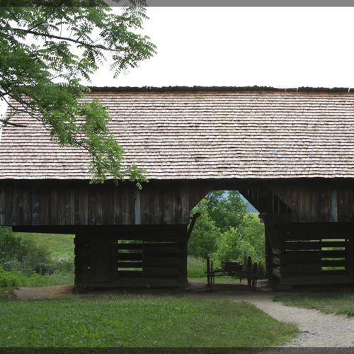
Experience a glimpse into the past at this historic homestead, featuring a unique saddlebag cabin and a well-preserved tub mill. The trail winds through former pastures and cornfields, offering insights into pioneer life in the region. A drove-through barn and scenic brooks add to the charm of this short loop.

Noland Creek Trail

Easy1 mi

This trail follows an old road bed, offering a gentle hike through a historic area once home to several families. The path is lined with sycamore and beech trees and features several bridges crossing Noland Creek. Hikers can explore old home sites, former orchards, and cemeteries, providing a glimpse into the past. The scenic creek and surrounding forests make for a peaceful and educational experience.

Noland Divide Trail

Extreme11.2 mi

This trail offers a steep and long hike through diverse landscapes, featuring a substantial elevation gain. It is known for its challenging terrain and scenic views, making it suitable for experienced hikers seeking a rigorous adventure.

Oconaluftee River Trail

Easy1.7 mi

This trail offers a leisurely stroll along the river, passing through a historic farm museum with log buildings from the late 1800s. The path is lined with diverse tree species and features occasional glimpses of the river. It's one of the few trails allowing pets and bicycles, making it accessible for families and those seeking a relaxed hike.

Old Settlers Trail

Extreme15.5 mi

This trail winds through remnants of former settlements, offering insights into the lives of early inhabitants. It features diverse landscapes, including forests of hemlocks, oaks, and pines, along with various creeks and historical sites like old chimneys and stone walls.

Old Sugarlands Trail

Moderate3.9 mi

This trail offers a peaceful journey through a dense forest, featuring remnants of historical settlements and a chance to spot wildlife like deer and bears. The path follows an old roadbed, providing a moderate climb with scenic views of surrounding mountains when leaves are down. It's a less crowded option compared to other trails in the area, making it ideal for those seeking solitude.

Porters Creek Trail

Porters Creek Trail

Moderate7.2 mi

This trail meanders through a lush forest, passing remnants of the Elbert Cantrell farmstead and the Ownby Cemetery. It features a stunning display of wildflowers, including yellow trillium and violets, and culminates at the picturesque Fern Branch Falls. The trail also offers a detour to the historic John Messer farm site, complete with a cantilevered barn.

Rabbit Creek Trail

Difficult7.7 mi

This trail features a mix of ridges and hollows, offering solitude despite lacking high mountain views. It follows the path of an old road and leads to several destinations, including backcountry campsites and scenic areas. The terrain varies, with some sections being former roads now reclaimed by nature.

Road Prong Trail

Moderate2.2 mi

This trail offers a challenging adventure through a dense, high-country forest filled with spruce and fir trees, moss, and lichen. It features several creek crossings and stunning waterfalls, including Trickling and Talking Falls. The trail's rugged terrain and scenic beauty make it a unique experience for hikers seeking adventure and solitude.

Russell Field Trail

Moderate3.4 mi

This trail offers panoramic views and traverses through old-growth forests and historic pastures like Russell Field, which was once used for grazing. The hike includes sections of mountain laurel tunnels and offers stunning displays of wildflowers. It connects with the Appalachian Trail, providing access to other scenic areas like Spence Field.

Smokemont Loop Trail

Smokemont Loop Trail

Moderate6 mi

This trail combines the Bradley Fork Trail and Smokemont Loop Trail, offering scenic views of the Oconaluftee River Valley. The hike includes a gradual ascent up Richland Mountain, followed by a descent back to the campground. The trail features rustic river crossings and diverse forest landscapes, making it a rewarding experience for nature lovers and those seeking exercise.

Snake Den Ridge Trail

Extreme5.8 mi

This trail offers scenic views of the mountains, historic sites like the Williamson Cemetery, and refreshing creek crossings. The terrain is rocky and rooty, requiring careful navigation. It connects to the Appalachian Trail, providing a mix of challenging climbs and downhill descents.

Springhouse Branch Trail

Springhouse Branch Trail

Difficult6.9 mi

This trail winds through a rich forest environment, featuring a variety of flora such as Wild Geranium, Broad Beech Fern, and Flame Azalea. It offers scenic views and encounters with wildlife like American Toads. The trail follows streams and crosses ridges, providing a diverse hiking experience.

Sugarland Mountain Trail

Sugarland Mountain Trail

Extreme11.7 mi

This trail traverses Sugarland Mountain, offering diverse forest types including deciduous, heath, and spruce-fir forests. It provides scenic views of surrounding mountains like Mount Le Conte and Blanket Mountain. The trail connects Fighting Creek Gap to the Appalachian Trail near Clingmans Dome Road.

Sugarlands Valley Nature Trail

Sugarlands Valley Nature Trail

Easy0.5 mi

Wander through a picturesque cove hardwood forest, taking in the historic stone chimneys and serene streamside views. The trail is paved and accessible, making it ideal for families and those with mobility aids. It offers a glimpse into the region's past, with remnants of early Appalachian settlements.

Sweat Heifer Creek Trail

Moderate3.6 mi

This trail offers a rigorous hike through lush forest, culminating in the picturesque Sweat Heifer Cascades. The steep elevation gain rewards hikers with breathtaking views and an immersive experience in nature.

Swinging Bridge Quiet Walkway

Swinging Bridge Quiet Walkway

Easy0.5 mi

This trail offers a peaceful escape into a serene forest, featuring stunning wildflowers and picturesque surroundings. It is an ideal spot for solitude and relaxation, with minimal disturbance from traffic or other hikers. The trail's easy accessibility makes it suitable for a variety of visitors.

Thomas Divide Trail

Extreme13.2 mi

This trail offers a peaceful hike along a ridgeline, featuring a variety of botanical species such as Witch Hobble and Turk's Cap Lilies. It provides a sense of solitude and is often used to connect other trails. The trail's higher elevation allows for unique plant life, though it lacks dramatic views or water features.

Turkeypen Ridge Trail

Moderate3.6 mi

This trail winds through old fields ablaze with wildflowers like azaleas and trillium, transitioning into forests dominated by rhododendron and mountain laurel. It offers a mix of ascending and level sections, culminating in cooler, moist hollows near the mountain. The trail connects with other paths, allowing for varied hiking experiences.

Twentymile Trail

Twentymile Trail

Easy0.5 mi

This trail offers a serene hike through the forest, initially following a former road that leads to scenic views near Cheoah Lake. It connects with other trails, providing options for longer hikes and access to the Appalachian Trail. The trail's smooth terrain makes it suitable for a variety of hikers.

Twin Creeks Trail

Easy1.9 mi

This trail offers a gentle walk through a forested area, providing a peaceful experience with natural surroundings. It connects with other trails, offering options for extended exploration.

West Prong Trail

West Prong Trail

Moderate2.6 mi

This trail offers a peaceful hike through a quiet forest, ascending the northern slopes of Fodderstack Mountain before descending towards the West Prong of the Little River. It features a creek crossing and ends at the Bote Mountain Trail junction, with options to extend the hike. The trail is popular for rainbow trout fishing and offers scenic picnic spots near Backcountry Campsite 18.

Beard Cane Trail

Moderate4.2 mi

This trail takes you through a picturesque hollow, offering a serene hiking experience. The path winds down between Beard Cane and Hatcher mountains, providing a peaceful escape into nature. While not as popular as some other trails, it offers a unique and less crowded hiking experience.

Beech Gap Trail

Difficult5.5 mi

This trail offers a climb through diverse hardwood forests, featuring abundant wildflowers and scenic vistas. The path leads to a gap with historical significance, offering insights into past logging and grazing practices.

Bell Branch Concession Horse Trail

Easy1.1 mi

This trail winds through a serene forest, providing a peaceful experience for both hikers and horseback riders. It is part of a network of trails that allow visitors to explore the diverse landscapes of the area.

Big White Oak Quiet Walkway

Easy0.5 mi

This trail offers a peaceful stroll through a protected woodland area, featuring minimal elevation change and scenic creek crossings. The path winds through tall tulip poplars and thick rhododendron, providing a serene escape from the nearby road.

Buchanan Cemetery Access

Easy0.4 mi

This trail leads to the Buchanan Cemetery, a historic site with graves dating back to the late 19th century. The journey involves descending into a valley, offering a glimpse into the past with its old headstones and natural surroundings. The trail's scenic route includes creek crossings and picturesque landscapes, typical of the region's rural beauty.

Buckeye Trail

Easy0.8 mi

This trail offers a unique blend of urban and rural landscapes, passing through Wayne National Forest and numerous Ohio State Parks. It connects over 100 communities and features landmarks like Serpent Mound and Fort Ancient. The trail's accessibility makes it a popular choice for both day hikers and long-distance enthusiasts.

Cabin Flats Trail

Easy1 mi

This trail offers a serene hike along the Bradley Fork, known for its vibrant wildflowers in spring. The path leads to backcountry campsite #49, providing a peaceful retreat amidst nature. The surrounding forest features a variety of flora and fauna, making it an ideal spot for nature enthusiasts.

Cades Cove Bicycle Tour

Cades Cove Bicycle Tour

Easy1.3 mi

Pedal through a picturesque valley filled with historic log cabins, churches, and a working grist mill. The route winds past lush meadows, mountain vistas, and diverse wildlife, offering a glimpse into 19th-century mountain life. Visitors can stop at multiple points of interest, including the Primitive Baptist Church and the Cable Mill. The scenic loop provides ample opportunities for photography and wildlife viewing, making it a unique blend of natural beauty and historical significance.

Campsite 67 Access Trail

Moderate2.1 mi

This trail offers a peaceful journey through natural surroundings, leading to a secluded campsite. The terrain is generally easy to navigate, making it suitable for hikers of various skill levels. The proximity to natural features provides an immersive experience.

Cane Creek Trail

Easy2.1 mi

This trail offers a moderate hike through varied natural environments, providing scenic views and opportunities to connect with nature. The terrain includes a mix of ground surfaces, making it suitable for those seeking a moderate challenge.

Carver Cemeter Access

Easy0.3 mi

This short hike leads to a historic cemetery, offering a glimpse into the region's past. The trail winds through the forest, providing a serene setting amidst nature. It is a great option for those interested in history and seeking a brief, easy hike.

Chestnut Branch Trail

Moderate2 mi

This trail traverses through a beautiful forest, featuring remnants of old homesteads and giant trees. The path parallels a stream with cascades and pools, offering a serene hiking experience. Historical artifacts along the trail highlight the area's past.

Clingmans Dome Bypass Trail

Easy0.5 mi

Cold Spring Gap Trail

Extreme10.7 mi

This trail descends steeply through a beautiful forest, following Cold Spring Branch down to Hazel Creek. The path is challenging, with rocky sections and stream crossings, offering a true wilderness experience amidst the scenic Smoky Mountains.

Cosby Horse Trail

Difficult8.9 mi

This trail offers a gentle journey through forested areas, suitable for horseback riding and hiking. It provides a peaceful experience with minimal elevation change, making it accessible to a wide range of visitors.

Cosby Nature Trail

Easy0.6 mi

This trail winds through a picturesque hardwood forest, offering views of historic sites and a variety of flora. The area is known for its vibrant spring wildflowers and stunning fall foliage, making it a charming destination for nature enthusiasts.

Crib Gap Trail

Moderate4.3 mi

This trail offers a scenic loop through the Smoky Mountains, providing a challenging hike with varied landscapes. It starts near the Cades Cove area and offers a mix of forested terrain and mountainous views.

Dry Sluice Gap Trail

Difficult4.1 mi

Duds Branch Concession Horse Trail

Easy1.5 mi

This trail offers a serene journey through a variety of forest ecosystems, providing a peaceful escape for both hikers and horseback riders. The trail's gentle terrain makes it suitable for families and beginners, offering a chance to connect with nature in a tranquil setting.

Fighting Creek Nature Trail

Easy1.2 mi

This trail offers a serene walk through a diverse forest featuring sycamore, sassafras, and shortleaf pine trees. It includes a restored 19th-century cabin and passes over streams, providing insights into local history and ecology. The trail is well-suited for families and those seeking a short, educational hike.

Grassy Branch Trail

Moderate2.6 mi

This trail offers a moderately challenging hike through a forested area, featuring several creek crossings and ridge traversals. The scenic route provides opportunities to connect with nature and enjoy the surrounding landscape.

Greenbrier Ridge Trail

Extreme15.2 mi

This trail offers a steady climb through a scenic landscape, featuring wildflowers and mountain streams. It connects several trails, providing access to the Appalachian Trail near Derrick Knob. The trail's moderate incline and scenic views make it a popular choice for hikers seeking a mix of natural beauty and connectivity to other trails.

Hatcher Mountain Trail

Moderate2.8 mi

This trail provides a peaceful alternative to more popular routes, connecting several trails in the area. It offers a chance to experience the beauty of the surrounding landscape without the crowds, making it a great choice for those seeking solitude.

Hickory Flats Quiet Walkway

Easy0.3 mi

This trail offers a peaceful stroll through a forest dominated by hickory trees. It features small bridges over creeks and provides a serene atmosphere, ideal for those seeking a quiet escape. The trail's gentle terrain makes it accessible for a variety of visitors.

Indian Creek Motor Trail

Easy1.8 mi

This trail winds through a forest rich in tulip trees, yellow birches, and red maple, with abundant spring wildflowers. A small waterfall is visible during wet months, and the trail follows a creek. It connects larger trails like Thomas Divide and Deeplow Gap, offering a serene hike through diverse forest landscapes.

Jenkins Ridge Trail

Difficult8.7 mi

This trail offers a challenging ascent through dense rhododendron thickets, eventually opening up to expansive mountain vistas at Spence Field. It connects with other trails, providing access to the Appalachian Trail and offering stunning views of the surrounding landscape.

Lakeshore Trail

Extreme33.5 mi

No description available

Lakeshore Trail Low Water Access

Easy0.2 mi

This short trail offers a serene walk along the lake's shoreline, providing a peaceful experience with minimal elevation change. The trail's easy accessibility makes it suitable for a variety of visitors seeking a brief, enjoyable hike.

Little Dudley Concession Horse Trail

Moderate2.9 mi

This trail traverses the picturesque Appalachian-Blue Ridge forests, offering scenic views and opportunities for horseback riding and trail running. It follows along Little Dudley Creek and Dudley Creek, providing a serene and natural experience.

Long Bunk Trail

Moderate3.5 mi

This trail winds through dense woods, crossing small streams and eventually follows a ridge known as Dude Branch, adorned with large oak trees. The scenic route offers a mix of forest and stream environments, providing a diverse hiking experience.

Loop Trail

Easy1.1 mi

This loop trail offers a serene journey through a forested area, featuring a variety of plant species and wildlife. The terrain is generally smooth, making it suitable for families and casual hikers. The trail's gentle slope allows for a leisurely pace, providing ample opportunities to observe the natural surroundings.

Lower Noland-Monteith Cemetery Access

Easy0.3 mi

This short trail leads to the Lower Noland-Monteith Cemetery, providing a peaceful walk through a forested area. The trail's easy grade makes it accessible for most visitors, offering a quiet retreat amidst nature.

McKee Branch Trail

Moderate2.3 mi

This trail offers a steep and rocky descent into a dense forest, culminating at McKee Branch. The path is challenging due to loose rocks and slippery conditions when wet. It provides a scenic hike with significant elevation change, suitable for those seeking a more rugged experience.

Newton Bald Concession Horse Trail Loop

Moderate2.4 mi

This trail offers a peaceful journey through the Great Smoky Mountains, suitable for horseback riding and hiking. The loop provides an opportunity to enjoy the natural beauty of the area with minimal elevation change, making it accessible for a variety of visitors.

Old Deep Creek Quiet Walkway

Easy0.2 mi

This trail offers a serene walk through a forested area, following the creek and providing a peaceful escape from the main park trails. It features a natural setting with minimal elevation change, making it accessible for most visitors.

Ollie Cove Trail

Easy0.3 mi

This trail begins at lake level and climbs towards the Lakeshore Trail, providing a scenic route that ends at Fontana Lake. The trail offers breathtaking views, particularly when turning back to take in the lake's vista.

Palmer Creek Trail

Moderate3.2 mi

This trail offers a serene journey through diverse forest environments, featuring natural beauty and potential wildlife encounters. The terrain is varied, providing a moderate challenge for hikers.

Pretty Hollow Gap Trail

Difficult5.1 mi

This trail offers a scenic hike along Pretty Hollow Creek, transitioning from rhododendron and galax to evergreen forests as elevation increases. The trail culminates at Pretty Hollow Gap, providing a mix of forested landscapes and creek-side walking.

Rhodedendron Creek Trail

Easy1 mi

This trail offers a scenic loop through a forest with a waterfall and wildflowers, providing a peaceful hike amidst nature's beauty.

Riverview Quiet Walkway

Easy1.3 mi

This trail offers scenic views of the Little Pigeon River and includes a visit to the Vance Newman Cemetery. The path is generally easy and level, making it suitable for most visitors. The surrounding area is rich in natural beauty and historical significance, providing a pleasant walking experience.

Rough Creek Trail

Moderate2.7 mi

This trail offers a challenging hike with varied terrain, featuring steep ascents and descents. The trail's natural beauty includes diverse landscapes and potential wildlife sightings. It is suitable for hikers seeking a moderate to difficult experience.

Roundtop Trail

Difficult7.4 mi

This trail traverses a forested landscape with steep climbs and descents, providing a secluded hiking experience. The path includes river crossings and offers panoramic views when the leaves are off the trees. Wildlife sightings are common, making it a great choice for those seeking solitude and nature.

Scott Mountain Trail

Moderate3.5 mi

Not available

Smokemont Nature Trail

Easy0.6 mi

No description available

Spruce Fir Nature Trail

Easy0.3 mi

This trail winds through a dense spruce-fir forest, offering a glimpse into a unique ecosystem typically found at higher latitudes. The forest is home to species like red squirrels and winter wrens, and features moss-covered logs and fallen trees that support new growth. The trail's boardwalks and virtually flat terrain make it accessible for all visitors.

Stone Pile Gap Trail

Easy0.8 mi

This trail offers a scenic descent through a lush forest dominated by mountain laurel, leading hikers towards Indian Creek. It connects with larger trails like the Thomas Divide Trail, providing access to other scenic areas.

Sunkota Ridge Trail

Moderate3.7 mi

This challenging trail ascends through dense forest, offering panoramic views from the ridge. The hike involves a significant elevation change, making it suitable for experienced hikers seeking a rewarding challenge.

Sutton Ridge Overlook Trail

Easy0.1 mi

This trail leads to a scenic overlook, providing panoramic views of the surrounding landscape. It is a relatively short hike, making it accessible for a variety of visitors. The trail is located in a beautiful natural setting, offering a peaceful escape into nature.

Swallow Fork Trail

Moderate3.9 mi

This trail offers a scenic descent through a lush forest, following an old logging railroad bed. It features beautiful creek views and a variety of flora, including Wild Hydrangea and Rosebay Rhododendron. The trail ends at Big Creek, providing access to additional hiking options.

Tow String Horse Trail

Moderate2.2 mi

This trail offers a scenic loop through the beautiful mountain ranges of the Great Smoky Mountains. It provides access to stunning vistas and is part of a network of trails popular for horseback riding and hiking. The trail's moderate challenge makes it suitable for a variety of visitors seeking to enjoy the park's diverse landscapes.

Tunnel Bypass Trail

Easy1.5 mi

This trail provides a gentle alternative to the tunnel, rising slightly before leveling out. It connects with the Lakeshore Trail and offers access to backcountry campsite 67, nestled among remnants of old homesteads. The trail is suitable for hikers and horseback riders alike.

Two Mile Lead Concession Horse Trail

Difficult6 mi

This trail offers a scenic horseback ride through the Appalachian forests, featuring streams like West Prong Little Pigeon River and Twomile Branch. It's part of a network of trails suitable for horseback riding and hiking, providing a unique way to experience the region's natural beauty.

Wet Bottom Trail

Easy1 mi

Follow Abrams Creek through a marshy area, once used by early settlers to protect cattle. The trail offers a glimpse into the past with the option to visit Elijah Oliver's homestead. The marshy conditions reflect the area's history and natural environment.

Whiteoak Branch Trail

Easy1.7 mi

This trail offers a peaceful journey through diverse landscapes. It features a mix of ground surfaces and varying elevations, providing a unique hiking experience. The surroundings are rich in natural beauty, making it a worthwhile adventure for those seeking tranquility and scenic views.

Beech Flats Quiet Walkway

Easy0.6 mi

This trail offers a peaceful stroll through a natural forest environment, ideal for those seeking a tranquil experience. The terrain is generally flat, making it accessible for most visitors.

Big Dudley Concession Horse Trail

Easy2.6 mi

This trail offers a serene horseback ride through the woods, following Grapeyard Branch and Dudley Creek. It's part of the extensive network of horse trails in the park, providing a peaceful experience amidst nature. The trail is suitable for those looking for a gentle ride with scenic views.

Bradshaw Cemetery Access Trail

Easy0.2 mi

This trail leads to the Bradshaw Cemetery, a historic site within the Great Smoky Mountains National Park. The cemetery is a testament to the region's rich cultural heritage, offering a glimpse into the lives of early settlers. The trail itself is a gentle walk through a beautiful forest, making it suitable for families and those seeking a brief, educational outing.

Carson-Messer Cemetery Access

Easy0.1 mi

This trail provides access to the Carson-Messer Cemetery, offering a glimpse into the region's history. The trail is short and easy, making it accessible for most visitors. It winds through a natural setting, ending at the cemetery, which is a significant historical site within the park.

Cataloochee Horse Trail

Easy1.6 mi

This trail offers a serene horseback ride through a picturesque valley surrounded by ancient mountains. It provides access to some of the park's most coveted horseback riding trails, including the Rough Fork and Caldwell Fork Trails. The area is rich in cultural history and wildlife, with elk herds often spotted in the valley.

Cemetary Trail

Easy0.8 mi

This trail offers a gentle hike through diverse environments, providing a peaceful escape. The trail's easy grade makes it accessible to a wide range of hikers. While specific features are not detailed, the trail likely includes natural beauty and possibly historical or cultural significance.

Conner @ Hickory Flats Cemetery Access

Easy0.2 mi

This trail provides access to the Conner @ Hickory Flats Cemetery, offering a glimpse into the region's historical past. The short, easy path allows visitors to explore the area's cultural heritage amidst the natural beauty of the Great Smoky Mountains.

Doc Caldwell Cemetery Access

Easy0.1 mi

This short trail leads to the Doc Caldwell Cemetery, offering a glimpse into the region's history. The cemetery is situated near the Cataloochee Entrance Road, providing a peaceful and reflective experience amidst the natural beauty of the surrounding mountains.

Eagle Creek Trail

Difficult8.6 mi

This trail offers breathtaking views of waterfalls, including Punch Bowl and Tunnel Falls, set amidst dense forest and towering basalt cliffs. It follows Eagle Creek, providing spectacular scenery and opportunities for both day hikes and multi-day backpacking trips.

Engine Creek Trail

Moderate2 mi

No description available

Ferguson Cabin Trail

Easy1.2 mi

This trail offers a glimpse into the region's history by leading to a historic cabin. The surroundings provide a serene natural setting, perfect for those seeking a short, easy hike.

Friendship Baptist Church Cemetery Access

Easy0.2 mi

This short trail leads to the Friendship Baptist Church Cemetery, offering a glimpse into the region's rich history and cultural heritage. Surrounded by the beautiful landscape of the Smoky Mountains, it provides a peaceful and reflective experience.

Grassy Branch Concession Horse Trail

Easy1.7 mi

This trail offers a glimpse into the historic landscapes of the Smoky Mountains, with remnants of old roads and stone fences. It connects with other trails, providing a deeper exploration of the area's natural and cultural heritage.

Kanati Fork Quiet Walkway

Moderate3 mi

This trail offers a peaceful, easy stroll suitable for families and those seeking a brief, relaxing hike. It winds through a forested area, providing a tranquil escape from more strenuous adventures.

Lagoon Trail

Easy0.1 mi

This trail features a simple, ground-surfaced path with minimal elevation change, making it accessible for casual hikers. However, its short length and lack of distinct features make it less notable compared to other trails.

Lakeview Quiet Walkway

Easy0.1 mi

This trail provides a peaceful stroll through a forested area, featuring small bridges over creeks and wooden steps. It highlights the park's diverse geology and tree species, offering a serene escape from more crowded trails.

Laurel Falls Quiet Walkway

Laurel Falls Quiet Walkway

Easy0.3 mi

This trail offers a peaceful walk through the woods, providing a chance to experience the natural beauty of the area without the need for extensive hiking. It is well-suited for those looking for a brief, easy excursion into the forest.

Lawson Cemetery Access

Easy0.1 mi

This short trail provides access to a historic cemetery, offering a glimpse into the region's past. The trail is easy and suitable for visitors interested in cultural and historical sites.

McClure Cemetery Access Trail

Easy0.1 mi

This short trail leads to McClure Cemetery, offering a glimpse into the region's past. The cemetery is nestled within a picturesque setting, providing a serene and reflective experience for visitors.

Painter Ridge Concession Horse Trail

Easy1.7 mi

This trail offers a scenic route through the Appalachian forests, allowing visitors to experience the natural beauty of the area. It is part of the concession horse trails, providing an opportunity for horseback riding amidst the picturesque landscape.

Pilkey Cemetery Access Trail

Easy0.9 mi

This trail leads to a peaceful cemetery, offering a chance to connect with nature and history. The surroundings are typically serene, providing a quiet escape.

Rich Mountain Loop Trail

Moderate3.3 mi

This loop offers stunning views, diverse wildflowers, and historic sites like the John Oliver Cabin. The trail features a mix of level meadows and steep climbs, providing a challenging yet rewarding hike. Wildlife sightings and scenic overlooks add to its charm.

Science Center Trail

Easy0.3 mi

This trail offers a brief, accessible hike suitable for all ages. It provides an opportunity to enjoy the surrounding landscape, though specific features are not detailed.

Spruce Mountain Trail

Easy1.1 mi

This trail winds through diverse forest types, providing a serene hiking experience. The trail's moderate terrain makes it suitable for casual hikers seeking a peaceful connection with nature.

Sutton-McGhee Cemetery Access

Easy0.1 mi

This short trail leads to the Sutton-McGhee Cemetery, offering a glimpse into the region's rich history. The cemetery is situated in a scenic area of the park, providing a peaceful and reflective atmosphere amidst the natural beauty of the mountains.

Woody-Conner Cemetery Access

Easy0.8 mi

This trail leads to a historic cemetery, offering a glimpse into the region's past. The hike involves a moderate climb through lush forest, culminating in a barren yet poignant landscape. The cemetery is well-maintained, reflecting the community's dedication to preserving its heritage.

Get offline trail maps and detailed hiking info in the Parka app

Download Parka — It's Free

Get offline trail maps for Great Smoky Mountains National Park

Free on the App Store

Get Parka

Why Park Lovers Choose Parka

Trip Planner

All the tools for epic adventures

Works Offline

Fully functional without cell service

Updated Weekly

Trail conditions, alerts, and closures

Try Risk-Free

7-day free trial, cancel anytime

Start Your 7-Day Free Trial

Unlock everything you need for your next national park trip. Your first week is on us!

National Park vista

Start your adventure today

Download Parka and plan your perfect national park trip in minutes.