ParkaDownload
Yosemite National Park

Trails in Yosemite National Park

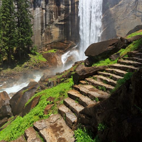
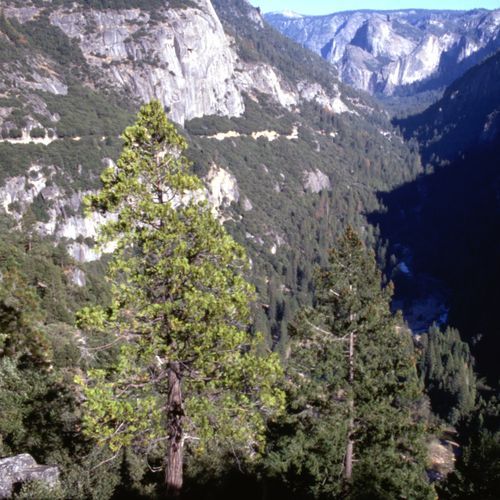
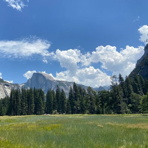
Yosemite is one of the world’s great hiking parks, with 95 trails that run the full spectrum: 39 easy, 28 moderate, 20 difficult, and 8 extreme. From flat, family-friendly paths to waterfalls and sequoia groves to quad-burning climbs that crest the sheer rim of Yosemite Valley, there’s a route for every pace and ambition. Most day hikes require no permit; the marquee exception is the Half Dome summit, an exposed cable ascent typically offered in the warm months. Elevation, snowpack, and seasonal water flow shape the experience here, turning spring into a season of thundering falls and summer into a showcase of granite domes, wildflower meadows, and big Sierra skies. Standout trails define the park’s character. The Mist Trail to Vernal and Nevada Falls is a signature granite staircase draped in spray, with the John Muir Trail offering a broader, less-steep return and a gateway to the high country. The Half Dome route remains the park’s legendary challenge, while the Upper Yosemite Fall Trail climbs to the brink of North America’s tallest waterfall. Four Mile Trail switchbacks to Glacier Point and links beautifully with the Panorama Trail for a grand loop back to the Valley. Beyond the valley walls, Tuolumne Meadows delivers alpine classics along the John Muir and Pacific Crest Trails, with Lyell Canyon’s gentle grades contrasting the granite domes above. Hetch Hetchy’s lakeside paths and Wawona’s Mariposa Grove round out the mix with quieter scenery and giant sequoias. What makes hiking here special is the way these routes stitch together iconic views and true wilderness—granite underfoot, waterfalls within earshot, and horizons that expand with every switchback.

Bridalveil Fall Trail

Bridalveil Fall Trail

Easy0.4 mi

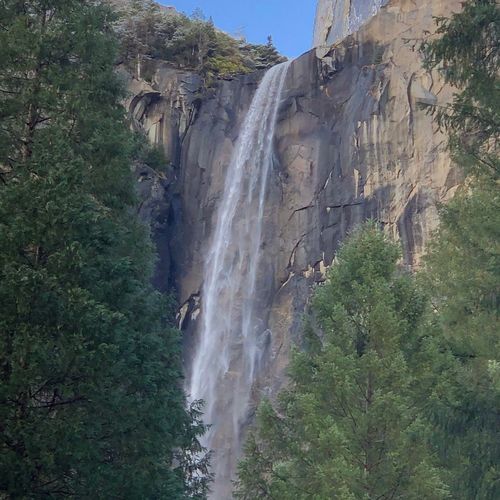
This short, paved path leads to the base of a majestic waterfall, offering stunning views and a chance to experience the power of nature. The trail is accessible year-round, though conditions can be icy in winter and wet during peak spring flows.
Elizabeth Lake Trail

Elizabeth Lake Trail

Moderate4.8 mi

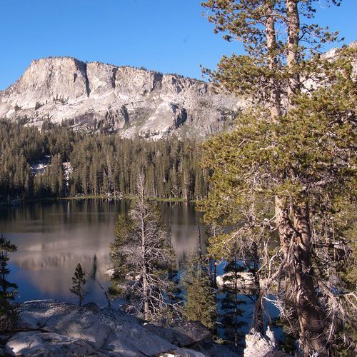
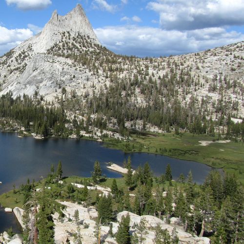
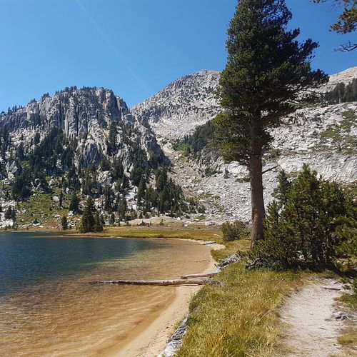
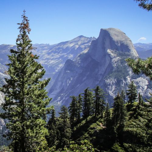
Situated beneath Unicorn Peak, this picturesque lake offers stunning views of surrounding granite promontories. The hike ascends steadily from the Tuolumne Meadows basin, providing a scenic route through shaded areas and eventually opening up to reveal the lake's tranquil beauty. The lake itself is ringed by evergreens and offers a serene spot for picnics or simply taking in the breathtaking scenery. The trail's proximity to popular attractions ensures accessibility while maintaining a moderate level of solitude.

Four Mile Trail

Four Mile Trail

Difficult9.6 mi

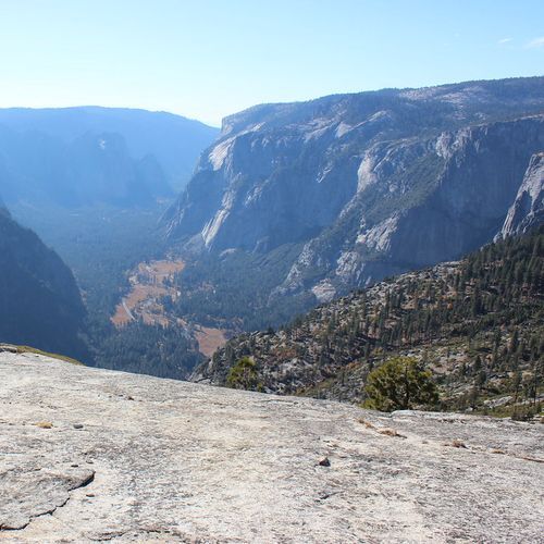
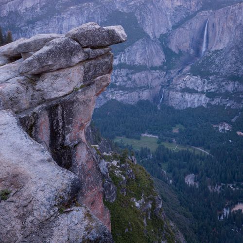
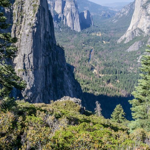
This trail ascends from the valley floor to a scenic overlook, offering breathtaking views of Yosemite's most famous landmarks, including El Capitan, Yosemite Falls, and Half Dome. The steep climb rewards hikers with stunning vistas of the valley below.

Gaylor Lakes Trail

Gaylor Lakes Trail

Moderate2.7 mi

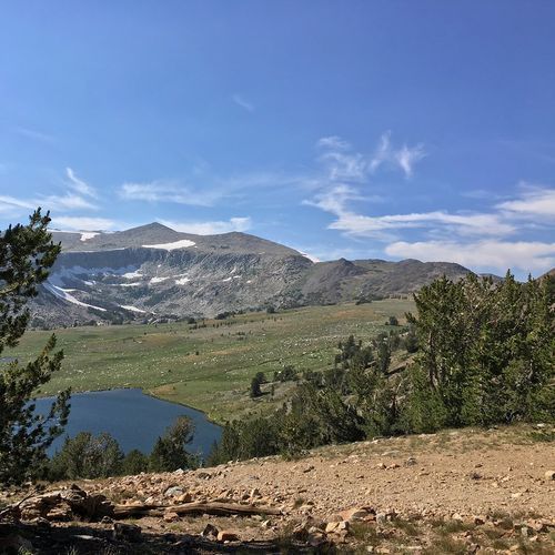
From the Tioga Pass Entrance Station this short but steep trail climbs steadily to a ridge with expansive views of Dana Meadows and the high Sierra. The route then drops about 200 feet to Middle Gaylor Lake and reaches the Gaylor Lakes Basin above Lower Gaylor Lake.

Grizzly Giant Loop Trail

Grizzly Giant Loop Trail

Easy2 mi

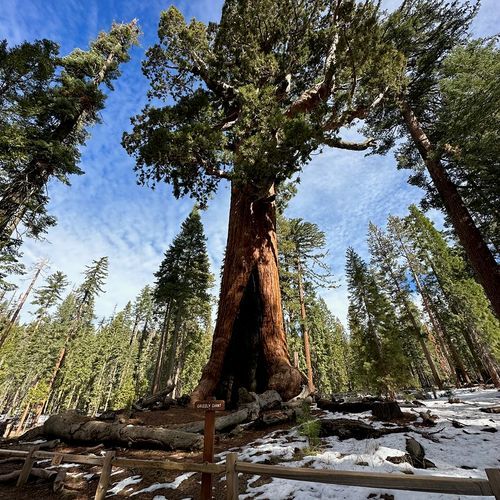
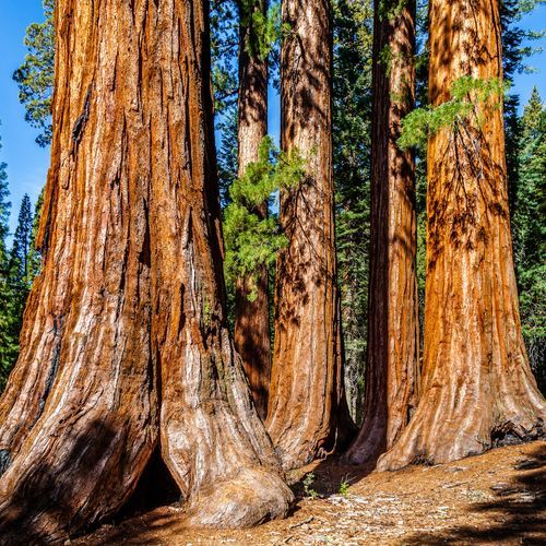
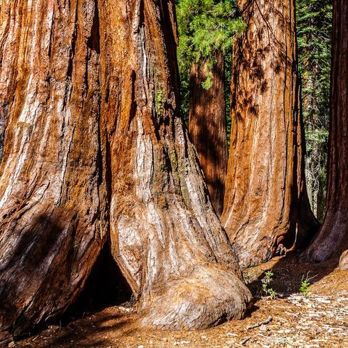
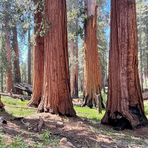
Traverse a forest of giant sequoias, home to many ancient trees. Highlights include the Grizzly Giant, one of the largest and oldest sequoias, estimated to be about 3,000 years old, the California Tunnel Tree, and notable sequoias like the Bachelor and Three Graces. This trail offers a glimpse into the history and grandeur of these wonders. It accommodates a variety of visitors, featuring a wheelchair-accessible section near the Grizzly Giant and loop options for shorter or longer walks suited to different abilities.

Half Dome Trail

Half Dome Trail

Extreme17.3 mi

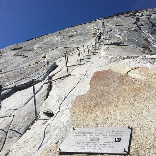
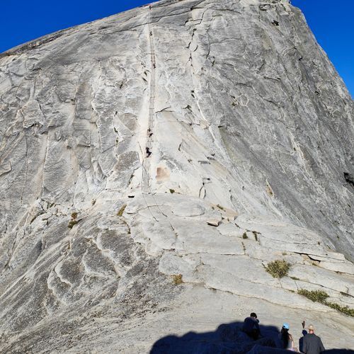
This iconic trail leads through lush forests and past waterfalls like Vernal and Nevada Falls, culminating in a steep ascent via cables to the summit. The hike offers panoramic views of Yosemite Valley and the High Sierra, but requires physical stamina and preparation due to its challenging terrain.

Lower Yosemite Fall Trail

Lower Yosemite Fall Trail

Easy1.2 mi

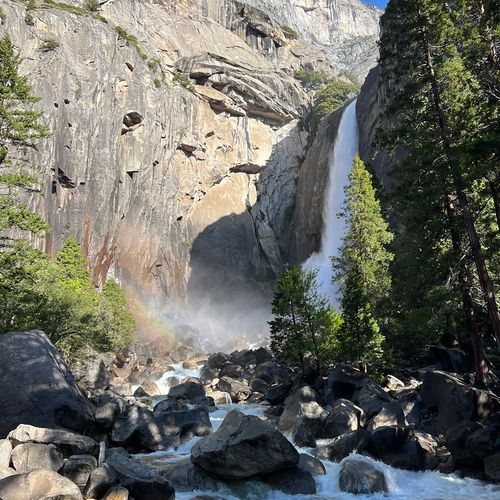
This short, paved loop offers front‑row views of both Upper and Lower Yosemite Falls and leads to the footbridge near the base of the lower fall. The lower fall is deafening in spring and early summer and you can expect to get sprayed when standing near the bridge; it often diminishes or dries by late summer. The trail is easy and paved with interpretive exhibits along the route. The eastern portion of the loop is wheelchair-accessible (when not covered in ice or snow), and paved sections are generally stroller-friendly, but full accessibility can depend on seasonal conditions. This is a very popular, often crowded destination.

Mist Trail

Mist Trail

Difficult6.3 mi

This iconic trail follows the Merced River, offering breathtaking views of Vernal Fall and Nevada Fall. The path is steep and slippery, especially during spring runoff, but rewards hikers with stunning vistas and unique geological features. The trail's popularity is evident in its high visitation rates, making it a must-experience for many park visitors.

Mono Pass Trail

Mono Pass Trail

Moderate7.6 mi

Follow the ancient path used by Native Americans and early explorers, traversing through lush meadows and alongside rushing creeks. The trail offers breathtaking views of Mono Lake and Bloody Canyon from Mono Pass. Historical sites, including old miner cabins, add to the trail's rich cultural heritage.

North Dome Trail

North Dome Trail

Difficult9.2 mi

This hike, starting from the Porcupine Creek Trailhead, offers outstanding views of Half Dome and Yosemite Valley. The route follows a paved section, crosses Porcupine Creek, and passes through forest and meadow before reaching the base of North Dome; a short climb leads to the dome summit for panoramic valley views. The trail also provides views of Indian Rock. The route is quieter than many valley trails, making for a more peaceful experience amid Yosemite's scenery.

Panorama Trail

Panorama Trail

Difficult9.3 mi

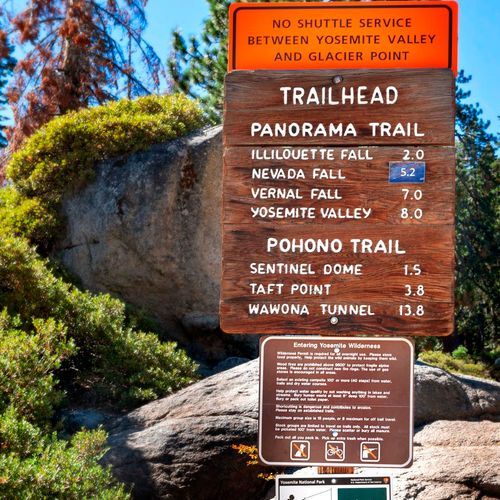
Descend through a scenic landscape featuring Half Dome and three stunning waterfalls: Nevada Fall, Vernal Fall, and Illilouette Fall. The trail offers breathtaking views of Yosemite Valley and traverses diverse terrain, including forests and granite cliffs. It's a popular choice for hikers seeking a mix of natural beauty and challenging terrain.

Sentinel Dome Trail

Sentinel Dome Trail

Moderate2.2 mi

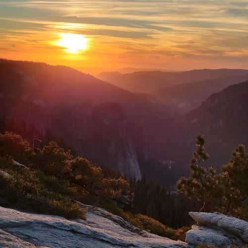
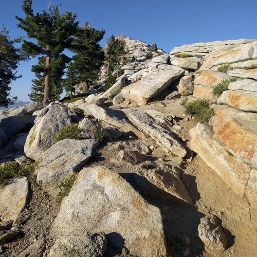
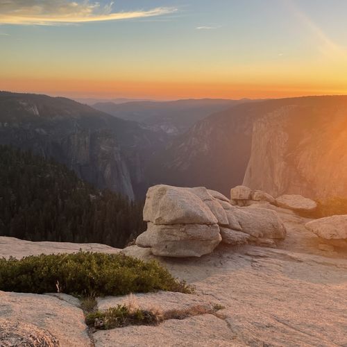
Climb a granite dome offering breathtaking 360-degree views of Yosemite Valley's most iconic landmarks, including Half Dome, El Capitan, and Yosemite Falls. The hike features a gradual ascent through a forested area before reaching the dome, where visitors can scramble up for spectacular vistas. Known for its stunning sunsets and stargazing opportunities, this spot provides an unforgettable experience amidst Yosemite's majestic landscape.

Ten Lakes Trail

Ten Lakes Trail

Difficult12.1 mi

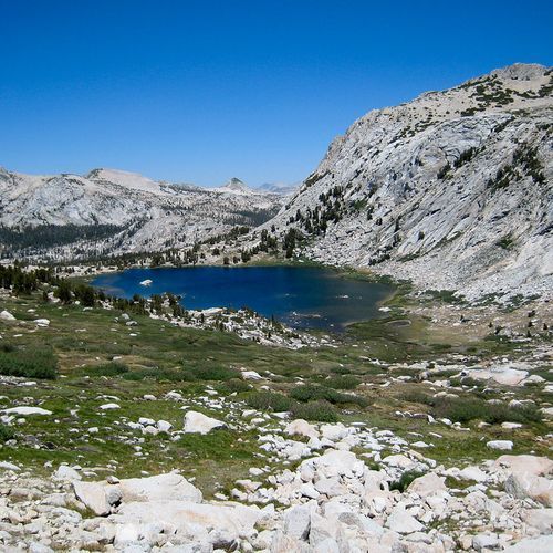
This trail traverses a rugged landscape shaped by alpine glaciers, featuring deep cirques and high, rim-rocked basins sheltering several lakes. The area offers remote backpacking and hiking opportunities through a scenic and challenging environment.

Upper Yosemite Fall Trail

Upper Yosemite Fall Trail

Difficult7.2 mi

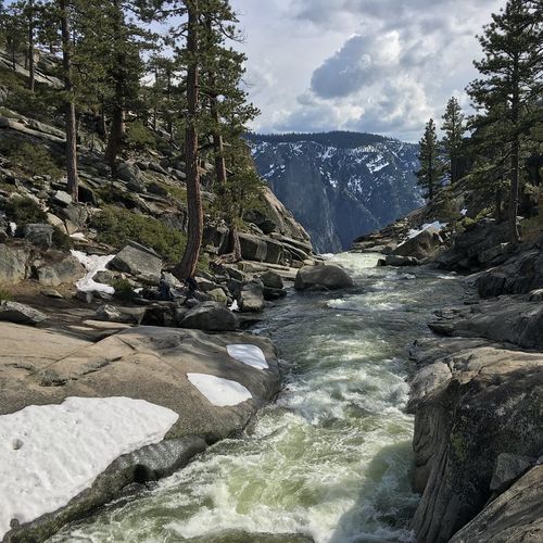
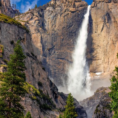
This challenging hike leads to the top of North America's tallest waterfall, offering breathtaking views of the valley below and iconic landmarks like Half Dome. The trail features numerous switchbacks through oak woodlands and exposed plateaus, culminating in a stunning view of Upper Yosemite Fall. The hike is steep and rocky, but the scenery is well worth the effort.

Yosemite Valley Loop Trail

Yosemite Valley Loop Trail

Easy20.3 mi

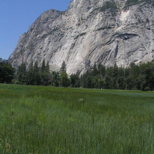
Wander through lush meadows and along the Merced River, passing beneath towering granite monoliths like El Capitan and taking in views of Yosemite Falls, Bridalveil Fall, and other natural wonders. The trail traverses a mix of forested areas and open spaces, providing occasional solitude amidst the bustling valley. Highlights include majestic views of Cathedral Rocks and, from the eastern section near Happy Isles/Mirror Lake, views of Half Dome and the serene Mirror Lake, which reflects the surrounding landscape during its seasonal presence.

Cathedral Lakes Trail

Cathedral Lakes Trail

Moderate4.6 mi

This scenic trail leads to two picturesque lakes nestled beneath the majestic Cathedral Peak. The hike offers stunning views of the surrounding mountains and meadows, providing a serene escape from the more crowded areas of the park. The trail is part of the John Muir Trail and features a mix of forested paths and open meadows.
Chilnualna Falls Trail

Chilnualna Falls Trail

Moderate7.9 mi

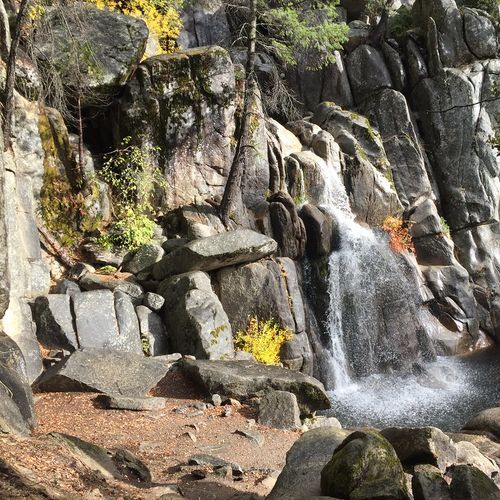
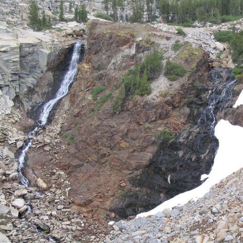
Follow Chilnualna Creek through a variety of forest types and open areas, featuring multiple cascades and culminating in a stunning waterfall. The trail offers expansive views of Wawona Dome and surrounding hills, making it a less crowded yet rewarding hike.

Clouds Rest Trail

Clouds Rest Trail

Extreme9.4 mi

Situated above Tenaya Canyon, this granite formation offers breathtaking 360-degree views of iconic landmarks like Half Dome, the Clark Range, and the Cathedral Range. The trail features a dramatic northwest face, polished by glaciers, and culminates in a summit with expansive vistas of the surrounding landscape. The hike includes steep climbs and descents, with scenic stops along the way, offering a unique perspective on the region's geological and natural beauty.

Glen Aulin - May Lake Trail

Glen Aulin - May Lake Trail

Moderate2.4 mi

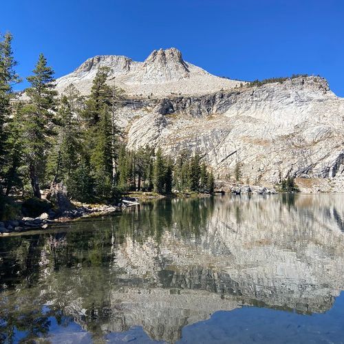
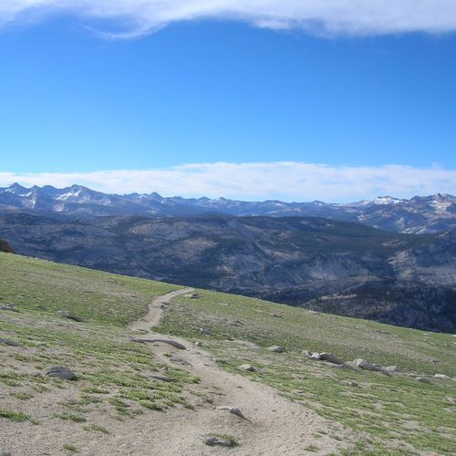
This combines two separate routes. Glen Aulin follows the Tuolumne River from the Tuolumne Meadows/Pacific Crest Trail corridor to the Glen Aulin area, passing river waterfalls (for example Waterwheel Falls) and scenic meadows. May Lake is a separate short trail north of Tioga Road that climbs to an alpine lake at the foot of Mt. Hoffmann; from May Lake an unofficial, unmarked spur involving boulder scrambling leads to the summit of Mt. Hoffmann for panoramic views of Yosemite's High Sierra.
Mariposa Grove Trail

Mariposa Grove Trail

Moderate3.5 mi

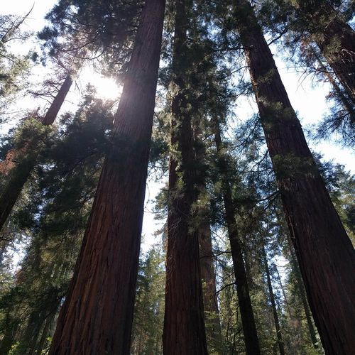
Traverse a forest of giant sequoias, including over 500 ancient trees. Highlights include the Grizzly Giant, one of the largest and oldest trees, and the California Tunnel Tree. The area offers both shorter and longer hiking options, making it accessible for a variety of visitors while showcasing these impressive natural landmarks.
Merced Grove Trail

Merced Grove Trail

Moderate3.1 mi

Descend into a tranquil valley filled with about 20 giant sequoias, offering a peaceful escape from more crowded areas. The trail follows an old road, lined with incense cedar and ponderosa pine, before reaching the sequoias. It's a less visited but equally impressive destination, providing a serene hiking experience.

Snake Dike Approach

Snake Dike Approach

Moderate1.9 mi

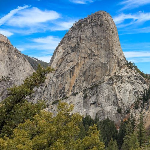
Follow the Muir Trail to the Mist Trail past Nevada Falls, then continue on the Muir Trail. The path contours around behind Liberty Cap to reach the base of a renowned natural feature. Pass a swampy area and ascend a weakness in the lower slabs to a ledge system. Traverse ledges beneath a steep buttress, hooking back right and up to the climb's base. The approach involves navigating through varied terrain, including trails and slabs, to access one of the most iconic climbs in the valley.

Swinging Bridge Trail

Swinging Bridge Trail

Easy1.3 mi

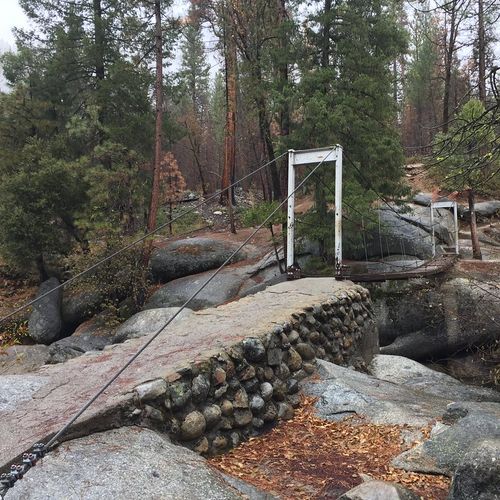
This trail leads to a picturesque (formerly swinging) bridge, offering a serene walk through a forest and along a river. The area is popular for swimming and picnicking during warmer months. The trail is easy and accessible, making it suitable for families and casual hikers.

Wawona Point

Wawona Point

Moderate9.5 mi

This demanding out-and-back hike leads to Wawona Point, a breathtaking overlook known for its sweeping vistas. The route passes some of the park’s most iconic giant sequoias, including the Bachelor and Three Graces and the Grizzly Giant, adding memorable highlights along the way. While connecting trails provide options for creative loop variations, hikers should be prepared for occasional icy patches and busy stretches. Start early, carry plenty of water, and wear sturdy footwear to make the most of this scenic adventure.

#14 Dewey Point Ridge Trail

#14 Dewey Point Ridge Trail

Easy2 mi

This trail offers breathtaking views of El Capitan, Cathedral Rocks, and the Yosemite high country. It passes through McGurk Meadow, featuring historic cabins and lush wildflowers, before reaching the scenic overlook at Dewey Point. The trail is known for its moderate difficulty and stunning vistas, making it a popular choice for hikers seeking a memorable experience.

Big Trees Loop Trail

Big Trees Loop Trail

Easy0.3 mi

A short, relatively flat 0.3-mile (0.5 km) loop beginning at the Mariposa Grove Arrival Area. Winding through a forest of giant sequoias, the Big Trees Loop features the Fallen Monarch and interpretive panels on the life and ecology of giant sequoias. The loop is wheelchair accessible and typically takes 30–45 minutes. Longer hikes that visit the Grizzly Giant and the California Tunnel Tree (for example, the 2-mile Grizzly Giant Loop) start from the same arrival area but are separate trails.

Bike Path

Difficult8.6 mi

Roll through picturesque meadows like Cook’s Meadow and Ahwahnee Meadow, offering stunning views of Half Dome and Yosemite Falls. The route follows paved bike paths, providing an immersive experience with iconic landmarks such as Sentinel Rock and El Capitan. Bicyclists can enjoy the tranquility of these natural settings while navigating the valley floor, which is dotted with historic sites and scenic vistas.

Carlon Falls Trail

Carlon Falls Trail

Easy1.5 mi

This trail follows the South Fork of the Tuolumne River through a shaded forest, leading to a serene waterfall. The hike offers opportunities for swimming and wildlife viewing, making it a popular spot during warmer months. The trail passes through areas affected by past fires, but lush vegetation remains, especially near the river.

Cook's Meadow Trail

Cook's Meadow Trail

Easy0.7 mi

Enjoy breathtaking views of Yosemite Falls, Half Dome, Glacier Point, and Sentinel Rock while strolling through a picturesque meadow. This easy loop offers a classic perspective on Yosemite Valley's most iconic features, making it a must-visit for any park visitor.

Dog Lake Trail

Moderate2.3 mi

Nestled in a picturesque setting, this small lake is ringed by evergreen trees and backed by granite mountains. The trail begins with a steep ascent before leveling out, offering a tranquil destination for hikers seeking solitude. The lake is home to various wildlife, including water birds and deer. It's a popular stop during summer months, though it remains less crowded than some other destinations. Combining this hike with a visit to nearby Lembert Dome provides panoramic views of the surrounding meadows and peaks.

Dozier Dome Climbing Approach

Moderate1.3 mi

Dozier Dome is a granite dome popular among climbers. The approach to the dome and its various climbing routes can change seasonally. Visitors can expect a mix of slab and crack climbing, making it an exciting destination for those looking for a challenge.

El Capitan Trail

El Capitan Trail

Extreme9.6 mi

This trail ascends to and along El Capitan, the towering granite monolith, passing through oak and pine forests and crossing small creeks on some approaches. The hike is strenuous, with significant elevation gain, and rewards hikers with expansive panoramic views of Yosemite Valley and the high country from the summit or valley rims. Common approaches begin from Tamarack Creek (Tioga Road) or from the Yosemite Valley/Yosemite Falls area.

Grizzly Trail

Easy1.4 mi

Embark on the Grizzly Trail, where you'll meander through the magnificent Mariposa Grove of Giant Sequoias, home to around 500 majestic trees. A highlight of your journey is the ancient Grizzly Giant, a stunning 3,000-year-old sequoia, along with the unique California Tunnel Tree. The trail offers a variety of hiking options, catering to different skill levels, and features an accessible section near the Grizzly Giant for those with mobility needs.

Guardians Loop Trail

Guardians Loop Trail

Easy1.4 mi

Wander through an upper section of the grove, passing by the Mariposa Grove Cabin, a historic site built by early guardian Galen Clark. The route highlights several notable sequoias, including the Galen Clark Tree and the Fallen Wawona Tunnel Tree. This area offers a more secluded experience compared to the lower grove, with fewer crowds and a chance to appreciate the tranquility of these ancient giants.

Happy Isles

Happy Isles

Easy0.1 mi

Happy Isles is a popular trailhead in Yosemite Valley and the starting point for multiple backcountry routes. From Happy Isles hikers commonly access trails to Illilouette Basin, Little Yosemite Valley (LYV), and routes beyond LYV (Donohue Pass–eligible). The Happy Isles trailhead is divided into quota categories for backpackers (to Illilouette, to LYV, or past LYV), and is a commonly used access point for those headed to Half Dome or longer wilderness trips.

High Sierra Loop

High Sierra Loop

Extreme47.4 mi

Granite peaks tower above ancient pine forests and tranquil lakes, with boulder-strewn rivers cutting through the landscape. The route passes through stunning alpine meadows and offers breathtaking views of iconic landmarks. Along the way, hikers encounter a series of rustic camps, providing a unique blend of wilderness adventure and rustic luxury. The scenery is punctuated by waterfalls and vast expanses of smooth granite, creating an unforgettable hiking experience.

Indian Arch Trail

Indian Arch Trail

Easy0.3 mi

This trail offers a glimpse into Yosemite's unique rock formations. The arch is a notable feature, often visited as part of longer hikes to areas like North Dome. The surrounding landscape provides opportunities for stargazing and wildlife spotting.

Ireland Lake Trail

Difficult7.5 mi

Nestled deep within the high Sierra, this alpine lake offers breathtaking views of surrounding mountain peaks. The journey involves traversing through Lyell Canyon, a picturesque sub-alpine meadow, before ascending on a well-maintained trail through pine forests. The trail provides stunning vistas of the Sierra range, including the Cathedral Range. The lake itself is a serene destination, perfect for backpackers seeking solitude and natural beauty. Water sources along the way include the Tuolumne River and Ireland Creek, requiring treatment before consumption.

Lembert Dome and Dog Lake Trail

Lembert Dome and Dog Lake Trail

Moderate0.9 mi

Climb a granite dome sculpted by glaciers, offering breathtaking 360-degree views of Tuolumne Meadows and surrounding peaks like Mt. Dana and Cathedral Peak. The ascent involves a gradual forest hike followed by a scramble up the dome's granite face. The summit provides a spectacular vantage point for observing the meadows and nearby mountains. Nearby, the tranquil Dog Lake offers an additional scenic destination for those combining this hike into a loop.

Lower Cathedral Lake Trail

Lower Cathedral Lake Trail

Easy0.6 mi

Lower Cathedral Lake is reached via a short spur (about 0.7 miles) off the Cathedral Lakes Trail from the Tuolumne Meadows trailhead. The lake sits at the foot of Cathedral Peak and provides classic views of Cathedral Peak and nearby granite peaks and alpine lakes. The Cathedral Lakes area is on the John Muir Trail and is a popular, often busy destination rather than a remote, secluded spot.

Lukens Lake Trail

Lukens Lake Trail

Easy2.3 mi

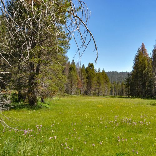
This trail leads to a picturesque lake nestled in a meadow filled with shooting stars and other wildflowers during the summer. The short route offers a quick and easy hike, while the longer route from White Wolf provides a more varied experience through forests and meadows.

McCabe Lakes Trail

Easy2.2 mi

This trail leads to secluded alpine lakes, offering breathtaking views of the surrounding mountains. The hike involves traversing through meadows and forests, with opportunities to see waterfalls along the way. The lakes are less trafficked, providing a more private experience for those willing to venture off the main trails.

McGurk Meadow Trail

McGurk Meadow Trail

Easy3.7 mi

Wander through a shaded forest to a picturesque meadow, where wildflowers bloom in vibrant colors during the summer months. The trail passes by the historic McGurk Cabin, a relic of the area's ranching past. This peaceful setting is home to diverse wildlife and offers a tranquil escape from crowded areas. The meadow's serene atmosphere and natural beauty make it an ideal spot for a leisurely hike or picnic.

Medlicott Dome Climbing Approach

Easy1.2 mi

A steep, aerobic climb leads to the base of a prominent granite dome, featuring a high concentration of popular climbing routes. The approach involves a climber's trail that connects to a well-maintained path, offering scenic views of surrounding peaks and lakes. The trail includes a notable bench that provides a gentle ascent along the dome's face, eventually leading to a more rugged terrain of granite slabs.

Mono Meadow Trail

Mono Meadow Trail

Moderate5.8 mi

Mono Meadow Trail drops steeply from the Mono Meadow Trailhead to a persistently wet high meadow that supports lush summer vegetation and wildflower displays; bring waterproof footwear and be prepared for steep, uneven terrain.

Mount Conness East Climbing Approach

Difficult2.3 mi

Climb through a scenic landscape of alpine lakes and rugged ridges, featuring minimal scree and boulder fields. The route involves class III climbing with significant exposure, particularly in the final summit section. The terrain transitions from grassy slopes to looser talus, culminating in a narrow ridgeline with breathtaking views. Camping opportunities are available throughout the area, making it suitable for both day climbs and multi-day excursions.

Mount Dana Trail

Mount Dana Trail

Difficult2.6 mi

Rising high in the Tioga Pass area, this mountain offers a challenging ascent through a stark alpine environment. The hike begins in a shaded meadow before transitioning into a steep, rocky climb with no shade. As elevation increases, the landscape transforms, featuring hardy shrubs, wildflowers, and patches of lingering snow. The summit provides spectacular views of Mono Lake, the Sierra Nevada, and surrounding peaks like Mt. Lyell and Mammoth Peak. The trail, though not officially maintained, is marked by cairns and offers a thrilling adventure for experienced hikers.

Mt. Hoffmann Trail

Mt. Hoffmann Trail

Moderate1.6 mi

Ascend through granite expanses and forests to reach the summit, offering breathtaking views of the surrounding mountains and valleys. The trail features a mix of maintained paths and unmarked routes, requiring some scrambling near the top. May Lake provides a serene backdrop before the ascent.

Pohono Trail

Pohono Trail

Extreme12.5 mi

This trail offers stunning views of Yosemite Valley's iconic landmarks like El Capitan and Yosemite Falls. It traverses through forests and along the valley rim, providing breathtaking vistas at points like Dewey Point and Taft Point. The trail is known for its scenic beauty and varied landscapes.

Polly Dome Lakes Trail

Polly Dome Lakes Trail

Easy0.4 mi

From the Murphy Creek/near-Tenaya Lake trailhead, hike through subalpine forest to reach a group of small alpine lakes located north of Tenaya Lake just past Polly Dome. The route travels through forested sections and opens onto granite landscapes with scattered glacial features; as you approach the lakes you get views of Polly Dome and the surrounding Sierra Nevada. Note: access to the lakes follows an unofficial, unmarked spur trail from the main route.

Red Peak Pass Trail

Difficult4.6 mi

This trail offers breathtaking views as it traverses the Clark Range, featuring steep granite trails and picturesque alpine lakes. The pass is surrounded by peaks over 11,000 feet, providing stunning vistas to both the south and north. The route involves a challenging ascent but rewards hikers with unique landscapes and geological formations.

Smith Peak Trail

Smith Peak Trail

Difficult12.6 mi

Ascend through shaded forests and meadows, passing remnants of an old cabin, to reach a summit offering breathtaking vistas of the Hetch Hetchy Reservoir and surrounding peaks. The trail traverses diverse landscapes, including areas recovering from wildfires, and features wildflowers and wildlife. The final ascent involves some bushwhacking through shrubs, but the reward is stunning views in all directions.

Snow Creek Trail

Snow Creek Trail

Moderate9.2 mi

Not applicable for this location

Sunrise Lakes Trail

Sunrise Lakes Trail

Moderate2.6 mi

This high-country route leads through mixed conifer forest and alpine meadows to the Sunrise Lakes, located south of Tenaya Lake on the slopes of Sunrise Mountain. The lakes offer scenic views of Tenaya Canyon and Mt. Hoffmann, and the area is often used as an access route toward Clouds Rest. Wildlife such as mule deer and black bears can be seen in the area.

Tenaya Lake Trail

Tenaya Lake Trail

Extreme5.1 mi

Tenaya Lake, located along Tioga Road, offers stunning views of an alpine lake framed by majestic granite peaks and lush forest. Trails branch off from the lake in two directions: north toward Murphy Creek and the Poly Dome/Ten Lakes area, and south toward Clouds Rest, Sunrise Lakes, and the Sunrise High Sierra Camp. This picturesque area features a beach, picnic facilities, and serves as a trailhead for hikes into the high country, including access to Clouds Rest.

Vogelsang High Sierra Camp

Vogelsang High Sierra Camp

Difficult14.3 mi

Winding through the high country, this route offers views of alpine lakes, meadows, and towering peaks. It provides access to the alpine environments of the Cathedral Range, with views of Rafferty, Fletcher, and Vogelsang Peaks. The trail passes near alpine lakes and along granite ridgelines, creating a dramatic backdrop for hiking and backpacking.

Young Lakes Trail

Young Lakes Trail

Extreme8.6 mi

This trail leads to a chain of three alpine lakes north of Tuolumne Meadows, with Ragged Peak rising above the first lake. The official trail ends at the first lake below Ragged Peak, but a well-used informal trail continues to the second and third lakes. The hike offers wide panoramic views of the Cathedral Range and Yosemite's high country; along the way, enjoy alpine meadows, forests, and creeks, a classic high-Sierra experience.

Young Lakes via Dog Lake Trail

Moderate3.4 mi

This trail offers stunning views of the Cathedral Range and leads to a chain of alpine lakes popular for backpacking and photography. The hike traverses forests and alpine meadows, providing vistas of nearby peaks such as Ragged Peak. The official trail ends at the first lake below Ragged Peak; a well-used informal route continues to the second and third lakes. The route is commonly done as an intermediate backpacking trip and offers opportunities for camping and fishing.

Alder Creek Trail

Difficult11.8 mi

Alder Creek Trail weaves through a serene pine forest, leading to a stunning 100-foot waterfall that is rarely seen by most visitors. This strenuous hike offers a more secluded experience, perfect for those in search of tranquility away from the busier paths. The natural beauty along the trail provides ample opportunities for photography and enjoying the peaceful sounds of nature.

Boothe Lake Trail

Easy0.3 mi

Buckeye Pass Trail

Difficult5.3 mi

Budd Lake Trail

Moderate2.9 mi

Forsyth Trail

Moderate2.4 mi

Happy Isles Fen Boardwalk

Easy0.3 mi

This short trail provides a serene experience, allowing hikers to traverse a boardwalk over wetlands near the Merced River. It offers a peaceful atmosphere and is suitable for all skill levels, making it an accessible option for visitors seeking a brief, easy hike.

Isberg Pass Trail

Extreme9.9 mi

Kerrick Meadow Trail

Difficult6.7 mi

Lower Gaylor Lake Trail

Moderate2.3 mi

The Gaylor Lakes trail from the Tioga Pass Entrance Station is a short but steep trail that typically takes 2–3 hours; expect a steady climb to a ridge with spectacular views of Dana Meadows and the high Sierra. The trail then drops about 200 feet toward the lakes and basin above Lower Gaylor Lake; check wilderness permit stations for current conditions, closures, and any stock-use restrictions before you go.

Murphy Creek Trail

Moderate2.8 mi

Murphy Creek Trail begins at the Tenaya Lake trailhead (Tioga Road) and heads north from Tenaya Lake toward Murphy Creek and the Poly Dome Lakes. It is one of two trails leaving Tenaya Lake (the other heads south toward Clouds Rest, Sunrise Lakes, and Sunrise High Sierra Camp) and provides access to the Murphy Creek/Poly Dome area in Yosemite National Park.

Nelson Lake Use Trail

Easy3.4 mi

North Dome Gully Climber's Descent

Easy0.2 mi

From the Porcupine Creek trailhead, the North Dome route is a 10.4-mile (16.7 km) round-trip hike through pine forest and meadow that typically takes 5–7 hours. After a paved stretch and crossing Porcupine Creek you'll descend steep steps to the dome’s base and climb to the summit for sweeping views of Half Dome, Indian Rock, Tenaya Canyon and Yosemite Valley; sources list elevation gain between about 580 and 1,100 feet.

Poopenaut Valley Trail

Poopenaut Valley Trail

Difficult2 mi

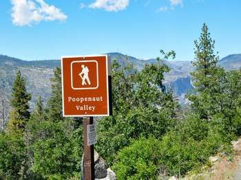
Poopenaut Valley Trail is a short but steep 2.5-mile (4 km) roundtrip hike in the Hetch Hetchy area that descends into Poopenaut Valley to the Tuolumne River, offering rugged canyon scenery and close river access. Begin at the signed trailhead four miles past the entrance station; expect a strenuous 1,279-foot (390 m) climb back out, making the route challenging despite its short distance.

South Face Route Approach

Moderate0.9 mi

Approach route used by climbers to reach the south face (commonly associated with Washington Column / 'Skull Queen'). This is not an officially maintained hiking trail and detailed approach directions are not provided here. Climbers should select the appropriate route/formation when applying for a climbing permit (see National Park Service climbing permit categories, e.g., "Washington Column-South Face/Skull Queen") and pick the most appropriate trailhead for their climb. For exact approach directions, route beta, and current conditions, consult climbing rangers, established guidebooks, or reputable climbing route databases prior to attempting the approach.

Sunnyside Bench Climber's Descent

Easy0.6 mi

Swan Slab Climber's Descent

Easy0.2 mi

Virginia Pass Trail

Difficult2.5 mi

This trail offers a scenic route from the Green Creek/Green Lake area into Northern Yosemite, passing through diverse landscapes and offering stunning views. The trail follows a use path that is generally easy to moderate, suitable for hikers looking for a less crowded experience.

Washburn Trail

Easy1.9 mi

Climb to a historic fire lookout with breathtaking 360-degree views of the surrounding landscape. The trail offers stunning vistas of the Grand Canyon and Hayden Valley, along with sightings of bighorn sheep. Wildflowers abound on the slopes, making this a picturesque hike.

After Six Scramble Descent

Easy0.3 mi

Chapel Boardwalk

Easy0.1 mi

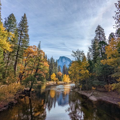
A short boardwalk that leads through Sentinel Meadow near Yosemite Chapel toward Upper Yosemite Fall. This easy, scenic walk is a popular stopping point for views of Yosemite Falls (and reflections of Half Dome in the Merced River nearby). The boardwalk traverses meadow vegetation and provides a convenient, family-friendly place to view the valley's waterfalls and typical meadow birdlife.

Chilnualna Falls Stock Trail

Chilnualna Falls Stock Trail

Easy0.2 mi

This trail follows Chilnualna Creek through forested terrain and passes cascades and the multi-tiered Chilnualna Falls. The route climbs steeply via a series of switchbacks and is described as very challenging in places; hikers should expect steep sections rather than a gentle, steady incline. The trail is lightly traveled and provides a quieter alternative to Yosemite’s busier trails, with waterfall views beginning soon after the trailhead and broader views of the Wawona valley and the Buena Vista Range from higher points. Chilnualna Falls is fullest in spring and early summer.

Chinquapin Trail

Moderate2.5 mi

No description available

Clouds Rest Bypass Trail

Clouds Rest Bypass Trail

Easy0.6 mi

The Clouds Rest Trail from the Sunrise Lakes trailhead at Tenaya Lake climbs through forest to Sunrise Lakes and onward to the Clouds Rest summit; the route is narrow and rocky, with about 2,300 feet of gain over a 14-mile round trip. From the summit you'll have sweeping views of the High Country, Tenaya Canyon, Half Dome and Yosemite Valley; permits are very high in demand and the trail can be snow-covered November through May, so check current conditions.

Crescent Lake Trail

Easy0.1 mi

Daff Dome Approach

Easy0.5 mi

This trail leads to Daff Dome, a notable granite feature in the Tuolumne Meadows area. The approach is generally short and pleasant, offering scenic views of the surrounding landscape. The dome itself is popular among rock climbers, featuring several multi-pitch slab and crack climbs.

Dana Fork Trail

Easy2.2 mi

This trail offers a less crowded route through the high country, connecting the Lower Gaylor Lakes Trail to the Mono Pass Trailhead. It traverses scenic landscapes with views of surrounding peaks and meadows, providing a tranquil hiking experience amidst the Sierra Nevada's natural beauty.

East Beach Trail

Easy0.4 mi

Eleanor Creek Gaging Station Trail

Easy0.4 mi

This trail offers a brief, easy walk through a woodland area, providing a serene escape into nature. It serves as a connector or alternative route, making it suitable for those looking for a quick, peaceful hike.

Five Open Books Descent Trail

Easy0.2 mi

This trail offers a scenic descent through granite formations, providing stunning views of Yosemite Valley. It is part of the broader Five Open Books area, known for its climbing routes and picturesque surroundings. The descent involves navigating through some third to fourth-class terrain, requiring careful footing and attention to the surroundings.

Iron Creek Trail

Moderate2.8 mi

Iron Creek Trail offers a scenic adventure nestled in nature. Enjoy a variety of landscapes, featuring lush greenery and picturesque viewpoints. This trail is perfect for hikers looking to explore the beauty of the outdoors while experiencing the tranquility of the surrounding wilderness.

Kendrick Creek Trail

Easy1.3 mi

Kendrick Creek Trail in Hetch Hetchy offers a scenic hiking experience. The trail features a variety of landscapes and provides opportunities to enjoy the natural beauty of the area. To enhance your visit, start early to avoid midday heat, carry plenty of water, and be cautious of loose sand and rocky footing. Make sure to stay on the trail near steep drop-offs, refrain from swimming above waterfalls, and remember that leashed pets and bikes are permitted only on the first paved mile.

Lunch Meadow Trail

Easy3.1 mi

Old Glacier Point Road

Moderate3.2 mi

This trail follows remnants of the historic Old Glacier Point Road, offering a glimpse into the past. It winds through scenic areas, providing views of the surrounding landscape. The route is less traveled, making it a unique experience for those interested in history and solitude.

Old Tioga Road

Moderate5.6 mi

Starting at Lukens Trailhead, the short, easy Tioga Road to Lukens Lake trail (1.6 mi round-trip, 200 ft elevation gain) winds through forest over a saddle into a meadow-ringed lake. Expect wildflowers in early summer and wet, muddy conditions until early August. Tioga Road access is seasonal, typically open from late May or June through November, with snow closures the rest of the year.

Perimeter Trail

Difficult4.5 mi

Stables Access

Easy1.7 mi

The Tuolumne Meadows Stable is the main access point for stables in the Tuolumne Meadows area, open during the summer from 7 AM to 4 PM. Visitors can enjoy the breathtaking scenery and tranquility of the surrounding landscape while participating in equestrian activities. Please remember that stock users must adhere to certain guidelines to help preserve the park’s natural beauty.

Tamarack Flat Trail

Difficult5.8 mi

The Tamarack Flat/Tamarack Creek route from Tioga Road (trailhead at Tamarack Creek, about 4 miles east of Crane Flat) winds through vast forests and across small creeks to the summit of El Capitan, offering expansive views of Yosemite Valley and the high country. This long out-and-back covers 21.6 miles with roughly 1,700 feet of gain; permit demand is low and access depends on Tioga Road and the seasonal opening of nearby Tamarack Flat Campground.

Get offline trail maps and detailed hiking info in the Parka app

Download Parka — It's Free

Get offline trail maps for Yosemite National Park

Free on the App Store

Get Parka

Why Park Lovers Choose Parka

Trip Planner

All the tools for epic adventures

Works Offline

Fully functional without cell service

Updated Weekly

Trail conditions, alerts, and closures

Try Risk-Free

7-day free trial, cancel anytime

Start Your 7-Day Free Trial

Unlock everything you need for your next national park trip. Your first week is on us!

National Park vista

Start your adventure today

Download Parka and plan your perfect national park trip in minutes.