ParkaDownload
Olympic National Park

Trails in Olympic National Park

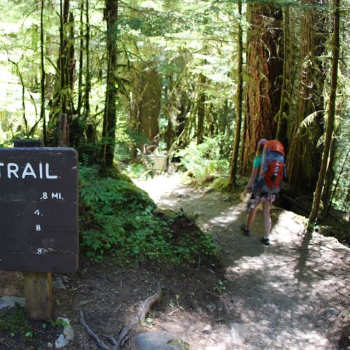
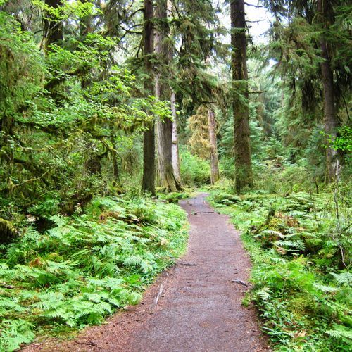
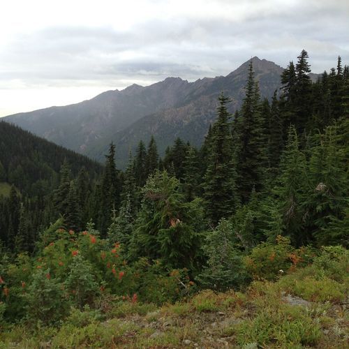
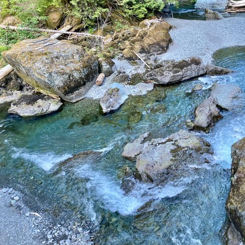
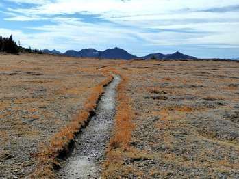
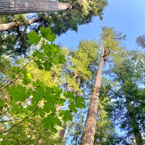
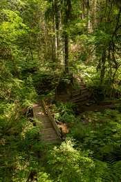
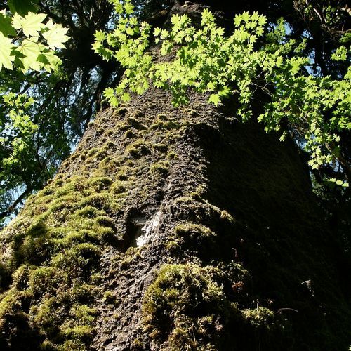
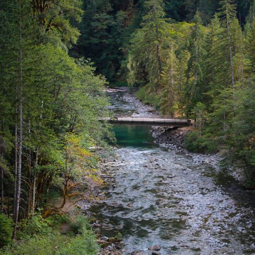
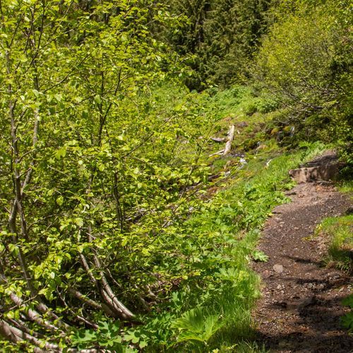
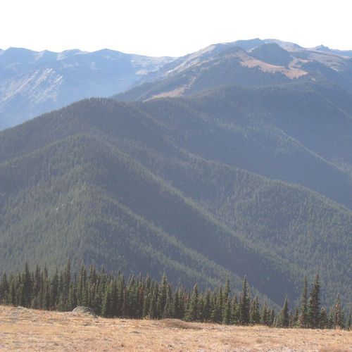
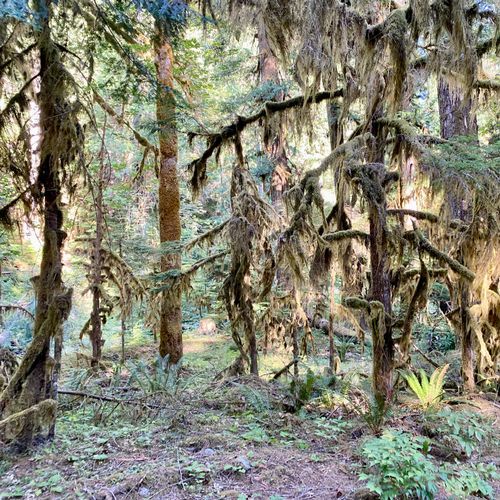
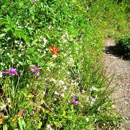
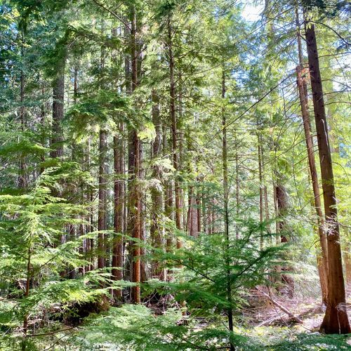
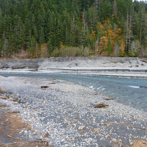
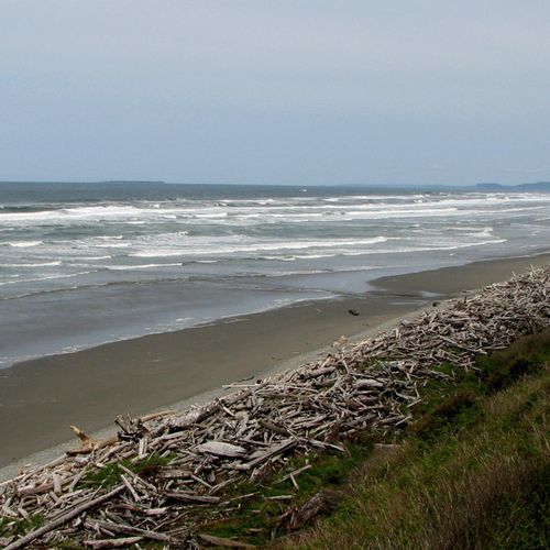
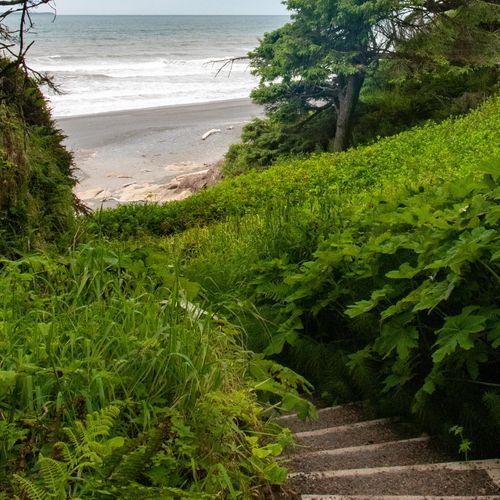
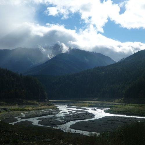
Olympic National Park is one of the West’s great hiking landscapes, with 191 trails spanning everything from easy forest rambles to punishing wilderness routes. The range is unusually broad: 92 easy trails make the park approachable for casual walkers and families, while moderate and difficult options open the door to deeper valley hikes, alpine viewpoints, and classic backcountry terrain. Then there are the extreme routes, which speak to Olympic’s wild core—steep, remote, and serious undertakings for strong, prepared hikers. That spread is exactly what makes the park so appealing: you can spend an hour under dripping moss and giant spruce, or disappear for days into a roadless mountain wilderness. The standout hikes capture Olympic’s astonishing variety. In the Hoh Rain Forest, the Hall of Mosses is the essential short walk, a compact introduction to the park’s cathedral-like old growth, while the Hoh River Trail stretches deep into the interior through lush rainforest toward glacier country. Hurricane Hill delivers one of the park’s most rewarding mountain hikes, with sweeping high-country views that feel dramatically removed from the lowland forests. Around Lake Crescent, Sol Duc, and the Quinault valleys, trails lead to waterfalls, river corridors, alpine lakes, and some of the park’s most beloved backpacking country, including routes toward Seven Lakes Basin and Enchanted Valley. What makes hiking here special is the sheer contrast packed into one park. Olympic is not a single landscape but a collection of them: temperate rain forest, glacier-carved peaks, salmon rivers, old-growth valleys, and rugged coastline, all tied together by trails. Much of the park’s interior remains roadless wilderness, so hiking is not just a pastime here—it is the way to truly enter the park. Few places in the country offer this kind of immersion, where a trail can carry you from fern-lined forest floor to open ridgeline, from hushed mossy groves to big, weather-shaped mountain country, all in the same national park.

Hall of Mosess Trail

Hall of Mosess Trail

Easy1.1 mi

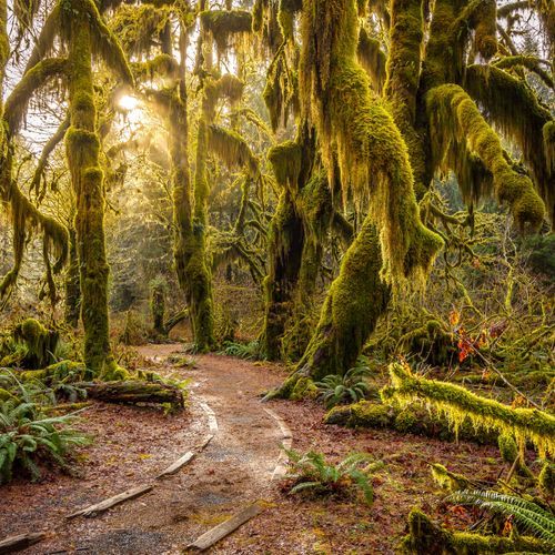
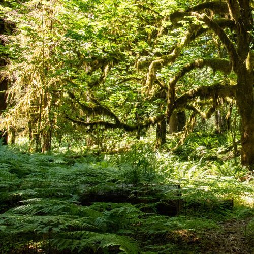
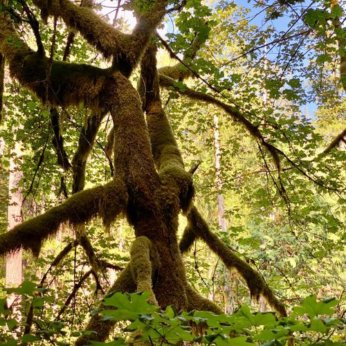
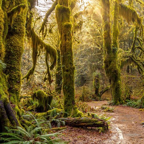
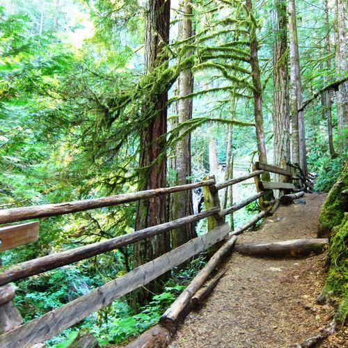
Step into a lush temperate rainforest where towering ancient trees, including western hemlocks, bigleaf maples, and Sitka spruces, are enveloped by a vibrant carpet of mosses and ferns. The air is cool and crisp, and the landscape is reminiscent of a fairytale. Wildlife such as Roosevelt elk and banana slugs inhabit this enchanting environment. The forest floor, rich with moss-covered nurse logs and giant fallen trees, offers a unique glimpse into the life cycle of this ecosystem.

Hurricane Hill Nature Trail

Hurricane Hill Nature Trail

Moderate3.5 mi

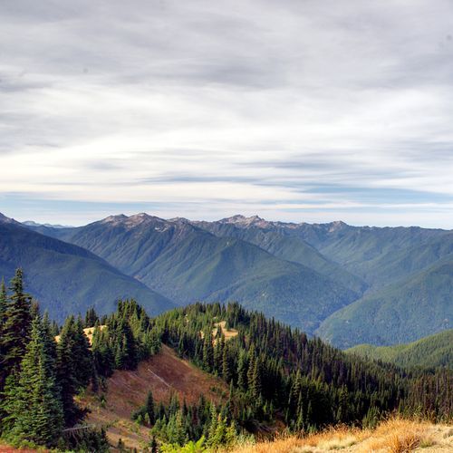
This trail offers stunning 360-degree views from its summit, including the Olympic Mountains, Vancouver Island, and the Strait of Juan de Fuca. The hike begins with a gentle slope before ascending more steeply, passing through open forests and wildflowers in early summer. The trail is well-maintained and accessible, making it a popular choice for visitors.

Lake Angeles Trail

Lake Angeles Trail

Difficult7.2 mi

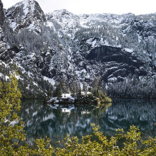
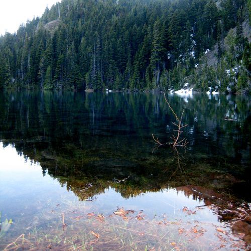
This trail climbs through shaded montane forest and transitions into subalpine forest and meadows. The lake basin contains a forested island and cliffs rise from the far shore, and the area offers views of the surrounding mountains. Hikers can reach and explore the lake and its shores.

Marymere Falls Trail

Marymere Falls Trail

Easy1.9 mi

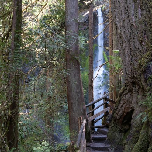
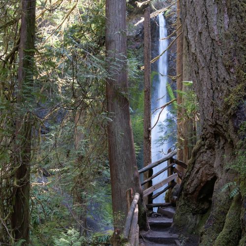
The Marymere Falls Trail begins at the Storm King Ranger Station and winds through old-growth temperate rainforest, with moss-covered trees and large big-leaf maples that give the area a cathedral-like atmosphere typical of the Pacific Northwest. The short trail leads to an overlook of Barnes Creek and Marymere Falls. Note that the first half-mile is a hard-packed surface with uneven terrain; while the trail is popular with families and day hikers, portions have uneven footing and visitors should be prepared for that.

Mount Storm King Trail

Mount Storm King Trail

Difficult4.1 mi

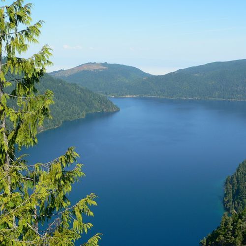
This steep trail climbs through forest from near Lake Crescent to exposed rocky overlooks with sweeping views of Lake Crescent. The route becomes increasingly demanding, transitioning to a rugged, exposed scramble toward the summit. The trail's scenic overlooks and challenging terrain make it a rewarding yet strenuous adventure.

Pyramid Mountain Trail

Pyramid Mountain Trail

Difficult6.9 mi

This trail offers a mix of terrains, leading hikers through diverse landscapes. The climb is moderate, with scenic views from the summit. The trail's surface is primarily dirt, making it suitable for hikers seeking a challenging yet rewarding experience.

Sol Duc Falls Trail

Sol Duc Falls Trail

Easy1.9 mi

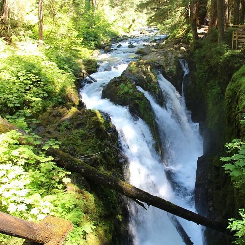
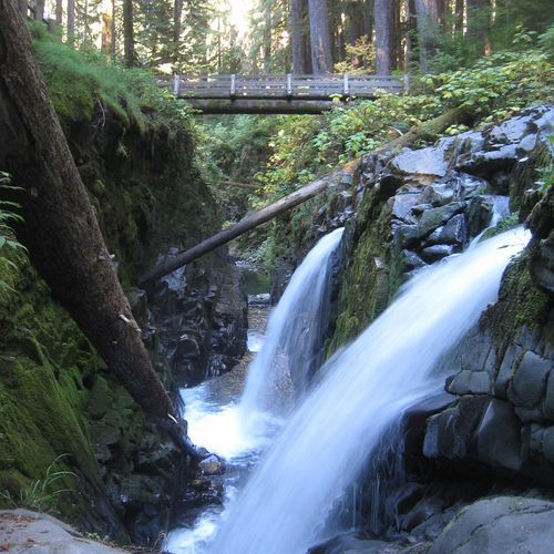
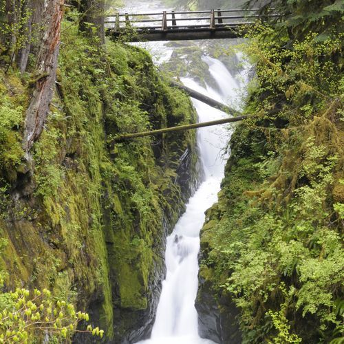
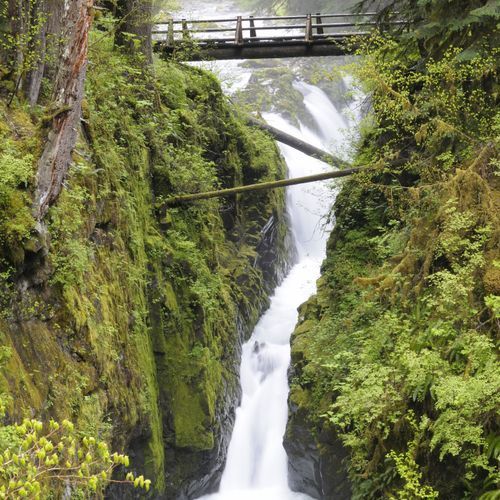
This short trail leads through old-growth forest to a viewpoint of Sol Duc Falls, a cascading waterfall on the Sol Duc River. The shaded path is lined with moss-covered rocks and dense vegetation and is a popular day hike for families and nature enthusiasts.

Spruce Nature Trail

Spruce Nature Trail

Easy

Meander through a centuries-old rainforest, observing 'nurse logs' where new seedlings grow on fallen trees. The trail offers stunning views of the Hoh River, known for its glacial waters, and is a prime spot to see Roosevelt Elk herds. Surrounded by towering moss-laden trees, this trail provides a quintessential rainforest experience.

Ancient Groves Nature Trail

Ancient Groves Nature Trail

Easy0.5 mi

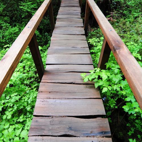
This short loop trail winds through a stunning old-growth forest, featuring giant trees covered in moss and offering views of the Sol Duc River. The trail includes boardwalks and short bridges, maintaining a peaceful atmosphere amidst the dense foliage. It's an ideal stop for those seeking a brief, tranquil hike amidst nature's grandeur.

Deer Lake Trail

Deer Lake Trail

Moderate6.6 mi

Deer Lake Trail is located in Olympic National Park's Deer Park / High Divide / Seven Lakes Basin area. The route passes through montane and old‑growth forest and subalpine meadows near Deer Lake and is often used as part of the High Divide / Seven Lakes Basin loop. Deer Park is an alpine area reached by a long, winding gravel road. Backpacking in this area requires a wilderness permit, and all food, garbage, and scented items must be stored in park‑approved bear canisters.

East Fork Quinault River Trail

East Fork Quinault River Trail

Extreme17.3 mi

This trail winds through a lush temperate rainforest, featuring old-growth forests, waterfalls, and a historic chalet. Wildlife such as black bears and Roosevelt elk are common. The trail offers a mix of forested sections and scenic river views, culminating in the picturesque Enchanted Valley.

Heart O' the Forest Trail

Heart O' the Forest Trail

Moderate4.2 mi

This trail offers a peaceful journey through a lush, old-growth forest, featuring large trees and a variety of flora. It meanders along streams and eventually descends into a creek valley, ending at a private property boundary. The trail's tranquility and scenic beauty make it a standout experience.

High Divide Traverse

High Divide Traverse

Extreme46.5 mi

Winding through ecosystems, from low-elevation old-growth rainforest and montane forest to subalpine meadows and high basins, the traverse offers breathtaking vistas of the glaciated peaks of Mount Olympus and views of numerous alpine lakes, including the Seven Lakes Basin. The route moves from dense old-growth forest up into subalpine environments where wildlife such as American black bears and Roosevelt elk may be encountered, and at higher points hikers are rewarded with expansive ridge views and colorful seasonal vegetation.

Hoh River Trail

Hoh River Trail

Moderate9 mi

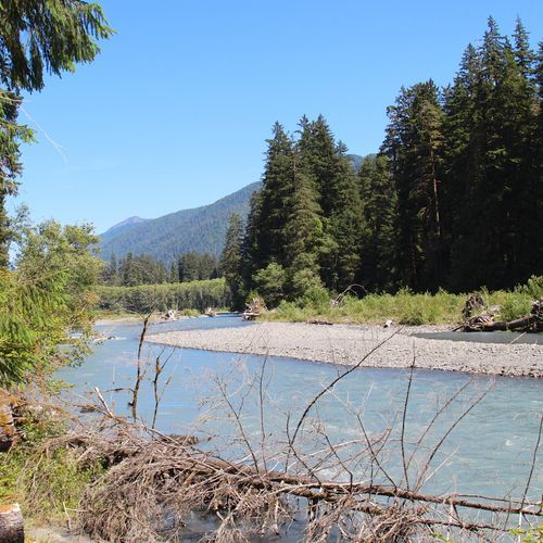
Wind through one of the world's most pristine temperate rainforests, featuring massive, moss-covered trees and the milky-gray Hoh River. The trail offers stunning views of alpine scenery and leads to the Blue Glacier moraine on the shoulder of Mount Olympus, where hikers can view Blue Glacier from below; reaching the glacier itself or climbing Mount Olympus requires glacier-travel skills and equipment. It's a habitat for Roosevelt elk and other wildlife, making it a unique and immersive hiking experience.

Hole in the Wall Trail

Hole in the Wall Trail

Moderate1.7 mi

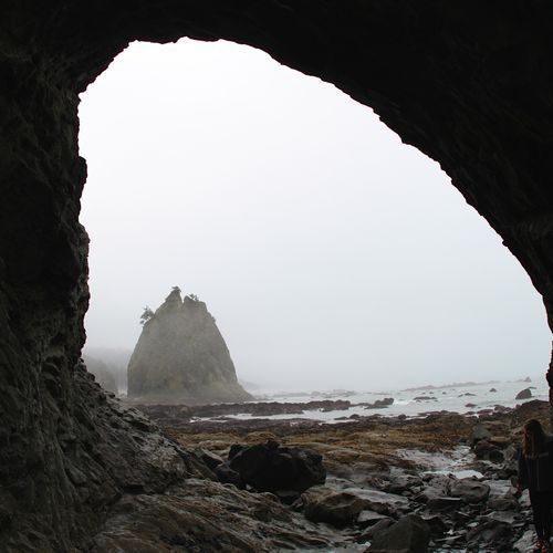
Experience a dramatic coastline where massive sea stacks and driftwood dominate the landscape. The journey involves navigating soft sand and cobblestone beaches, with opportunities to explore tide pools filled with marine life. At low tide, a narrow arch allows passage to a secluded beach, offering breathtaking views of the rugged shoreline. The area is rich with wildlife, including eagles and pelicans, and features unique geological formations shaped by relentless ocean waves.

Kestner Homestead Trail

Kestner Homestead Trail

Easy1.3 mi

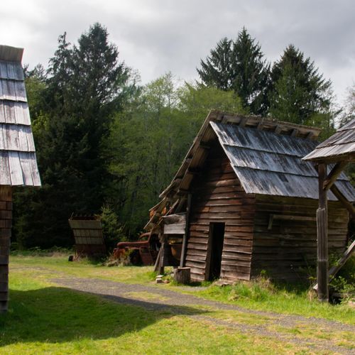
Walk through a temperate rainforest dominated by maple and moss on a self-guided 1.3-mile loop that leads to the historic Kestner Homestead. The trail passes through maple glades and mossy benches, includes a short bridge and gently rolling tread, and provides interpretive information about homestead life and early settlers.

Lover's Lane Trail

Lover's Lane Trail

Moderate5.7 mi

This trail winds through a lush forest of towering Douglas-firs, hemlocks, and Sitka spruce, offering stunning views of the Sol Duc River and culminating at the picturesque Sol Duc Falls. The loop provides a serene hike with opportunities to relax at the Sol Duc Hot Springs Resort afterward.

Madison Falls Nature Trail

Madison Falls Nature Trail

Easy0.2 mi

This 0.1-mile, paved, gently sloping accessible trail leads to a 60-foot waterfall. The trail passes through forested vegetation and has information kiosks at the trailhead; an accessible vault toilet is located near the gravel parking lot. The trail is in the Elwha area, where large-scale river restoration has occurred.

Maple Glade Nature Trail

Maple Glade Nature Trail

Easy0.4 mi

This short loop winds through a lush rainforest, featuring moss-covered bigleaf maple trees and tranquil stream channels. The trail is ideal for families and offers an immersive experience with its moss-draped trees and vibrant greenery. It connects to the Kestner Homestead Trail for a longer exploration.

Ozette Loop

Ozette Loop

Moderate8.7 mi

Winding through lush coastal rainforest and along the rugged shoreline, the Ozette Loop offers scenic Pacific Ocean views and tall seastacks. The area contains evidence of long Makah habitation, with artifacts from the Ozette area well documented rather than specifically documented petroglyphs along the trail. Visitors often see seals and migrating gray whales, and the route includes boardwalks plus designated beach and backcountry campsites for day hikes or multi-day trips (permits required).

Second Beach Trail

Second Beach Trail

Easy0.6 mi

This short hike leads through a dense forest to a stunning Pacific coastline, featuring iconic sea stacks and expansive tide pools. The beach offers breathtaking sunsets and diverse wildlife, making it a must-visit destination.

Aurora Ridge Primitive Trail

Aurora Ridge Primitive Trail

Difficult5.4 mi

This trail traverses a high, forested ridge, providing stunning views of the surrounding landscape. The trail passes through old growth and montane forests, offering a unique hiking experience with diverse ecosystems. It requires careful planning due to its steep elevation changes and remote location.

Badger Valley Trail

Badger Valley Trail

Difficult4.1 mi

This trail offers mountain and valley vistas, traversing high alpine and subalpine meadows, short meadow grasses, and gravel-sized scree. The tread is maintained and the elevation trend is moderate; the route is generally rated moderate in difficulty. When snow melts, usually in late August, there are no reliable water sources and snow can persist into the season; ice axes and self-arrest skills are recommended, camping is limited to Roaring Winds Camp, and bear canisters are required in the high country.

Bailey Range Way Trail

Moderate2.7 mi

Experience the wild heart of the Olympic Mountains by traversing rugged alpine ridges and subalpine meadows. The Bailey Range Way follows exposed, often steep ridgelines with challenging route‑finding and may include seasonal snowfields; it does not cross crevassed glaciers. At lower elevations the route drops into old‑growth forest, offering a variety of ecosystems and spectacular views.

Big Cedar Nature Trail

Big Cedar Nature Trail

Easy0.1 mi

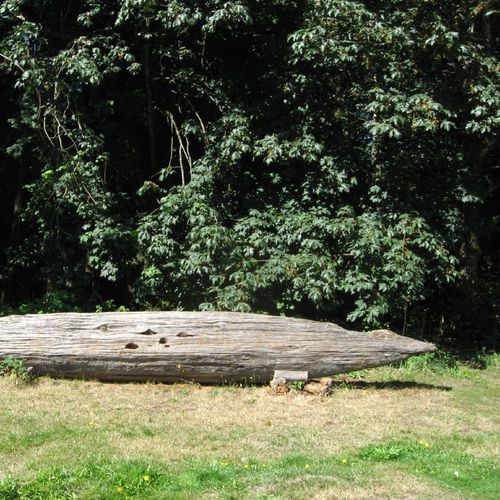
This short trail leads to the Big Cedar, a western red cedar that was partially felled by a 2014 storm. The remaining standing portion and the fallen half (about 14 feet in diameter) are an impressive sight; a smaller, still-impressive living cedar is also nearby. The compacted-gravel trail is generally wide and stable, but the edges slope off steeply where the trail circles the tree, so use caution near the tree.

Black and White Lakes Primitive Trail

Black and White Lakes Primitive Trail

Moderate1.9 mi

This challenging loop traverses through a canopy of old-growth trees, leading to a high alpine meadow with serene lakes. The trail features waterfalls and creeks, offering a scenic hike with varied landscapes. The return includes a primitive route that requires bushwhacking in some areas.

Blue Glacier Primitive Trail

Blue Glacier Primitive Trail

Difficult3.4 mi

Venture into the heart of the wilderness, where the grandeur of the Blue Glacier awaits. This primitive trail offers a challenging trek through dense forests, alpine meadows, and rugged terrain. As the path ascends, hikers are rewarded with breathtaking views of the glacier and surrounding peaks. The trail also provides opportunities to spot wildlife, including marmots, mountain goats, and a variety of bird species. Despite its demanding nature, the trail's stunning vistas and close encounters with the park's diverse ecosystems make it a rewarding journey for experienced hikers.

Bogachiel Peak Trail

Easy0.2 mi

Located near the Seven Lakes Basin, this area offers stunning views of the surrounding landscape. The High Divide trail provides access to Bogachiel Peak, offering breathtaking vistas.

Boulder Lake Trail

Moderate2.8 mi

This trail leads to a picturesque subalpine lake, offering panoramic views of the surrounding landscape. The path winds through stands of fir and hemlock, providing a serene hiking experience. Late summer brings the chance to spot bears foraging for huckleberries near the lake.

Cameron-Lost Primitive Trail

Difficult5.1 mi

This trail offers a challenging hike with steep ascents through forested slopes and into wildflower meadows. The route includes sections of scree and potential exposure, requiring careful navigation. The trail's remote nature and lack of clear signage contribute to its primitive classification.

Charlia Lakes Trail

Charlia Lakes Trail

Moderate1.9 mi

This trail offers a scenic journey through the Olympic wilderness, featuring alpine lakes and challenging terrain. The route often involves significant elevation changes and can be part of a larger, more demanding hike when combined with other trails.

Cirque Rim Nature Trail

Easy0.5 mi

This trail offers a scenic loop through high alpine meadows, with views of the Strait of Juan de Fuca and, on clear days, Vancouver Island and San Juan Islands. The path is paved (asphalt) and overlook interpretive signs highlight natural features. Note: van-accessible parking is available at the trailhead, but portions of the Cirque Rim Trail are steep (typical slopes of 12–20%) and may be difficult for some wheelchair users; the grade may require assistance and not meet accessibility standards.

Deer Lake Meadow Trail

Easy0.5 mi

This trail offers a short, easy walk suitable for families or those looking for a brief outdoor excursion. The forested surroundings provide a peaceful atmosphere, though specific features like notable landmarks or scenic views are not detailed.

Deer Ridge Trail

Difficult4.3 mi

Descend from the Three Forks area through montane forest into subalpine meadows, with notable rhododendrons and broad views of surrounding ridges and valleys. The trail splits shortly after Three Forks and continues past the park boundary into Olympic National Forest toward Slab Camp, offering scenic overlooks of Grand Valley and nearby peaks.

Devil's Punchbowl Trail

Easy0.2 mi

This trail offers a unique opportunity to explore dramatic geological formations, including tilted rock layers and scenic vistas. The area is characterized by its distinctive landscape, shaped by tectonic forces and erosion. Visitors can enjoy both the natural beauty and the educational aspects of the trail.

Dodger Point Primitive Trail

Extreme4.7 mi

This trail offers stunning views of the Olympic Mountains, leading to a historic fire lookout. The route passes through montane forests and subalpine meadows, offering spectacular vistas and opportunities to see wildlife. The trail's remote location makes it a challenging yet rewarding adventure.

Dosewallips River Road

Difficult6.3 mi

Follow the washed-out Dosewallips Road/roadbed through the Dosewallips River valley; it now functions as a trail, adding about 6.5 miles while leading through river terraces into forest and providing access to backpacking campsites and junctions to Lake Constance, Constance Pass and the West Fork Dosewallips. This dirt trail is used by hikers and backpackers; regulations prohibit pets and bicycles on maintained trails (the washed-out road may have different allowances), and some routes restrict stock; check current regulations before riding.

Dosewallips River Trail

Dosewallips River Trail

Extreme14.5 mi

A dirt trail runs through the forested Dosewallips River valley, passing mossy slopes and terrace forests. The route provides access to backpacking campsites and connects to trails leading up the West and Main Forks toward alpine passes and lakes. The trail traverses lowland forest habitat where visitors may encounter typical Olympic Peninsula wildlife.

Duckabush River Trail

Duckabush River Trail

Extreme14.7 mi

This trail offers a challenging journey through diverse landscapes, transitioning from forested valleys to alpine environments. It provides access to scenic destinations like Hart Lake and Marmot Lake, with stunning views of surrounding peaks.

Eagle Lakes Trail

Easy0.4 mi

This primitive path branches off from the Aurora Ridge Trail about five miles from the Sol Duc area trailhead. Eagle Lakes are small but charming, and an excellent place for bird watching in solitude.

Elwha River Trail

Difficult8.3 mi

This trail traverses through a lush forest, offering scenic views of the Elwha River. It features historic sites, including log cabins, and provides access to various campsites. The trail is known for its well-maintained path and diverse wildlife, making it a popular choice for hikers looking to explore the region's natural beauty.

Ericsons Bay Primitive Trail

Ericsons Bay Primitive Trail

Easy1.9 mi

This trail traverses an ancient coastal forest, offering stunning beach access. It features a flat elevation trend and is known for its primitive trail conditions. The trail ends near South Sand Point, providing scenic views of the coastline.

Flapjack Lakes Trail

Flapjack Lakes Trail

Difficult13.9 mi

This trail leads to two picturesque lakes that lie side by side just below treeline in a subalpine basin, surrounded by dense montane/subalpine forest and the peaks of the Sawtooth Range. The hike offers scenic views and opportunities for side trips to the nearby Black & White Lakes area. The site provides backcountry campsites, vault toilets, and community bear food-storage wires, making it a popular destination for backpackers and nature enthusiasts.

Gladys Divide Primitive Trail

Gladys Divide Primitive Trail

Moderate1.4 mi

Gladys Divide Primitive Trail offers a rugged journey through enchanting forested mountain terrain, featuring breathtaking mountain and valley views. The trail includes steep and challenging sections, with rough, unmaintained paths and potential stream or river crossings that may be hazardous during high water. It meanders through montane and old-growth forest types, connecting to the park’s network of primitive routes. Be prepared for an adventure in this pristine natural setting.

Grand Lake Trail

Easy0.4 mi

Traverses subalpine meadows and lake basins and passes by Grand Lake, Moose Lake, and Gladys Lake, offering wildflower displays and mountain vistas. The trail tread is maintained but includes some steep sections and a few small creek crossings that can require getting your feet wet. Wildlife is present. Bear wires are available at Grand Lake, Moose Lake, and Gladys Lake, and solar composting toilets are located at Grand Lake and Moose Lake. The trail is typically best visited from early/mid July through September. Always treat water from creeks and lakes before drinking.

Grand Pass - Lillian Ridge Loop

Extreme8.9 mi

Descend into the Grand Valley through subalpine meadows to a basin of subalpine lakes, including Grand Lake, Moose Lake, and Gladys Lake. The route then climbs toward surrounding ridgelines that offer expansive views of nearby peaks and the Olympic Mountains. The trail passes through a mix of open subalpine meadow and denser forest, with abundant wildflowers and general wildlife sightings.

Grand Pass Peak Trail

Difficult2.7 mi

The trail begins at a high elevation, traversing tundra-like terrain before descending into a valley filled with alpine lakes, including Grand, Moose, and Gladys Lakes. The route offers stunning views of surrounding mountains and meadows, featuring abundant wildflowers and wildlife such as marmots. As the trail ascends to the pass, it crosses scree slopes and subalpine forests, culminating in panoramic views of the surrounding landscape.

Graves Creek Primitive Trail

Graves Creek Primitive Trail

Moderate5.8 mi

This trail offers solitude and access to old-growth forests high above the Quinault River Valley. It features glimpses of waterfalls in spring and signs of wildlife such as cougar, deer, and elk. The trail crosses several creeks through a rich forest dominated by hemlock, cedar, and fir, providing a serene hiking experience.

Gray Wolf Pass Trail

Gray Wolf Pass Trail

Moderate3.3 mi

Experience a diverse landscape of montane forests, subalpine meadows, and low forested river valleys. The trail offers solitude and stunning natural beauty, with opportunities to observe wildlife and enjoy the serene surroundings.

Gray Wolf River Trail

Extreme8.6 mi

This trail traverses through montane forests, subalpine forests, and meadows, offering stunning views of high subalpine terrain and low forested river valleys. It features maintained trails with moderate to steep elevation changes, providing a challenging yet scenic hike.

Griff Creek Trail

Griff Creek Trail

Difficult2.7 mi

This trail ascends through a montane forest, offering scenic views of the Elwha River and surrounding peaks. It provides a challenging yet rewarding hike with unique vantages of the area. The trail starts near the Elwha Ranger Station, though access may require a short road walk due to past washouts.

Happy Lake Trail

Extreme9.2 mi

This trail traverses through montane forests and subalpine meadows, offering scenic views and access to serene lakes like Happy Lake. The route features diverse ecosystems and unique geological formations, making it a popular choice for nature enthusiasts.

High Ridge Nature Trail

High Ridge Nature Trail

Easy0.4 mi

This trail offers stunning vistas of the surrounding mountains and meadows, with frequent wildlife sightings. The steep incline provides a good workout, and the trail's popularity ensures it is well-traveled during peak seasons. Visitors can enjoy blooming wildflowers and observe deer and other wildlife along the way.

Home Sweet Home Trail

Home Sweet Home Trail

Difficult2.4 mi

Remote section of backcountry trail connecting to nearby O'neil Pass, Duckabush River, and North Fork Skokomish River trails. The trail passes the Home Sweet Home campground, which is nestled in a picturesque valley with stunning views of surrounding mountains.

Hurricane Hill to Elwha River Valley

Hurricane Hill to Elwha River Valley

Difficult11.4 mi

This challenging trail drops steeply to the Elwha River Valley, offering expansive views of the Bailey Range and the Strait of Juan de Fuca. The trail traverses through dense forests and opens up into wide meadows, eventually returning to the summit of Hurricane Hill. The hike is notable for its dramatic elevation changes and stunning vistas.

Hurricane Ridge to Switchback Trail

Hurricane Ridge to Switchback Trail

Moderate2.3 mi

This route in the Hurricane Ridge area travels through beautiful subalpine meadows and challenging steep sections, connecting with the Klahhane Ridge and Klahhane Switchback trails. It offers dramatic mountain vistas, particularly in summer and early fall. Some portions are steep and can be strenuous, making it important to choose segments suited for children or less-experienced hikers. Enjoy the stunning scenery and the diverse landscape as you explore this captivating trail.

Irely Lake Trail

Irely Lake Trail

Easy2.2 mi

This trail winds through a lush, temperate rainforest, featuring large trees, moss, and ferns. It follows Irely Creek, requiring two creek crossings, before reaching the serene Irely Lake. The area is rich in wildlife, including waterfowl and Osprey. The trail's gentle terrain makes it accessible for a variety of hikers.

Kalaloch Big Cedar Nature Trail

Kalaloch Big Cedar Nature Trail

Easy0.2 mi

This short loop trail leads to a magnificent western redcedar, a testament to the region's primeval beauty. Despite being partially felled by a storm, the tree remains an awe-inspiring sight. The trail offers a glimpse into the cycle of life as the tree decomposes, becoming a nurse log for future generations of giants.

Kalaloch Creek Nature Trail

Kalaloch Creek Nature Trail

Easy0.7 mi

Kalaloch Nature Trail offers a tranquil walk through a lush coastal rainforest, featuring moss-covered trees. The easy, family-friendly loop includes stairs and only minimal elevation change, making it accessible for all ages.

LaCrosse Basin Way Trail

Easy1.3 mi

This trail offers a serene journey through subalpine forests and meadows, culminating in breathtaking views of the surrounding peaks. It connects to several lakes, including Marmot Lake and Hart Lake, providing ample opportunities for camping and wildlife viewing. The trail's tranquil atmosphere and picturesque landscapes make it a gem for those seeking solitude and natural beauty.

LaCrosse Pass Trail

Extreme5.6 mi

This trail traverses through montane forests, subalpine forests, and subalpine meadows, offering breathtaking views of the surrounding landscape. It connects the West Fork Dosewallips River valley with the Duckabush River Valley, providing a challenging yet rewarding hiking experience.

Lake Constance Route

Lake Constance Route

Moderate1.6 mi

This is a difficult, very steep route that gains significant elevation in a short distance and in places requires using your hands to scramble. The trail leads to Lake Constance, a subalpine lake with rocky shores and surrounding trees, and provides access to Avalanche Canyon. The route is rough and lightly maintained; expect steep, rocky terrain and short sections of hand-over-hand climbing. Wilderness permits and campsite quotas apply for overnight stays at Lake Constance.

Lillian River Trail

Moderate2.3 mi

This trail leads through a mix of lowland and montane forests, offering solitude and scenic views along the river. The path is narrow and less frequented than other trails in the area, providing a peaceful hiking experience.

Little River Trail

Little River Trail

Difficult14.8 mi

This trail winds through a variety of forest types, featuring old-growth trees, moss-covered basalt outcroppings, and remnants of historical water pipes. The path offers numerous river crossings and scenic views, making it a unique and engaging hike.

Long Ridge Trail

Long Ridge Trail

Extreme10.6 mi

A slightly overgrown dirt trail that passes through a meadow with low-height vegetation. Purple wildflowers bloom along the route, and distant snowcapped mountain peaks can be seen (view from Dodger Point).

Lost Pass Trail

Lost Pass Trail

Easy0.8 mi

This trail ascends through montane and subalpine forests into expansive meadows, offering breathtaking views of surrounding peaks. The steep climb leads to a dramatic change in scenery, with fields of wildflowers and snowgrass dominating the landscape.

Maiden Peak boot path

Easy0.3 mi

Meander through subalpine forests and vibrant meadows filled with wildflowers, offering breathtaking vistas of snow-capped mountain peaks and the Strait of Juan de Fuca. The journey includes a scenic traverse of Green Mountain, with opportunities to spot wildlife like marmots and deer. A faint boot path leads to the summit, providing expansive 360-degree views of the surrounding landscape.

Marymere Falls Nature Trail

Marymere Falls Nature Trail

Easy0.5 mi

This trail begins at the Storm King Ranger Station and winds through old-growth forest to an overlook of Barnes Creek and Marymere Falls. The first half-mile is a hard-packed surface with some uneven terrain. The trail is well-maintained and popular with visitors, but visitors should be aware of uneven surfaces on the approach to the overlook.

Mink Lake Trail

Mink Lake Trail

Difficult4.6 mi

Wander through an enchanted forest of moss, ferns, and large trees, eventually reaching a quaint, marshy lake. The tranquil waters are home to jumping fish and a variety of birds. The trail passes through old growth forest and subalpine meadows, offering a serene escape into nature. Along the way, the forest transitions from second-growth to ancient firs, with skunk cabbage and trillium blooming in early summer. The surrounding landscape is dotted with wildflowers and offers glimpses of the surrounding mountains.

Mount Angeles Trail

Mount Angeles Trail

Easy0.6 mi

This trail offers breathtaking 360° views from the summit of Mount Angeles, including Puget Sound, Vancouver Island, and the Olympic Mountains. The hike begins with moderate terrain but culminates in a challenging rock scramble. The trail alternates between exposed ridges and dense forests, providing diverse landscapes throughout the journey.

Mount Constance Route #1

Mount Constance Route #1

Difficult2.1 mi

This route, commonly described for the Lake Constance approach, is an extremely steep, little‑maintained climber's route requiring scrambling and hand use in places as it rises from montane forest into subalpine terrain to a small alpine lake (Lake Constance). The route is exposed and rated difficult, suitable only for experienced hikers/climbers. Note the lake is a quota overnight area with limited campsites, requires wilderness permits, forbids campfires above certain elevations, and mandates bear-safe food storage; a composting toilet is present.

North Fork Skokomish River Trail

North Fork Skokomish River Trail

Extreme24 mi

Hike through a lush, lowland forest river valley and ascend to subalpine meadows, offering breathtaking views of the Olympic Range. The trail features ancient forests and scenic river crossings, making it a great option for both day hikes and longer backpacking trips.

O'Neil Pass Trail

Difficult6.9 mi

This trail traverses through lowland forest river valleys, montane forests, and subalpine meadows, offering stunning views of Mount Anderson, Mount Steel, and Mount Duckabush. The area is ideal for backpacking, with campsites available at Marmot Lake and Upper Duckabush. The trail features record-sized trees and requires careful planning due to its remote location.

Obstruction Point-Deer Park Trail

Obstruction Point-Deer Park Trail

Difficult15.4 mi

This trail traverses alpine meadows and subalpine forests between Deer Park and Obstruction Point, offering panoramic views of the surrounding mountains and lowlands. Wildlife such as black bears may be encountered. The route is noted for its late‑summer wildflower displays and scenic vistas, and is among the highest trails in the park.
Old West Lake Mills Trail

Old West Lake Mills Trail

Moderate1.9 mi

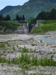
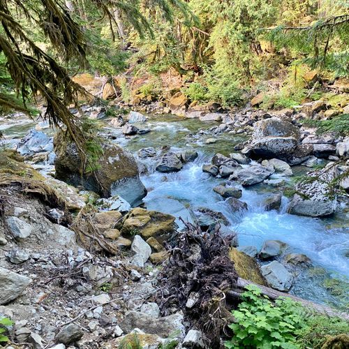
This trail winds through a forested area, offering scenic views of the Elwha River. The landscape has changed significantly since the removal of the Elwha Dam, allowing for the natural restoration of habitats. Hikers can observe the effects of this restoration and enjoy the serene surroundings.

PJ Lake Trail

Easy0.8 mi

Descend steeply through a forested trail to reach a serene, emerald lake. The trail's dramatic drop offers breathtaking views, culminating in a picturesque destination. The surrounding landscape provides a tranquil escape, with the lake's beauty being a highlight of the journey.

Peabody Creek Loop

Peabody Creek Loop

Easy0.4 mi

This tranquil loop winds through an old-growth forest, crossing a bridge and occasionally passing under fallen trees. The trail is well maintained and offers a peaceful escape from the nearby visitor center.

Peabody Creek Trail

Peabody Creek Trail

Moderate3 mi

Follow Peabody Creek through a dense forest filled with moss and ferns, offering a tranquil escape. The trail features numerous creek crossings and steep inclines, surrounded by towering trees. It's a dog-friendly route suitable for hikers and runners seeking solitude.

Queets Fir Trail

Queets Fir Trail

Easy0.1 mi

Journey through a lush, verdant rainforest, teeming with moss-covered trees and ferns. The trail's highlight is the world's largest Sitka spruce tree, a testament to the park's rich biodiversity. The dense forest canopy provides a habitat for a variety of bird species, making it a haven for birdwatchers. The trail also offers glimpses of the Queets River, adding a serene water element to the forest landscape. A perfect blend of tranquility and adventure, it provides an intimate experience of the park's unique ecosystem.

Queets River Trail

Queets River Trail

Difficult9.4 mi

This trail traverses an old-growth temperate rainforest along the Queets River, featuring very large conifers and a diverse plant community, and the path follows the river while offering wildlife-viewing opportunities. Note: accessing the trail requires fording the Queets River at the trailhead; the crossing can be difficult or hazardous and is commonly waist-deep in summer. The route passes through rainforest valleys and along tributary streams, with established backcountry campsites at places such as Spruce Bottom and on gravel bars.

Rain Shadow Nature Trail

Rain Shadow Nature Trail

Moderate0.4 mi

From the summit of Blue Mountain, enjoy expansive views of the Cascades, Vancouver Island, and the Strait of Juan De Fuca. The trail offers a scenic, interpretive experience with wildflowers and wildlife sightings, including deer and wild rabbits. The surrounding landscape includes mountain ranges, river valleys, and distant cities, providing a rich tapestry of natural beauty.

Rialto Beach Nature Trail

Rialto Beach Nature Trail

Easy0.1 mi

Experience the dramatic Olympic Coast by walking along the beach to Hole-in-the-Wall, a natural rock arch carved by the sea. The journey offers stunning views of James Island and numerous sea stacks. At low tide, explore vibrant tidepools teeming with marine life. This scenic hike is suitable for families and hikers of all experience levels.

Royal Lake Trail

Royal Lake Trail

Easy0.2 mi

This trail winds through a mossy forest and along Royal Creek, offering stunning views of the surrounding ridgelines. The journey culminates at an emerald lake, with options to explore the surreal Upper Royal Basin, featuring alpine meadows and glacial tarns.

Sand Point Trail

Easy0.2 mi

This trail takes you through an interesting forest, often on boardwalks, before reaching the beach. It offers birdwatching, wildlife viewing, and tidepooling opportunities. The final approach involves navigating over driftwood, and the beach provides ample space to explore.

Shady Lane Trail

Shady Lane Trail

Easy2.4 mi

This trail offers a serene walk along the North Fork Skokomish River, featuring stunning riverine scenery and towering cedars and spruce. The path takes you through shaded areas, past moss-draped maple trees, and along cliffs before dropping into the flats. It's a year-round favorite for its tranquil atmosphere and natural beauty.

Six Ridge Primitive Trail

Six Ridge Primitive Trail

Extreme9.6 mi

This rugged primitive route follows ridgelines and offers expansive mountain views and remote solitude. Hikers travel through forested ridge and river-valley landscapes; several sections between Belview and McGravey Lakes can be difficult to follow, so map and compass skills are recommended. There is no water between the North Fork Skokomish River Trail and Belview, and bear canisters are recommended where suitable trees for hanging food are lacking.

South Coast Beach Travelway

South Coast Beach Travelway

Easy0.5 mi

This trail offers breathtaking views of the ocean, opportunities to see wildlife like seals and eagles, and scenic beach walks interrupted by steep overland trails. Hikers must navigate tidal restrictions and challenging terrain, including ladders and rope-assisted climbs.

South Fork Skokomish River Trail

South Fork Skokomish River Trail

Extreme15.1 mi

Following the Lower South Fork of the Skokomish River, this trail showcases dense old-growth forest and a constant backdrop of rushing water. The route starts with a set of switchbacks that climb a few hundred feet through sword fern and salal, then levels out in a lofty grove of mature firs high above the river. After passing trees that have stood for centuries, the trail drops back down to the river corridor. Beyond this point, the walking is mostly gentle, with minor ups and downs and a few small creek crossings. The forest shifts between maple and alder near the water and darker stands of hemlock and fir, accompanied by steady river sounds. While the full trail runs 10.3 miles to the upper trailhead, many hikers turn around earlier. Popular turnaround spots include a bridge and waterfall just under four miles in, near the former Camp Comfort site, or a viewpoint near a river bend around five miles. The trail is used year-round by hikers, mountain bikers, and equestrians, and is suitable for most skill levels, with the initial climb being the main challenge for younger hikers. Roosevelt elk are frequently seen in this area.

Staircase Rapids Loop Trail

Staircase Rapids Loop Trail

Moderate2.1 mi

Wander through a lush temperate rainforest under a canopy of old-growth Douglas firs, western hemlocks, and western redcedars. The trail winds through old-growth forest to a bridge over the North Fork Skokomish River, offering views of rapids and river overlooks. The forest floor is carpeted with mosses and ferns, creating a serene natural setting. A short spur trail leads to a massive fallen western red cedar (the Big Cedar).

Sundown Lake Trail

Moderate1.4 mi

This trail winds through old-growth forests and crosses scenic mountain passes, offering stunning views of rugged landscapes. The journey culminates at a serene lake nestled among towering peaks, providing a tranquil retreat for those willing to undertake the challenging hike.

Sunrise Viewpoint Nature Trail

Easy0.3 mi

The trail passes through montane and subalpine areas with seasonal wildflowers and offers scenic mountain views and overlooks. Hikers will encounter varying inclines and a mix of trail tread types.

Switchback Trail

Switchback Trail

Difficult4.3 mi

This trail offers breathtaking views as it switchbacks up to Klahhane Ridge, featuring stunning vistas of Mt. Olympus and Port Angeles. The path winds through forests and meadows, culminating in dramatic mountain scenery. While challenging, the trail rewards hikers with expansive views and diverse landscapes.

Three Forks Trail

Three Forks Trail

Difficult8.5 mi

Descend through varied landscapes, including open meadows and dense forests, to reach stunning river cascades. The trail offers breathtaking views of surrounding ridges and valleys.

Upper Gray Wolf River Trail

Upper Gray Wolf River Trail

Extreme9 mi

Meandering through montane and subalpine forests, the trail offers a diverse landscape of high subalpine terrain and low forested river valleys. Along the river, hikers encounter waterfalls, wildflowers, and opportunities to spot wildlife. Much of the route lies within Olympic National Park; overnight backcountry use requires an NPS wilderness permit. Campsites such as Three Forks, Gray Wolf Camp, Camp Ellis, and Falls Camp provide established resting points. Bear canisters are required in the subalpine high country (above Falls Camp) where trees are generally too small to hang food properly.

Upper Lena Lake Trail

Easy0.5 mi

This trail ascends through montane forest into a subalpine lake basin, offering mountain views and abundant wildflowers. Upper Lena Lake lies in a subalpine meadow; maintained campsites, toilets, and a community bear wire are located at the lake.

Upper Lena Lakes

Extreme6.8 mi

Nestled in a montane forest and subalpine lake basin, this scenic route follows Lena Creek and climbs into a high alpine basin to Upper Lena Lake. The trail passes through forest and subalpine meadows with abundant wildflowers and offers expansive mountain views. Camping is allowed at designated sites at Upper Lena Lake; community bear wires and toilets are available. Stock is prohibited, campfires are not allowed at the lake, and wilderness permits are limited year-round; plan and obtain permits in advance. Treat or filter all water from Lena Creek and the lake before drinking.

Upper Royal Basin Trail

Upper Royal Basin Trail

Extreme6.6 mi

This trail ascends through lush forests and opens into expansive alpine meadows, featuring wildflowers and stunning mountain vistas. The highlight is the breathtaking Royal Basin, surrounded by peaks over 7,000 feet tall, including Mount Deception and Mount Clark. The area is known for its serene tarns and abundant wildlife, such as marmots.
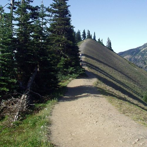
Wagonwheel Lake Trail

Difficult5.1 mi

This trail offers a challenging ascent through montane and subalpine forests, culminating in a small, picturesque lake. The hike is renowned for its steep incline and limited shoreline access, but rewards with serene alpine surroundings.

West Elwha Trail

West Elwha Trail

Moderate3 mi

This scenic trail follows the Elwha River along its west bank (access via Herrick Road), offering views of the valley and opportunities to spot salmon during migration seasons. The path winds through a lush, densely forested area with ferns before continuing along the river's bend.

West Fork Dosewallips River Trail

West Fork Dosewallips River Trail

Extreme8.6 mi

The West Fork Dosewallips River Trail follows the river through mossy, forested valleys and opens into mountain meadows. Hikers pass through forest and meadow environments, including Honeymoon Meadows, and can continue higher into Olympic's backcountry toward passes such as Anderson Pass.

Wolf Creek Trail

Wolf Creek Trail

Difficult16.1 mi

Immerse yourself in the lush, old-growth forests of the Pacific Northwest. The trail offers a serene walk along the banks of Wolf Creek, with the soothing sounds of the flowing water providing a tranquil backdrop. Witness the diverse ecosystem, home to a variety of bird species and other wildlife. The trail also offers a glimpse of the area's logging history with remnants of old cabins and machinery scattered along the path. The dense canopy provides a cool respite during summer months, while the fall brings a burst of color with the changing leaves. A year-round destination for those seeking solitude and natural beauty.

Wynoochee Pass Trail

Moderate3.3 mi

This trail traverses through a beautiful forest, featuring large trees and numerous feeder streams. It steeply climbs to a pass, offering views of ponds and then descends to a serene lake surrounded by tall walls. The hike includes scenic meadows with views of rocky ridges.

Anderson Moraine Primitive Trail

Easy0.7 mi

Aurora Creek Primitive Trail

Difficult3.4 mi

This trail offers a rugged experience through dense forest, with a focus on natural beauty and solitude. The terrain is varied, requiring hikers to be prepared for uneven ground and changing conditions. It is ideal for those seeking a more secluded hiking experience.

Aurora Ridge Trail

Aurora Ridge Trail

Extreme14.5 mi

This trail traverses a high, forested ridge, providing stunning views of Lake Crescent and the Sol Duc River. It features a mix of old growth and montane forests, with steep elevation changes. The trail is known for its scenic vistas and challenging terrain.

Beach 1 Nature Trail

Beach 1 Nature Trail

Easy0.2 mi

This trail offers a beautiful coastal experience with spruce burls along the way. It is an ideal choice for those seeking a short, accessible hike near the ocean, providing a glimpse into the natural beauty of the area.

Beach 3 Nature Trail

Beach 3 Nature Trail

Easy0.2 mi

Meander through a coastal forest before descending to a beach, offering stunning ocean views and opportunities to observe wildlife like eagles and seals.

Beach 4 Nature Trail

Beach 4 Nature Trail

Easy0.2 mi

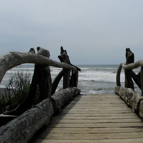
Descend through a coastal forest to a driftwood footbridge and onto the beach, where tidepools teem with marine life like giant green anemones and purple sea stars. The trail offers breathtaking views of the coastline and the iconic Destruction Island Lighthouse in the distance.

Big Flat Trail

Easy0.1 mi

This trail offers a brief journey through varied natural settings, though specific details about its location and features are unclear. It may involve traversing unpaved terrain with minimal elevation change.

Bypass Trail

Easy0.8 mi

This trail offers a gentle walk through diverse landscapes, providing a peaceful escape from more crowded areas. It features a mix of ground surfaces and moderate elevation changes, making it suitable for those seeking a casual hike.

Cascade Rock Trail

Moderate1.8 mi

This trail winds through a forested area, providing scenic views of the surrounding landscape. It is a challenging route that requires a moderate level of physical fitness. The trail's terrain and elevation changes offer a rewarding experience for those who enjoy hiking in natural environments.

Cascading Terraces Nature Trail

Easy0.4 mi

This short loop trail winds through a lush rainforest, featuring moss-covered trees and a serene atmosphere along the Quinault River. The trail offers a peaceful and easy walk, ideal for those looking to experience the beauty of a temperate rainforest.

Cat Basin Cutoff

Easy0.3 mi

This trail offers a brief journey through diverse landscapes, though specific features are not detailed in available sources. It is suitable for those seeking a short, easy hike.

Cat Basin Primitive Trail

Difficult2.4 mi

This trail offers a peaceful walk through a forested area, providing scenic views and a chance to connect with nature. The terrain is generally easy to navigate, making it suitable for hikers of various skill levels.

Cedar Lake Primitive Trail

Moderate1.9 mi

This trail offers a peaceful journey through a forested area, providing an opportunity to connect with nature. The terrain is generally easy to navigate, making it suitable for casual hikers. While specific features like lakes or notable landmarks are not detailed, the trail's natural beauty is a highlight.

Constance Pass Trail

Extreme7.3 mi

This trail traverses through subalpine meadows and montane forests, offering steep elevation changes and scenic views. The route is challenging and requires careful navigation, especially in areas with rough trail conditions.

Dosewallips Terrace Nature Trail

Dosewallips Terrace Nature Trail

Easy0.6 mi

This loop winds through forested terraces above the Dosewallips River, offering scenic views of the surrounding landscape. The trail is characterized by its gentle elevation changes and serene forest environment, making it an enjoyable hike for those seeking a peaceful experience.

Finley Peak Route

Extreme11 mi

No description available

Four Stream Trail

Moderate2.7 mi

This trail follows the southern bank of the Skokomish River, offering scenic views and a peaceful river overlook. The accessible portion is well-maintained, though the trail becomes less maintained beyond this point. It's a great option for those seeking a short, easy hike with river views.

Gregory Mine Route

Easy0.6 mi

This trail offers a glimpse into the region's mining history, featuring remnants of past operations. The route provides scenic views of the surrounding landscape, making it a unique experience for those interested in both nature and historical exploration.

Happy Lake Ridge Trail

Happy Lake Ridge Trail

Extreme33.3 mi

Happy Lake Ridge Trail passes through montane forest, subalpine forest, and subalpine meadows, offering ridge views of distant snowcapped peaks and a forested river valley. The trail has moderate to steep elevation trends and is rated Moderate in difficulty. Unique features include diverse ecosystems and river views; note that much of the trail lacks reliable water sources.

Hart Lake Way Trail

Easy0.6 mi

This short trail offers a serene forest experience with minimal elevation change. It is ideal for those seeking a quick, easy hike amidst nature. However, it does not appear to be located within Olympic National Park.
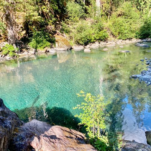
Hayden Pass Trail

Difficult6.2 mi

This trail offers a challenging hike across varied landscapes, providing scenic views and a demanding route suitable for experienced hikers. The trail's diverse terrain includes forested areas and potentially rugged sections, making it a rewarding adventure for those seeking a challenge.

Hoh Lake Trail

Hoh Lake Trail

Extreme5.9 mi

This trail takes you through a stunning temperate rainforest, featuring moss-draped trees and diverse wildlife. The ascent leads to breathtaking views of the surrounding mountains and culminates at a tranquil alpine lake, offering a serene retreat amidst nature's grandeur.

Hoh River to Third Beach

Extreme15.7 mi

Traverse dense Hoh rainforest to the rugged Olympic coast and reach Third Beach. Pass coastal forest and descend to driftwood beaches with tidepools and sea stacks; you may see bald eagles, seals. Terrain varies: sand, rocky/pebbly shores, algae boulders, driftwood; some sections need rope/ladder climbs and are passable only at mid/low tides. Camping is in designated coastal sites and back-in drift logs; overnights require wilderness permits; store food/scented items in park-approved bear canisters; limited campsites and parking; plan ahead.

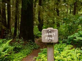
James Pond Nature Trail

James Pond Nature Trail

Easy0.2 mi

This short loop trail winds through a forest to a small marshy pond, offering a glimpse into the local ecosystem. The trail is suitable for all ages and provides a peaceful setting for nature observation.

Krause Bottom Trail

Easy0.4 mi

This trail offers a chance to see elk and experience the power of the Elwha River at Goblin Gates. It passes through a riparian forest with diverse tree species and includes historic sites like old homesteader clearings. The area is rich in local history and natural beauty.

Lake Beauty Primitive Trail

Easy0.4 mi

Mount Tom Creek Route

Easy0.1 mi

Hike through lush, moss-covered forests alongside the Hoh River, encountering wildlife like elk. The trail offers scenic views of the river and surrounding landscape, with opportunities to explore hidden detours and waterfalls. Campsites are available near the river, providing a serene experience amidst nature.
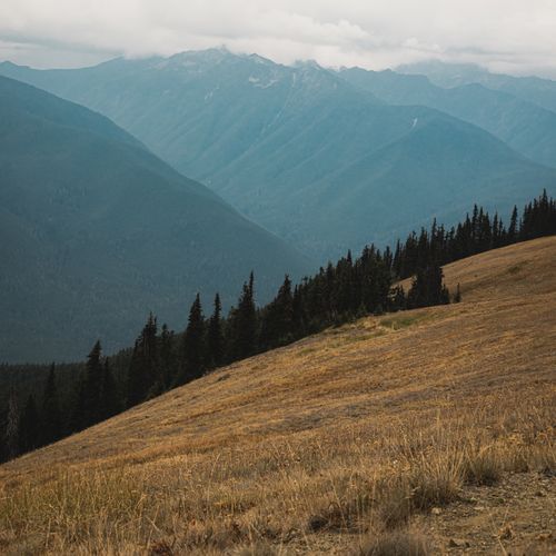
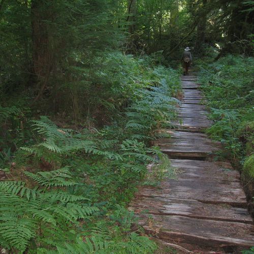
North Fork Sol Duc River Trail

North Fork Sol Duc River Trail

Difficult7.2 mi

This trail traverses an old-growth forest and follows the North Fork Sol Duc River, offering stunning views of the river and surrounding landscape. The path requires several river crossings, which can be hazardous during certain seasons. The trail's unique features include ancient forests and diverse wildlife habitats.

North Fork Soleduck Route

North Fork Soleduck Route

Difficult2.6 mi

This trail traverses an ancient forest, featuring massive trees and ferns, along the North Fork Sol Duc River. The path includes several river fords and offers stunning views of deep pools carved into the rock. The trail's unique ecosystem and challenging terrain make it a standout hiking experience.

North Snyder-Jackson Trail

Difficult6.1 mi

This trail offers a primitive traverse through rugged terrain, connecting high and low traffic areas. It passes near historic sites, including former guard stations and early settlers' homesteads. The trail rises over Indian Pass and descends to the Bogachiel River, offering scenic views of the river's twists and curves.

O'Neil Creek Route

Moderate2.8 mi

This route traverses through a lush rainforest, offering views of the Quinault River and surrounding wildlife, including bears and mountain lions. The trail is part of a larger network that leads to Enchanted Valley, known for its historic chalet and picturesque landscapes.

Olymic Coast North

Extreme32 mi

Towering sea stacks rise from the ocean, while ancient forests of cedar and spruce give way to sandy beaches and rocky headlands. The coastline is dotted with vibrant tidepools filled with sea stars and anemones, and offers stunning views of marine wildlife, including whales and eagles. Steep overland trails and occasional scrambling between beaches add to the adventure, while wilderness campsites provide ocean views. The route requires careful planning around tides to navigate headlands and river crossings.

Rica Canyon Trail

Moderate3.4 mi

This trail descends into Rica Canyon, offering views of the Elwha River and surrounding forests of bigleaf maple, red alder, and black cottonwood. The area is rich in history, with remnants of old homesteads and clearings. The trail connects to the broader Geyser Valley trail system, providing access to other scenic and historic sites.

Sam's River Loop Trail

Sam's River Loop Trail

Easy2.9 mi

This loop trail offers a serene journey through a temperate rainforest, showcasing various stages of forest growth. It's an ideal choice for families and those seeking a tranquil experience amidst nature. The trail's flat terrain makes it accessible for most hikers, providing a chance to observe the rich ecosystem of the rainforest.

Slough Trail

Slough Trail

Easy1.1 mi

This trail winds through broad meadows filled with wildflowers in early summer, attracting a variety of wildlife including bison and sandhill cranes. The path follows an old wagon road, offering scenic views and excellent fly fishing spots along Slough Creek.

Smith Lake Primitive Trail

Moderate2 mi
Smokey Bottom Trail

Smokey Bottom Trail

Easy1.9 mi

This forested trail follows the edge of the former Lake Mills reservoir, offering pocket views of the Elwha River and remnants of the old dam. The lush forest features huge trees and small feeder streams, leading to Boulder Creek. The trail connects with a new pathway along the former lakebed, showcasing revegetation efforts.

South Fork Hoh River Trail

Moderate4.6 mi

South Snider Jackson Trail

Extreme9.4 mi

This trail provides a challenging hike with significant elevation gain, offering solitude and scenic views. It traverses a ridge, providing an opportunity to experience the natural beauty of the area away from more crowded trails.

Upper Barnes Creek Trail

Extreme8.6 mi

This trail offers a challenging hike through a dense forest, following a creek and offering scenic views of the surrounding landscape. The trail is less frequented compared to other popular trails in the area, providing a more secluded hiking experience.

Ahlstroms Prairie Routes

Easy0.1 mi

Pass through a boggy meadow named Ahlstrom's Prairie, known for its unique vegetation and historical context. The area is part of a larger network of trails that lead to the Pacific coast, offering scenic views and diverse wildlife.

Allens Bay Route

Easy2.2 mi

This trail offers a mix of forested and coastal landscapes, providing hikers with a diverse range of natural scenery. The route traverses through varied ecosystems, showcasing the unique biodiversity of the region.

B Loop Trail

Easy1.3 mi

Baldy Trail

Easy3 mi

This trail offers a secluded experience with varied landscapes, including forests and wildflowers. The highlight is the 360-degree view from the granite dome at the top, providing a unique perspective compared to other popular trails.

Barnes Point Trails

Easy0.9 mi

This trail winds through a lush forest of old-growth trees, including cedar and Douglas fir, along the shores of a pristine lake. Interpretive signs highlight the area's rich history and ecological importance. It offers a serene environment with opportunities to observe unique forest features like nurse logs.

Beach 6 Nature Trail

Easy0.2 mi

This trail offers a short, easy walk through a coastal environment, providing opportunities to observe marine life and enjoy scenic views. The trail's proximity to the ocean allows visitors to appreciate the dynamic intertidal zone and its inhabitants.

Bogachiel River South Bank Trail

Easy1.7 mi

This trail winds through a lush temperate rainforest, featuring towering spruce, hemlock, and fir trees. The path follows the Bogachiel River, offering scenic river views and access to picturesque streams. The trail is known for its solitude and adventure, with sections that can be muddy and overgrown, especially during wet months.

Boulder Creek Camp Area Switchback Trail

Easy0.6 mi

This short trail offers a gentle walk through a forested area, providing an easy and accessible route for visitors. It is ideal for those seeking a brief, leisurely hike without significant elevation changes.

Bovee's Meadow Trail

Easy0.2 mi

This easy, family-friendly trail leads through a picturesque meadow, providing a tranquil experience amidst the dense forest surroundings. It is an ideal choice for those seeking a short, accessible hike with scenic views.

Clear Lake Way Trail

Moderate1.8 mi

This trail offers a brief, easy hike suitable for casual exploration. It traverses ground surfaces, providing a straightforward walking experience.

Coastie Head Primitive Trail

Easy0.2 mi

This trail offers a brief but scenic coastal experience, providing views of the ocean and surrounding landscape. It is suitable for those looking for a short, easy hike.

Crystal Ridge Bootpath

Moderate2 mi

na

Cub Peak Way Trail

Easy0.4 mi

Eagle Point Trail

Easy0.7 mi

This trail offers a mix of terrain with notable elevation changes, providing scenic views throughout. While specific features are not detailed, the trail's easy difficulty makes it accessible for casual hikers.

East Twin Creek Route

Easy0.6 mi

This trail offers a serene walk through a forest with varied flora. It's ideal for those seeking a peaceful, easy hike with opportunities to observe local wildlife and vegetation.

Elk Overlook Trail

Easy0.2 mi

No description available

Elwha Forest Loop Trail

Easy0.4 mi

This short loop trail offers a quick escape into the forest near Port Angeles. It provides a peaceful walk through natural surroundings, ideal for those seeking a brief outdoor experience.

Headquarters trail

Easy0.3 mi

This trail offers a brief, easy hike suitable for families and beginners, winding through a natural setting that showcases the park's diverse flora.

Hidden Lake Way Trail

Easy0.2 mi

This trail traverses alpine meadows known as the Hanging Gardens, offering breathtaking views of the Garden Wall and surrounding mountains. Wildlife such as mountain goats and bighorn sheep are common sights. The trail descends steeply to a glacially carved lake, providing opportunities for fishing and exploring the shoreline.

Higley Peak Trail

Easy0.4 mi

Hoh Head Low Tide Route

Easy1.8 mi

Hoh Head Way Trail

Easy0.7 mi

No description available

Kloochman Rock Route

Difficult2.9 mi

This trail offers a challenging climb with steep scrambles, making it a favorite among rock climbers. The route involves navigating through rugged terrain, providing breathtaking views for those who dare to ascend.

Little River Viewpoint Nature Trail

Easy0.1 mi

This short trail offers a glimpse into the natural beauty of the area, with its asphalt surface making it accessible for a variety of visitors. However, specific details about its features and attractions are not available due to a lack of information in official sources.

Ludden Peak Way Trail

Easy1.6 mi

No description available

Marmot Loop

Moderate3.2 mi

No description available

Martins Park Primitive Trail

Moderate2.1 mi

This trail traverses through subalpine meadows and forests, offering scenic views of alpine lakes. The moderate elevation change provides a challenging yet rewarding hike. The trail's remote setting requires careful planning and adherence to wilderness regulations.

Mini Trail

Moderate5.8 mi

This short trail offers a peaceful walk through a natural setting, ideal for those seeking a brief escape into nature. The fine gravel surface makes it accessible for casual hikers.

Mora Group Use Trail

Easy0.1 mi

This trail offers a brief, easy stroll through a coastal forest, providing a glimpse into the diverse ecosystems of the Olympic Peninsula. The proximity to the Quillayute River adds to its natural appeal.

Mount Hopper Way Trail

Easy1.4 mi

This trail offers a chance to experience the diverse landscapes of the Olympic Mountains, with opportunities for scrambling and exploration. The route provides access to Hagen Lake and Lake of the Angels, offering scenic vistas and a variety of flora and fauna.

Mount Olson Way Trail

Difficult3.2 mi

This trail offers a moderate hike through a mix of terrain, providing scenic views of the surrounding landscape. It is a lesser-known trail, making it ideal for those seeking solitude.

North Blue Mountain Trail

Easy0.2 mi

This short trail offers a gentle stroll through natural scenery, ideal for those seeking a brief, easy hike. The trail's short length and easy terrain make it accessible for a variety of visitors.

Potholes Way Trail

Easy0.1 mi

No description available

Rip Rap Pullout Way Trail

Easy0.1 mi

This trail offers a brief, easy walk suitable for those looking for a short, low-impact experience. However, it does not appear to be a well-documented or popular trail within Shenandoah National Park.

Rooses Prairie Primitive Trail

Easy0.4 mi

This trail offers a serene journey through a diverse landscape of bogs, fens, and grasslands, providing habitat for various wildlife and plant species. The area is historically significant, having been used by indigenous peoples for food gathering and hunting. Today, it remains a biological focus area due to its high biodiversity.

Round Lake Trail

Easy0.7 mi

This trail offers a peaceful journey through a forested area, culminating at a serene lake. The surroundings provide a tranquil atmosphere, ideal for nature enthusiasts and those seeking a relaxing hike.

Rustler Creek Route

Moderate2.9 mi

This trail offers a journey through diverse natural settings, providing opportunities to experience the beauty of the surrounding wilderness. The terrain varies, offering a mix of challenges and scenic views.

Saddle Rock Primitive Trail

Easy0.2 mi

This short trail offers a straightforward hike with minimal elevation gain, making it suitable for beginners or those seeking a quick outdoor excursion. The trail's short length and easy difficulty level make it accessible for a variety of visitors.

Skyline loop

Extreme37.5 mi

Slide Peak Route #2

Difficult4 mi

This trail offers a gentle climb through diverse natural environments, providing scenic views and opportunities to connect with nature. The route is suitable for casual hikers looking for a leisurely experience.

Smokey Hill Trail

Easy0.4 mi

No description available

Sol Duc Campground Nature Trail

Sol Duc Campground Nature Trail

Easy0.5 mi

This short loop trail offers a glimpse into the lush rainforest ecosystem, featuring western hemlock, Sitka spruce, and Douglas-fir. Interpretive signs highlight how early pioneers lived off the land. The trail provides barrier-free access and is suitable for families with children.

Sourdough Mountain Way Trail

Easy0.3 mi

No description available

South Kalaloch Beach

South Kalaloch Beach

Difficult14.5 mi

No description available

South Race St Sidewalk

Easy0.1 mi

This short path offers a brief stroll through a local urban setting, providing a simple and accessible walking route for those in the area.

Staircase Hydro Nature Trail

Staircase Hydro Nature Trail

Easy0.1 mi

No description available

Steamboat Creek Primitive Trail

Easy0.2 mi

This trail offers a tranquil experience, allowing hikers to connect with nature in a peaceful setting. The easy terrain makes it accessible for families and beginners, while the surrounding environment provides a chance to observe local wildlife and flora.

Terminus Primitive Trail

Easy0.4 mi

This trail offers a brief yet engaging hike, suitable for those seeking a gentle introduction to the area's natural beauty. The path winds through a variety of landscapes, providing opportunities to observe local flora and fauna.

Willoughby Lake Route

Easy1 mi

No description available

Get offline trail maps and detailed hiking info in the Parka app

Download Parka — It's Free

Get offline trail maps for Olympic National Park

Free on the App Store

Get Parka

Why Park Lovers Choose Parka

Trip Planner

All the tools for epic adventures

Works Offline

Fully functional without cell service

Updated Weekly

Trail conditions, alerts, and closures

Try Risk-Free

7-day free trial, cancel anytime

Start Your 7-Day Free Trial

Unlock everything you need for your next national park trip. Your first week is on us!

National Park vista

Start your adventure today

Download Parka and plan your perfect national park trip in minutes.