
Yellowstone National Park hiking guide
Hellroaring Creek Trail
A 9.6-mile out-and-back with 1,460 ft of climbing in Mammoth Hot Springs, rated moderate.
Key facts
- Length
- 9.6 mi (15.5 km)
- Elevation gain
- 1,460 ft (446 m)
- Route type
- Out and back
- Difficulty
- Moderate
- Area
- Mammoth Hot Springs
- Highest point
- 6,500 ft
- Lowest point
- 5,857 ft
- Horses
- Allowed
About Hellroaring Creek Trail
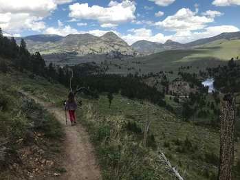
Follow the Hellroaring Creek Trail as it descends through mature forest and sagebrush toward the Yellowstone River. The route passes through stands of Douglas fir and provides opportunities to spot wildlife such as elk and moose. The trail reaches the confluence of Hellroaring Creek and the Yellowstone River.
Route map
This route was checked by Parka editors.
