
Gates of the Arctic National Park and Preserve is a remote and spectacular wilderness in Alaska, entirely above the Arctic Circle. This park is a remarkable expanse of pristine landscapes. No roads or trails lead into Gates of the Arctic, making it one of the ultimate destinations for true wilderness adventure. The park encompasses over eight million acres, roughly the size of Switzerland, featuring dramatic mountain ranges, boreal forests, and the flowing rivers that are home to the western Arctic caribou herd. It was established to preserve the arctic ecosystem and the subsistence opportunities for local indigenous communities.
Visitors to Gates of the Arctic will encounter an environment where wildlife such as grizzly bears, wolves, moose, and over 145 species of birds thrive in their natural habitats. The summer months bring the midnight sun, providing 24 hours of daylight, which allows explorers endless hours to witness the raw beauty of the tundra's wildflowers and the echoing calls of loons across clear lakes. Winter transforms the park into a serene expanse of white, illuminated by the ethereal glow of the aurora borealis.
Gates of the Arctic is also a land of cultural richness, historically occupied by the Nunamiut and Koyukon peoples, who have adapted to the harsh arctic conditions for generations. These indigenous groups continue to live in and around the park, relying on the land and its resources as they have for thousands of years. Archaeological sites dot the landscape, providing glimpses into the deep human history of the region.
The park challenges its visitors to be self-reliant and to carry a deep respect for nature. Hiking, paddling, and camping in Gates of the Arctic are profound encounters with nature, drastically different from experiences offered in more accessible national parks. Each visit demands responsible preparation and a sturdy awareness of the extreme conditions one may face, be it navigating the rapids of the Noatak River or encountering polar temperatures.
Gates Of The Arctic National Park & Preserve
Alaska
Alaska
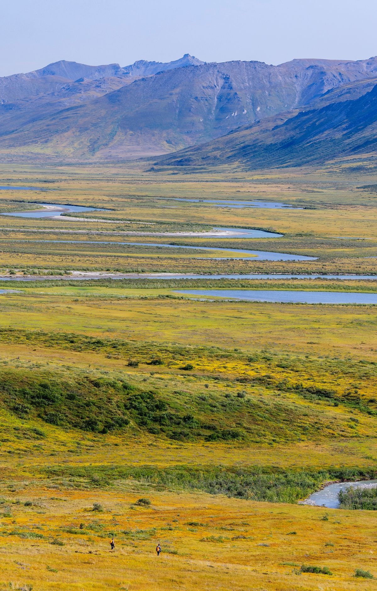
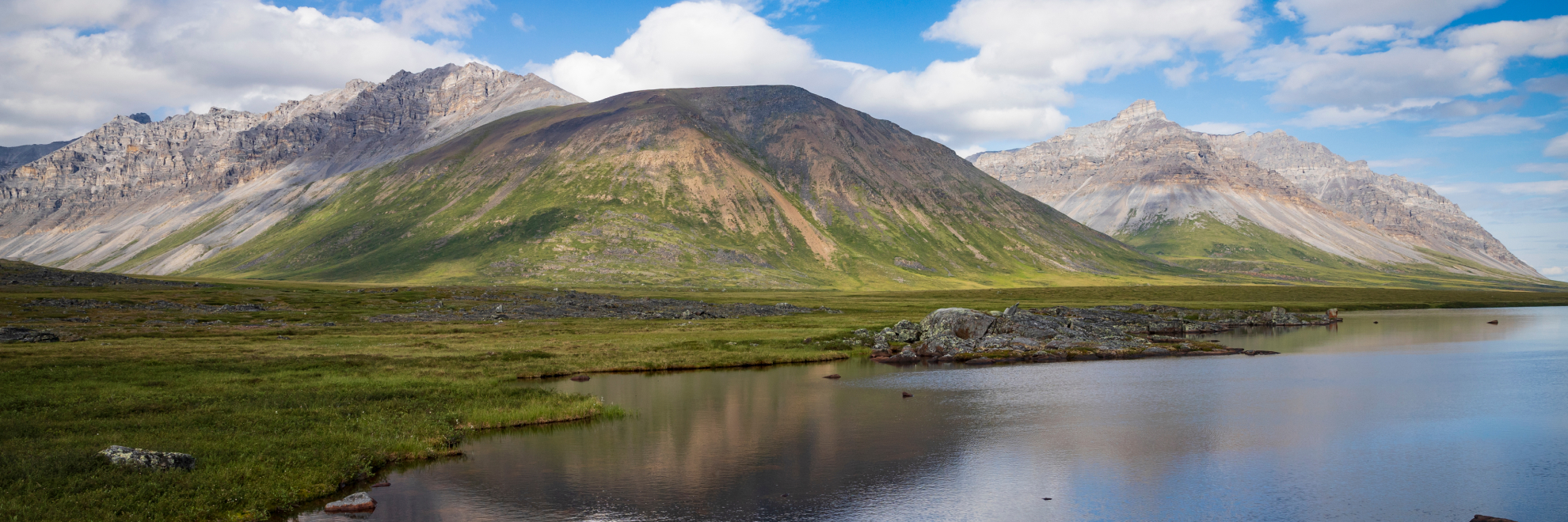
Lying entirely north of the Arctic Circle, Gates of the Arctic National Park and Preserve is the northernmost national park in the United States. It protects portions of the central Brooks Range in northern Alaska, where towering peaks rise above tundra, boreal forest and icy rivers. With no roads or trails, the wilderness is reached by bush plane or on foot, and visitors can go backpacking and hiking through it. Six rivers hold the Wild Rivers designation. Caribou move through valleys carved by glaciers, and the intact arctic ecosystems here have supported people for thousands of years. Arrigetch Peaks and Mount Igikpak draw hikers, and Frigid Crags and Boreal Mountain flank the North Fork of the Koyukuk River.
Park Areas
All areas →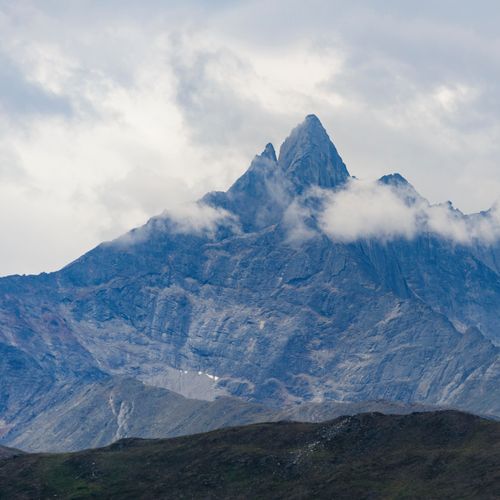
Arrigetch Peaks
Granite pinnacles rise thousands of feet from the central Brooks Range, with walls climbing 3,000 to 4,000 feet above the valleys. Glacial ice and running water wore away the surrounding rock, which sits several thousand feet below the summits. Where the granite meets surrounding rock, contacts are sharp and well exposed, showing how the intrusion joins its edge and host rock. The peaks have long served as a landmark for the Inupiat of northwestern Alaska, and their name means fingers of the hand extended. Technical climbers come to test the faces, while hikers and backpackers fly in by floatplane, since no roads or trails reach the area. Lower Arrigetch Creek has few campsites that see heavy use, so campers should stick to existing spots and bring a stove. The peaks also hold National Natural Landmark status.
Walker Lake
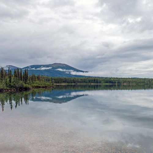
A 14-mile-long mountain lake, this National Natural Landmark sits where the spruce forest runs out to the north, and few places show so plainly how the lay of the land and the living things around it depend on each other. Clear, still water holds the reflections of the mountains that rise around it, and paddlers in canoes come to take in the lake in quiet and be alone with the scenery. No roads reach the lake, so most visitors arrive by floatplane, which drops them on the shore. From there, they can make a wilderness camp on lakeshores or gravel bars. Camping here is primitive, since the park has no established campgrounds, so campers need to bring every piece of gear and the skills to look after themselves.
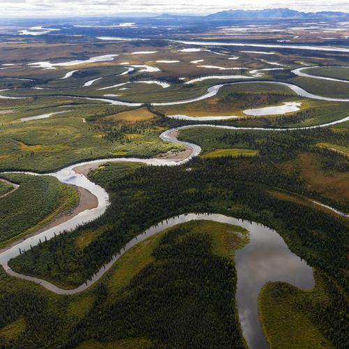
Alatna River
The Alatna River is one of six National Wild and Scenic Rivers in the park, and its 83 miles wind through glacier-carved valleys and rolling tundra. Most river travel here is done in rafts, inflatable canoes, or packrafts, since charter operators rarely haul rigid canoes. Reaching the river means flying in by air taxi, and operators decide where they can drop off and pick up each group. Depending on the stretch, gravel pull-outs may suit backcountry camping. Expect very cold water, shifting water levels, logjams, and a few rapids. Backpackers who hike in will also face river crossings, which are among the riskiest tasks in the park. Arrigetch Peaks, with their granite walls, rise in the southwest of the park.
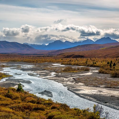
John River
Among the six national Wild and Scenic Rivers in the park, this 52-mile waterway flows through glacier-carved valleys of the Brooks Range and, in places, steep V-shaped canyons. Most trips are made in rafts, inflatable canoes or packrafts, since bush planes are a common way in, and the air taxi operator you book with will help decide where you can be dropped off and picked up. Water temperatures stay cold, and levels can shift quickly with the weather, while logjams, strainers and sweepers add hazards to the rapids. Depending on the river, gravel pull-outs may suit backcountry camping. Hiking the river valleys is another option, as they often serve as corridors for crossing mountain passes. With no roads or trails to reach the river, the setting offers real wilderness solitude.
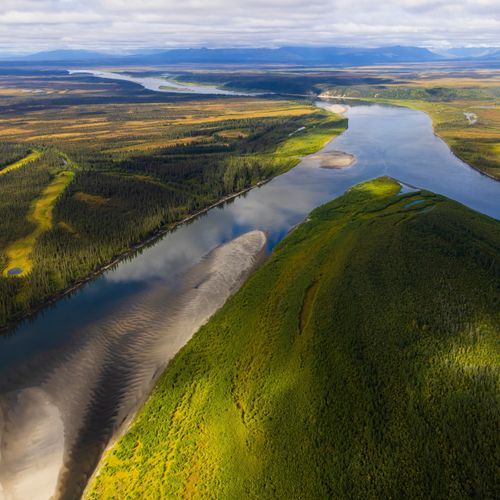
Kobuk River
A designated National Wild and Scenic River, this waterway runs about 110 miles within the park and is one of six such rivers here. Its headwaters rise in the Kobuk-Selawik Lowlands at the park's southern edge. Black and white spruce mixed with poplar grow along the valley, part of a boreal forest that reaches north to about the spine of the Brooks Range. With no roads in the park, most visitors arrive by bush plane or on foot, then float the river in rafts or pack rafts. Wilderness camping is allowed throughout the park, and gravel bars serve as campsites along the banks. Keep an eye out for brown bears, black bears and moose from the water, and watch for eagles and other birds of prey overhead.
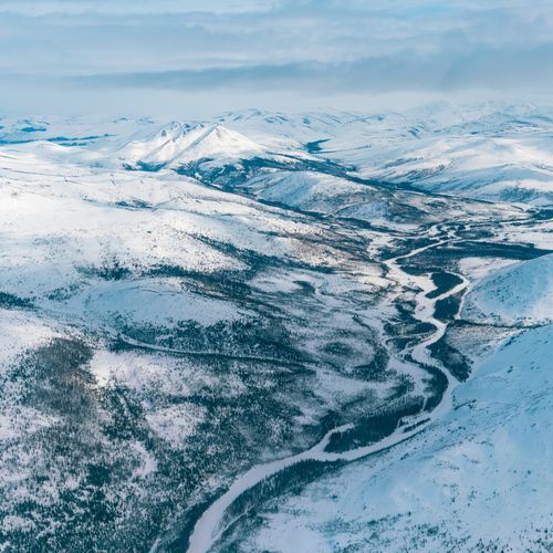
North Fork Koyukuk River
The North Fork Koyukuk River is one of six rivers in this park with National Wild and Scenic River designation. Robert Marshall, a wilderness advocate who traveled North Fork Koyukuk country frequently, called two peaks, Frigid Crags and Boreal Mountain, the gateway from the central Brooks Range into the far north Arctic. Glacier-carved valleys and remote wilderness frame the river corridor. Visitors float the river, hike and backpack the surrounding terrain, and camp in the wilderness, where Brooks Range weather can shift from day to day and even within a single 24-hour period. Temperature extremes are possible even in summer, so come prepared.
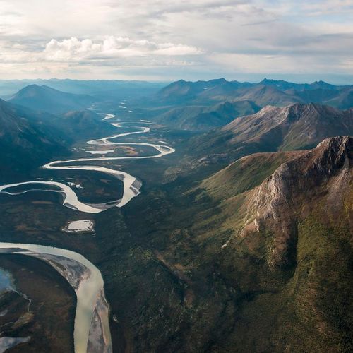
Tinayguk River
The Tinayguk is one of six rivers in the park carrying National Wild and Scenic River designation, and its 44-mile corridor runs through remote wilderness with no roads or trails. Paddlers often float it by packraft, inflatable canoe, or other collapsible boat, and most trips are likely to involve at least one river crossing. Crossings rank among the most dangerous activities in the park, so travelers wait for the water to drop and cross together. Hikers travel across the Brooks Range, where glacier-carved valleys and arete-topped mountains make up the predominant landscape. Campers can set up tents on the stony riverbanks along the Tinayguk Wild River. Getting there takes a bush plane or a hike in, and travelers find the solitude and isolation of wilderness.
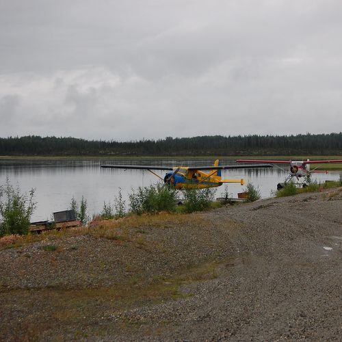
Bettles Ranger Station and Visitor Center
This small ranger station in Bettles, Alaska, sits just outside the park's boundaries and serves as a jumping-off point for anyone heading into the backcountry. Staff help visitors plan their trips and orient themselves before they go. Access is by air, and the station sits about 300 yards from the airstrip along a gravel walkway. Its blue wooden A-frame building holds exhibits on the park and its wildlife, and a large wall map shows the region's geography and topography. Films about the park and interpretive programs add to what a visit offers. The entrance is reached by an accessible ramp, and accessible restrooms are on site.
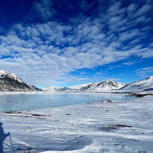
Anaktuvuk Pass
Perched on a broad 2,100-foot pass through the Brooks Range, this small village is home mostly to inland Iñupiat, known as Nunamiut, many of whom still hunt caribou as part of daily life. Because it sits off the road system, commercial flights from Fairbanks are the usual way in. The Anaktuvuk Pass Ranger Station can point you toward hiking routes and lends out bear-resistant food containers. Hikers can set out on foot from the village, but no trails lead into the park, and rivers must be crossed along the way. Campers can pitch tents on ground the city council has set aside near the airstrip's east access road. The Simon Paneak Memorial Museum shares Nunamiut history and culture, and the Nunamiut Corporation Store and Hotel offers groceries and lodging.
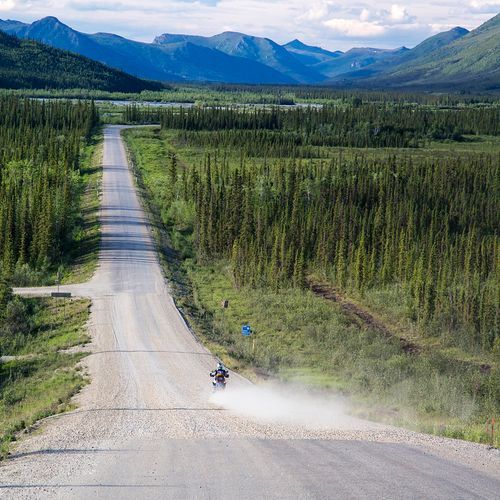
Coldfoot and Wiseman
Both communities grew out of gold rush booms along the Middle Fork of the Koyukuk River, just off the Dalton Highway. Coldfoot earned its name when prospectors arriving in 1899 lost their nerve as winter approached and turned back. Its full-service truck stop now offers lodging, dining, gasoline and a post office, and the Arctic Interagency Visitor Center is based here. Wiseman, founded in 1908 along Wiseman Creek, keeps many of its old log cabins, and residents lead heritage tours through town. Robert Marshall spent a full year there in the 1930s, and his book Arctic Village portrays the community. Hikers can reach the park from the Dalton Highway, which passes within five miles of its eastern side, though the park has no established trails and river crossings are needed.
Popular Hiking Trails
All trails →Visitor Centers
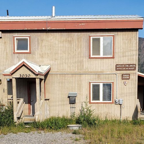
Anaktuvuk Pass Ranger Station
9:00AM - 5:30PM
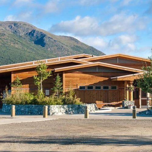
Arctic Interagency Visitor Center
12:00PM - 8:00PM
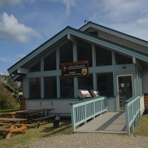
Bettles Ranger Station and Visitor Center
Closed
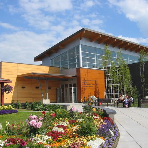
Fairbanks Alaska Public Lands Information Center
8:00AM - 6:00PM
About the Park
Park Areas
Arrigetch Peaks is renowned for its dramatic granite spires, offering a remote wilderness experience without established trails. This area is significant for climbers and photographers, providing insights into the geological history of the Brooks Range through its ancient glacial formations. Walker Lake stands out for its pristine waters and surrounding rugged mountains, offering solitude and opportunities for fishing and wildlife viewing, including caribou and bears. Accessible mainly by air, it attracts those seeking an undisturbed wilderness experience. The Alatna River flows through diverse landscapes, offering solitude and cultural significance, with routes historically used by indigenous peoples. It is less trafficked, enhancing its appeal for wildlife sightings, including caribou and wolves.
John River provides a unique wilderness experience with opportunities for kayaking and rafting, featuring a mix of calm stretches and challenging rapids. Its remote location ensures fewer visitors, offering solitude and diverse wildlife habitats. Kobuk River offers excellent rafting and fishing opportunities, with archaeological sites revealing ancient human presence. The Noatak River, with its unspoiled landscapes, attracts visitors for kayaking and canoeing, supporting a rich array of wildlife. The North Fork Koyukuk River offers a secluded environment for fishing and hiking, with insights into the region's glacial history. Tinayguk River provides challenging paddling and hiking through rugged terrain, offering solitude and dramatic mountain vistas.
Bettles Ranger Station and Visitor Center serves as a gateway for wilderness exploration, providing essential information and guidance. Anaktuvuk Pass offers a glimpse into the Nunamiut lifestyle and serves as a corridor for caribou migrations. Coldfoot and Wiseman provide insights into northern Alaskan life, with Coldfoot offering essential traveler services and Wiseman maintaining its historic charm.
Park Guides
All 11 guides →Floatplanes from Bettles: Reaching the Park
There are no roads into Gates of the Arctic, so most people arrive by air. Most visitors book an air taxi, flying in small aircraft that carry floats for water landings or tundra tires for rough ground.
Brooks Range Extremes: -75°F Winters, 90°F Summers
The park has an arctic and sub-arctic climate, and it shapes nearly every part of a trip. Winters bring an average minimum near minus 67 degrees, while summers are brief and cool.
Trailless Travel and Route-Finding with USGS Maps
Gates of the Arctic has no established trails, so every route is one you must choose and work out yourself.
Floating Arctic Rivers: Rapids, Sweepers, Logjams
Floating the Wild and Scenic Rivers is one of the main ways to travel through Gates of the Arctic.
Climbing Arrigetch, Doonerak and Igikpak
The Arrigetch Peaks lie in the central Brooks Range, the northernmost chain of mountains on the continent.
