Parka
Hot Springs National Park

Trails in Hot Springs National Park

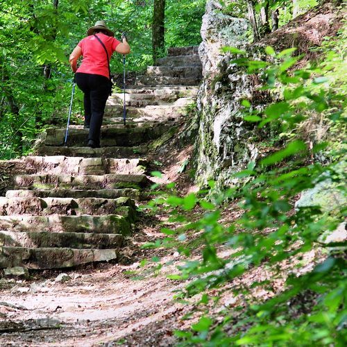
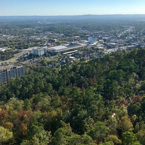
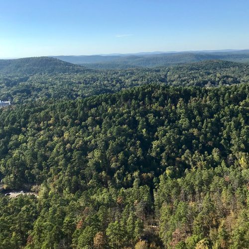
Hot Springs National Park offers an unusually accessible hiking experience: roughly 26 miles of trails wind through wooded ridges, creek corridors, overlooks, and historic landscapes just steps from downtown Hot Springs and Bathhouse Row. Most routes are short and interconnected, making the park especially rewarding for casual walkers, families, and visitors who want to pair a scenic hike with a day exploring the thermal springs and grand bathhouse architecture. The Hot Springs Mountain and North Mountain trail networks provide the greatest variety for easygoing rambles and moderate climbs, with forest scenery and broad views that quickly make the city feel distant. For a more ambitious outing, head to the Sunset Trail, the park’s signature long-distance hike. This demanding 13- to 17-mile loop crosses West, Sugarloaf, and North Mountains, delivering a more remote, backcountry-style feel than the park’s central pathways. West Mountain also offers quieter woodland routes and elevated viewpoints. What makes hiking here special is the contrast: one moment you are near historic thermal springs in the heart of town, and the next you are climbing through Arkansas forest beneath ridgelines, surrounded by geology, flowing water, and the sense of escape that has drawn visitors here for generations.

Goat Rock Trail

Goat Rock Trail

Moderate1.9 mi280 ft gainOut and back

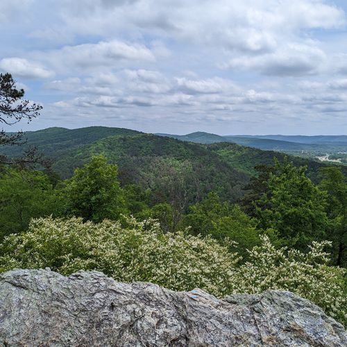
This trail offers wide views over the Ouachita Mountains and the recharge zone that feeds the park's thermal springs. The path begins just south of the North Mountain Overlook parking area, which has limited spaces, so arriving early helps. It also connects with the Gulpha Gorge Trail, giving a route up from the campground.
Grand Promenade

Grand Promenade

Easy0.9 mi77 ft gainOut and back

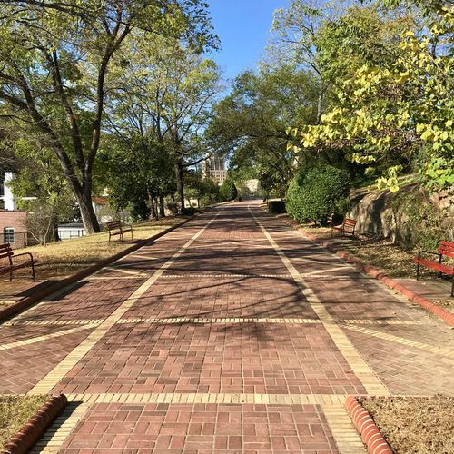
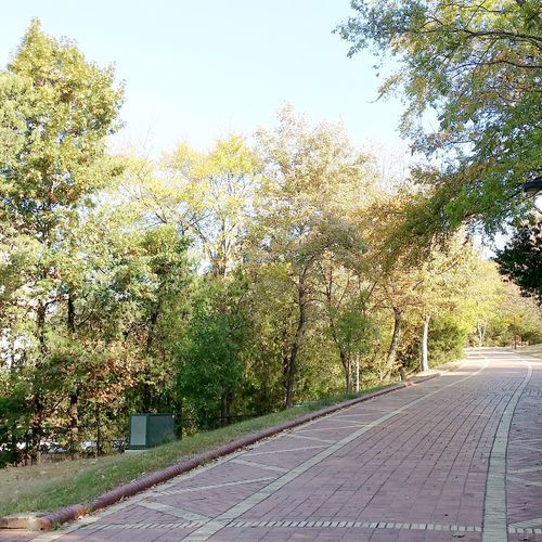
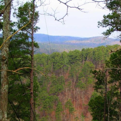
This paved walk runs along the hillside above the historic bathhouses, with ramps and staircases rising from several points downtown. Benches with backs and waysides dot the route, letting you take in the bathhouse facades and the wooded slopes of North Mountain. It also links to the Peak, Oertel and Tufa Terrace trails, making it a common starting point for hikes up the mountain. Bring your own water, as none is readily available along the way.

Hot Springs Mountain Trail

Hot Springs Mountain Trail

Moderate3.1 mi680 ft gainLoop

This mostly level path circles the summit, with several overlooks of the surrounding ridges. Access is from the picnic area and pavilion at the top of the mountain road, or from the Peak Trail. Sunset Trail and Goat Rock Viewpoint are both close by, so it's convenient to pair this walk with other routes in the area.

Sunset Trail

9.3 mi3,670 ft gain

This long route tracks along the park's edge through varied terrain, and three road crossings let you split it into shorter sections. The West Mountain stretch opens to views over Lake Hamilton and the southern park, while the Sugarloaf Mountain ridge leads to Balanced Rock, a novaculite outcrop with one of the park's most scenic vistas. Expect steep, rocky footing near Cedar Glades Road, and follow the orange blazes, since side paths lead onto private land.

Canyon Trail

Canyon Trail

0.6 mi340 ft gain

This route climbs from downtown Hot Springs up West Mountain, linking the town to a network of short, interconnected trails above. The trailhead sits behind the Mountain Valley Water building, and the climb is steepest between West Mountain Drive and the West Mountain Trail. Bathhouse Row and the Fordyce Visitor Center are a short walk from the start, so the climb pairs naturally with a stroll through town.

Gulpha Gorge Trail

Gulpha Gorge Trail

0.7 mi400 ft gain

This route links the campground at the foot of the gorge with a network of trails above it. Expect a steep climb heading west from the campground, and a stone walkway over the creek that can be slick when wet. Hikers can also start from the top of Hot Springs Mountain and head downhill, reaching Goat Rock Trail and Oertel Trail along the way.

Mountain Top Trail

1.4 mi820 ft gain

This trail links Whittington Park with the network of paths that wrap around West Mountain above Hot Springs. Hikers coming from the south face a steep start, while those heading north climb steadily before a steep drop back down to the park. Joined with Canyon Trail and West Mountain Trail, it forms a loop around the mountain and crosses Sunset Trail partway along.

Peak Trail

Peak Trail

0.5 mi380 ft gain

Climbing from the Grand Promenade, this route ends at the Hot Springs Mountain Tower and the top of Hot Springs Mountain, where overlooks offer wide views. The surface starts as pavement and gradually turns to gravel, and the climb is steep enough to feel in the legs. At the summit, a picnic area makes a good place to rest, and connecting trails allow longer loops around the mountain.

Pullman Trail

5.3 mi1,010 ft gain

This is the only trail in the park open to bicycles, so it suits riders who want something beyond the paved roads. Hikers share the route, which passes an archeological site on its way to the city's Northwoods Trails network. The trailhead lies at the end of a short drive from the visitor center, where a bike park and signs show how the routes connect.

Whittington Trail

Whittington Trail

1.2 mi69 ft gainLoop

This flat gravel loop circles Whittington Park, with a surface that suits joggers and walkers alike. Benches with backs are spaced around the park, so there's a spot to rest along the way. Water is available across the street at the Whittington Spring jug station, though the park has no restrooms. Mountain Top Trail links the park to the West Mountain trails for anyone wanting a longer outing.

Arlington Trail

Arlington Trail

0.1 mi93 ft gain

This short walk begins near the Arlington Hotel and links up with Lower Dogwood Trail, making it a handy connector in the park's trail network. The path climbs at a mild, steady grade through wooded ground, and it can be walked in any season. Because it sits close to Bathhouse Row and the Fordyce visitor center, it works well as a quick break between historic stops.

Floral Trail

Floral Trail

0.4 mi240 ft gain

This connector trail links the Lower Dogwood and Honeysuckle trails through the wooded hills above downtown Hot Springs. It drops into a valley and climbs the far side, so expect a steady up-and-down rhythm under the trees. Bathhouse Row sits a short walk away, so it pairs easily with a stroll through the historic downtown.

Fountain Trail

Fountain Trail

0.1 mi58 ft gainLoop

This short link begins on Fountain Street just below the entrance to Hot Springs Mountain Drive, and crossing the road brings you to Honeysuckle Trail. It is a steep climb into the hills, so expect a noticeable effort in a short stretch. Its lower end sits a short walk from Bathhouse Row and the Grand Promenade, which makes it a convenient add-on to a downtown stroll.

Grand Avenue Trail

Grand Avenue Trail

0.1 mi52 ft gain

This link trail joins Oertel Trail with Grand Avenue, so it works well as a connector between the city streets and the wooded slopes above Hot Springs. Expect a steady climb, with the Grand Promenade and Gulpha Gorge trails within walking distance. A local motel sits just south of the trailhead, and visitors park in a field beside it.

Honeysuckle Trail

Honeysuckle Trail

0.5 mi210 ft gain

This trail links the Peak Trail with the Hot Springs Mountain Trail, so it doubles as a connector between two longer routes. It climbs steadily, and the Floral Trail and Fountain Trail both meet it, offering options for shaping a loop. The Peak Trailhead and Bathhouse Row are both within a short walk, so the trail slots easily into a visit to the historic bathhouses.

Lower Dogwood Trail

Lower Dogwood Trail

0.7 mi320 ft gainLoop

The path climbs the flank of North Mountain above Hot Springs, then ends its ascent at a cluster of boulders marking the western tip of the route before dropping downhill. Those rocks make a natural place to pause and take in the ridges. Connections to the Goat Rock Trail, the Floral Trail and the upper section of this route let hikers stitch together a longer outing.

Oak Trail

Oak Trail

0.9 mi270 ft gain

This trail runs along the West Mountain side of the park, linking the Canyon Trail fork with the trails above town. Its northeastern end is mostly level, but a short stretch between West Mountain Trail and West Mountain Drive climbs more steeply. The route crosses West Mountain Drive at a marked crosswalk. Bathhouse Row and the Fordyce Bathhouse Visitor Center are a short walk away, so it pairs naturally with time in downtown Hot Springs.

Oertel Trail

Oertel Trail

1.4 mi520 ft gain

The trail begins at an iron gate near the Army and Navy Hospital, reached by climbing the grand staircase behind the Fordyce Visitor Center and the steps above the Grand Promenade. Expect a gravel road at first, then very steep stretches that reward patience. It links up with Gulpha Gorge Trail from the campground and with Short Cut Trail to the Hot Springs Mountain picnic area.

Reserve Trail

Reserve Trail

0.3 mi99 ft gain

This short link trail connects the downtown streets with Oertel Trail at a Y-shaped junction. Expect a steady uphill grade as the path gains height between the city and the forested slopes above. Bathhouse Row and the Fordyce Bathhouse Visitor Center are within walking distance, so it makes a convenient add-on to a visit to the historic core.

Short Cut Trail

Short Cut Trail

0.2 mi150 ft gain

This short connector joins the Oertel Trail with the Hot Springs Mountain Trail near the picnic area atop the mountain. The path is steep, so expect a climb on the way up. You can park at the picnic area and walk it down to the Oertel, or climb the Oertel from the campground or visitor center to reach it. Bathhouse Row is a short walk down at the foot of the mountain.

Tufa Terrace Trail

Tufa Terrace Trail

0.2 mi70 ft gain

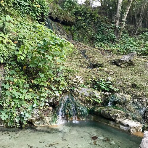
A paved path makes a steady climb from its lower end near Hot Water Cascade, just steps from Bathhouse Row. It crosses over the Grand Promenade and Peak Trail, so it can link you to other routes on the mountain. Reach it from the Grand Promenade or Arlington Lawn for a short outing through the heart of the historic spring district.

Upper Dogwood Trail

Upper Dogwood Trail

1.0 mi200 ft gain

This trail travels the slopes around North Mountain, with brief climbs separated by long, mostly level stretches. It links with the Lower Dogwood and Goat Rock trails, so it can be folded into a longer outing. Trailheads sit near North Mountain Overlook, reached from the Goat Rock Trail or from the top of Gulpha Gorge Trail. Goat Rock Viewpoint and Gulpha Gorge Campground are both close by.

West Mountain Trail

West Mountain Trail

1.2 mi270 ft gain

Both sections of this mountain route rise and fall gradually, so the pace stays unhurried from start to finish. Fewer visitors use it than the trails nearer downtown, which gives better chances of spotting wildlife along the way. You can reach it from Whittington Park or the Canyon Trailhead, and linking it with the Mountain Top Trail makes a loop around the mountain.

Dewdropper

0.6 mi83 ft gain

Fordyce Peaks Trail

1.2 mi560 ft gain

A side path branches off the Sunset Trail to reach a view of the Fordyce Peaks, rising above the city of Hot Springs. Because the spur does not loop, you will retrace your steps to return to the main trail. Start from the parking area at the top of Cedarglades Road in a residential neighborhood, and stay on marked routes since neighboring land is private.

Pumphouse

0.4 mi92 ft gain

Within walking distance of the popular Pullman Trailhead

Length is the full route as drawn on the Parka map, so out-and-back trails count both directions. Gain is the total ascent over that route.

Get offline trail maps and detailed hiking info in the Parka app

Download Parka — It's Free

Get offline trail maps for Hot Springs National Park

Free on the App Store

Get Parka

Why Park Lovers Choose Parka

Trip Planner

All the tools for epic adventures

Works Offline

Fully functional without cell service

Updated Weekly

Trail conditions, alerts, and closures

Try Risk-Free

7-day free trial, cancel anytime

Start Your 7-Day Free Trial

Unlock everything you need for your next national park trip. Your first week is on us!

National Park vista

Start your adventure today

Download Parka and plan your perfect national park trip in minutes.

Explore All 63 National Parks

Browse parks by region and discover your next adventure