Yosemite National Park guide · 1 min read
Glacier Point Road and Its Viewpoints
Glacier Point sits at the end of Glacier Point Road, about 30 miles and an hour's drive from Yosemite Valley.
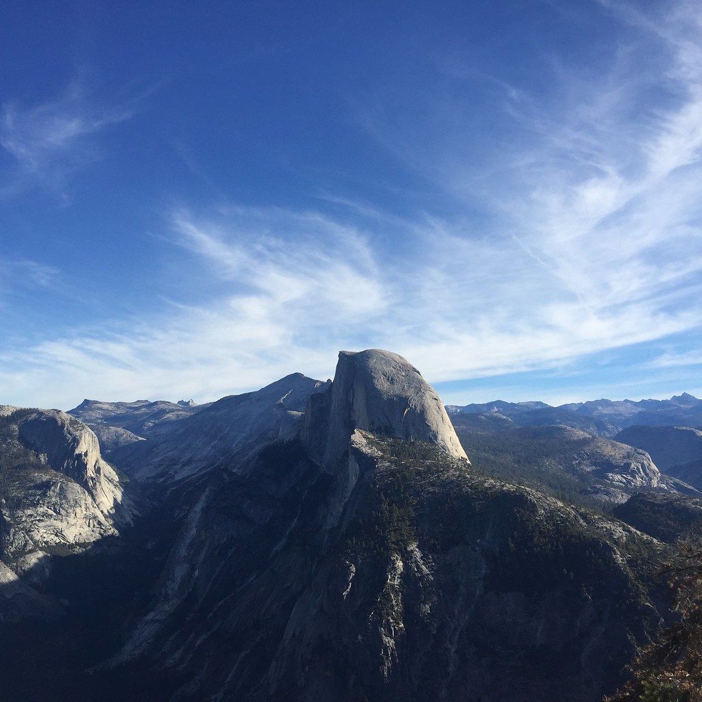
A short, paved, wheelchair-accessible path leads from the parking area to an overlook 3,214 feet above Curry Village. From the rail you face Half Dome head-on, with Yosemite Valley, Yosemite Falls and the high country spread out below and beyond.
Washburn Point, just south of Glacier Point, has a similar panorama and a more direct view of Vernal and Nevada Falls. Both overlooks are also good places for high-elevation stargazing.
Sentinel Dome starts from the Sentinel Dome and Taft Point Trailhead along the road. The round trip is about two miles with roughly 400 feet of climbing, finishing with a steep walk up bare granite to 360-degree views of Half Dome, El Capitan, Yosemite Falls, Vernal Fall and Nevada Fall. Stay off the dome during thunderstorms. Taft Point leaves from the same trailhead, a 1.8-mile hike with views of Yosemite Valley and El Capitan, and the two combine into a 4.9-mile loop.
The Pohono Trail runs 13.7 miles along the south rim between Glacier Point and Tunnel View, passing Taft, Dewey and Stanford points with views of El Capitan, Yosemite Falls, North Dome and Half Dome. Starting at Glacier Point means about 1,100 feet of gain on a gradual descent, while starting at Wawona Tunnel means 4,150 feet. The Mono Meadow Trail is a moderate 3 miles that stays wet through summer and includes log crossings.
In winter, the road is groomed beyond Badger Pass Ski Area, and cross-country skiers can follow it 10.5 miles to Glacier Point. That makes a 21-mile day trip or an overnight, either at a ski hut that requires a reservation or camping with a wilderness permit from the Badger Pass Ranger Station.