ParkaDownload
Zion National Park

Trails in Zion National Park

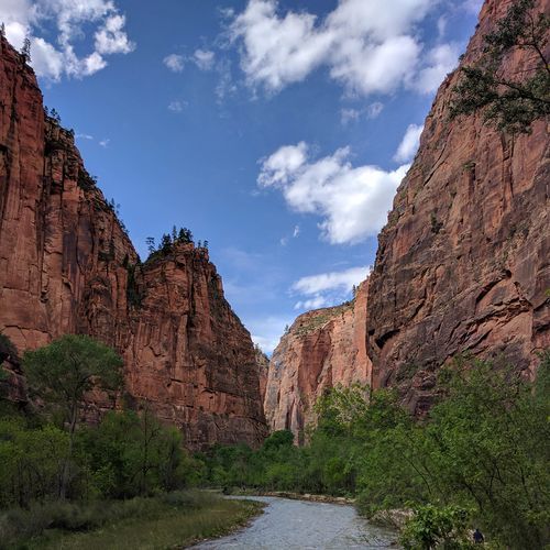
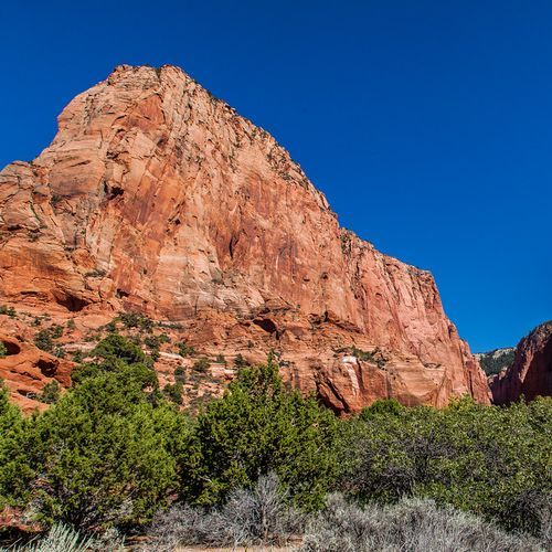
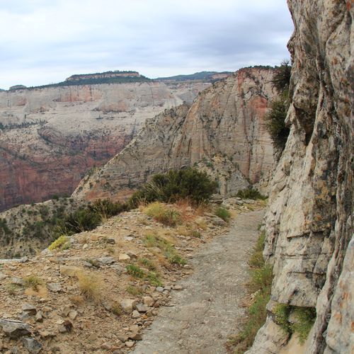
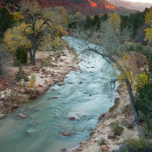
Hiking is the main event in Zion, and few parks deliver such a dramatic range of trail experiences in such a compact landscape. With 37 trails spread across easy, moderate, difficult, and extreme categories, Zion offers everything from short riverside walks and gentle pool-side rambles to full-value canyon adventures and exposed, adrenaline-fueled climbs. Beginners can ease into the park on accessible, low-elevation routes like the Riverside Walk or the Emerald Pools trails, while stronger hikers can step up to longer climbs, rim routes, and backcountry-style outings that reveal a wilder side of the park beyond the shuttle stops and famous viewpoints. The headliners are unmistakable. Angels Landing is Zion’s signature challenge, a thrilling ascent known for steep switchbacks, narrow rock fins, chain-assisted sections, and some of the most electrifying views in the national park system. The Narrows is its perfect counterpart: less about elevation and more about immersion, leading hikers directly into the Virgin River through soaring sandstone walls in one of the most unforgettable slot canyon experiences in America. Beyond those icons, trails in Zion Canyon, Kolob Canyons, and the park’s rim and wilderness areas round out the lineup with everything from family-friendly strolls to strenuous all-day efforts. What makes hiking here special is the sheer intimacy of the landscape. Zion does not ask you to admire scenery from a distance; it pulls you into it. Trails weave along the canyon floor beneath towering cliffs, climb into hanging viewpoints, and venture into narrow passages where stone, water, light, and scale feel almost theatrical. Whether you want an easy introduction or a serious test of nerve and endurance, Zion turns a hike into a full sensory experience—one defined by red rock grandeur, vertical drama, and a rare sense of being completely inside the canyon.

Angels Landing Trail

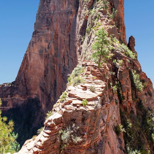
Angels Landing Trail

Extreme4.3 mi

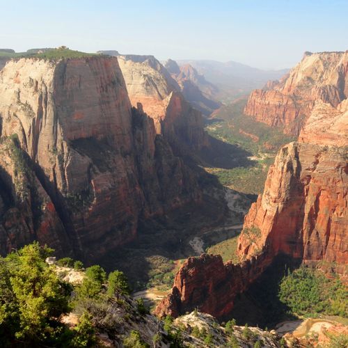
Climb through steep switchbacks and narrow ridges with sheer drop-offs, using chains as handrails. The trail ascends from the Virgin River gorge, passing through Walter’s Wiggles, a series of 21 switchbacks, before reaching Scout Lookout. Beyond this point, the path becomes even more treacherous, culminating in a thrilling scramble to the summit. Panoramic views of Zion Canyon await at the top, offering a spectacular vista of iconic rock formations like the Great White Throne and Observation Point.

Canyon Overlook Trail

Canyon Overlook Trail

Easy0.9 mi

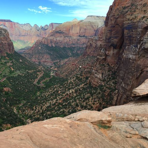
This short hike offers breathtaking views of Zion Canyon, including the Towers of the Virgin, Bridge Mountain, and the Streaked Wall. The trail begins with stone steps and winds through shaded alcoves and over slickrock, culminating at a viewpoint with stunning vistas. It's a must-do for photographers and casual visitors alike, though caution is advised due to exposed areas.

East Rim Trail

East Rim Trail

Difficult10.5 mi

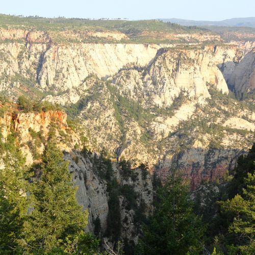
This trail traverses the eastern rim of the canyon, offering breathtaking views of Checkerboard Mesa and Jolley Gulch. It passes through a ponderosa pine forest and ends with a dramatic descent into Echo Canyon. The trail features a variety of landscapes, from sandy trails to slickrock slopes, and connects to other notable trails like Observation Point.

Kolob Arch

Kolob Arch

Difficult14.3 mi

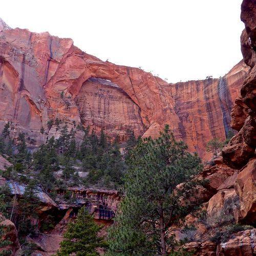
Hike through a scenic landscape of juniper and oak brush, descending into the Timber Creek area and passing by cottonwoods and box elders. The trail rises to a low saddle that offers wide views of the surrounding mountains. From the Lee Pass route the path follows Timber and La Verkin Creeks to a viewpoint of a massive arch perched high on a canyon wall (Kolob Arch). The area is rich in wildlife, including reptiles, birds, and mammals, and offers awe-inspiring views of the Kolob Terrace.

Pa'rus Trail

Pa'rus Trail

Easy3.2 mi

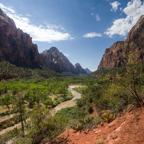
The Pa'rus Trail is a paved, multi-use path that meanders along the Virgin River between Zion Canyon Visitor Center and Canyon Junction, with views of sandstone cliffs and desert vegetation. It is the park’s most accessible trail, paved with minimal elevation change, but wheelchair users may need assistance in places with some grades and cross slopes that exceed accessible limits. Leashed pets are allowed and the path is shared with bicyclists and pedestrians, offering many photo opportunities, especially near sunset.

Taylor Creek Trail

Taylor Creek Trail

Moderate5 mi

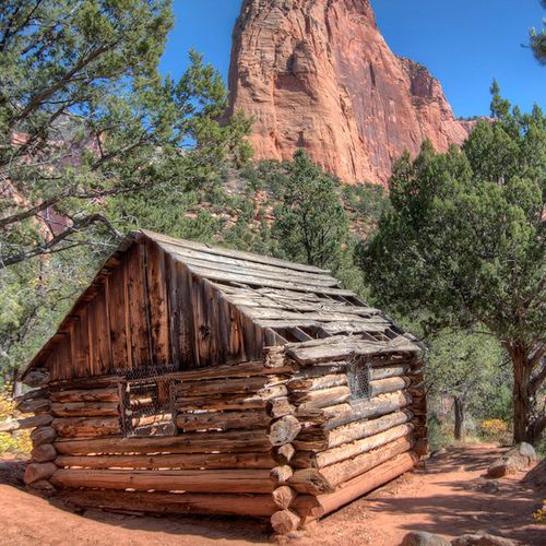
Taylor Creek Trail winds through a tight box canyon, guiding hikers toward the Double Arch Alcove, where erosion has sculpted striking openings in the Navajo sandstone. Near the canyon entrance, the route enters the Zion Wilderness and crosses Taylor Creek multiple times. Expect icy stretches in winter and wet feet during spring runoff. Along the way, the trail passes the Kanarraville Fold and two historic homestead cabins from the early 1930s before reaching the alcove.

The Subway Bottom-Up Approach

The Subway Bottom-Up Approach

Moderate7.3 mi

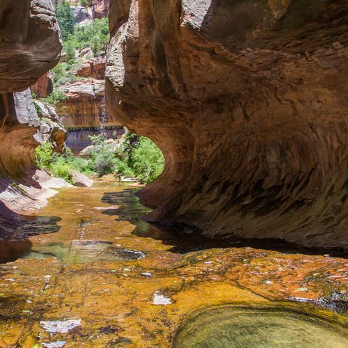
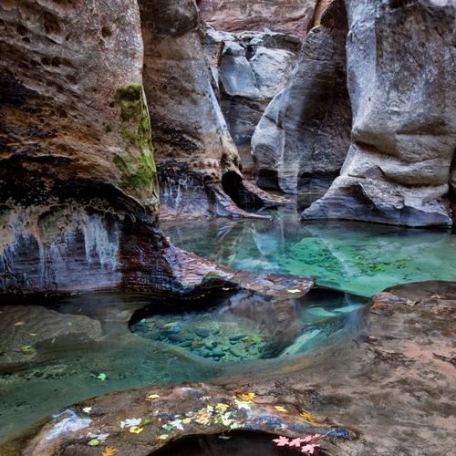
This hike follows the Left Fork of North Creek, featuring numerous river crossings and stunning natural formations. The trail culminates at the Subway, a unique tunnel-like section carved into the sandstone. The journey requires navigating through rugged terrain and offers breathtaking views of the canyon's emerald pools and waterfalls.

Watchman Trail

Watchman Trail

Moderate3.9 mi

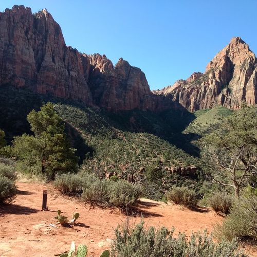
This trail offers a scenic hike through desert vegetation with panoramic views of Springdale and lower Zion Canyon. It is a moderate hike with rocky, uneven tread, steps, and some steep sections; the overlook has high drop-offs and no guardrail. A short loop section near the trailhead provides additional viewpoints.

West Rim Trail

West Rim Trail

Difficult14.6 mi

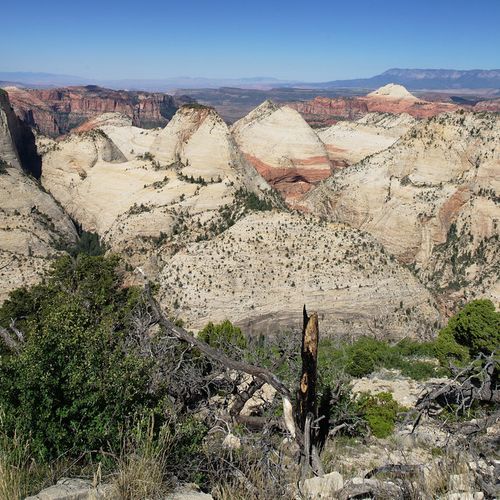
The West Rim Trail offers breathtaking, sweeping views of Zion Canyon. It begins at the West Rim Trailhead near Lava Point (on Kolob Terrace Road), traverses the high-elevation rim with views into Wildcat Canyon, Potato Hollow, and Phantom Valley, and then drops steeply down into Zion Canyon, ending near The Grotto/Grotto Picnic Area. Hikers can optionally add the Angels Landing spur via Scout Lookout; the route often provides more solitude than many of the busier canyon trails.

Zion Narrows Bottom-Up Day-Hiking Route

Zion Narrows Bottom-Up Day-Hiking Route

Difficult9.1 mi

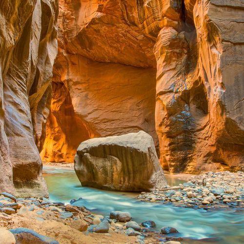
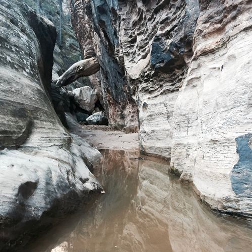
Wade through the Virgin River, surrounded by towering Navajo sandstone walls that rise like giants. The hike begins with a paved riverside walk before entering the river, where the path winds through shallow to waist-deep water. As the canyon narrows, the scenery becomes increasingly dramatic, with fewer crowds allowing for a more serene experience. The hike offers stunning views and unique rock formations, making it a memorable adventure.

Zion Narrows Top-Down Hiking Route

Zion Narrows Top-Down Hiking Route

Difficult15.1 mi

Follow the Virgin River through a gorge carved over millennia, surrounded by towering cliffs that rise as much as about 2,000 feet. The top-down (full) Narrows route begins in East Zion and descends into Zion Canyon, ending at the Temple of Sinawava. Much of the route is traveled in the river and requires wading; water depth commonly reaches thigh-deep (varies by season and flow), with slippery, uneven footing, obstacles, and occasional deep pools. Highlights include the iconic Wall Street section, where narrow passageways and towering walls create an unforgettable experience.

Emerald Pools Trail

Emerald Pools Trail

Moderate2.9 mi

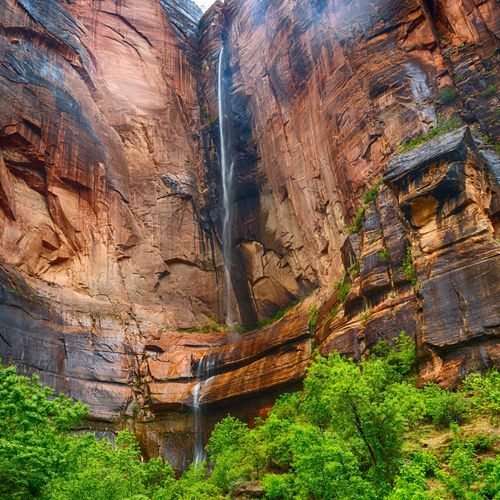
This trail leads to a tranquil pool at the base of majestic cliffs, offering breathtaking views of canyon landmarks like Lady Mountain and The Great White Throne. The path winds through pinyon-juniper woodlands, providing a peaceful escape amidst the dramatic landscape.

Kayenta Trail

Kayenta Trail

Moderate3.1 mi

This trail offers views of Zion Canyon and connects hikers to the Emerald Pools. It is accessible from the Grotto area, but contains steep sections, staircases with steps up to 21 in (53.3 cm), overhanging rocks, and some narrow tread; hikers with small children, limited mobility, or difficulty with steps should use caution.

La Verkin Creek Trail

La Verkin Creek Trail

Difficult8.5 mi

This trail descends through a scenic valley, offering breathtaking views of the surrounding cliffs. It follows La Verkin Creek, providing access to numerous campsites and the opportunity to visit the impressive Kolob Arch. Beyond the arch, hikers can explore Bear Trap Canyon and Willis Canyon for additional scenic experiences.

Observation Point

Observation Point

Easy0.4 mi

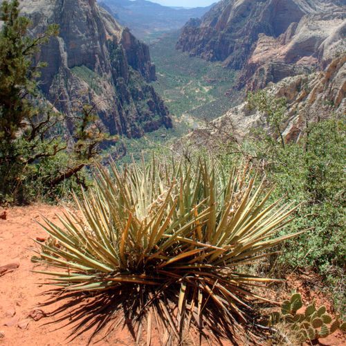
This trail offers breathtaking views of Zion Canyon, including Angels Landing and the Virgin River. It winds through diverse landscapes, including Echo Canyon, before reaching the viewpoint. The hike is known for its steep inclines and stunning vistas.

Riverside Walk

Riverside Walk

Moderate1.9 mi

This trail follows the Virgin River, providing a tranquil experience with lush vegetation and unique rock formations. It features hanging gardens and offers access to the Narrows, where hikers can wade into the river. The path is well-suited for families and those seeking a leisurely hike.

Timber Creek Overlook

Timber Creek Overlook

Moderate1.2 mi

Follow a short trail along a rocky ridge to a scenic viewpoint overlooking Timber Creek and surrounding peaks. The route features gently sloping sections along with some steep areas, steps, and rock obstacles, so be prepared for uneven footing. The overlook offers rewarding views, though the trail may not be suitable for strollers or those requiring level, obstacle-free paths.

Archaeology Trail

Easy0.1 mi

This short hike leads to the remains of an Ancestral Puebloan food storage site, offering stunning views of the surrounding landscape. The site, once home to a small pueblo, now features interpretive signs and foundational remains. It's a great spot to imagine life over a thousand years ago.

Cable Mountain Trail

Cable Mountain Trail

Moderate3.2 mi

This trail leads to a remote peak with stunning views of the canyon below. It features the remnants of a historic cable system used to transport timber from the plateau to the valley. The hike offers a mix of scenic vistas and historical significance, making it a unique experience for those willing to venture off the beaten path.

Chinle Trail

Chinle Trail

Difficult11.5 mi

Meander through the open desert, passing the red cliffs of Mount Kinesava and enjoying sweeping views of the surrounding cliffs, including the West Temple. The trail passes through areas of petrified wood and highly developed cryptobiotic soil and continues to the junction with Scoggins Wash before connecting with Coalpits Wash.

Deertrap Mountain

Moderate3.2 mi

Situated on the East Rim, Deertrap Mountain offers expansive views into Zion Canyon from the rim. The hike follows the East Rim Trail to the edge of Deertrap Mountain with canyon vistas to the north and south. The route passes through varied terrain, from desert shrub to stands of ponderosa pine, and provides a less crowded alternative for hikers. Notable canyon features and formations in view from the rim include parts of Zion Canyon and nearby formations such as the Court of the Patriarchs and Mountain of the Sun. The trail is accessed via the East Rim Trail near the Stave Spring junction; Stave Spring is a pipe that provides water (after treatment) for overnight hikers.

East Mesa Trail

East Mesa Trail

Moderate4.4 mi

This route hikes through ponderosa and pinyon‑juniper forest, with brief views into the surrounding canyons. The East Mesa Trail leads to the East Rim Trail; continuing a short distance on the East Rim Trail reaches Observation Point, which offers views into Zion Canyon. The East Mesa Trailhead is accessible only via high‑clearance/4‑wheel‑drive dirt roads off North Fork Road; please respect private property and park only in designated spaces.

Grotto Trail

Grotto Trail

Easy1.1 mi

This trail provides a leisurely stroll through the canyon, with opportunities to see wildlife and enjoy the scenic beauty of the surroundings. It connects a picnic area to a lodge, offering amenities along the way. The trail is suitable for all ages and abilities due to its flat and easy nature.

Hop Valley Trail

Hop Valley Trail

Difficult13.1 mi

The Hop Valley Trail begins off Kolob Terrace Road and weaves through open fields, offering wide views of the surrounding rock formations before descending into Hop Valley. The valley floor features a flat, sandy bottom bordered by high vertical walls. You'll often see cattle along the route, which crosses through private inholdings. The trail extends to the far end of the valley, leading to a steep descent toward La Verkin Creek and providing access to Kolob Arch via the La Verkin Creek Trail.

Northgate Peaks

Northgate Peaks

Moderate4.2 mi

Wander through ponderosa pine and mixed-conifer (including quaking aspen) forests and open meadows to a sandstone/slickrock viewpoint overlooking the Northgate Peaks and other rugged mountains (including Guardian Angels) and the Wildcat Canyon. The trail offers a quieter alternative to busier Zion routes, with sweeping vistas of sandstone formations and deep canyons, and connects with the West Rim Trail from the Wildcat Canyon Trailhead.

Orderville Canyon Day Hike Section

Easy0.5 mi

Orderville Canyon is a dramatic slot canyon with numerous water-filled sections, boulders, and lush riparian vegetation. Travel in and out of the canyon involves wading, scrambling, and occasional downclimbing. Orderville Canyon joins the Virgin River Narrows; hikers on the Narrows can continue downstream to the Temple of Sinawava via the Riverside Walk.

Sand Bench Trail

Sand Bench Trail

Moderate3.7 mi

Sand Bench Trail begins near the Court of the Patriarchs (with an option to hike as a 3.9-mile loop or a 1.5-mile one-way to Zion Lodge) and climbs up to benches above the canyon, providing views of the canyon and surrounding mountains. Large portions of the route are very soft sand, and the trail includes features such as bridges, a seasonal creek crossing (water levels vary), steps, and rocky sections. Some segments are steep.

Stave Spring Trail

Stave Spring Trail

Easy0.5 mi

Provides access to the East Rim Trail, which is a strenuous route to Observation Point, featuring roughly 2,000 feet of elevation gain through upper Echo Canyon. It offers spectacular, secluded views of Zion's East Mesa and the Virgin River valley, with best hiking conditions in late spring and fall.

Telephone Canyon

Easy2.3 mi

Located high on the West Rim, this canyon offers a challenging yet scenic route through a series of steep rappels and dramatic drops. The technical section is short but intense, featuring over a dozen rappels, including one as long as 185 feet. The approach involves a significant climb, but the views and unique canyoneering experience make it rewarding. The canyon's name originates from a former telephone line that once traversed the area. Experienced canyoneers often combine this with other nearby canyons for a longer, more varied adventure.

The Subway Top-Down Approach

The Subway Top-Down Approach

Extreme7.9 mi

The Subway Top‑Down is a technical canyoneering route through the Left Fork (Subway) slot canyon; expect multiple rappels, off‑trail route‑finding, and unavoidable long swims in very cold water, so wetsuits or drysuits and full canyoneering gear (ropes, harnesses) are recommended. A Wilderness Permit is required, guiding is prohibited, and the route begins near Wildcat Canyon Trailhead and exits at Left Fork Trailhead; it is not a simple hike and should be attempted only by those with appropriate skills and equipment.

Upper Orderville Canyon Trail

Upper Orderville Canyon Trail

Easy0.4 mi

Begin in an open valley with large trees, then descend into a dramatic slot canyon. The terrain narrows, featuring numerous waterfalls, boulders, and lush vegetation, creating a fun obstacle course. Key obstacles include The Boundary Boulder, The Guillotine, and Corkscrew Falls, requiring careful navigation and potentially a short rope. The canyon eventually joins The Narrows, offering a stunning conclusion to the adventure. Water protection is essential, and a wetsuit is recommended due to cold water conditions.

Wildcat Canyon Trail

Wildcat Canyon Trail

Difficult11.5 mi

Wildcat Canyon Trail winds through ponderosa pine forest and opens into wide meadows, offering a mix of sun and shade and sweeping views of the Northgate Peaks and down into Wildcat Canyon. The trail crosses the canyon and connects with the West Rim Trail; the primary water source noted by the park is Wildcat Spring (usually a small flow). Best used in late spring through fall, the trail can be wet or snow-covered into late spring.

South Fork of Taylor Creek Trail

Easy1.5 mi
Hidden Canyon [CLOSED]

Hidden Canyon [CLOSED]

Easy2.5 mi

This formerly popular trail experienced several dangerous rockslides and is not open to the public at this time.

Lower Emerald Pool Trail

Lower Emerald Pool Trail

Easy0.8 mi

This trail winds through a pinyon-juniper woodland, leading to a picturesque pool surrounded by natural beauty. The path is paved and accessible, making it suitable for a variety of visitors. The area is a vital water source for local wildlife, and visitors are encouraged to respect its fragility.

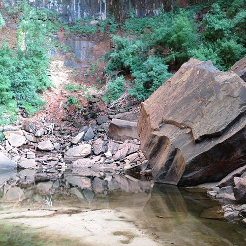
Middle Emerald Pools

Middle Emerald Pools

Easy0.8 mi

This trail offers views of Zion Canyon, red rock formations, and the Virgin River. It leads to emerald-colored pools nestled among cliffs and riparian vegetation. The hike is popular for its scenic beauty and relative short length.

Wrangler Trail

Easy1 mi

This trail traverses the scenic Hayden Valley, offering views of wildlife and natural beauty. It requires fording Sour Creek, adding an adventurous element to the hike. The trail leads to a peaceful lake, providing a serene destination amidst the park's diverse landscapes.

Get offline trail maps and detailed hiking info in the Parka app

Download Parka — It's Free

Get offline trail maps for Zion National Park

Free on the App Store

Get Parka

Why Park Lovers Choose Parka

Trip Planner

All the tools for epic adventures

Works Offline

Fully functional without cell service

Updated Weekly

Trail conditions, alerts, and closures

Try Risk-Free

7-day free trial, cancel anytime

Start Your 7-Day Free Trial

Unlock everything you need for your next national park trip. Your first week is on us!

National Park vista

Start your adventure today

Download Parka and plan your perfect national park trip in minutes.